Horseriding trail network
Saddle up your horse and explore rugged wilderness with awe-inspiring views on the horseriding trail network in D'Aguilar National Park.
- Journey type
- Walk, cycle, horse
- Distance
- Various trail network
- Time suggested
- Various
- Grade
- Various
Accessible by
- Conventional vehicle
- Horse
- Bicycle
Journey facilities
- Lookout (natural)
- Walking
- Cycling
- Horseriding
-
![Take your horse along the horseriding trails in D'Aguilar National Park.]() Take your horse along the horseriding trails in D'Aguilar National Park.
Photo credit: Maxime Coquard © Queensland Government
Take your horse along the horseriding trails in D'Aguilar National Park.
Photo credit: Maxime Coquard © Queensland Government
-
![A leisurely ride along the horseriding trails is a great way to experience the park.]() A leisurely ride along the horseriding trails is a great way to experience the park.
Photo credit: Maxime Coquard © Queensland Government
A leisurely ride along the horseriding trails is a great way to experience the park.
Photo credit: Maxime Coquard © Queensland Government
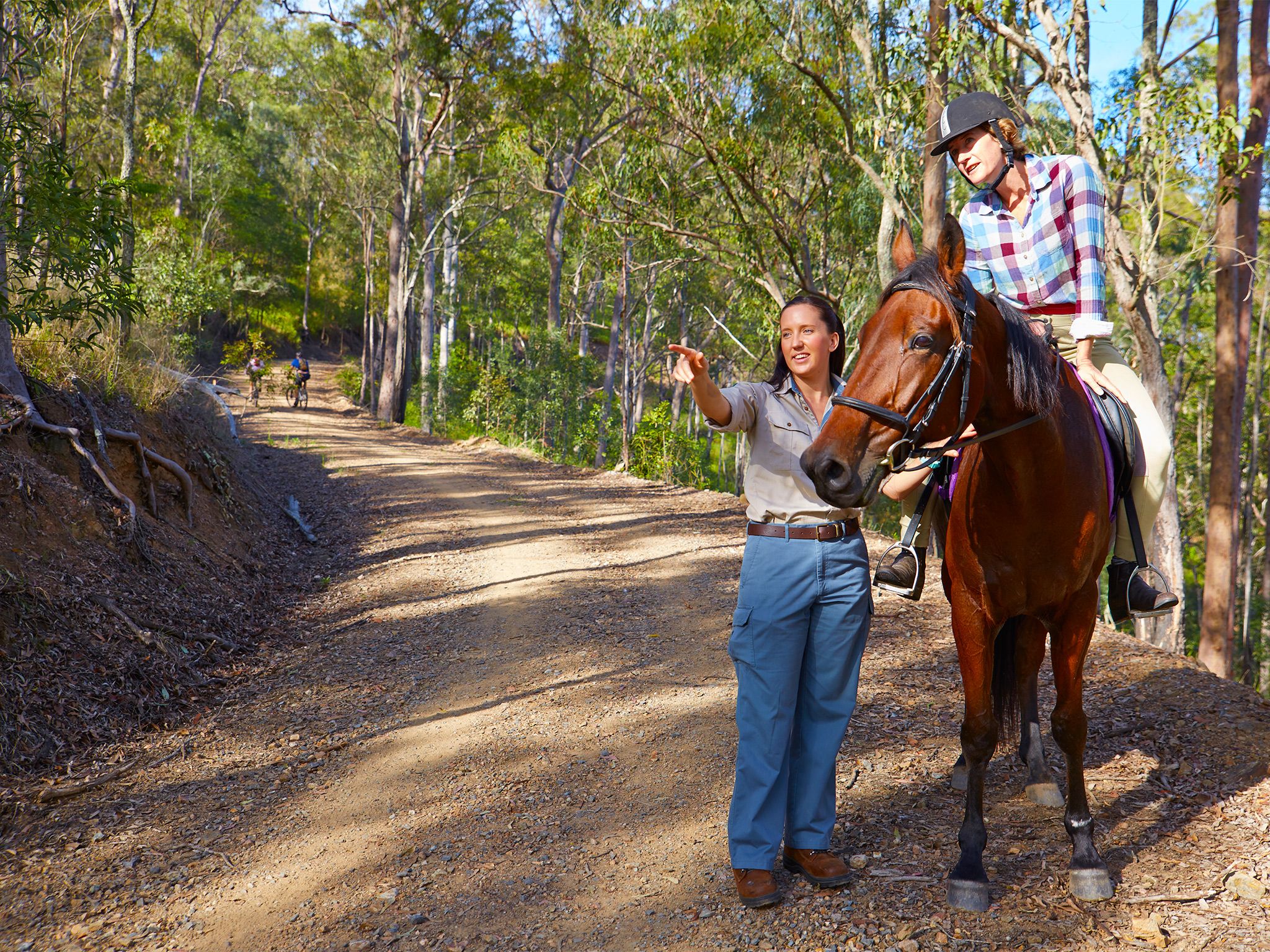
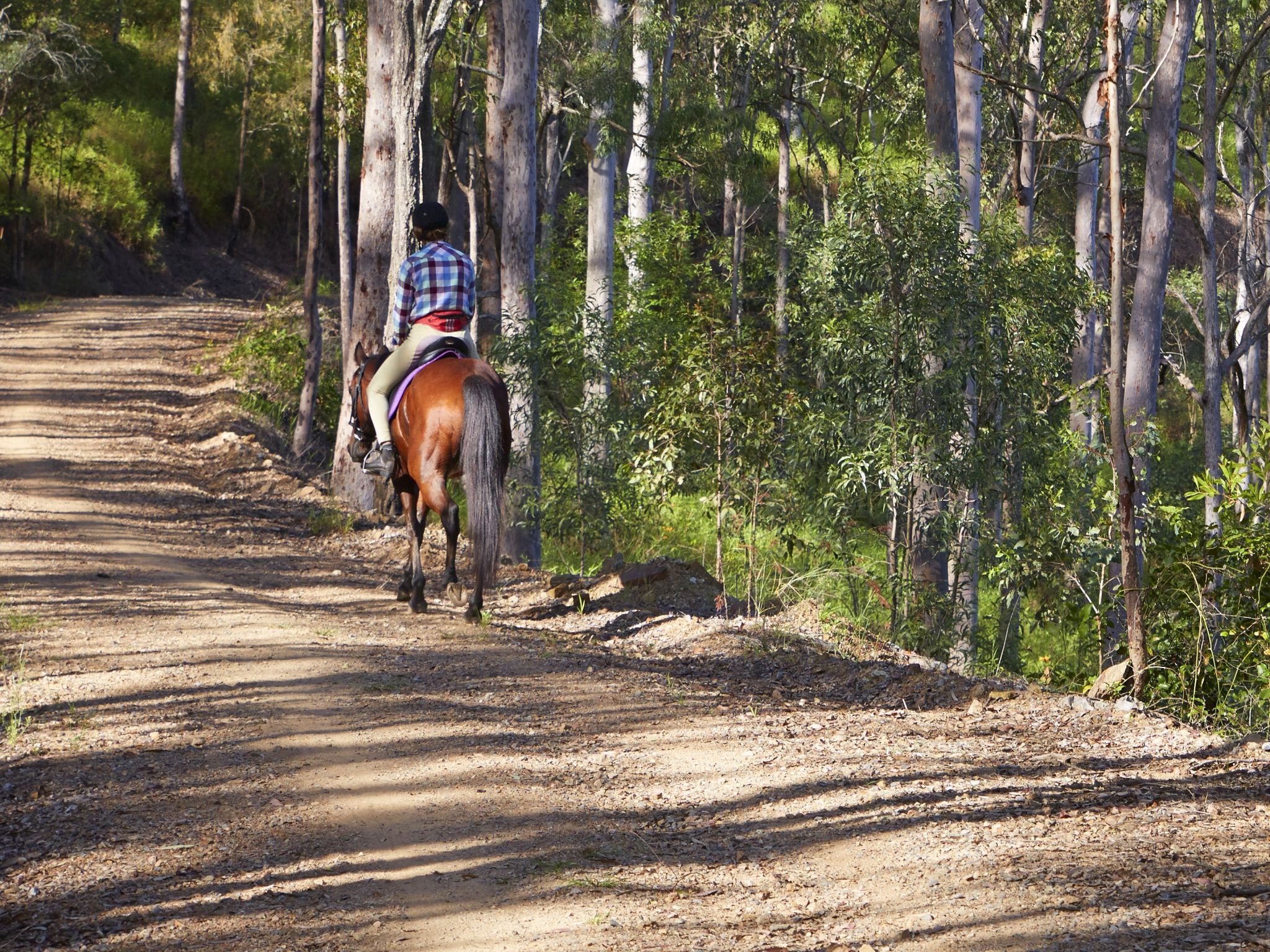
Take a leisurely horseride through the park along shared trails and experience the wonders of the bush at Brisbane's back door.
Ride through beautiful valleys and ridges cloaked in sun-dappled forests, impressive towering trees, stands of grass trees, lush subtropical rainforest and expansive vistas to the east and west.
Though there are several bush camps along the trail network in the South D’Aguilar section—only walkers and mountain-bike riders can use these sites. Horseriders, be aware that horses are not permitted to stay in the park overnight.
More detail about the horseriding trail network is provided in the South D'Aguilar shared trails map and the D'Aguilar National Park—South D’Aguilar section topographic map, available for purchase from the Walkabout Creek Discovery Centre at The Gap.
Getting there and getting around
Most of the horseriding trail network runs through the South D'Aguilar section of D'Aguilar National Park, between 10km and 35km north-west of Brisbane's city centre. There are a couple of trails in the North D'Aguilar section (Mount Mee) of the park, about 70km from Brisbane, that are open to horseriders and walkers only.
- Access roads are suitable for conventional (2WD) vehicles. For more information about accessing the horseriding trails in D'Aguilar National Park, please consult the South D'Aguilar shared trails map and the Mount Mee forest drives and trails map or purchase a D'Aguilar National Park—South D’Aguilar section topographic map from the Walkabout Creek Discovery Centre.
South D'Aguilar section
- From the Brisbane suburb of The Gap, take Mount Nebo Road (tourist route number 8).
- Continue along Mount Nebo Road through the park.
- There are many entry points to the trail network from access roads along Mount Nebo Road.
North D'Aguilar section (Mount Mee)—Northern and Southern trails
- From the township of Dayboro, drive north along McKenzie Street for 2km to the junction of Lacey Creek and Mount Pleasant roads.
- To access the southern trail, turn left onto Lacey Creek Road and follow for 8.5km. Turn right onto Wirth Road and travel a further 3km to the locked gate at the park boundary. Due to the narrow road, there is limited area for horse floats to be turned around.
- To access the northern trail, turn right onto Mount Pleasant Road and drive 4km, then follow Mount Brisbane and Chambers roads to the park entrance. There is limited space at the trail entrance to turn horse floats around.
Wheelchair access
There are no wheelchair-accessible facilities along this trail network.
Before you visit
Opening hours
Horseriding trail network is open 24 hours a day—no overnight stay.
Check park alerts for the latest information on access, closures and conditions.
Visiting safely
For more safety information see:
- Flood recovery roadworks within Camp Mountain and Bellbird Grove areas. 8 April to 31 May 2024
- Mt Mee - Mill Rainforest walking track closed due to storm damage 5 January 2021 to 30 September 2024
- Camp Mountain Road Works 24 January to 30 June 2024