4WD and trail bike road network
Four-wheel drive or ride your registered trail bike on the designated forest drive network in the northern section of D’Aguilar National Park.
- Journey type
- 4WD, trail bike
- Distance
- Various road network
- Time suggested
- Various
- Grade
- Various
Accessible by
- 4WD
- Trail bike
Journey facilities
- Lookout (natural and constructed)
- Wheelchair access (may require assistance)
- Scenic drive
- Trail bike riding
-
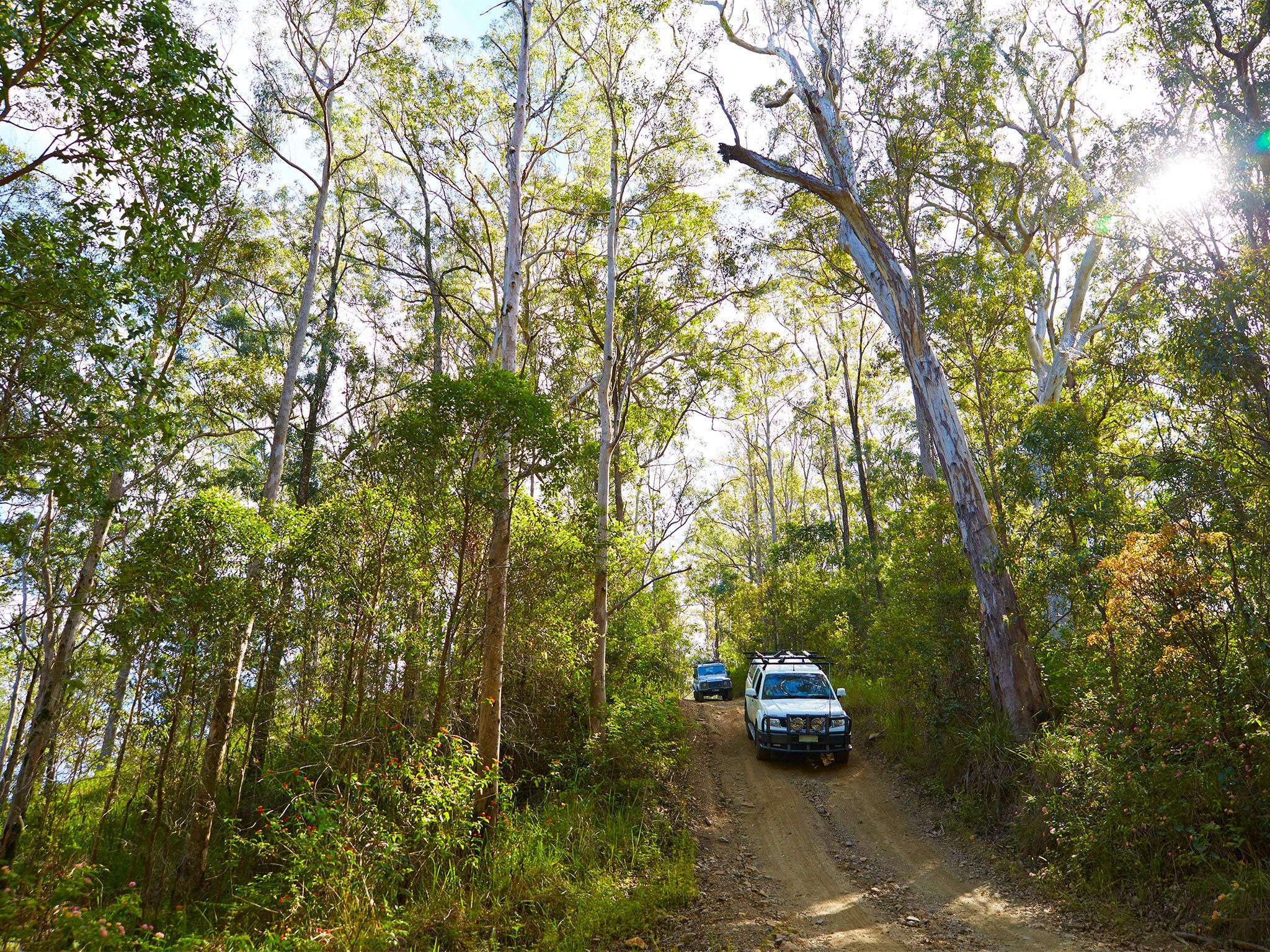
![Escape the city to the bush in North D'Aguilar, driving on dirt roads that wind through mountains and valleys.]() Escape the city to the bush in North D'Aguilar, driving on dirt roads that wind through mountains and valleys.
Photo credit: Maxime Coquard © Queensland Government
Escape the city to the bush in North D'Aguilar, driving on dirt roads that wind through mountains and valleys.
Photo credit: Maxime Coquard © Queensland Government
-
![A 4WD adventure on the road network is a great way to experience the wonders of this park.]() A 4WD adventure on the road network is a great way to experience the wonders of this park.
Photo credit: Maxime Coquard © Queensland Government
A 4WD adventure on the road network is a great way to experience the wonders of this park.
Photo credit: Maxime Coquard © Queensland Government
-
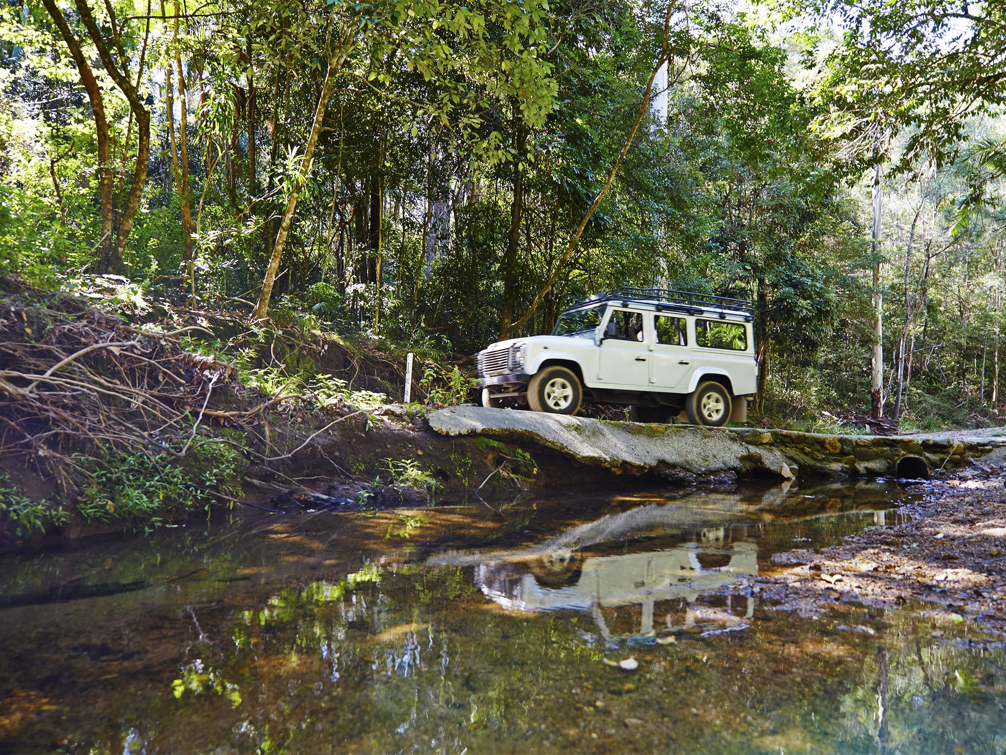
![Rumble over creek crossings throughout the northern section of D'Aguilar National Park.]() Rumble over creek crossings throughout the northern section of D'Aguilar National Park.
Photo credit: Maxime Coquard © Queensland Government
Rumble over creek crossings throughout the northern section of D'Aguilar National Park.
Photo credit: Maxime Coquard © Queensland Government
-
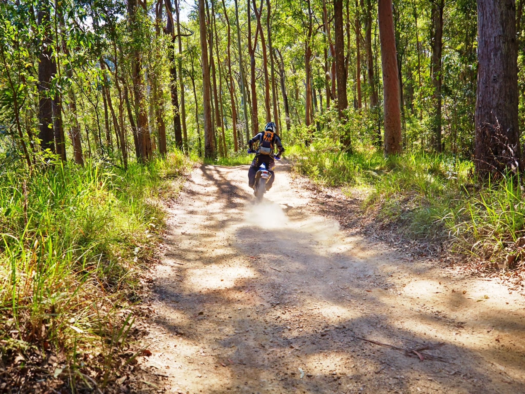
![Get on your trail bike and explore the extensive road network in the northern section of the park.]() Get on your trail bike and explore the extensive road network in the northern section of the park.
Photo credit: Maxime Coquard © Queensland Government
Get on your trail bike and explore the extensive road network in the northern section of the park.
Photo credit: Maxime Coquard © Queensland Government

Take a scenic 4WD or trail bike ride through towering trees and lush subtropical rainforest, to rocky escarpments with expansive views.
Journey along one of three popular routes on offer—the Western escarpment forest drive, Mount Mee forest drive and Range Road forest drive.
Stop along the way to stretch your legs on a bushwalk at Falls lookout track or cool your feet in the tranquil waterholes at Rocky Hole track and Broadwater.
Stay overnight at Neurum Creek camping area or Archer camping area, accessible from the Mount Mee forest drive, and enjoy a chorus of frog song.
Four-wheel drive or ride your trail bike on the designated forest drive network in the northern section of D’Aguilar National Park. All vehicles, including trail bikes, must be road registered and stay on the designated 4WD and trail bike roads—access to all other roads and trails is prohibited. Be aware of walkers and horseriders who might share or cross the roads.
More details about the 4WD and trail bike road network is provided in the Mount Mee forest drives and trails map .
Getting there and getting around
The 4WD and trail bike road network is in the North D'Aguilar section (Mount Mee) of D'Aguilar National Park, about 70km from Brisbane city. A road registered trail bike or 4WD is required.
- This unsealed road network can be accessed from The Gantry or from the northern entrance to the park (see access details below).
- The sealed road to The Gantry is suitable for conventional (2WD) vehicles. The unsealed road network beyond The Gantry is suitable only for 4WD vehicles or trail bikes.
- The maximum speed limit on forest drives is 40km/hr. All road rules apply.
- Read 4WD with care for important information on 4WD safety and minimal impact driving.
- Read trail bike ride with care for tips on riding safely and riding with care.
- See the Mount Mee forest drives and trails map for more information.
Mount Mee access roads will be closed following a rain event of greater than 100mm within a 24hr period due to causeway flooding and for visitor safety.
From the south
- Drive 24km from Dayboro via Mount Mee Road (tourist route number 29) and Sellin Road to the park's entrance.
- Continue 920m to The Gantry.
From the north
- Drive 17km from Woodford via the D'Aguilar Highway, Neurum, Stanton and Rassmussen roads to the park's northern entrance.
- Drive on to link up with the Mount Mee forest drive.
Wheelchair access
There is wheelchair access to toilets, picnic tables and barbecues within The Gantry day-use area. Assistance may be required.
Before you visit
Opening hours
4WD and trail bike roads are open 24 hours a day.
Check park alerts for the latest information on access, closures and conditions.
Visiting safely
For more safety information see:
- Flood recovery roadworks within Camp Mountain and Bellbird Grove areas. 8 April to 31 May 2024
- Mt Mee - Mill Rainforest walking track closed due to storm damage 5 January 2021 to 30 September 2024
- Camp Mountain Road Works 24 January to 30 June 2024