Falls lookout track
Enjoy a peaceful walk with excellent views of Bulls Falls and the surrounding ridges and valleys from two lookout points.
- Journey type
- Walk
- Distance
- 1km return Start and finish points are the same and the traveller must return via the same path
- Time suggested
- Allow 30min walking time
- Grade
- Grade 2 walking track
Accessible by
- 4WD
- Trail bike
Journey facilities
- Lookout (constructed)
- Walking
-
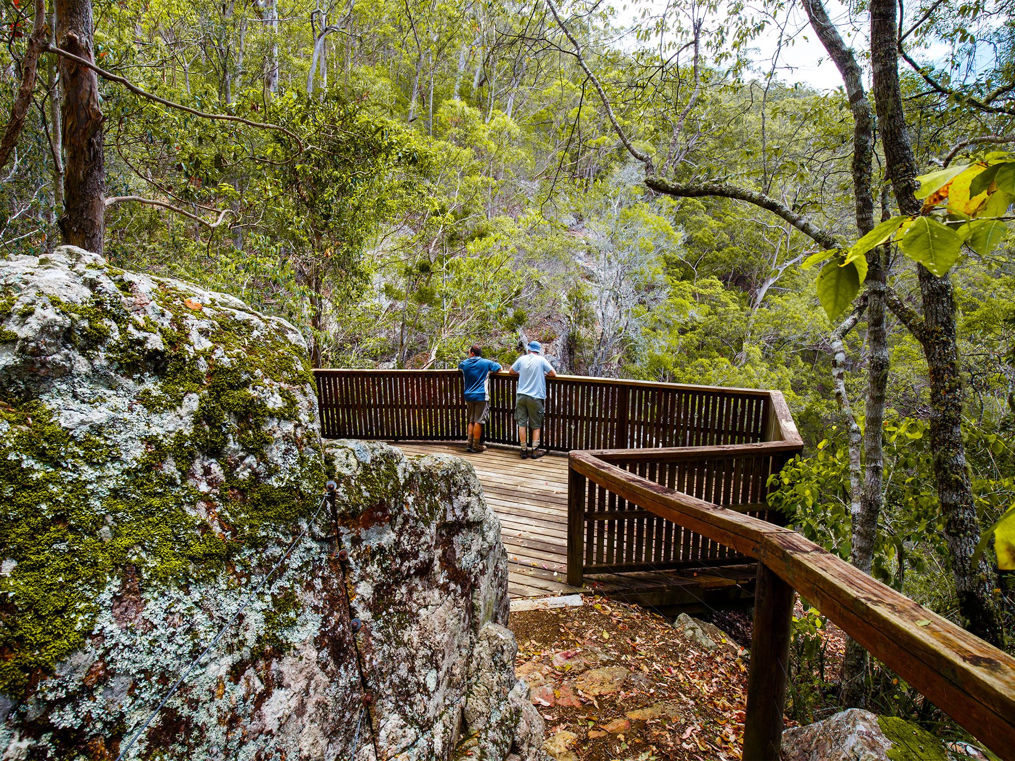
![Enjoy views of Neurum Valley and Bulls Falls from the end of the track.]() Enjoy views of Neurum Valley and Bulls Falls from the end of the track.
Photo credit: Tomek Z Genek © Queensland Government
Enjoy views of Neurum Valley and Bulls Falls from the end of the track.
Photo credit: Tomek Z Genek © Queensland Government
-
![The Falls lookout track is an easy 400m walk.]() The Falls lookout track is an easy 400m walk.
Photo credit: Tomek Z Genek © Queensland Government
The Falls lookout track is an easy 400m walk.
Photo credit: Tomek Z Genek © Queensland Government
Make a stop on the Mount Mee forest drive to discover a tranquil sanctuary in D’Aguilar National Park’s northern section.
This easy walk travels through scrub forest to a lookout platform boasting sweeping panoramas of the northern D'Aguilar Range and picturesque Neurum Valley.
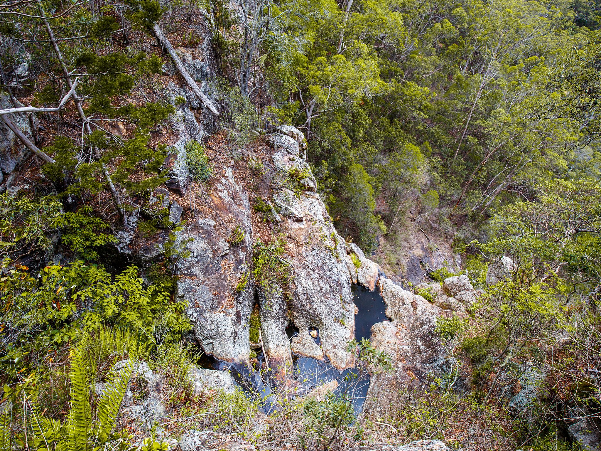
Continue a further 80m to Bulls Falls where you'll be treated to beautiful vistas of sheltered rainforest pools and rocky crags.
Listen for bowerbirds, wompoo fruit-doves and yellow-tailed cockatoos that call this forest home. Take a pair of binoculars and see if you can spy wildlife along the walk.
Getting there and getting around
Falls lookout track is in the North D'Aguilar section (Mount Mee) of D'Aguilar National Park, about 70km from the city of Brisbane.
- The track begins from the Falls lookout car park.
- Access to Falls lookout track is recommended for four-wheel drive (4WD) vehicles and trail bikes only.
- The maximum speed limit on forest roads is 40km/hr and all road rules apply.
- Read 4WD with care for important information on 4WD safety and minimal impact driving.
- Read trail bike ride with care for tips on riding safely and riding with care.
Mount Mee access roads will be closed following a rain event of greater than 100mm within a 24hr period due to causeway flooding and for visitor safety.
From the south
- Drive 24km from Dayboro, via Mount Mee Road (tourist route number 29) and Sellin Road to the park's entrance.
- Drive past The Gantry then turn right onto the Mount Mee forest drive. Drive 850m and veer left at the junction and travel 200m to the Falls lookout car park.
From the north
- Drive about 17km from Woodford, via the D'Aguilar Highway, Neurum, Stanton and Rassmussen roads to the park's northern entrance.
- Travel south along the Mount Mee forest drive, following signs to the Falls lookout car park, about 1.2km from the park's entrance.
Wheelchair access
There are no wheelchair-accessible facilities on this track. The closest wheelchair-accessible facilities are at The Gantry day-use area.
Before you visit
Opening hours
Falls lookout track is open 24 hours a day.
Check park alerts for the latest information on access, closures and conditions.
Visiting safely
For more safety information see Visiting D'Aguilar National Park safely and Walk with care.
- Flood recovery roadworks within Camp Mountain and Bellbird Grove areas. 8 April to 31 May 2024
- Mt Mee - Mill Rainforest walking track closed due to storm damage 5 January 2021 to 30 September 2024
- Camp Mountain Road Works 24 January to 30 June 2024