South Boundary Road trail
Set out for adventure on this long and challenging shared trail through tall eucalypt forest, with lovely views towards Enoggera Reservoir.
- Journey type
- Walk, cycle, horse
- Distance
- 22km one way A path where the start point is different to the finish point
- Time suggested
- Varied
- Grade
- Various
Accessible by
- Conventional vehicle
- Horse
- Bicycle
Journey facilities
- Walking
- Cycling
- Horseriding
-
![The trail is for walkers, mountain bike riders and horseriders.]() The trail is for walkers, mountain bike riders and horseriders.
Photo credit: Maxime Coquard © Queensland Government
The trail is for walkers, mountain bike riders and horseriders.
Photo credit: Maxime Coquard © Queensland Government
-
![Enjoy a mountain bike ride from The Gap to just before Mount Nebo on the South Boundary Road trail.]() Enjoy a mountain bike ride from The Gap to just before Mount Nebo on the South Boundary Road trail.
Photo credit: Maxime Coquard © Queensland Government
Enjoy a mountain bike ride from The Gap to just before Mount Nebo on the South Boundary Road trail.
Photo credit: Maxime Coquard © Queensland Government
-
![Climb steep and forested ridges to views of Enoggera Reservoir.]() Climb steep and forested ridges to views of Enoggera Reservoir.
Photo credit: © Sue Gregory
Climb steep and forested ridges to views of Enoggera Reservoir.
Photo credit: © Sue Gregory
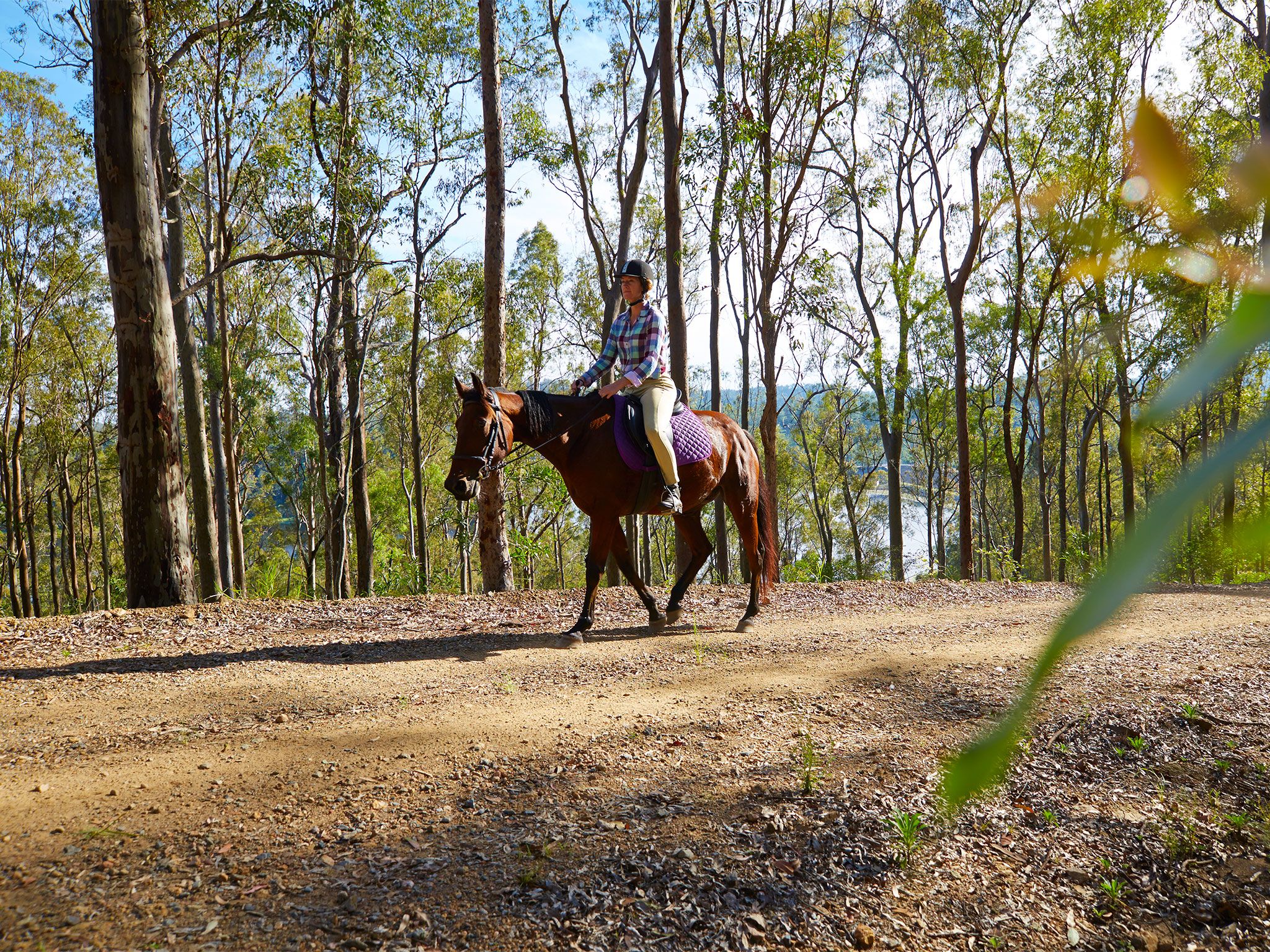
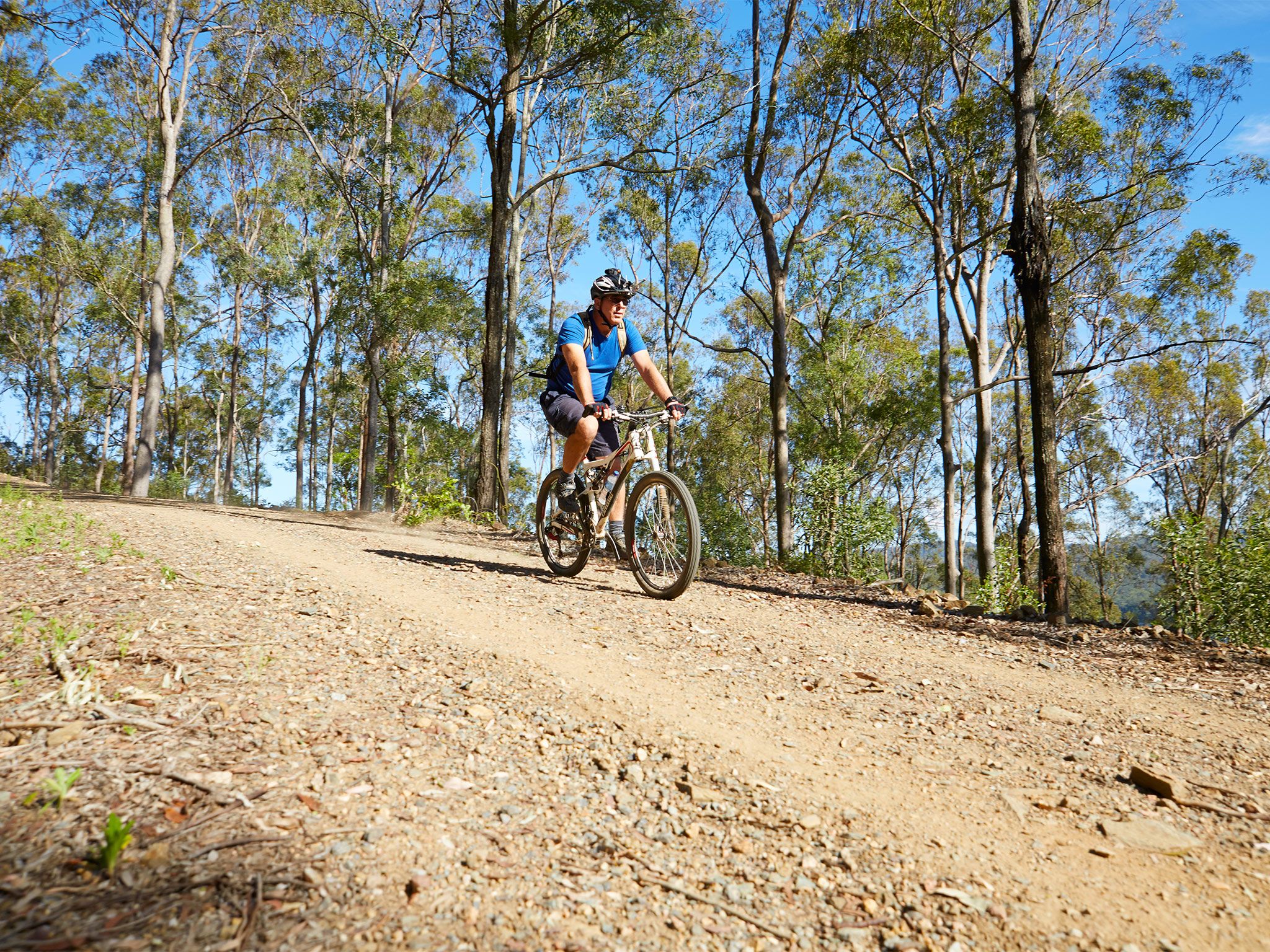
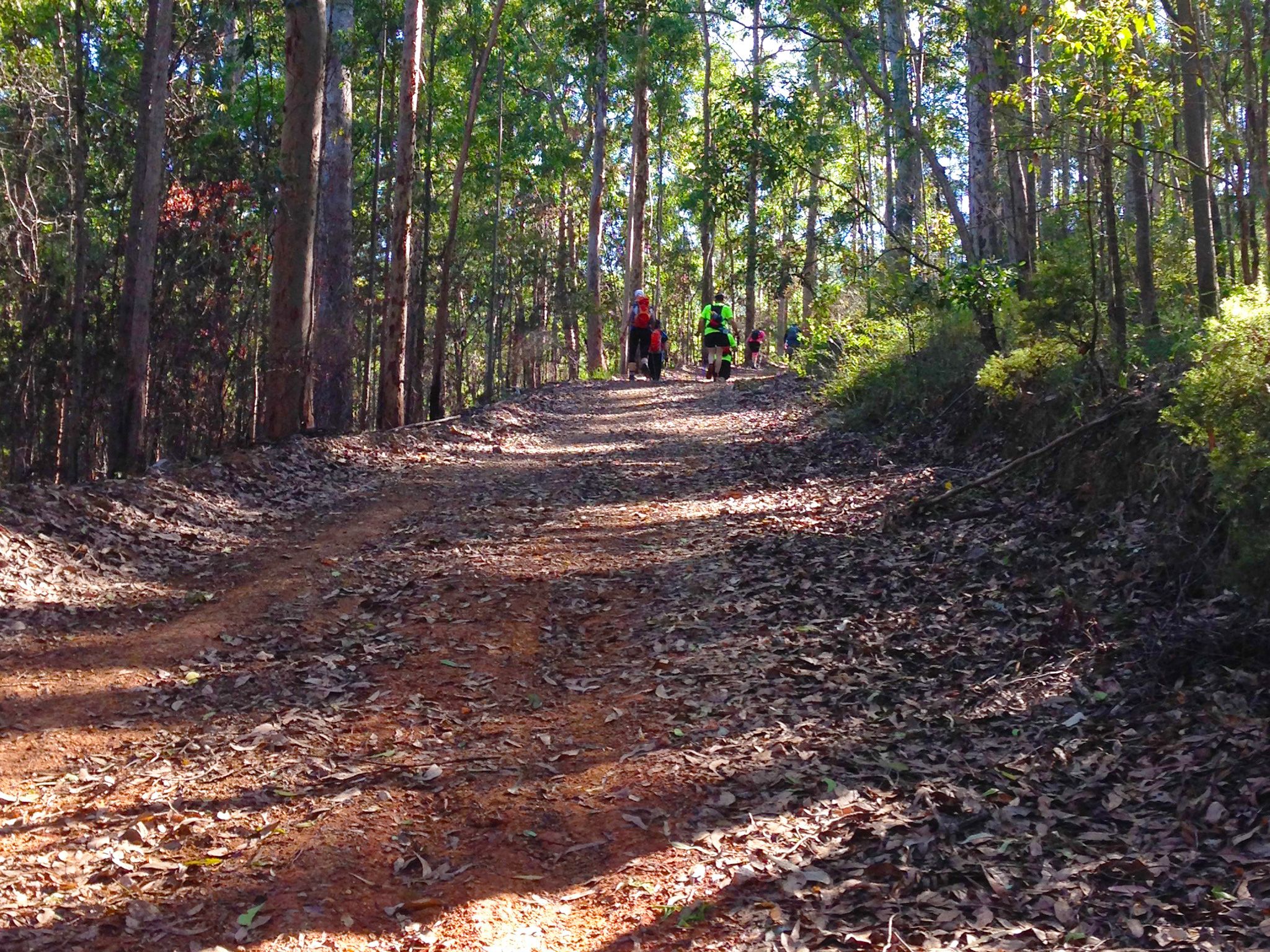
Enjoy a hike, horse or mountain-bike ride along a beautiful forest ridge, linking The Gap to Bullockys Dam, near Jollys Lookout on Mount Nebo Road.
Pass through stands of stately gum trees at the start of the shared trail, with views looking back towards the glistening water of Enoggera Reservoir, before challenging yourself on several long climbs.
Mountain-bike riders and walkers can pitch a tent and rest weary legs for the night at Scrub Road remote bush camp, located along this trail.
Horseriders, be aware that horses are not permitted to stay in the park overnight.
More detail about the mountain bike trail network and horseriding trail network is provided in the South D’Aguilar shared trails map and the D'Aguilar National Park—South D’Aguilar section topographic map, available for purchase from the Walkabout Creek Discovery Centre at The Gap.
Getting there and getting around
The South Boundary Road trail is in the South D'Aguilar section of D'Aguilar National Park, between 12km and 32km north-west of Brisbane's city centre. You can start from either the southern or the northern end of the trail.
Access roads are sealed and suitable for conventional (2WD) vehicles.
From the south
- The South Boundary Road trail begins at the end of Payne Road, which is off Waterworks Road in the Brisbane suburb of The Gap.
- There is limited legal parking available at the end of Payne Road. Please organise to be dropped off and/or picked up from this location.
- Do not block access to the gate as Park Rangers and emergency vehicles need access at all times.
From the north
- From the Brisbane suburb of The Gap, take Mount Nebo Road (tourist route number 8) to Walkabout Creek Discovery Centre.
- Continue north-west along Mount Nebo Road for 16km to Bullockys Dam, at the junction with South Boundary Road, located between Jollys Lookout and Boombana.
- Alternatively, drive about 27km from Samford via Mount Glorious and Mount Nebo roads to Bullockys Dam, at the junction with South Boundary Road, located between Jollys Lookout and Boombana.
- Start the trail at Bullockys Dam, at the junction of Mount Nebo and South Boundary roads.
Wheelchair access
There are no wheelchair-accessible facilities on this trail. The closest wheelchair-accessible facilities are located at Jollys Lookout.
Before you visit
Opening hours
South Boundary Road trail is open 24 hours a day.
Check park alerts for the latest information on access, closures and conditions.
Visiting safely
For more safety information see:
- Flood recovery roadworks within Camp Mountain and Bellbird Grove areas. 8 April to 31 May 2024
- Mt Mee - Mill Rainforest walking track closed due to storm damage 5 January 2021 to 30 September 2024
- Camp Mountain Road Works 24 January to 30 June 2024