Mount Mathieson trail
Immerse yourself in early pioneer history and experience the rugged landscape of Main Range on this physically challenging walk.
- Journey type
- Walk
- Distance
- 8.1km return Start and finish points are the same and the traveller must return via the same path
- Time suggested
- Allow 3hr walking time.
- Grade
- Grade 4 walking track
Accessible by
- 4WD
Journey facilities
- Lookout (natural)
- Walking
-
![Immerse yourself in the rugged landscape of the Main Range.]() Immerse yourself in the rugged landscape of the Main Range.
Photo credit: © Chris Whitelaw
Immerse yourself in the rugged landscape of the Main Range.
Photo credit: © Chris Whitelaw
-
![Take in views of Mount Mitchell and Mount Cordeaux.]() Take in views of Mount Mitchell and Mount Cordeaux.
Photo credit: Cameron Semple © High and Wide
Take in views of Mount Mitchell and Mount Cordeaux.
Photo credit: Cameron Semple © High and Wide
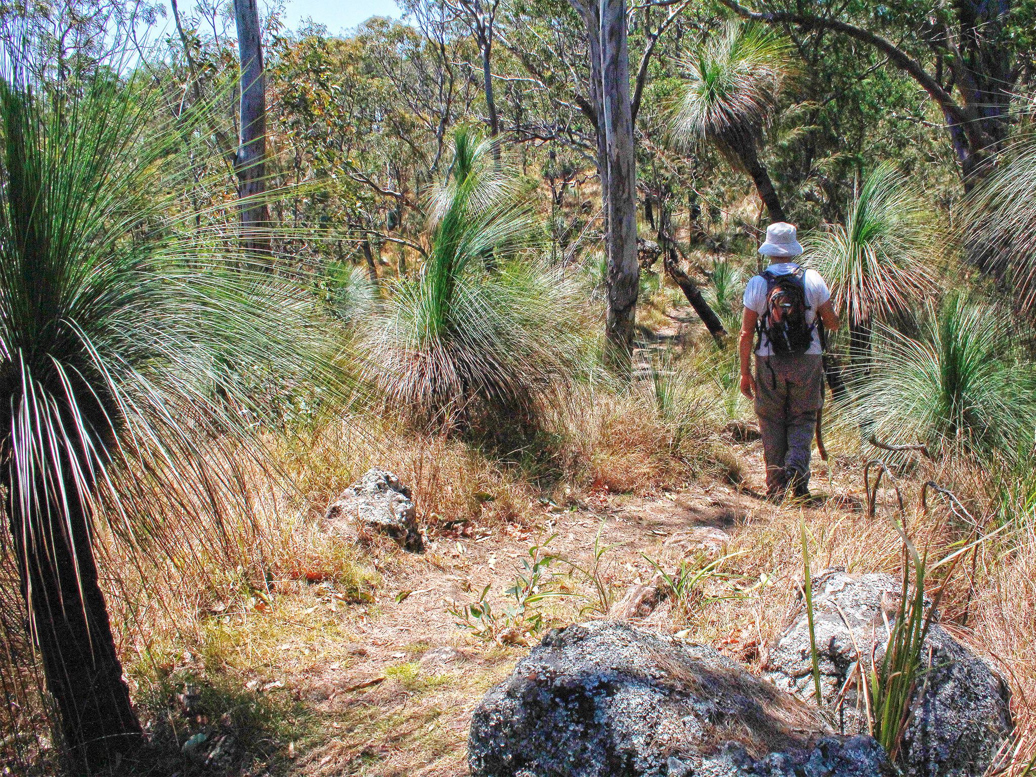
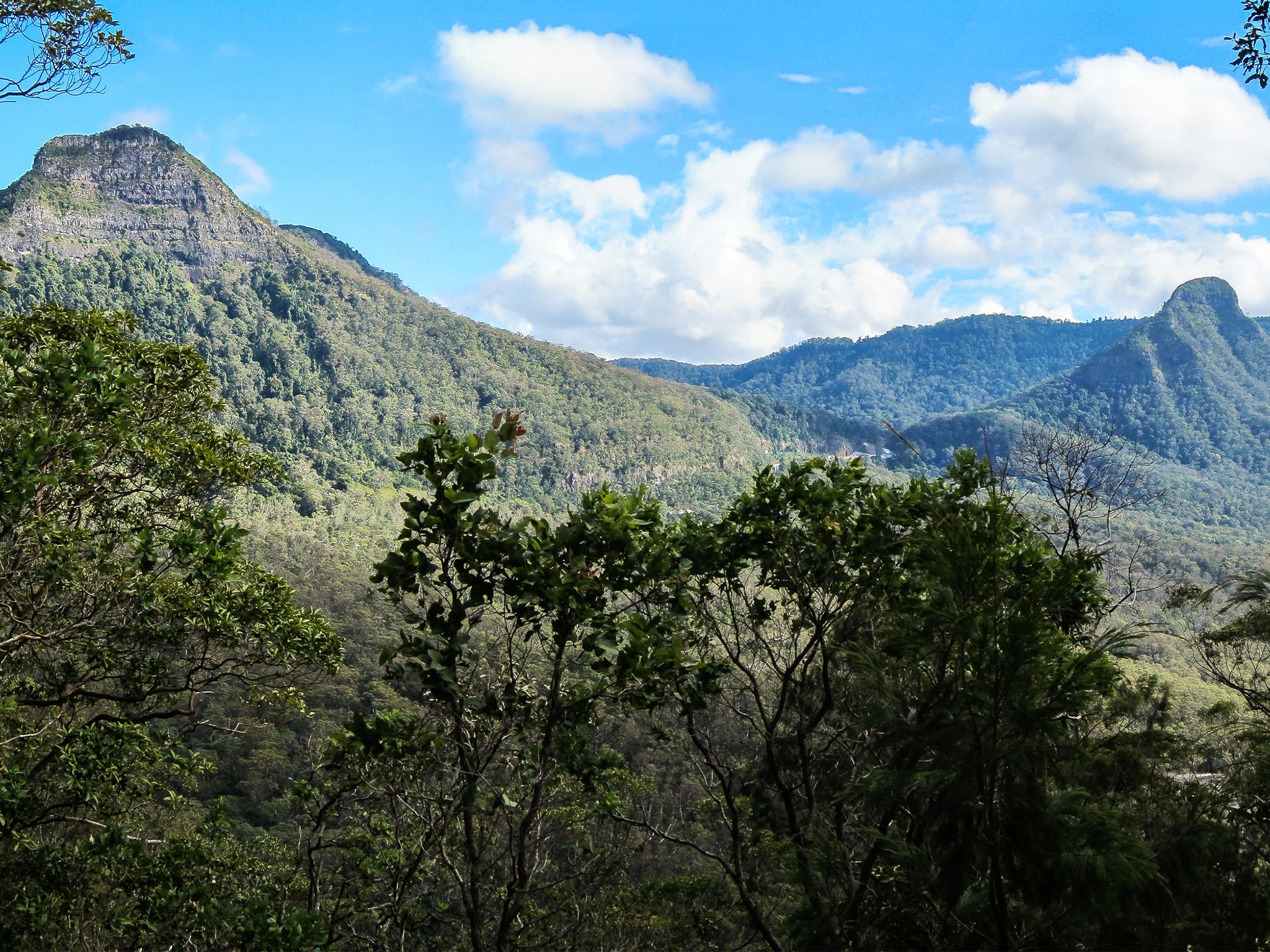
Take in the views of Cunninghams Gap from the natural lookouts along this rough trail through lofty eucalypts and lush rainforest.
From the Pioneer picnic area the first part of the trail, to Mount Mathieson, is a gentle grade. From there the trail is more rugged and you’ll need to tackle quite steep, rocky and narrow sections.
As you walk through the rainforest keep an eye out for the timber jinker (wagon), a relic from the early timber-cutting years.
Learn about the early pioneering years from informative signs along the trail.
This park is part of the Gondwana Rainforests of Australia World Heritage Area, famed for its ongoing geological processes, evolutionary history, and diversity (especially of rare, threatened and endemic species).
Getting there and getting around
The Mount Mathieson trail is in the Spicers Gap section of Main Range National Park about 120km south-west of Brisbane.
- The trail has two trail heads at the:
- Pioneer picnic area
- western end of Spicers Gap Road, 2.7km from the park entrance (4WD only). Close all gates after passing through.
Getting to the Spicers Gap section
Eastern approach
- The eastern approach to Spicers Gap is suitable for 4WD vehicles.
- From Brisbane, drive about 95km south-west on the Cunningham Highway.
- About 5km west of Aratula turn onto Lake Moogerah Road, drive 6km then turn onto Spicers Gap Road and a further 6km to the park entrance.
For tourism information for all regions in Queensland, see Queensland.com, and for friendly advice on how to get there, where to stay and what to do, find your closest accredited visitor information centre.
Wheelchair access
There are no wheelchair-accessible facilities.
Before you visit
Opening hours
Mount Mathieson trail is open 24 hours a day.
Check park alerts for the latest information on access, closures and conditions.
Visiting safely
For more safety information see Visiting Main Range safely and Walk with care.
- Main Range National Park - Cunninghams Gap section walking track closures 7 February to 5 May 2024
- Roadworks at Cunninghams Gap - Mount Mitchell track temporarily realigned 10 November 2023 to 31 July 2024