Knoll T30 remote bush camp
Settle in for the night at this old survey point in a knoll-top clearing surrounded by lush and thick subtropical rainforest.
Accessible by
- Walk-in
Camping area facilities
- Tent camping
- Long walk to tent
- Walking
-
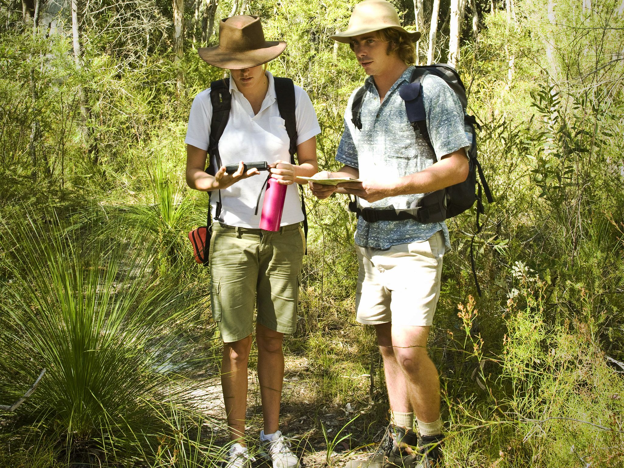
![You need specialist skills to get to this remote bush camp.]() You need specialist skills to get to this remote bush camp.
Photo credit: Briony Masters © Queensland Government
You need specialist skills to get to this remote bush camp.
Photo credit: Briony Masters © Queensland Government
-
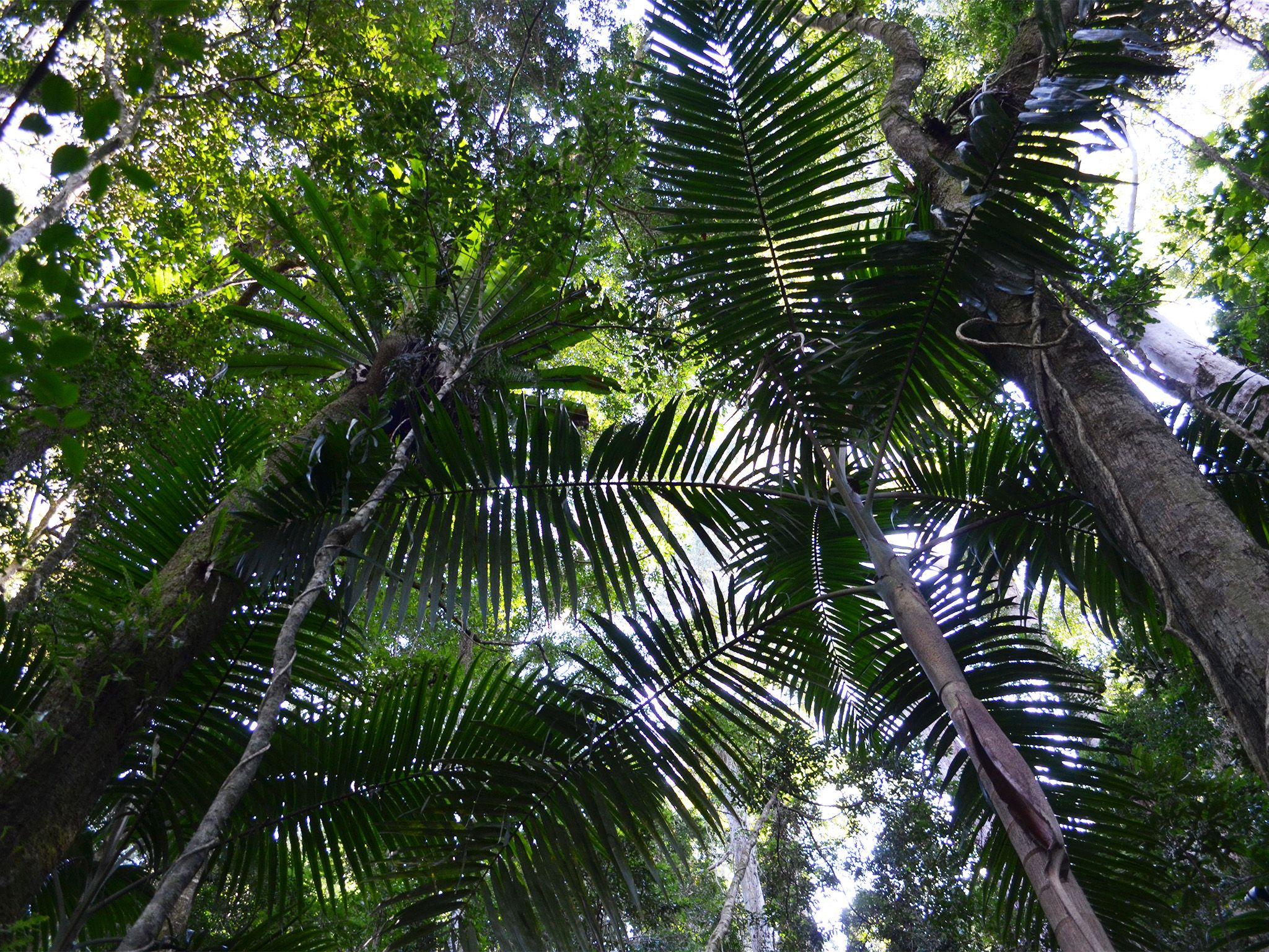
![Camp under the subtropical rainforest canopy.]() Camp under the subtropical rainforest canopy.
Photo credit: © Jennifer Bartlett
Camp under the subtropical rainforest canopy.
Photo credit: © Jennifer Bartlett
Always check
- Park alerts for the latest information on access, closures and conditions.
- Bureau of Meteorology weather forecasts.
- Current bushfire warnings and incidents and also fire bans and restrictions.
- Your camping permit is booked.
- Any park-specific camping information for
Main Range.
- Visiting Main Range safely for important safety information.
If you’re an experienced off-track walker with specialist equipment and well-developed navigational skills, then the walk to this remote camp site is for you.
This rugged section of Main Range is covered in thick rainforest festooned with tangled vines. The crest of the range curves to the east so the views aren’t as extensive as in other parts of the park, but the walk is still fantastic.
This crest area of the park is untouched, unlike much of the area to the west that was selectively logged between 1923 and 1985. Red cedar, hoop pine, tulip oak, purple laurel and other prized timber trees became buildings and furniture in Ipswich and Brisbane, with some even finding its way onto ships bound for England.
This park is part of the Gondwana Rainforests of Australia World Heritage Area, famed for its ongoing geological processes, evolutionary history, and diversity (especially of rare, threatened and endemic species).
Getting there and getting around
Knoll T30 Creek remote area bush camp is in Main Range National Park, about 120km south-west of Brisbane.
Before preparing to walk to remote camping areas, walkers should consider their experience and preparedness levels. A high level of physical fitness and navigational skills are essential.
- Plan to walk safely and be responsible.
- Familiarise yourself with the area before attempting an extended walk.
- Check park alerts for the latest information on access, closures and conditions.
- Research the route thoroughly and get local advice. Recommended maps for bushwalking are 1:25,000 topographic maps. It is also advisable to carry a recognised guidebook for the area.
- Carry good navigation and communication gear.
- Complete a bushwalking advice form and leave your plan with a responsible person.
- Contact your local walking club or Bushwalking Queensland for further information.
Camping permits are essential.
Before you visit
Opening hours
Knoll T30 remote area bush camp is open 24 hours a day. Check-in to your camp after 2pm and check-out by 11am on the day of departure.
Check park alerts for the latest information on access, closures and conditions.
Camping area features: Pleasant rainforest site. No views.
Location: Map Sheet: Cunninghams Gap 9341-11, Grid Reference: 387 023, GPS Reference: TBA.
Access: Nearest vehicle access is by 2WD to The Crest car park at Cunninghams Gap on the Cunningham Highway or by high clearance 2WD via Lookout Road from the Goomburra camping area to Sylvesters Lookout walking track. After heavy rains and with increased creek flow, access via Lookout Road is affected and may require high-clearance 4WD vehicles or become impassable.
Number of sites: Open area without separately-defined sites. Maximum of 8 people.
Camp sites are suitable for: self-sufficient, walk-in camping.
Camp site surface: Dirt, leaf litter.
Facilities: None. Must be self-sufficient. Water collected from creeks should be treated before drinking. All rubbish (including food scraps) must be carried out.
Open fires: Prohibited. Use fuel stoves only.
Generator use: Not allowed.
Essentials to bring: Drinking water, extra food, first-aid kit, topographic map, compass, torch, warm clothing, wet weather gear, rubbish bags, insect repellent, fuel or gas stove and a small trowel for burying human waste. Read more about before you visit.
Bookings: book online or learn about our camping booking options.
Mobile phone coverage: Poor.
Upcoming camping area availability
Visiting safely
For more safety information see Visiting Main Range safely and camp with care.
- Main Range National Park - Cunninghams Gap section walking track closures 7 February to 5 May 2024
- Roadworks at Cunninghams Gap - Mount Mitchell track temporarily realigned 10 November 2023 to 31 July 2024