Spicers Peak (East) remote bush camp
Discover a magical landscape and eagle-eye views at this sheltered site at the top of Spicers Peak.
Accessible by
- Walk-in
Camping area facilities
- Tent camping
- Long walk to tent
- Walking
-
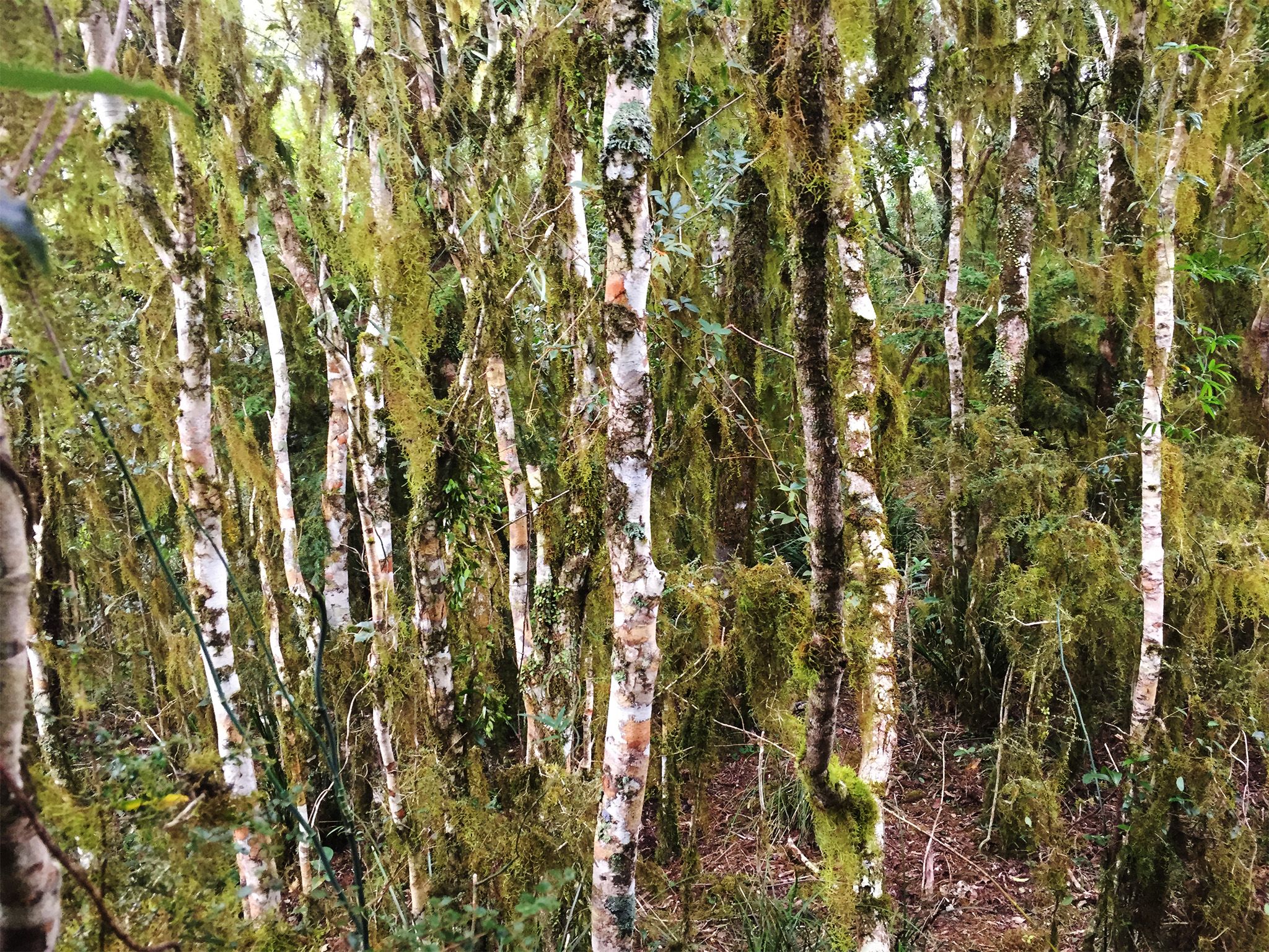
![Sitting high above the eastern landscape, the camp is surrounded by moss- and lichen-covered rainforest.]() Sitting high above the eastern landscape, the camp is surrounded by moss- and lichen-covered rainforest.
Photo credit: © Noah Bergel-Bartlett
Sitting high above the eastern landscape, the camp is surrounded by moss- and lichen-covered rainforest.
Photo credit: © Noah Bergel-Bartlett
-
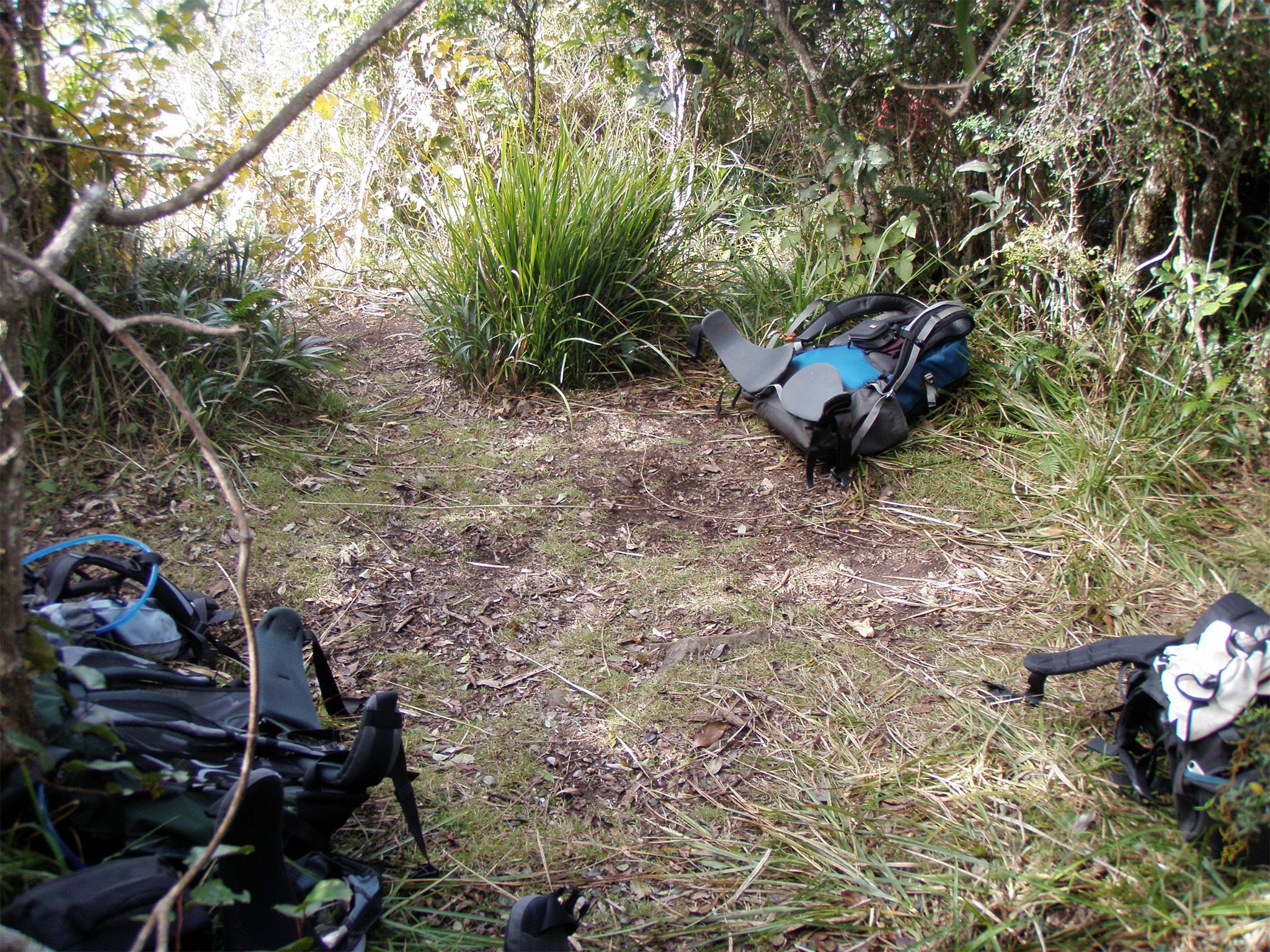
![The camp is a small site at the top of Spicers Peak.]() The camp is a small site at the top of Spicers Peak.
Photo credit: Steve Finlayson © Queensland Government
The camp is a small site at the top of Spicers Peak.
Photo credit: Steve Finlayson © Queensland Government
Always check
- Park alerts for the latest information on access, closures and conditions.
- Bureau of Meteorology weather forecasts.
- Current bushfire warnings and incidents and also fire bans and restrictions.
- Your camping permit is booked.
- Any park-specific camping information for
Main Range.
- Visiting Main Range safely for important safety information.
If you’re an experienced off-track walker with specialist equipment and well-developed navigational skills, then the walk to this remote camp site is for you.
Reap the rewards of the tough walk to the camp by taking in the sights from the cliff face. You'll be captivated by expansive views of the Fassifern Valley and mounts Greville, Edwards, French and Moon. Further east, Moreton Bay and the island can be seen fringing the peaceful horizon. Looking south, Main Range's rugged spine and prominent peaks stretch towards the horizon, and the unmistakeable silhouette of Mount Barney dominates the distant skyline.
This park is part of the Gondwana Rainforests of Australia World Heritage Area, famed for its ongoing geological processes, evolutionary history, and diversity (especially of rare, threatened and endemic species).
Getting there and getting around
Spicers Peak (East) remote area bush camp is in Main Range National Park, about 120km south-west of Brisbane.
Before preparing to walk to remote camping areas, walkers should consider their experience and preparedness levels. A high level of physical fitness and navigational skills are essential.
- Plan to walk safely and be responsible.
- Familiarise yourself with the area before attempting an extended walk.
- Check park alerts for the latest information on access, closures and conditions.
- Research the route thoroughly and get local advice. Recommended maps for bushwalking are 1:25,000 topographic maps. It is also advisable to carry a recognised guidebook for the area.
- Carry good navigation and communication gear.
- Complete a bushwalking advice form and leave your plan with a responsible person.
- Contact your local walking club or Bushwalking Queensland for further information.
Camping permits are essential.
Before you visit
Opening hours
Spicers Peak (East) remote area bush camp is open 24 hours a day. Check-in to your camp after 2pm and check-out by 11am on the day of departure.
Check park alerts for the latest information on access, closures and conditions.
Camping area features: Small elevated rough site on the margin between rainforest and heath with nearby views to the east and south. A lesser-used tent site is located just west of the rock cairn. Exposed rock on and around the peak can cause significant distortion of compass readings. Variations from -40 o to +180 o have been noted.
Location: Map Sheet: Cunninghams Gap 9341-11, Grid Reference: 419 917, GPS Reference: 56J 0441921 6891650 (WGS 84).
Access: Nearest vehicle access is by 2WD to Governors Chair car park via Spicers Gap Road.
Number of sites: Open area without separately-defined sites. Maximum of 4 people.
Camp sites are suitable for: self-sufficient, walk-in camping.
Camp site surface: Grass.
Facilities: None. Must be self-sufficient. No water available nearby. All rubbish (including food scraps) must be carried out.
Open fires: Prohibited. Use fuel stoves only.
Generator use: Not allowed.
Essentials to bring: Drinking water, extra food, first-aid kit, topographic map, compass, torch, warm clothing, wet weather gear, rubbish bags, insect repellent, fuel or gas stove and a small trowel for burying human waste. Read more about before you visit.
Bookings: book online or learn about our camping booking options.
Mobile phone coverage: Poor.
Upcoming camping area availability
Visiting safely
For more safety information see Visiting Main Range safely and camp with care.
- Main Range National Park - Cunninghams Gap section walking track closures 7 February to 5 May 2024
- Roadworks at Cunninghams Gap - Mount Mitchell track temporarily realigned 10 November 2023 to 31 July 2024
- Box Forest track - Fallen trees across track 27–28 April 2024