Paddys Knob remote bush camp
Base yourself at this remote camp site high above the Condamine Gorge and explore the south-western part of the park.
Accessible by
- Walk-in
Camping area facilities
- Tent camping
- Long walk to tent
- Walking
-
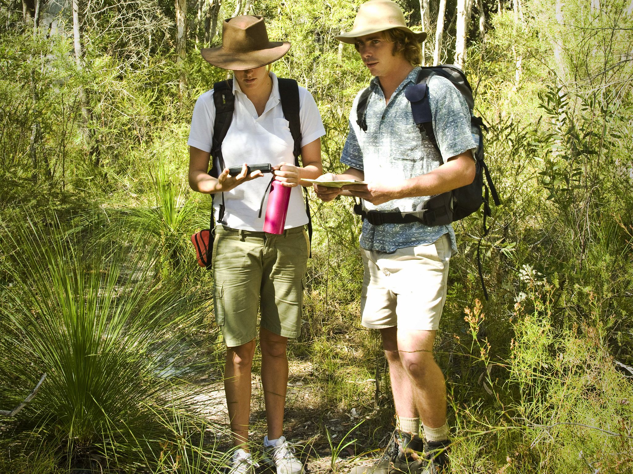
![You need specialist skills to get to this remote bush camp.]() You need specialist skills to get to this remote bush camp.
Photo credit: Briony Masters © Queensland Government
You need specialist skills to get to this remote bush camp.
Photo credit: Briony Masters © Queensland Government
-
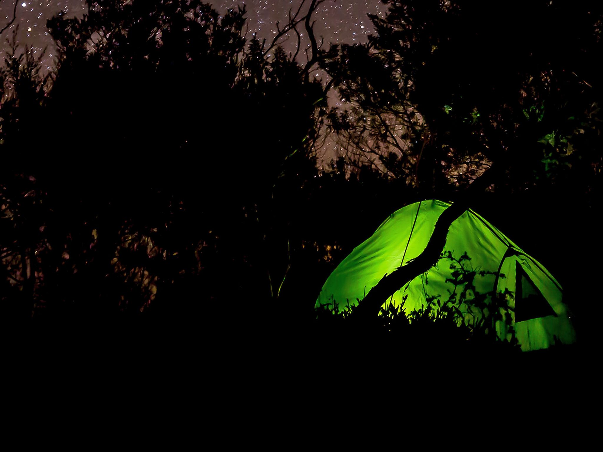
![Camp under a starry sky at this remote area bush camp.]() Camp under a starry sky at this remote area bush camp.
Photo credit: © Casey Eveleigh Photography
Camp under a starry sky at this remote area bush camp.
Photo credit: © Casey Eveleigh Photography
Always check
- Park alerts for the latest information on access, closures and conditions.
- Bureau of Meteorology weather forecasts.
- Current bushfire warnings and incidents and also fire bans and restrictions.
- Your camping permit is booked.
- Any park-specific camping information for
Main Range.
- Visiting Main Range safely for important safety information.
If you’re an experienced off-track walker with specialist equipment and well-developed navigational skills, then the walk to this remote camp site is for you.
Nestled in a grassy open area and surrounded by eucalypt forest, this camp site is 400m north-east of Paddys Knob, a protruding feature within the southern cliff line of Condamine Gorge.
Also known as Cambanoora Gorge, and beginning south-west of the historical area known as The Head, the gorge is framed by Wilsons Peak to the south and majestic Mount Superbus. The gorge finishes about 7km east of Killarney.
Grab your camera when you head to the cliff because you’ll get some spectacular shots up and down the gorge.
This park is part of the Gondwana Rainforests of Australia World Heritage Area, famed for its ongoing geological processes, evolutionary history, and diversity (especially of rare, threatened and endemic species).
Getting there and getting around
Paddys Knob remote area bush camp is in Main Range National Park, about 120km south-west of Brisbane.
Before preparing to walk to remote camping areas, walkers should consider their experience and preparedness levels. A high level of physical fitness and navigational skills are essential.
- Plan to walk safely and be responsible.
- Familiarise yourself with the area before attempting an extended walk.
- Check park alerts for the latest information on access, closures and conditions.
- Research the route thoroughly and get local advice. Recommended maps for bushwalking are 1:25,000 topographic maps. It is also advisable to carry a recognised guidebook for the area.
- Carry good navigation and communication gear.
- Complete a bushwalking advice form and leave your plan with a responsible person.
- Contact your local walking club or Bushwalking Queensland for further information.
Camping permits are essential.
Before you visit
Opening hours
Paddys Knob remote area bush camp is open 24 hours a day. Check-in to your camp after 2pm and check-out by 11am on the day of departure.
Check park alerts for the latest information on access, closures and conditions.
Camping area features
Located in open forest north-east of Paddys Knob. Prominent grassy areas, which were once grazed, provide the opportunity for expansive views. Views of Condamine Gorge can also be seen at Paddys Knob approximately 400m south-west from the site.
Location: Map sheet: Wilsons Peak 9341-21, Grid reference: 440 708, GPS reference: 56J 0440126 6870751 (WGS 84).
Access: Nearest 2WD/4WD vehicle access is east of Mount Colliery township via Gambubal Road.
Number of sites: Open area without separately-defined sites. Maximum of 8 people.
Camp sites are suitable for: self-sufficient, walk-in camping.
Camp site surface: Grass.
Facilities: None. Must be self-sufficient. Water is usually available under most conditions within 300 m west of the site. Water collected from creeks should be treated before drinking. All rubbish (including food scraps) must be carried out.
Open fires: Prohibited. Use fuel stoves only.
Generator use: Not allowed.
Essentials to bring: Drinking water, extra food, first-aid kit, topographic map, compass, torch, warm clothing, wet weather gear, rubbish bags, insect repellent, fuel or gas stove and a small trowel for burying human waste. To protect water quality, ensure toilet areas are located at least 100m from the creek. Read more about before you visit.
Bookings: book online or learn about our camping booking options.
Mobile phone coverage: Poor.
Upcoming camping area availability
Visiting safely
For more safety information see Visiting Main Range safely and camp with care.
- Main Range National Park - Cunninghams Gap section walking track closures 7 February to 5 May 2024
- Roadworks at Cunninghams Gap - Mount Mitchell track temporarily realigned 10 November 2023 to 31 July 2024
- Box Forest track - Fallen trees across track 27–28 April 2024