Teebing (Wathumba Spit) camping area
This protected beach camping area is one of the island’s most secluded, and a paradise for water activities.
Accessible by
- Boat
Camping area facilities
- Anchoring allowed
- Generators allowed (conditions apply)
- Tent camping
- Short walk to tent
- Walking
- Canoeing and kayaking
- Fishing
-
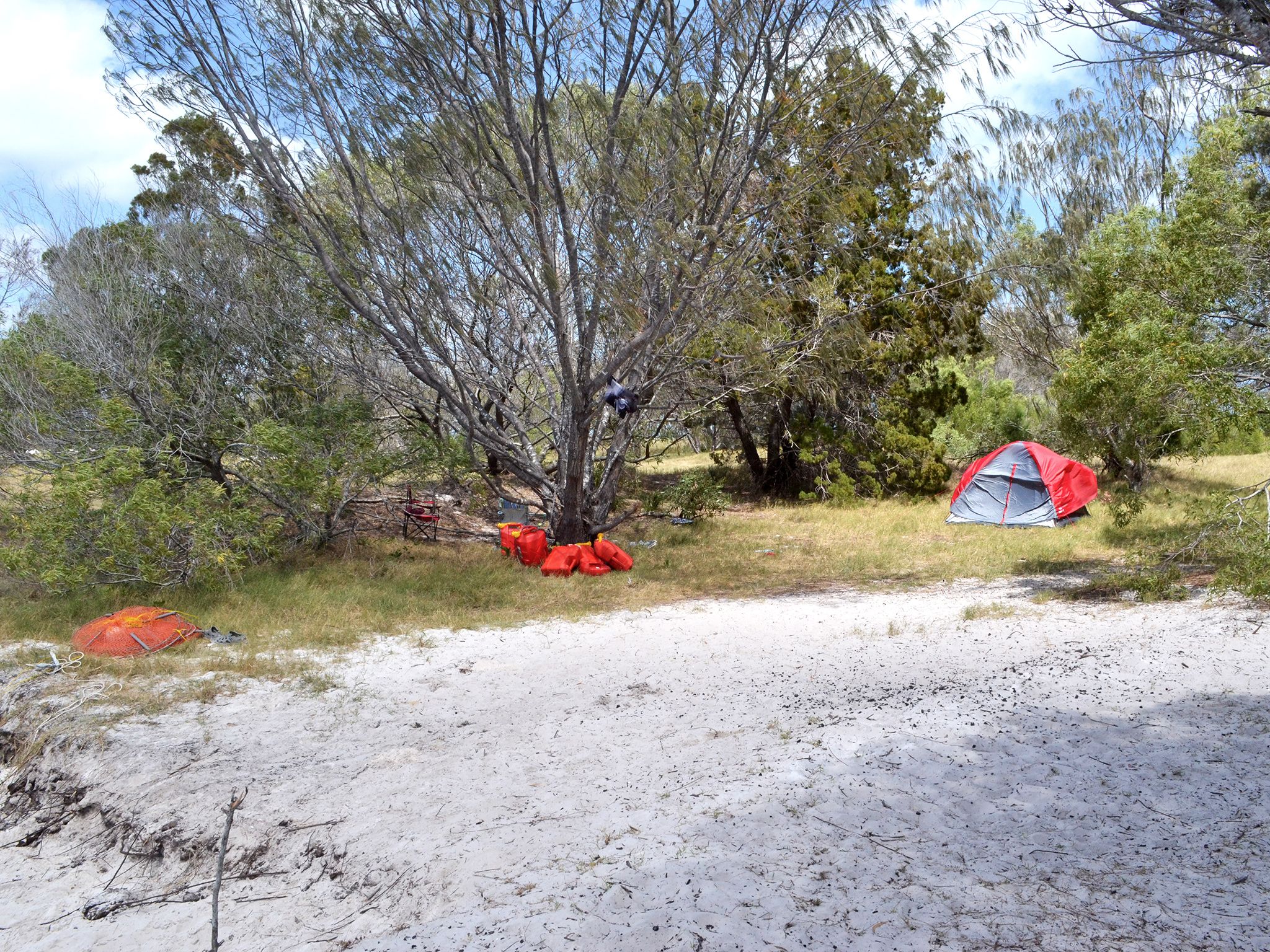
![Enjoy very low-key camping on beautiful Platypus Bay.]() Enjoy very low-key camping on beautiful Platypus Bay.
Photo credit: Rob Cameron © Queensland Government
Enjoy very low-key camping on beautiful Platypus Bay.
Photo credit: Rob Cameron © Queensland Government
-
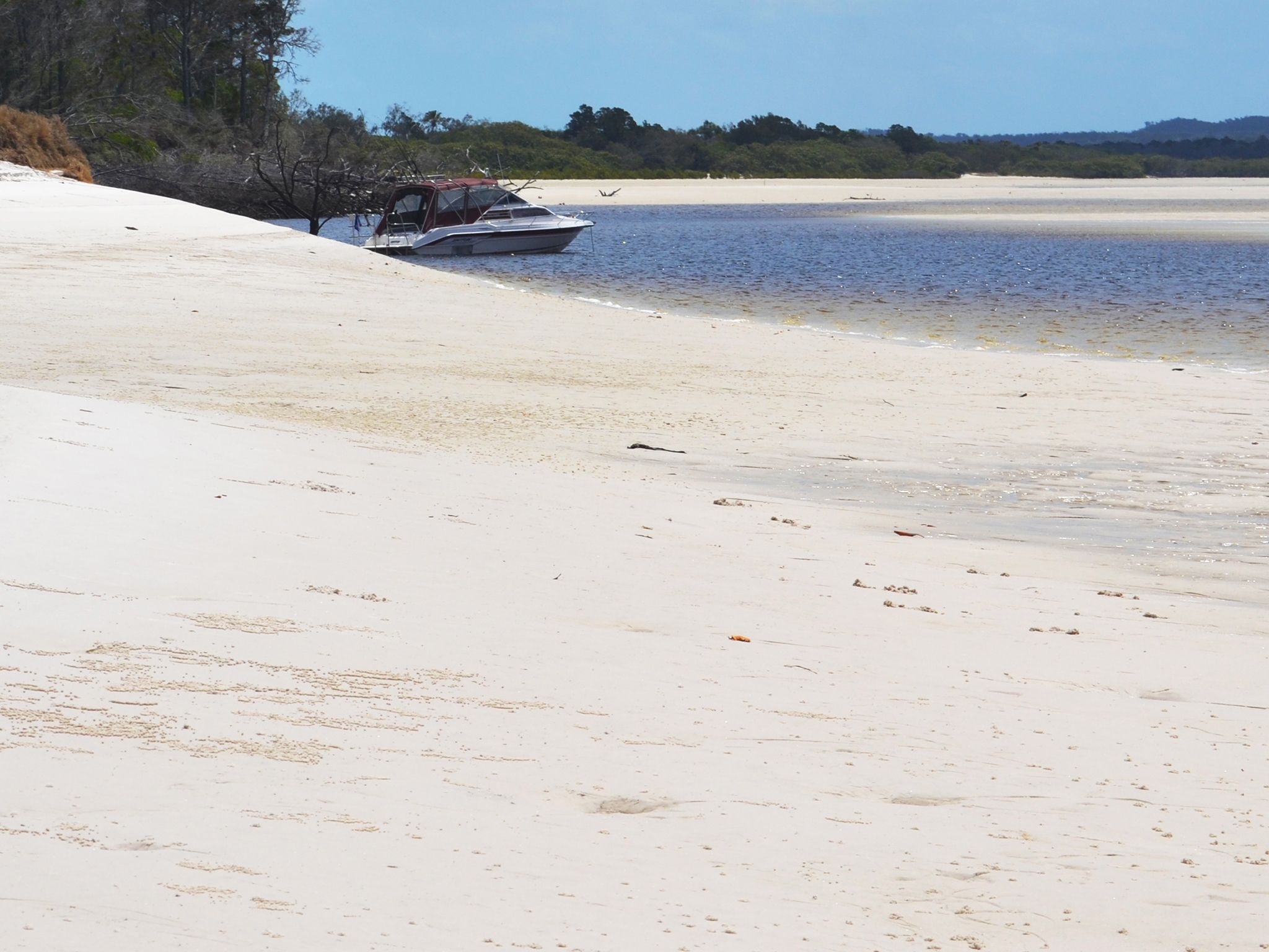
![Drop your anchor and camp right on the water's edge.]() Drop your anchor and camp right on the water's edge.
Photo credit: Rob Cameron © Queensland Government
Drop your anchor and camp right on the water's edge.
Photo credit: Rob Cameron © Queensland Government
-
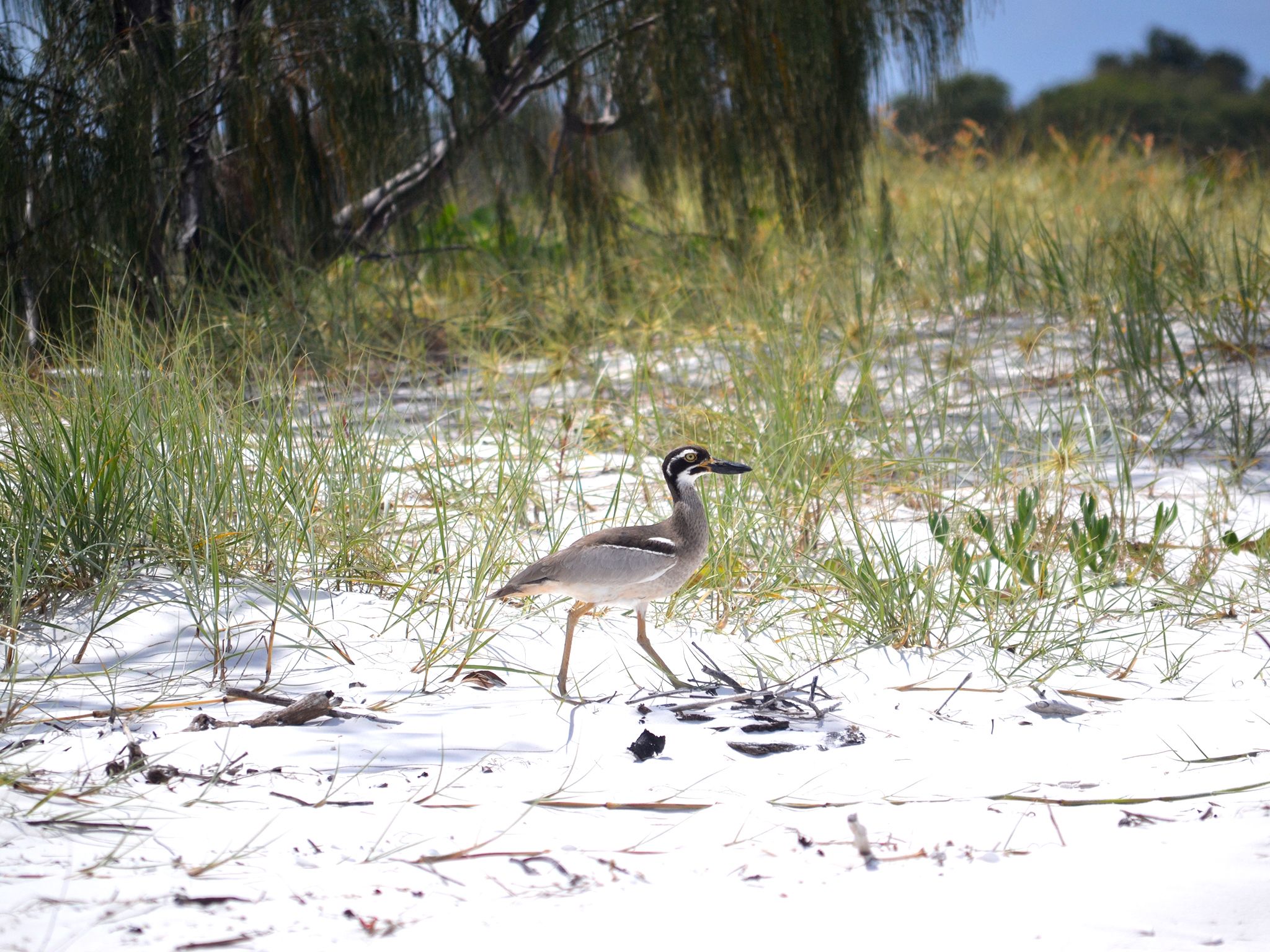
![At night, listen for the beach stone-curlews' plaintive and eerie calls.]() At night, listen for the beach stone-curlews' plaintive and eerie calls.
Photo credit: Rob Cameron © Queensland Government
At night, listen for the beach stone-curlews' plaintive and eerie calls.
Photo credit: Rob Cameron © Queensland Government
Always check
- Park alerts for the latest information on access, closures and conditions.
- Bureau of Meteorology weather forecasts.
- Current bushfire warnings and incidents and also fire bans and restrictions.
- Your camping permit is booked.
- Any park-specific camping information for
K'gari.
- Visiting K'gari safely for important safety information.
Laid out on the protected inside edge of a sandy foredune belt, this beach camping area is on the western side of Wathumba Creek.
Set up camp among the dunes, shaded by coastal forests, and then head out to fish and explore in the Great Sandy Marine Park. Sheltered Platypus Bay is also great for canoeing and kayaking. The waters here are brimming with life and you’re bound to see and catch plenty.
In winter, sit back in your camp chair and watch humpback whales breech and play in the calm ocean waters.
This park is part of the K'gari (Fraser Island) World Heritage Area, famed for its exceptional natural beauty, outstanding examples of coastal dune landform development and evolutionary history.
Getting there and getting around
Teebing (Wathumba Spit) camping area is on K'gari, 15km off the coast of Hervey Bay and about 300km north of Brisbane.
- The camping area is on the western beach shoreline of the Wathumba Creek estuary in Platypus Bay, 36.5km north of the Moon Point estuary.
- It is only accessible by boat at high tide via Wathumba Creek in the Great Sandy Marine Park.
- The GPS location is Zone 56J, easting—523012 and northing—7237580.
- The map location is latitude S24˚58'37" and longitude E153˚13'41".
Getting to K'gari
You can get to the island by high clearance 4WD, on foot, by plane or with a commercial tour.
- Check the K'gari conditions report for the latest information on access, closures and conditions within the recreation area.
- Subscribe to the RSS feed to receive automated updates. (About RSS feeds).
By 4WD
- Your high clearance 4WD must have low range functions.
- Remember all vehicles must be registered, drivers must be licensed and all Queensland road rules apply, even on beaches.
- Read 4WD with care for important information on 4WD safety and minimal impact driving.
- A vehicle access permit must be purchased. Display the permit on your windscreen before driving in the recreation area.
From Inskip Point (15mins from Rainbow Beach)
- At the end of the bitumen on Inskip Point Road, reduce tyre pressure, engage 4WD and drive 500m onto the beach.
- Drive onto the Manta Ray barge for the 10–15min trip to Hook Point on the southern tip of K'gari, and the start of the Eastern Beach scenic drive.
- Bookings for this barge are not required.
From River Heads (east of Maryborough)
- Travel 10.6km along River Heads Road to the Barges landing area.
- The trip to Wanggoolba Creek on the western side of K'gari takes 30–45min.
- The trip to Kingfisher Bay on the western side of K'gari takes 50mins–1hr.
- These barges run at fixed times and bookings are essential.
On foot
- Walkers can board a vehicle barge to the island (details above) or arrive by plane.
By plane
- Flights leave from Hervey Bay and Maryborough.
By private vessel
- Access K'gari's sheltered western coastline by private vessel. The eastern coastline of the island is extremely hazardous and exposed to very rough ocean conditions.
- Launch your boat at one of the many boat ramps on the mainland between Tin Can Bay and Burnett Heads. There are no boat ramps on K'gari.
- See Maritime Safety Queensland's Beacon to Beacon Guides for the Great Sandy Strait and Hervey Bay for detailed navigational maps.
- The waters adjacent to K'gari are in the Great Sandy Marine Park.
- If you're heading out on the water make sure you know your zones so you can follow the rules.
- Read boat and fish with care for tips on boating and fishing safety and caring for parks.
Commercial tours
- You can join a range of tours that leave from a variety of centres.
- For tourism information for all regions in Queensland, see Queensland.com, and for friendly advice on how to get there, where to stay and what to do, find your closest accredited visitor information centre.
Before you visit
Opening hours
Teebing (Wathumpa Spit) camping area is open 24 hours a day. Check-in to your camp after 2pm and check-out by 11am on the day of departure.
Check park alerts for the latest information on access, closures and conditions.
Upcoming camping area availability
Visiting safely
For more safety information see Visiting K'gari safely and camp with care.
- Central Station visitor facility upgrades planned from April to July 2024 4 March to 31 July 2024
- Park Alert-Tukkee Wurroo (Indian Head) walking track temporary closure 14 June 2021 to 30 June 2024
- Woralie Road Dump Ezy Temporary Closure 13 July 2023 to 13 July 2024
- Prescribed Burn - Figtree Creek 14 April to 31 May 2024
- Prescribed Burn - Duck Creek 19 March to 31 May 2024
- Prescribed burn - Exploration Break East 1 March to 31 August 2024
- Planned burn - Binngih Sandblow to Orchid Beach 1 March to 31 August 2024
- Dingo (Wongari) Seasonal Information - Mating Season 1 March to 31 May 2024
- Marine Stingers Warning 1 November 2023 to 31 May 2024
- Park Alert - K'gari Planned Burn Season 2024 12 February to 31 August 2024
- Threatening dingo activity - Eli Creek, Waddy Point and Wathumba 8 December 2023 to 30 April 2024
- Beware crocodiles
- Be dingo-safe
- Beware marine stingers (jellyfish)
Conditions report
K'gari conditions report Updated 26 Apr 2024
Critical information for your safety is included in the conditions report—always check it before you visit.