Garrys Anchorage camping area
Named after a famous Butchulla tracker, this peaceful boat-only area offers shade and shelter on the island's south-western shore.
Accessible by
- Boat
Camping area facilities
- Anchoring allowed
- Generators allowed (conditions apply)
- Picnic tables
- Tent camping
- Short walk to tent
- Walking
- Canoeing and kayaking
- Boating
- Fishing
-
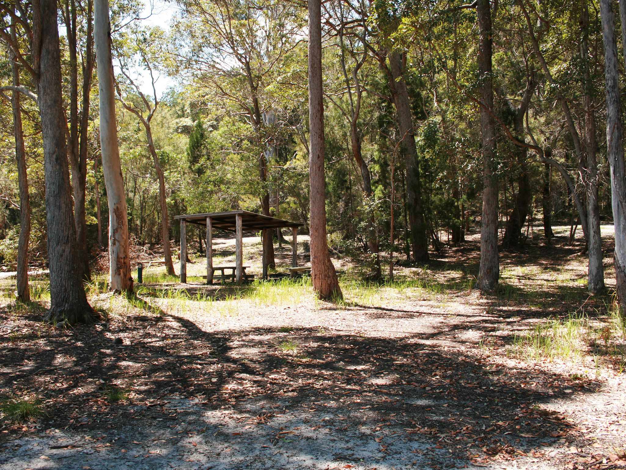
![Camp beneath the shady canopies of tall eucalypt trees.]() Camp beneath the shady canopies of tall eucalypt trees.
Photo credit: Jenna Tapply © Queensland Government
Camp beneath the shady canopies of tall eucalypt trees.
Photo credit: Jenna Tapply © Queensland Government
-
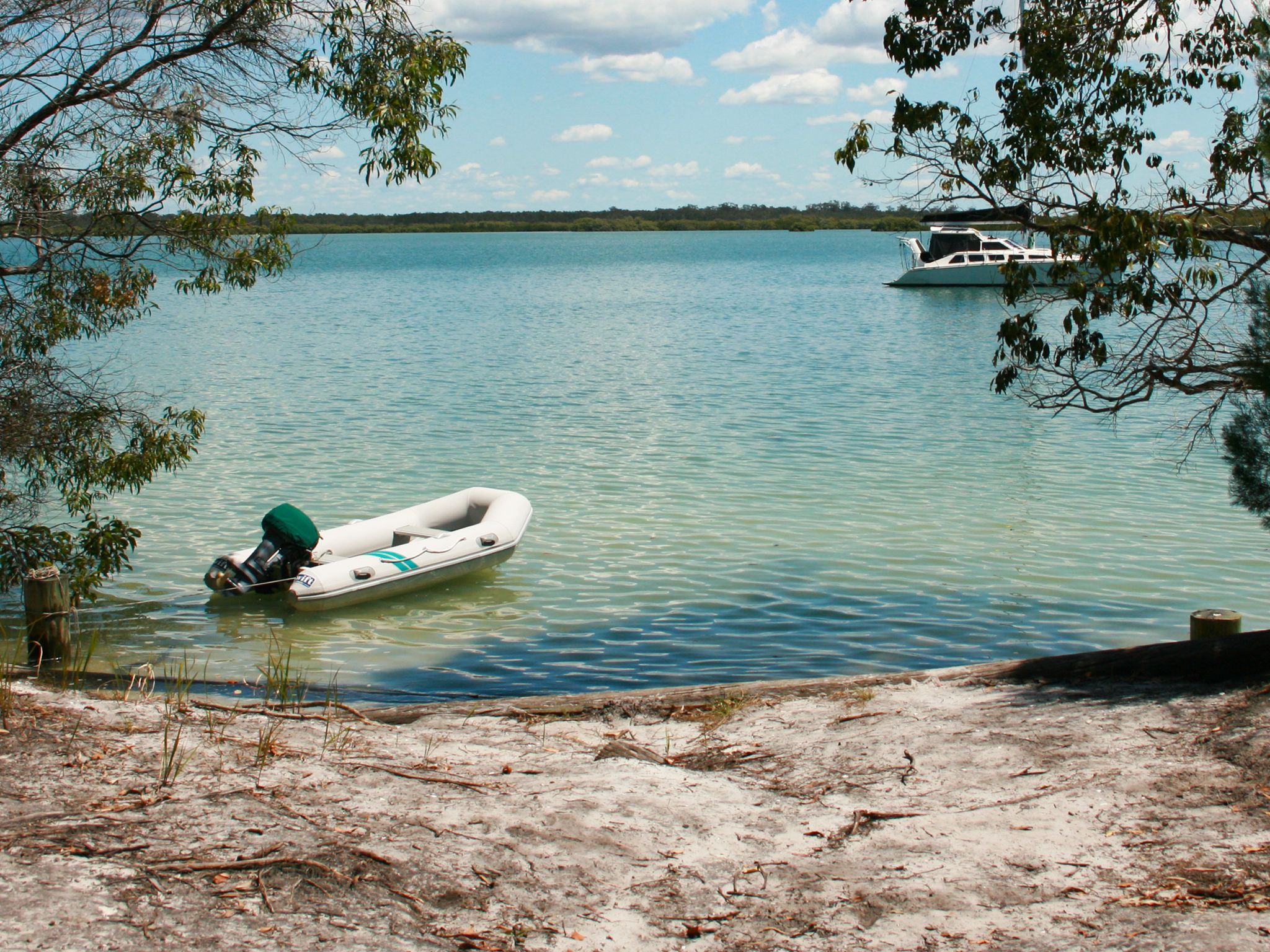
![A boaties delight and still-water haven.]() A boaties delight and still-water haven.
Photo credit: Jenna Tapply © Queensland Government
A boaties delight and still-water haven.
Photo credit: Jenna Tapply © Queensland Government
Always check
- Park alerts for the latest information on access, closures and conditions.
- Bureau of Meteorology weather forecasts.
- Current bushfire warnings and incidents and also fire bans and restrictions.
- Your camping permit is booked.
- Any park-specific camping information for
K'gari.
- Visiting K'gari safely for important safety information.
Set in a sheltered bay east of Stewart Island, the camping area is a refuge from the wind and rough weather. Pitch your tent in the shady eucalypt forest before heading out to explore the Great Sandy Marine Park. The exposed sand flat in front of the camping area is a popular spot for roosting seabirds.
Garry Owens was born on the island in nearby Yidney Creek. He was wiry and sharp-witted Butchulla man, renowned for his horse riding and tracking skills. Garry helped the Victorian police track Australia’s most notorious bushranger, Ned Kelly.
This park is part of the K'gari (Fraser Island) World Heritage Area, famed for its exceptional natural beauty, outstanding examples of coastal dune landform development and evolutionary history.
Getting there and getting around
Garrys Anchorage camping area is on K'gari, 15km off the coast of Hervey Bay and about 300km north of Brisbane.
- The camping area is on the west coast of the island, in the Great Sandy Strait.
- It is only accessible by boat via the Great Sandy Marine Park.
- The approximate GPS location is Zone 56J, easting—497390 and northing—7165290.
- The map location is latitude S25˚37'48" and longitude E152˚58'26".
Getting to K'gari
You can get to the island by high clearance 4WD, on foot, by plane or with a commercial tour.
- Check the K'gari conditions report for the latest information on access, closures and conditions within the recreation area.
- Subscribe to the RSS feed to receive automated updates. (About RSS feeds).
By private vessel
- Access K'gari's sheltered western coastline by private vessel. The eastern coastline of the island is extremely hazardous and exposed to very rough ocean conditions.
- Launch your boat at one of the many boat ramps on the mainland between Tin Can Bay and Burnett Heads. There are no boat ramps on K'gari.
- See Maritime Safety Queensland's Beacon to Beacon Guides for the Great Sandy Strait and Hervey Bay for detailed navigational maps.
- The waters adjacent to K'gari are in the Great Sandy Marine Park.
- If you're heading out on the water make sure you know your zones so you can follow the rules.
- Read boat and fish with care for tips on boating and fishing safety and caring for parks.
Before you visit
Opening hours
Garrys Anchorage camping area is open 24 hours a day. Check-in to your camp after 2pm and check-out by 11am on the day of departure.
Check park alerts for the latest information on access, closures and conditions.
Upcoming camping area availability
Visiting safely
For more safety information see Visiting K'gari safely and camp with care.
- Central Station visitor facility upgrades planned from April to July 2024 4 March to 31 July 2024
- Park Alert-Tukkee Wurroo (Indian Head) walking track temporary closure 14 June 2021 to 30 June 2024
- Woralie Road Dump Ezy Temporary Closure 13 July 2023 to 13 July 2024
- Prescribed Burn - Figtree Creek 14 April to 31 May 2024
- Prescribed Burn - Duck Creek 19 March to 31 May 2024
- Prescribed burn - Exploration Break East 1 March to 31 August 2024
- Planned burn - Binngih Sandblow to Orchid Beach 1 March to 31 August 2024
- Dingo (Wongari) Seasonal Information - Mating Season 1 March to 31 May 2024
- Marine Stingers Warning 1 November 2023 to 31 May 2024
- Park Alert - K'gari Planned Burn Season 2024 12 February to 31 August 2024
- Threatening dingo activity - Eli Creek, Waddy Point and Wathumba 8 December 2023 to 30 April 2024
- Beware crocodiles
- Be dingo-safe
- Beware marine stingers (jellyfish)
Conditions report
K'gari conditions report Updated 26 Apr 2024
Critical information for your safety is included in the conditions report—always check it before you visit.