Park is closed
Six Mile Waterhole camping area
Camp beside this large waterhole on the Laura River and explore the feature-packed southern part of the park.
Accessible by
- 4WD
Camping area facilities
- Campfires allowed (conditions apply)
- Generators allowed (conditions apply)
- Tent camping
- Tent camping beside car
- Scenic drive
- Fishing
-
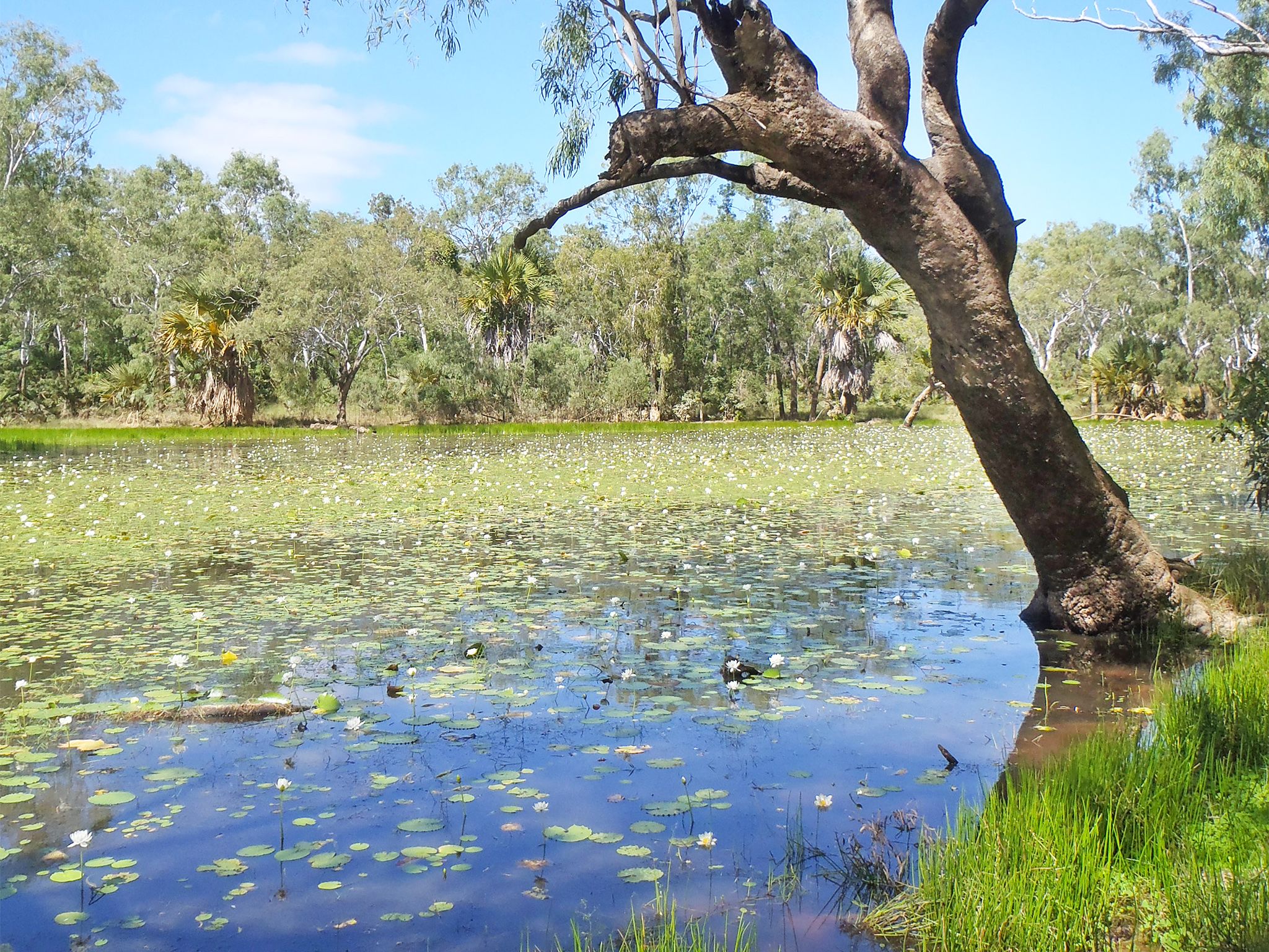
![Camp beside the waterhole and birdwatch in the nearby swamps and lagoons.]() Camp beside the waterhole and birdwatch in the nearby swamps and lagoons.
Photo credit: © Queensland Government
Camp beside the waterhole and birdwatch in the nearby swamps and lagoons.
Photo credit: © Queensland Government
-
![Camp beside a large waterhole on the steep western bank of the Laura River.]() Camp beside a large waterhole on the steep western bank of the Laura River.
Photo credit: © Queensland Government
Camp beside a large waterhole on the steep western bank of the Laura River.
Photo credit: © Queensland Government
Always check
- Park alerts for the latest information on access, closures and conditions.
- Bureau of Meteorology weather forecasts.
- Current bushfire warnings and incidents and also fire bans and restrictions.
- Your camping permit is booked.
- Any park-specific camping information for
Rinyirru (Lakefield).
- Visiting Rinyirru (Lakefield) safely for important safety information.
The self-service kiosk at this park has been decommissioned.
Visitors need to book their camping permit before they visit. Book online, at an over-the-counter booking office or by phone.
Not far from the southern entrances to the park, you’ll be glad to arrive at this camp after a dusty day on the road.
Enjoy a peaceful night’s sleep and then pack a picnic lunch and daytrip to the nearby Old Laura Homestead, Lake Emma and Horseshoe Lagoon. The richly historical homestead will introduce you to the long and varied history of the park, and the lakes and lagoons will deliver hours of birdwatching.
If you’re keen to fish, flick lures from the riverbank near the camp, or head up the road and try your luck at Catfish Waterhole.
Rinyirru (Lakefield) National Park (CYPAL) is jointly managed by the Rinyirru (Lakefield) Aboriginal Corporation and the Queensland Government.
Getting there and getting around
Six Mile Waterhole camping area is in the southern part of Rinyirru (Lakefield) National Park (CYPAL), 340km north-west of Cairns, and 140km west of Cooktown, on southern Cape York Peninsula.
- This camping area is south of Lakefield ranger base on the western bank of the Laura River.
- You need a 4WD to access the park and camping area.
- Read 4WD with care for important information on 4WD safety and minimal impact driving.
From the south
- Drive 2km north past Laura on the Peninsula Developmental Road and take the Lakefield turn-off.
- Drive 25km to the park.
- Continue 1km and turn left onto Lakefield Road.
- Drive 12km north to and turn turn right at the Six Mile turn-off.
- The camping area is 3km along this road.
From Battle Camp Road
- Drive 85km west from Cooktown along Battle Camp Road to the park's eastern boundary.
- Continue 26km and turn right onto Lakefield Road.
- Drive 12km north and turn right at the Six Mile turn-off.
- The camping area is 3km along this road.
From the north
- Take the Lakefield turn-off at the Musgrave Roadhouse on the Peninsula Developmental Road and drive 38km east on Marina Plains Road to the park.
- Continue 119km through the park, past the Lakefield ranger base and turn left at the Six Mile turn-off.
- The camping area is 3km along this road.
For tourism information for all regions in Queensland, see Queensland.com, and for friendly advice on how to get there, where to stay and what to do, find your closest accredited visitor information centre.
Before you visit
Seasonal closures
Rinyirru (Lakefield) National Park (CYPAL) is closed throughout the wet season every year.
- Camping areas south of Lakefield ranger base are closed from 1 December to 31 May.
- Camping areas north of the Lakefield ranger base are closed from 1 December to 30 June.
- These dates vary each year depending on weather and road conditions.
- Refer to the park map for location of the Lakefield ranger base and camping areas.

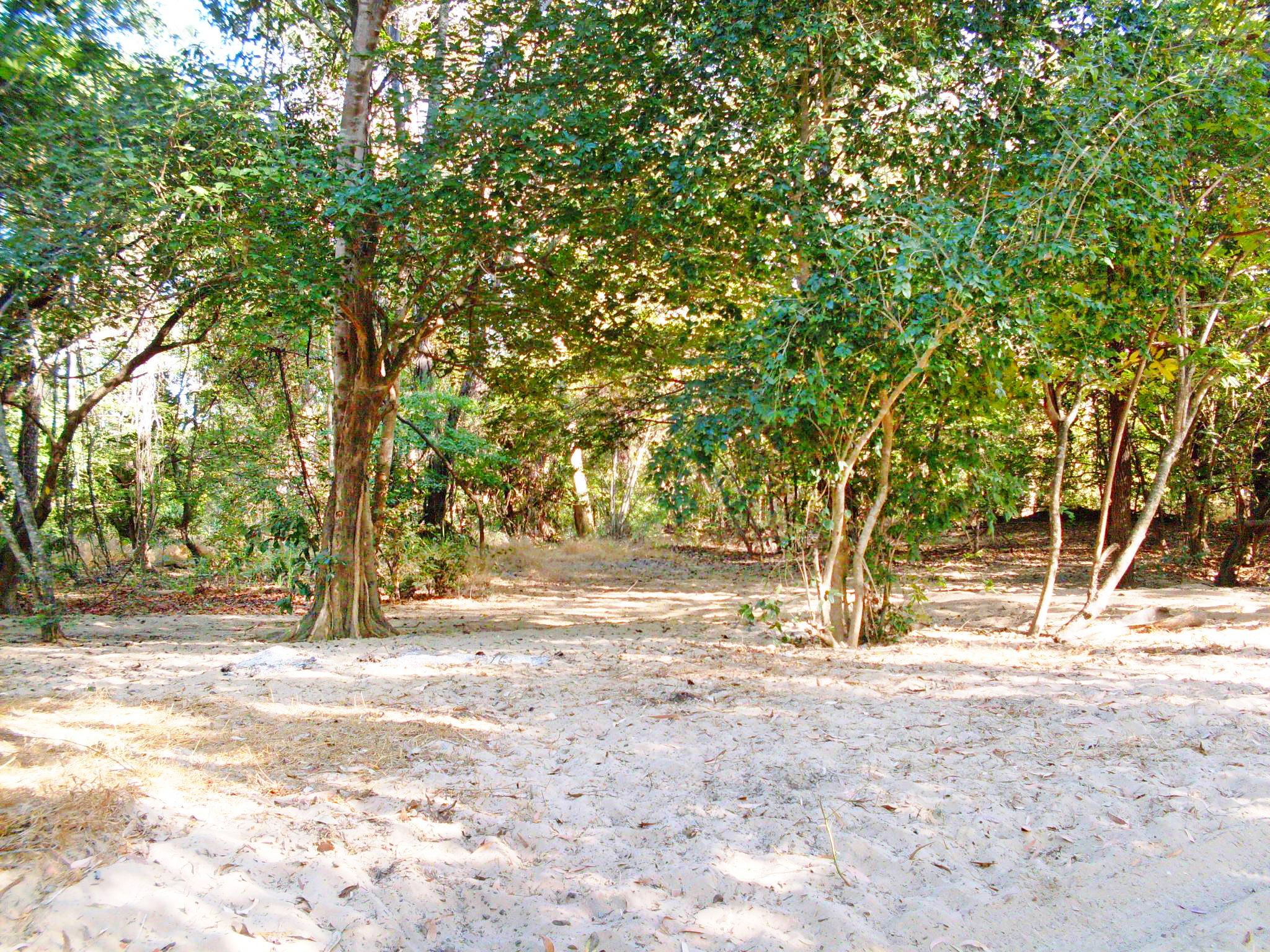
Camp site one at Six Mile Waterhole camping area.
Photo credit: Queensland Government
Camping area features
Adjacent to a large waterhole on the steep western bank of the Laura River. Nearby are swamps and lagoons, which are ideal for bird watching. Large crocodiles are frequently seen here—be croc wise in croc country.
Location: southern part of the park on the western bank of the Laura River, 3km east of Lakefield Road—by road, the turn-off is 12km north of Old Laura Homestead and 15km south of New Laura ranger base.
Map: Rinyirru (Lakefield) National Park (CYPAL) southern camping areas map
Access: the camping area can be reached by four-wheel-drive vehicle only. It is not accessible for camper trailers, caravans, campervans or buses. The road becomes impassable after rain.
Boat launching: nil.
Number of sites: one numbered site—maximum two cars (six people).
Camp sites are suitable for: tent camping beside your car.
Camp site surface: dirt and sand.
Shade: partial shade.
Facilities: nil.
Open fires: allowed (except when fire bans apply). Fuel stoves are recommended. Do not collect firewood in the park.
Generators: only generators operated at less than 65dB(A), when measured 7m from the generator, are permitted, and only between 8am and 7pm.
Essentials to bring: adequate food and drinking water, equipment for treating water, rubbish bags, insect repellent, mosquito nets, fuel stove and adequate fuel and spare parts for your vehicle. Read more about before you visit.
Bookings: book online, over-the-counter or by phone prior to arrival. Bookings are essential and should be made well in advance for May to August and the September school holidays.
Mobile phone coverage: not available.
Upcoming camping area availability
Visiting safely
For more safety information see Visiting Rinyirru (Lakefield) safely and camp with care.
- Wet season closure: Rinyirru (Lakefield) National Park (CYPAL) 1 December 2023 to 14 July 2024