Park is closed
Kalpowar Crossing day-use area
Enjoy a picnic in the shade alongside a stretch of permanent waterholes on the mighty Normanby River.
Accessible by
- 4WD
Attraction facilities
- Toilets (non-flush)
- Picnic tables
-
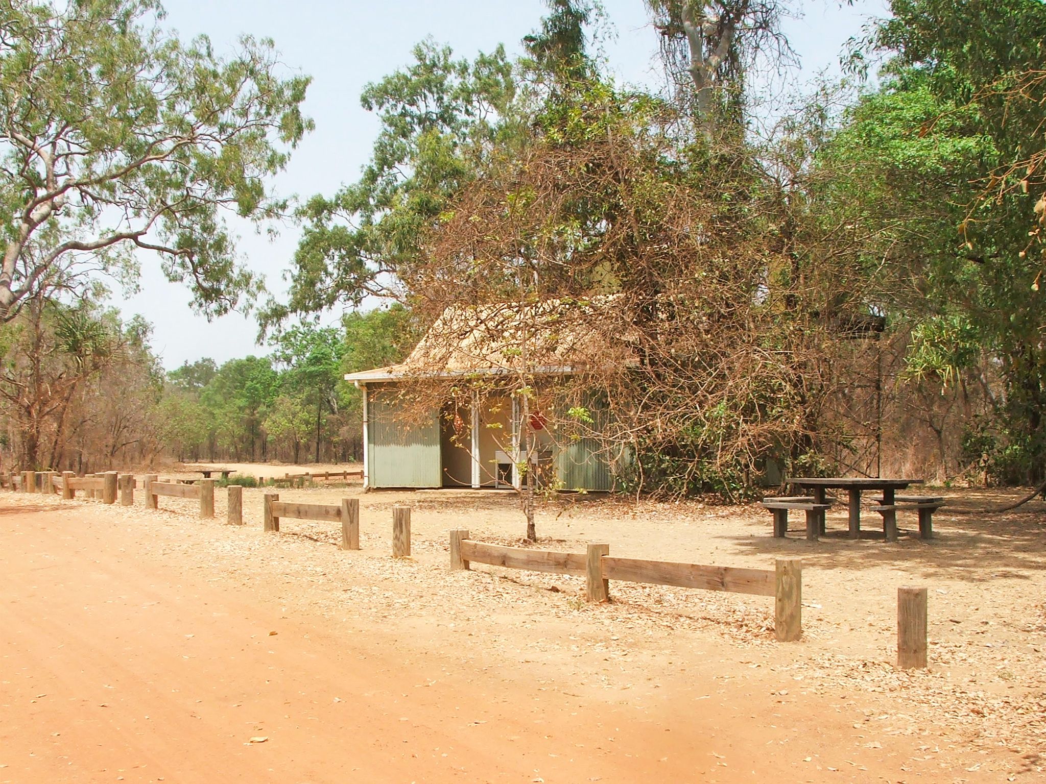
![Enjoy the day-use area's facilities.]() Enjoy the day-use area's facilities.
Photo credit: © Queensland Government
Enjoy the day-use area's facilities.
Photo credit: © Queensland Government
-
![Magnificent weeping paperbarks line the river.]() Magnificent weeping paperbarks line the river.
Photo credit: © John Augusteyn
Magnificent weeping paperbarks line the river.
Photo credit: © John Augusteyn
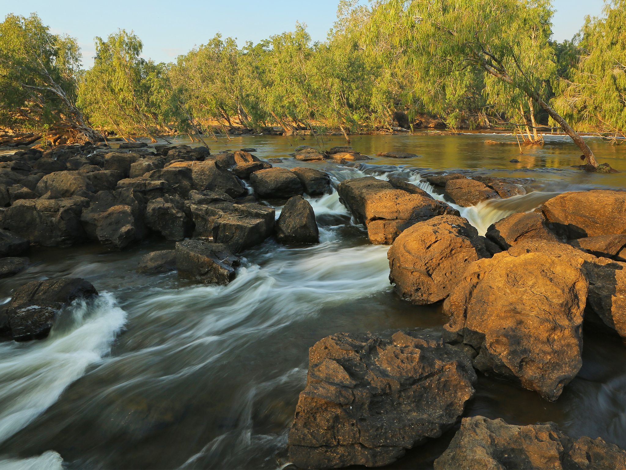
Beside a vast 8km stretch of permanent waterholes, it's little wonder this site is treasured by locals and travellers alike. Not only is it a wonderful spot for a picnic, but it’s also a great stopover for people travelling to Cape Melville National Park.
Before you sit down for lunch, stretch your legs on the Kalpowar discovery walk. Wander along the bank of the river, through vine forest and open woodlands, with magnificent weeping paperbarks reaching elaborately above you.
If you’ve got time, launch you boat at the causeway and spend a few hours fishing, or throw in a line from the bank.
Rinyirru (Lakefield) National Park (CYPAL) is jointly managed by the Rinyirru (Lakefield) Aboriginal Corporation and the Queensland Government.
Getting there and getting around
Kalpowar Crossing day-use area is in the central part of Rinyirru (Lakefield) National Park (CYPAL), 340km north-west of Cairns, and 140km west of Cooktown, on southern Cape York Peninsula.
- This day-use area is on the western bank of the Normanby River.
- You need a 4WD to access the park and day-use area.
- Read 4WD with care for important information on 4WD safety and minimal impact driving.
From Cape Melville
- Drive 70km from Wakooka in Cape Melville National Park to Kalpowar on the eastern boundary of Rinyirru (Lakefield) National Park (CYPAL).
From the south
- Drive 2km north past Laura on the Peninsula Developmental Road and take the Lakefield turn-off.
- Drive 25km to the park.
- Continue 59km through the park north and turn right at the Wakooka Road turn off.
- Drive 3km east to the day-use area.
From the north
- Take the Lakefield turn-off at the Musgrave Roadhouse on the Peninsula Developmental Road and drive 38km east on Marina Plains Road to the park.
- Continue 73km south through the park, past the Lakefield ranger base, and turn left at the Wakooka Road turn-off.
- Drive 3km to the day-use area.
For tourism information for all regions in Queensland, see Queensland.com, and for friendly advice on how to get there, where to stay and what to do, find your closest accredited visitor information centre.
Wheelchair access
There are no wheelchair-accessible facilities.
Before you visit
Opening hours
Kalpowar Crossing day-use area is open 24 hours a day
Check park alerts for the latest information on access, closures and conditions.
Seasonal closures
Rinyirru (Lakefield) National Park (CYPAL) is closed throughout the wet season every year.
- Camping areas south of Lakefield ranger base are closed from 1 December to 31 May.
- Camping areas north of the Lakefield ranger base are closed from 1 December to 30 June.
- These dates vary each year depending on weather and road conditions.
- Refer to the park map for location of the Lakefield ranger base and camping areas.
- Check park alerts for the latest information on access, closures and conditions.
- See the Bureau of Meteorology for weather conditions and forecasts.
- See traffic and travel information for road and travel conditions.
Visiting safely
For more safety information see Visiting Rinyirru (Lakefield) safely.
- Wet season closure: Rinyirru (Lakefield) National Park (CYPAL) 1 December 2023 to 14 July 2024