Park is closed
Nifold Plain
This sprawling plain, dotted with stately termite mounds, is one of the most photographed features in the park.
Accessible by
- 4WD
Attraction facilities
- Lookout (natural)
-
![Marvel at the vast grasslands of the Nifold Plain.]() Marvel at the vast grasslands of the Nifold Plain.
Photo credit: Doug Davidson © Queensland Government
Marvel at the vast grasslands of the Nifold Plain.
Photo credit: Doug Davidson © Queensland Government
-
![Discover the fascinating termite mounds that dot the plains.]() Photo credit: © John Augusteyn
Photo credit: © John Augusteyn
-
![Experience a magnificent sunset on Nifold Plain.]() Photo credit: John Augusteyn © Queensland Government
Photo credit: John Augusteyn © Queensland Government

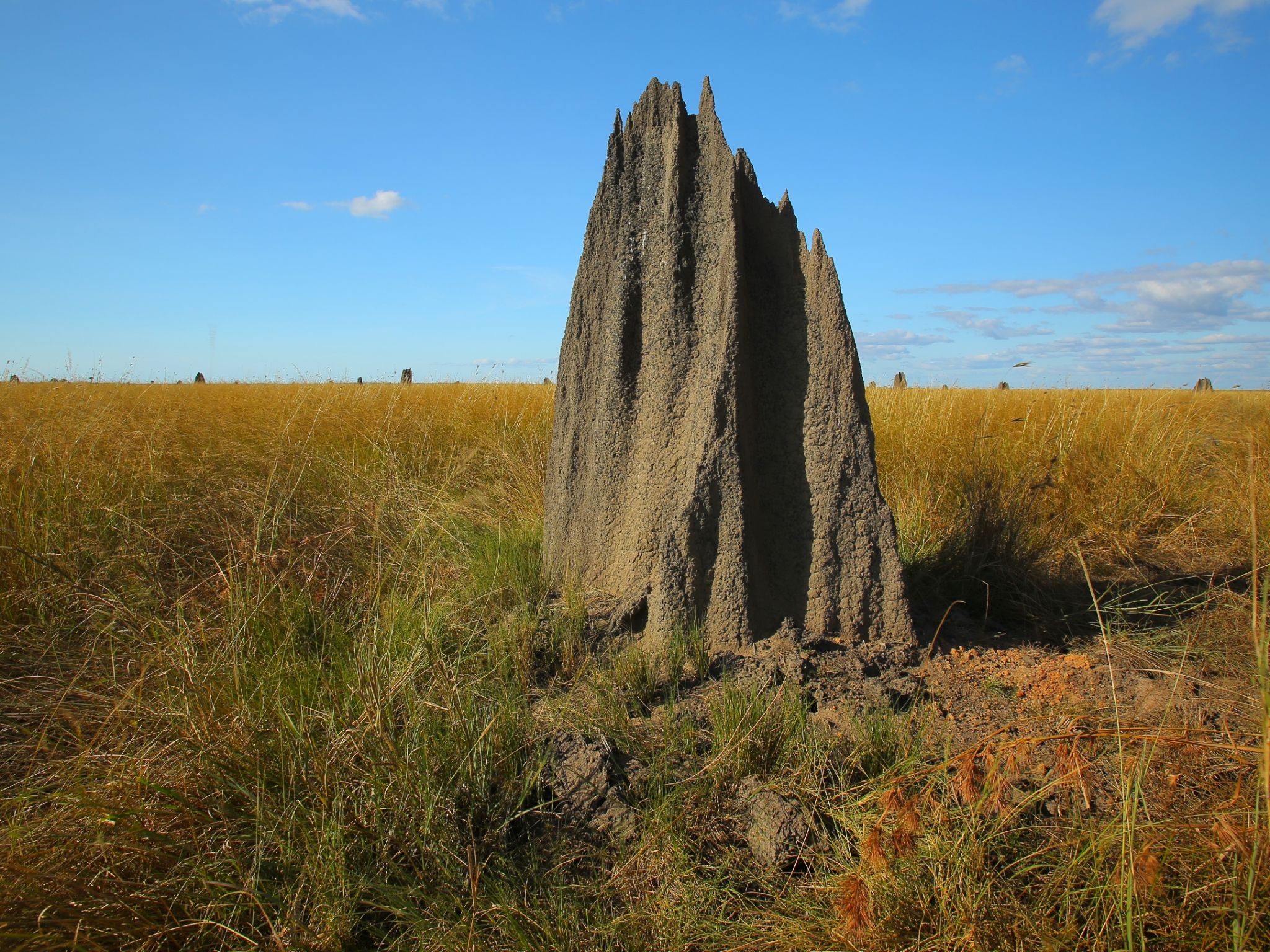

Dawn and dusk dowse the plains with subtle colours and gentle light so these are the best times to visit. Pull up on the edge of the road and take in the spectacular sweeping grasslands scattered with beautifully sculptured termite mounds. You can’t go wrong with a camera here—see if you can get a shot of the termite mounds silhouetted against the sun.
Keep your eyes peeled for pairs of robust Australian bustards, their heads peeking just above the grass, and flocks of colourful finches careening across the plain.
Rinyirru (Lakefield) National Park (CYPAL) is jointly managed by the Rinyirru (Lakefield) Aboriginal Corporation and the Queensland Government.
Getting there and getting around
Nifold Plain is in the northern part of Rinyirru (Lakefield) National Park (CYPAL), 340km north-west of Cairns, and 140km west of Cooktown, on southern Cape York Peninsula.
- Nifold Plain extends between the Hann and Saltwater crossings.
- You need a 4WD to access the park.
- Read 4WD with care for important information on 4WD safety and minimal impact driving.
From the north
- Take the Lakefield turn-off at the Musgrave Roadhouse on the Peninsula Developmental Road and drive 38km east on Marina Plains Road to the park.
- Continue 15km into the park to Saltwater Crossing then drive 31km along Lakefield Road towards Hann Crossing for views over the Nifold Plain.
From the south
- Drive 2km north past Laura on the Peninsula Developmental Road and take the Lakefield turn-off.
- Drive 25km to the park.
- Continue 86km through the park, past the Lakefield ranger base to the Hann Crossing.
- Follow Lakefield Road for 31km to Saltwater Crossing for views over the Nifold Plain.
From Cape Melville
- Drive 70km from Wakooka in Cape Melville National Parkto Kalpowar on the eastern boundary of Rinyirru (Lakefield) National Park (CYPAL).
- Continue 1km and turn right onto Lakefield Road.
- Drive 26km to the Hann Crossing and follow Lakefield Road for 31km to Saltwater Crossing for views over the Nifold Plain.
For tourism information for all regions in Queensland, see Queensland.com, and for friendly advice on how to get there, where to stay and what to do, find your closest accredited visitor information centre.
Wheelchair access
There are no wheelchair-accessible facilities.
Before you visit
Opening hours
Nifold Plain is open 24 hours a day
Check park alerts for the latest information on access, closures and conditions.
Seasonal closures
Rinyirru (Lakefield) National Park (CYPAL) is closed throughout the wet season every year.
- Camping areas south of Lakefield ranger base are closed from 1 December to 31 May.
- Camping areas north of the Lakefield ranger base are closed from 1 December to 30 June.
- These dates vary each year depending on weather and road conditions.
- Refer to the park map for location of the Lakefield ranger base and camping areas.
- Check park alerts for the latest information on access, closures and conditions.
- See the Bureau of Meteorology for weather conditions and forecasts.
- See traffic and travel information for road and travel conditions.
Visiting safely
For more safety information see Visiting Rinyirru (Lakefield) safely.
- Wet season closure: Rinyirru (Lakefield) National Park (CYPAL) 1 December 2023 to 14 July 2024