Park is closed
Bizant River camping area
Camp under the stars above the Bizant River and explore the natural riches of the rivers and Princess Charlotte Bay.
Accessible by
- 4WD
Camping area facilities
- Campfires allowed (conditions apply)
- Generators allowed (conditions apply)
- Tent camping
- Camper trailer camping
- Tent camping beside car
- Scenic drive
- Boating
- Fishing
-
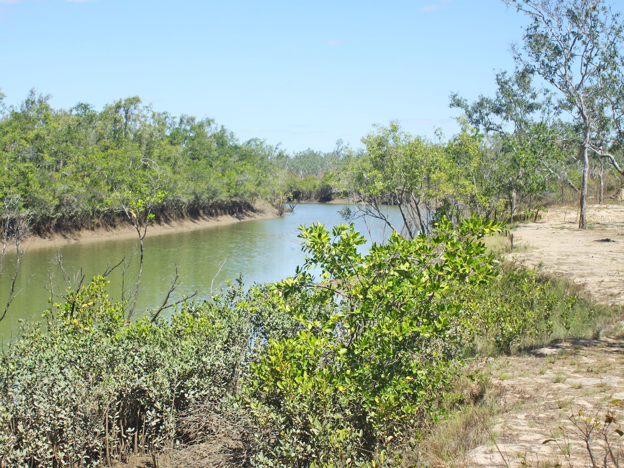
![The Bizant River camping area has access to Princess Charlotte Bay.]() The Bizant River camping area has access to Princess Charlotte Bay.
Photo credit: Doug Davidson © Queensland Government
The Bizant River camping area has access to Princess Charlotte Bay.
Photo credit: Doug Davidson © Queensland Government
-
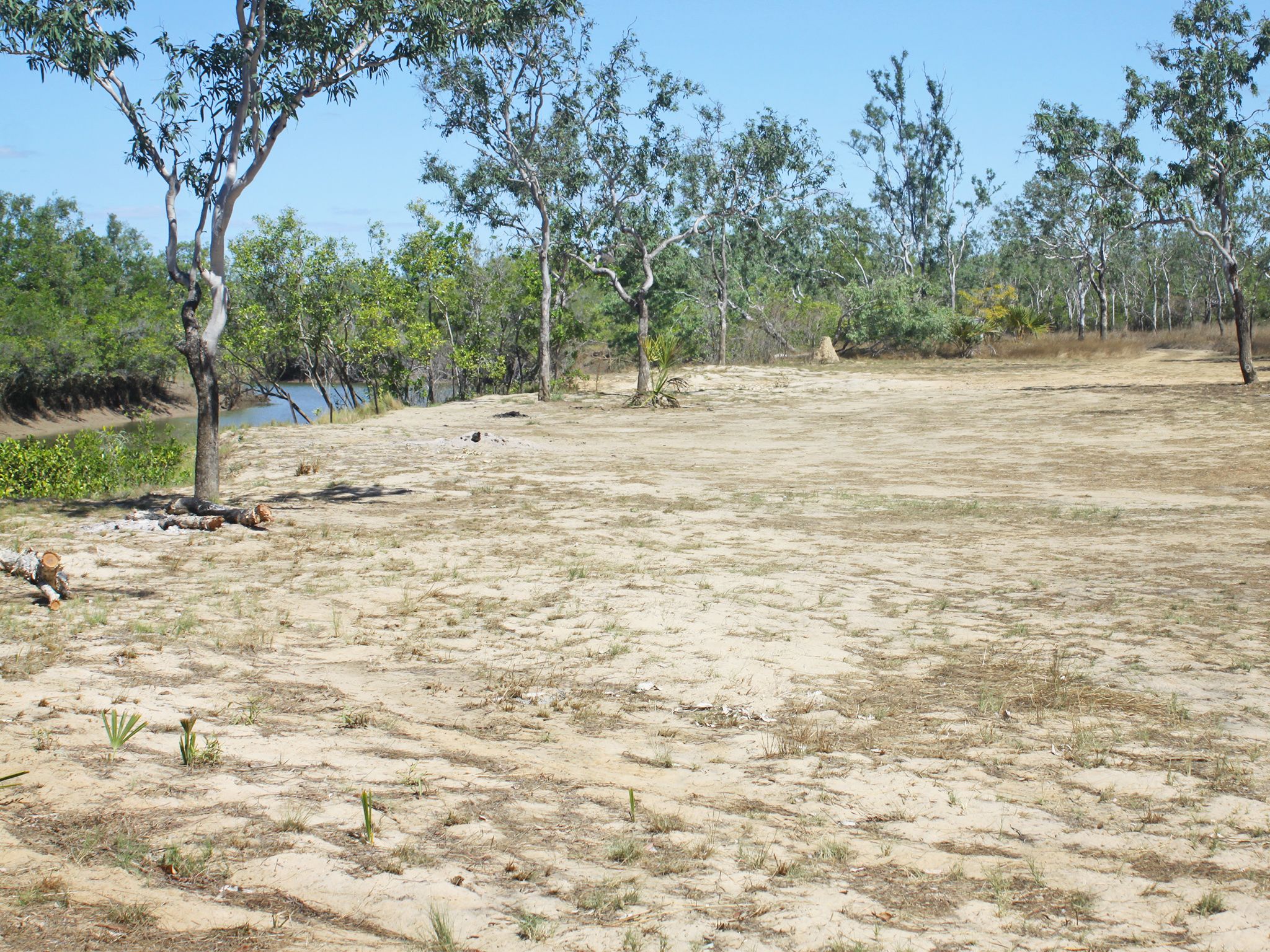
![Set up camp on an open flat next to the Bizant River.]() Set up camp on an open flat next to the Bizant River.
Photo credit: Doug Davidson © Queensland Government
Set up camp on an open flat next to the Bizant River.
Photo credit: Doug Davidson © Queensland Government
Always check
- Park alerts for the latest information on access, closures and conditions.
- Bureau of Meteorology weather forecasts.
- Current bushfire warnings and incidents and also fire bans and restrictions.
- Your camping permit is booked.
- Any park-specific camping information for
Rinyirru (Lakefield).
- Visiting Rinyirru (Lakefield) safely for important safety information.
The self-service kiosk at this park has been decommissioned.
Visitors need to book their camping permit before they visit. Book online, at an over-the-counter booking office or by phone.
In the north-western part of the park on the Bizant River, this open and sunny camping area sits on a flat above a steep river bank.
After you’ve set up camp, launch your boat and head downstream to the pristine water of Princess Charlotte Bay. Make sure you flick a few lures at any promising snags on the way!
Critically endangered Bizant River sharks, or speartooth sharks, are found in the river. Very little is known about this species, but they are susceptible to line fishing, gill netting and habitat destruction. Take care if you happen to hook one and return it unharmed to the water.
Rinyirru (Lakefield) National Park (CYPAL) is jointly managed by the Rinyirru (Lakefield) Aboriginal Corporation and the Queensland Government.
Getting there and getting around
Bizant River camping area is in the northern part of Rinyirru (Lakefield) National Park (CYPAL), 340km north-west of Cairns, and 140km west of Cooktown, on southern Cape York Peninsula.
- This camping area is north-east of the Hann Crossing on the Bizant River.
- You need a 4WD to access the park and camping area.
- Read 4WD with care for important information on 4WD safety and minimal impact driving.
From the north
- Take the Lakefield turn-off at the Musgrave Roadhouse on the Peninsula Developmental Road and drive 38km east on Marina Plains Road to the park.
- Continue 46km through the park to the Hann Crossing.
- Turn right and drive north-east for 25km to the camping area.
From the south
- Drive 2km north past Laura on the Peninsula Developmental Road and take the Lakefield turn-off.
- Drive 25km to the park.
- Continue north and north-east for 104km through the park, past the Lakefield ranger base, to the camping area.
From Cape Melville
- Drive 70km from Wakooka in Cape Melville National Park to Kalpowar on the eastern boundary of Rinyirru (Lakefield) National Park (CYPAL).
- Continue 1km to Lakefield Road.
- Turn right and drive 44km north-east to the camping area.
For tourism information for all regions in Queensland, see Queensland.com, and for friendly advice on how to get there, where to stay and what to do, find your closest accredited visitor information centre.
Before you visit
Seasonal closures
Rinyirru (Lakefield) National Park (CYPAL) is closed throughout the wet season every year.
- Camping areas south of Lakefield ranger base are closed from 1 December to 31 May.
- Camping areas north of the Lakefield ranger base are closed from 1 December to 30 June.
- These dates vary each year depending on weather and road conditions.
- Refer to the park map for location of the Lakefield ranger base and camping areas.

Camp site one at Bizant River camping area.
Photo credit: Queensland Government
Camping area features
On the flat above a steep (2m high) river bank adjacent to the Bizant River boat ramp—an unformed boat ramp providing access to the tidal Bizant River and Princess Charlotte Bay. Large crocodiles are frequently seen here—be croc wise in croc country.
Location: northern part of the park on the Bizant River—by road, 25km north-north-east of Hann Crossing and 44km north-north-west of Lakefield ranger base.
Map: Rinyirru (Lakefield) National Park (CYPAL) northern camping areas map
Access: the camp site can be reached by four-wheel-drive vehicle only. It is not accessible for caravans, campervans or buses. The road becomes impassable after rain.
Boat launching: boat trailer access.
Number of sites: one numbered site—maximum four cars and trailers (12 people).
Camp sites are suitable for: tent camping beside your car and camper trailers.
Camp site surface: dirt and grass (seasonal).
Shade: nil.
Facilities: nil.
Open fires: allowed (except when fire bans apply). Fuel stoves are recommended. Do not collect firewood in the park.
Generators: only generators operated at less than 65dB(A), when measured 7m from the generator, are permitted, and only between 8.00am and 7.00pm.
Essentials to bring: adequate food and drinking water (no fresh water available), rubbish bags, insect repellent, mosquito nets, fuel stove and adequate fuel and spare parts for your vehicle. Read more about before you visit.
Bookings: book online, over-the-counter, or by phone prior to arrival. Bookings are essential and should be made well in advance for May to August and the September school holidays.
Mobile phone coverage: not available.
Upcoming camping area availability
Visiting safely
For more safety information see Visiting Rinyirru (Lakefield) safely and camp with care.
- Wet season closure: Rinyirru (Lakefield) National Park (CYPAL) 1 December 2023 to 14 July 2024