Park is closed
Hanushs Waterhole camping area
With plenty of space and three adjoining sites, this centrally-located camping area is perfect for groups travelling together.
Accessible by
- 4WD
Camping area facilities
- Campfires allowed (conditions apply)
- Generators allowed (conditions apply)
- Tent camping
- Camper trailer camping
- Tent camping beside car
- Scenic drive
- Boating
- Fishing
-
![You can wet a line in the Normanby River.]() You can wet a line in the Normanby River.
Photo credit: Doug Davidson © Queensland Government
You can wet a line in the Normanby River.
Photo credit: Doug Davidson © Queensland Government
-
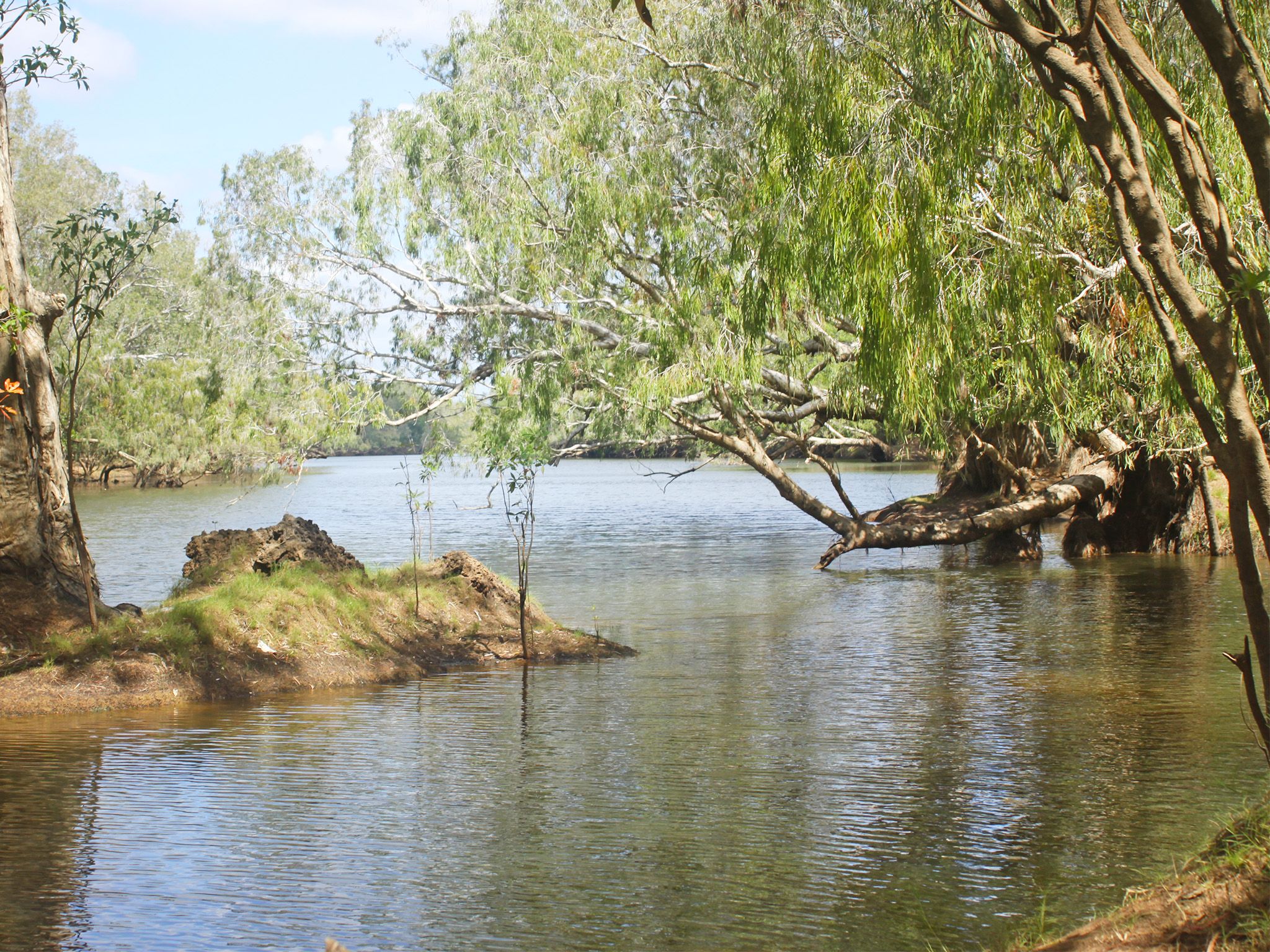
![The camping area is on the western bank of a large and permanent waterhole on the Normanby River.]() The camping area is on the western bank of a large and permanent waterhole on the Normanby River.
Photo credit: Doug Davidson © Queensland Government
The camping area is on the western bank of a large and permanent waterhole on the Normanby River.
Photo credit: Doug Davidson © Queensland Government

Always check
- Park alerts for the latest information on access, closures and conditions.
- Bureau of Meteorology weather forecasts.
- Current bushfire warnings and incidents and also fire bans and restrictions.
- Your camping permit is booked.
- Any park-specific camping information for
Rinyirru (Lakefield).
- Visiting Rinyirru (Lakefield) safely for important safety information.
The self-service kiosk at this park has been decommissioned.
Visitors need to book their camping permit before they visit. Book online, at an over-the-counter booking office or by phone.
Set up camp high above this long and deep waterhole on the Normanby River, and then wet a line to see if you can land a fish for dinner. Spend the rest of the day relaxing with family and friends, taking in the peaceful surrounds.
After a peaceful night's sleep, jump in the car and explore the surrounding park. The Breeza Homestead, and Red Lily and White Lily lagoons are just down the road. Further afield, but still within driving distance, are waterholes, creek, rivers and historic sites.
At night, gather around a camp fire and share the day’s stories before falling asleep to the sounds of Rinyirru at night.
Rinyirru (Lakefield) National Park (CYPAL) is jointly managed by the Rinyirru (Lakefield) Aboriginal Corporation and the Queensland Government.
Getting there and getting around
Hanush's Waterhole camping area is in the central part of Rinyirru (Lakefield) National Park (CYPAL), 340km north-west of Cairns, and 140km west of Cooktown, on southern Cape York Peninsula.
- This camping area is north of Lakefield ranger base, along the western bank of the Normanby River.
- You need a 4WD to access the park and camping area.
- Read 4WD with care for important information on 4WD safety and minimal impact driving.
From the north
- Take the Lakefield turn-off at the Musgrave Roadhouse on the Peninsula Developmental Road and drive 38km east on Marina Plains Road to the park.
- Continue 67km south through the park and turn left at Hanush's Waterhole turn-off.
- Drive 8km north to the camping area.
From Cape Melville
- Drive 70km from Wakooka in Cape Melville National Parkto Kalpowar on the eastern boundary of Rinyirru (Lakefield) National Park (CYPAL).
- Continue 1km to Lakefield Road and turn right.
- Drive 6.5km north and turn right at the Hanush's Waterhole turn-off.
- Drive 8km north to the camping area.
From the south
- Drive 2km north past Laura on the Peninsula Developmental Road and take the Lakefield turn-off.
- Drive 25km to the park.
- Continue 66.5km through the park, past the Lakefield ranger base and turn right at the Hanush's Waterhole turn-off.
- Drive 8km north to the camping area.
For tourism information for all regions in Queensland, see Queensland.com, and for friendly advice on how to get there, where to stay and what to do, find your closest accredited visitor information centre.
Before you visit
Seasonal closures
Rinyirru (Lakefield) National Park (CYPAL) is closed throughout the wet season every year.
- Camping areas south of Lakefield ranger base are closed from 1 December to 31 May.
- Camping areas north of the Lakefield ranger base are closed from 1 December to 30 June.
- These dates vary each year depending on weather and road conditions.
- Refer to the park map for location of the Lakefield ranger base and camping areas.

Camp site three at Hanushs Waterhole camping area.
Photo credit: Queensland Government
Camping area features
Adjacent to a large, permanent waterhole on the 5m high western bank of the Normanby River. This permanent waterhole is ideal for fishing and is perfect for very large groups or families who wish to camp close together, as all sites are adjoining. Large crocodiles are frequently seen here—be croc wise in croc country.
Location: central part of the park on the western bank of the Normanby River, 8km north of Lakefield Road—by road, the turn-off is 6.5km north of Lakefield ranger base.
Map: Rinyirru (Lakefield) National Park (CYPAL) central camping areas map
Access: the camping area can be reached by four-wheel-drive vehicle only. It is not accessible for caravans, campervans or buses. The road becomes impassable after rain.
Boat launching: nil.
Number of sites: three numbered sites.
| Site | Camp size |
|---|---|
| 1 | Maximum 2 cars and trailers (6 people). |
| 2 | Maximum 2 cars and trailers (6 people). |
| 3 | Maximum 2 cars and trailers (6 people). |
Camp sites are suitable for: tent camping beside your car and camper trailers
Camp site surface: dirt and grass (seasonal).
Shade: site one has partial shade, and sites two and three have no shade.
Facilities: nil.
Open fires: allowed (except when fire bans apply). Fuel stoves are recommended. Do not collect firewood in the park.
Generators: only generators operated at less than 65dB(A), when measured 7m from the generator, are permitted, and only between 8.00am and 7.00pm.
Essentials to bring: adequate food and drinking water, equipment for treating water, rubbish bags, insect repellent, mosquito nets, fuel stove and adequate fuel and spare parts for your vehicle. Read more about before you visit.
Bookings: book online, over-the-counter or by phone prior to arrival. Bookings are essential and should be made well in advance for May to August and the September school holidays.
Mobile phone coverage: not available.
Upcoming camping area availability
Visiting safely
For more safety information see Visiting Rinyirru (Lakefield) safely and camp with care.
- Wet season closure: Rinyirru (Lakefield) National Park (CYPAL) 1 December 2023 to 14 July 2024