Park is closed
Mick Fienn Waterhole camping area
Take your pick from this group of camp sites scattered along the beautiful Normanby River in the central area of the park.
Accessible by
- 4WD
Camping area facilities
- Campfires allowed (conditions apply)
- Generators allowed (conditions apply)
- Tent camping
- Camper trailer camping
- Tent camping beside car
- Scenic drive
- Boating
- Fishing
-
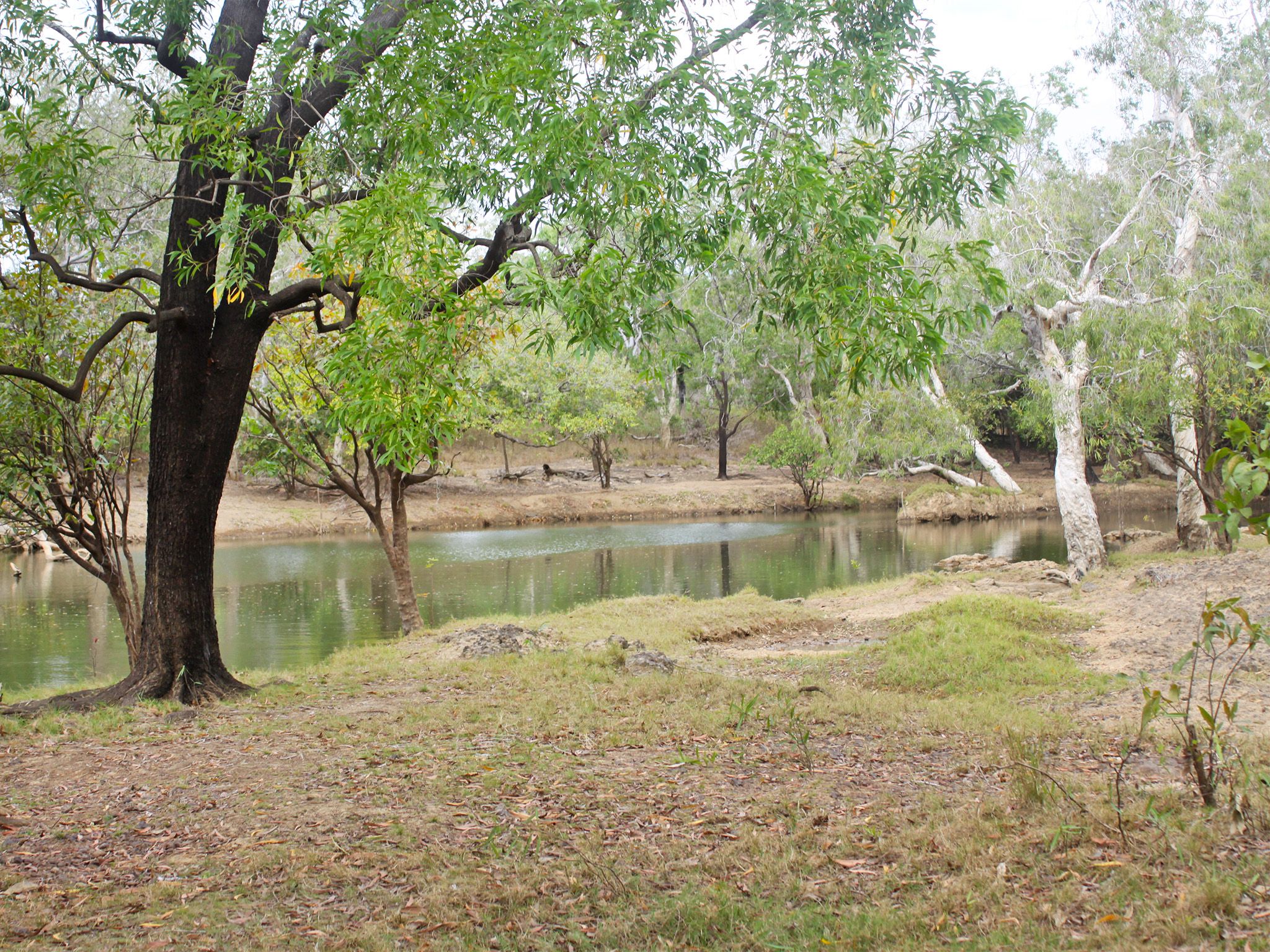
![The five camp sites are scattered along the western bank of the Normanby River.]() The five camp sites are scattered along the western bank of the Normanby River.
Photo credit: Doug Davidson © Queensland Government
The five camp sites are scattered along the western bank of the Normanby River.
Photo credit: Doug Davidson © Queensland Government
-
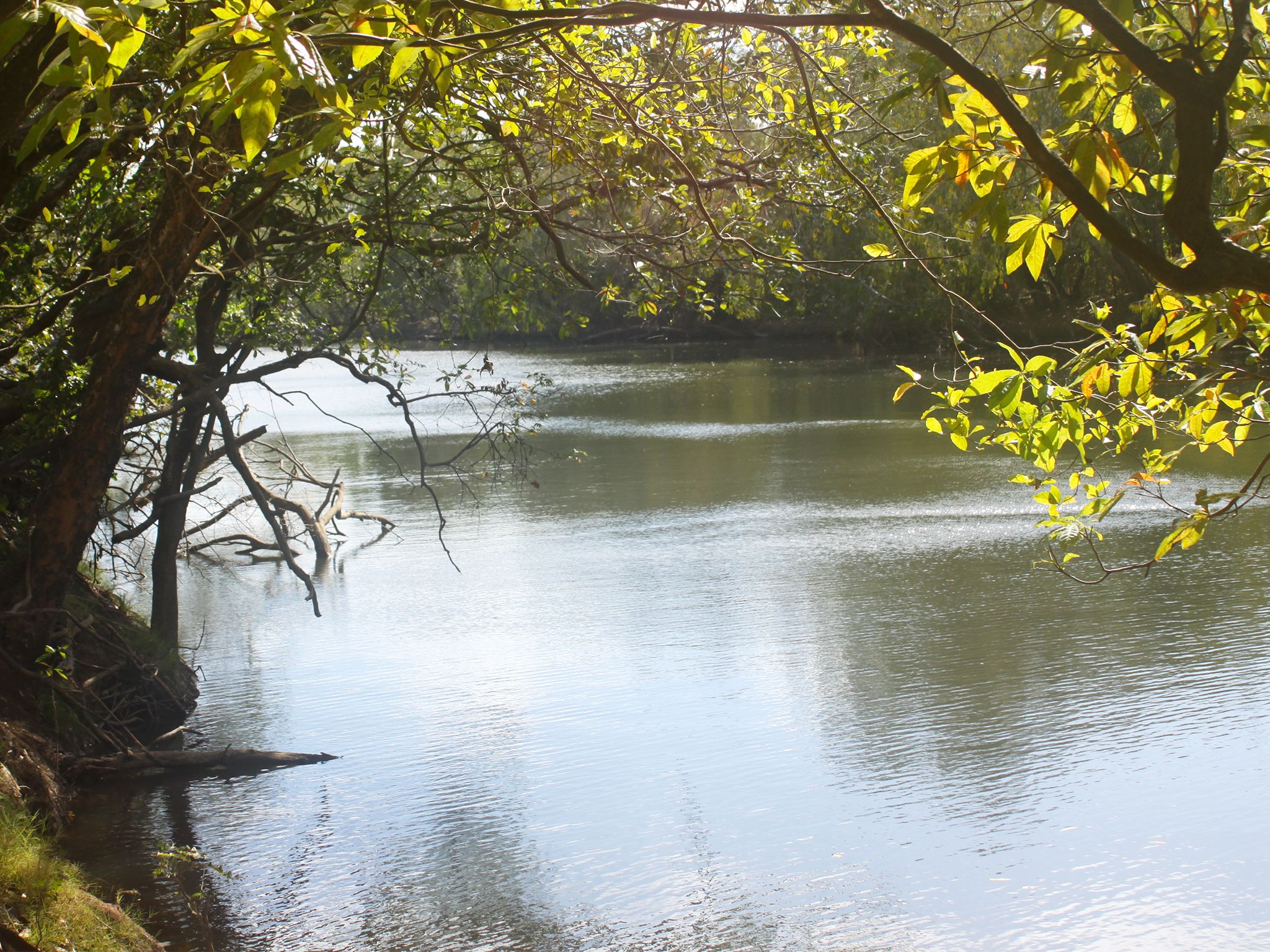
![The camping area is on a deep, permanent waterhole on the Normanby River.]() The camping area is on a deep, permanent waterhole on the Normanby River.
Photo credit: Doug Davidson © Queensland Government
The camping area is on a deep, permanent waterhole on the Normanby River.
Photo credit: Doug Davidson © Queensland Government
Always check
- Park alerts for the latest information on access, closures and conditions.
- Bureau of Meteorology weather forecasts.
- Current bushfire warnings and incidents and also fire bans and restrictions.
- Your camping permit is booked.
- Any park-specific camping information for
Rinyirru (Lakefield).
- Visiting Rinyirru (Lakefield) safely for important safety information.
The self-service kiosk at this park has been decommissioned.
Visitors need to book their camping permit before they visit. Book online, at an over-the-counter booking office or by phone.
Set up your Rinyirru base camp next to a cluster of deep, permanent waterholes on this low western bank of the Normanby River.
Spend the days fishing and exploring along the waterholes. You can cast lures from the bank or manually launch (no trailers) your boat at camp sites one and two.
After a day of fishing and exploring, relax around a fire under a cloudless, star-spangled night sky. See how many constellations you can find and listen for the sounds of the park’s nocturnal animals. Don’t stay up too late because a chorus of birdsong will wake you at dawn!
Rinyirru (Lakefield) National Park (CYPAL) is jointly managed by the Rinyirru (Lakefield) Aboriginal Corporation and the Queensland Government.
Getting there and getting around
Mick Fienn Waterhole camping area is in the central part of Rinyirru (Lakefield) National Park (CYPAL), 340km north-west of Cairns, and 140km west of Cooktown, on southern Cape York Peninsula.
- The camping area is on the western bank of the Normanby River.
- You need a 4WD to access the park and camping area.
- Read 4WD with care for important information on 4WD safety and minimal impact driving.
From the north
- Take the Lakefield turn-off at the Musgrave Roadhouse on the Peninsula Developmental Road and drive 38km east on Marina Plains Road to the park.
- Continue 81km south through the park, past the Lakefield ranger base, and turn left at the Mick Fienn turn-off.
- Drive 9km north-east to the camping area.
From the south
- Drive 2km north past Laura on the Peninsula Developmental Road and take the Lakefield turn-off.
- Drive 25km to the park.
- Continue 50km north through the park, past the New Laura ranger base, and turn right at the Mick Fienn turn-off.
- Drive 9km north-east to the camping area.
From Battle Camp Road
- Drive 85km west from Cooktown along Battle Camp Road to the park's eastern boundary.
- Continue 75km through the park, past the New Laura ranger base.
- Turn right and the Dingo Waterhole turn-off and drive 9km east to the camping area.
- The camping area is a further 9km north-east along this road.
For tourism information for all regions in Queensland, see Queensland.com, and for friendly advice on how to get there, where to stay and what to do, find your closest accredited visitor information centre.
Before you visit
Seasonal closures
Rinyirru (Lakefield) National Park (CYPAL) is closed throughout the wet season every year.
- Camping areas south of Lakefield ranger base are closed from 1 December to 31 May.
- Camping areas north of the Lakefield ranger base are closed from 1 December to 30 June.
- These dates vary each year depending on weather and road conditions.
- Refer to the park map for location of the Lakefield ranger base and camping areas.

Camp site two at Mick Fienn Waterhole camping area.
Photo credit: Queensland Government
Camping area features
Adjacent to deep, permanent waterholes on the low (<1m high) western bank of the Normanby River. Large crocodiles are frequently seen here—be croc wise in croc country.
Location: central part of the park on the western bank of the Normanby River, 9km east of Lakefield Road—by road, the turn-off is 24km north of New Laura ranger base and 9km south of Lakefield ranger base.
Map: Rinyirru (Lakefield) National Park (CYPAL) central camping areas map
Access: the camping area can be reached by four-wheel-drive vehicle only and the access road crosses the Kennedy River. It is not accessible for caravans, campervans or buses. The road becomes impassable after rain.
Boat launching: manual launching (no trailer access) from sites one and two only.
Number of sites: five numbered sites.
| Site | Camp size |
|---|---|
| 1 | Maximum 2 cars and trailers (6 people). |
| 2 | Maximum 2 cars and trailers (6 people). |
| 3 | Maximum 3 cars and trailers (8 people). |
| 4 | Maximum 2 cars and trailers (6 people). |
| 5 | Maximum 4 cars and trailers (12 people). |
Camp sites are suitable for: tent camping beside your car and camper trailers.
Camp site surface: dirt and grass (seasonal).
Shade: sites one, two and four have partial shade, and sites three and five have no shade.
Facilities: individual and communal fire rings.
Open fires: allowed (except when fire bans apply) in fire rings only. Fuel stoves are recommended. Do not collect firewood in the park.
Generators: only generators operated at less than 65dB(A), when measured 7m from the generator, are permitted, and only between 8.00am and 7.00pm.
Essentials to bring: adequate food and drinking water, equipment for treating water, rubbish bags, insect repellent, mosquito nets, fuel stove and adequate fuel and spare parts for your vehicle. Read more about before you visit.
Bookings: book online, over-the-counter or by phone prior to arrival. Bookings are essential and should be made well in advance for May to August and the September school holidays.
Mobile phone coverage: not available.
Upcoming camping area availability
Visiting safely
For more safety information see Visiting Rinyirru (Lakefield) safely and camp with care.
- Wet season closure: Rinyirru (Lakefield) National Park (CYPAL) 1 December 2023 to 14 July 2024