Mount Norman
Challenge yourself on this trek deep into eucalypt forests, past massive granite outcrops and alongside colourful rock slabs towards Girraween's highest peak.
- Journey type
- Walk
- Distance
- 11km (or 4km from Mount Norman day-use area) return Start and finish points are the same and the traveller must return via the same path
- Time suggested
- Allow 4–5hr walking time (or 1.5–3hr return if walking from Mount Norman day-use area).
- Grade
- Grade 4 walking track
Accessible by
- Conventional vehicle
- Bicycle
Journey facilities
- Walking
-
![The Mount Norman walk leads to the base of Girraween's highest peak.]() The Mount Norman walk leads to the base of Girraween's highest peak.
Photo credit: © Ben Blanche
The Mount Norman walk leads to the base of Girraween's highest peak.
Photo credit: © Ben Blanche
-
![Mount Norman walk passes through gently sloping open areas dotted with wildflowers in spring.]() Mount Norman walk passes through gently sloping open areas dotted with wildflowers in spring.
Photo credit: Maxime Coquard © Queensland Government
Mount Norman walk passes through gently sloping open areas dotted with wildflowers in spring.
Photo credit: Maxime Coquard © Queensland Government
-
![Pass amazing granite outcrops and colourful rock slabs on the Mount Norman walk.]() Pass amazing granite outcrops and colourful rock slabs on the Mount Norman walk.
Photo credit: Maxime Coquard © Queensland Government
Pass amazing granite outcrops and colourful rock slabs on the Mount Norman walk.
Photo credit: Maxime Coquard © Queensland Government
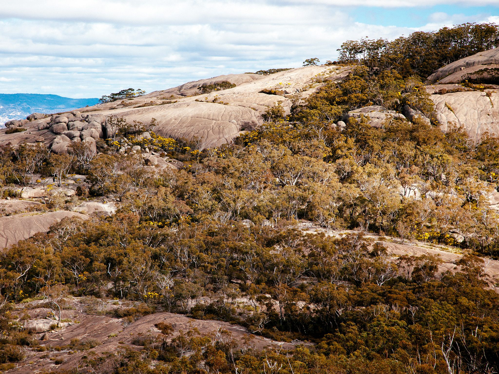
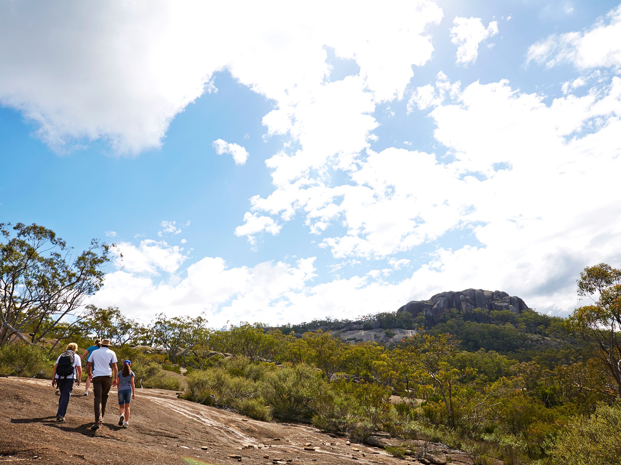

From the Girraween Visitor Centre, pass Castle Rock, then head deep into the park’s tall eucalypt forests. Encounter rocky ridges, moist gullies blanketed with bracken and gently-sloping open areas sprinkled with wildflowers in spring. Admire views of the Eye of the Needle on Mount Norman's northern face before reaching the rocky slabs at the base of the Mount Norman monolith.
Alternatively, hike 4km from the Mount Norman day-use area through rock gardens and stands of graceful Wallangarra white gums on the mountain’s southern face.
The track does not reach the 1267m summit—the final approach is suitable for rock climbers only.
Getting there and getting around
Mount Norman is one of the southern walking tracks in Girraween National Park, located on the Queensland–New South Wales border, 260km south-west of Brisbane.
The track to Mount Norman begins on the southern side of Pyramids Road, near the Girraween Visitor Centre car park. Alternatively you can access the park from Mount Norman day-use area in the south of the park.
There are three access roads (northern, western and southern) to the centre, all accessible by conventional vehicles.
From Brisbane to western entrance
- Drive about 220km south-west along the New England Highway via Warwick to Stanthorpe.
- Continue 26km along the New England Highway to Wyberba (30km north of Tenterfield).
- Turn onto Pyramids Road and follow this winding bitumen road through the Wyberba Valley 6km east to the western park entrance.
- Drive about 3km on Pyramids Road to the Girraween Visitor Centre.
From Brisbane to northern entrance
- Drive about 220km south-west along the New England Highway via Warwick to Stanthorpe.
- Turn onto Sugarloaf Road, which turns into Eukey Road and drive about 15km via Storm King Dam towards Eukey.
- About 1km before Eukey, turn onto Breens Road, drive 2.5km then turn onto Pyramids Road and drive about 6km to the northern park entrance.
- Drive about 4km on Pyramids Road to the Girraween Visitor Centre.
From Tenterfield (NSW) to southern entrance
- Drive 18km north on the New England Highway to Wallangarra.
- In Wallangarra, cross to the eastern side of the railway line, go over the railway bridge and turn left onto sealed and signposted Mount Norman Road.
- After about 2km the road changes to gravel. Turn right across a grid and continue for 1km then turn right at the water treatment plant and enter the park's southern entrance.
- Drive 3.5km on Mount Norman Road to Mount Norman day-use area.
Wheelchair access
There are no wheelchair-accessible facilities.
Before you visit
Opening hours
Mount Norman is open 24 hours a day.
Check park alerts for the latest information on access, closures and conditions.
Visiting safely
For more safety information see Visiting Girraween safely and Walk with care.
- There are currently no park alerts for this park.