Castle Rock
Witness a spectacular array of birdlife and panoramic views from one of the park's signature peaks as you hike through shady woodlands.
- Journey type
- Walk
- Distance
- 5.2km return Start and finish points are the same and the traveller must return via the same path
- Time suggested
- Allow 1.5–2hr walking time.
- Grade
- Grade 4 walking track
Accessible by
- Conventional vehicle
- Bicycle
Journey facilities
- Lookout (natural)
- Walking
-
![Castle Rock track has a steep climb over exposed granite rocks to and from the summit.]() Castle Rock track has a steep climb over exposed granite rocks to and from the summit.
Photo credit: Maxime Coquard © Queensland Government
Castle Rock track has a steep climb over exposed granite rocks to and from the summit.
Photo credit: Maxime Coquard © Queensland Government
-
![Eucalypt forests provide shade and birdwatching opportunities on the Castle Rock track.]() Eucalypt forests provide shade and birdwatching opportunities on the Castle Rock track.
Photo credit: Maxime Coquard © Queensland Government
Eucalypt forests provide shade and birdwatching opportunities on the Castle Rock track.
Photo credit: Maxime Coquard © Queensland Government
-
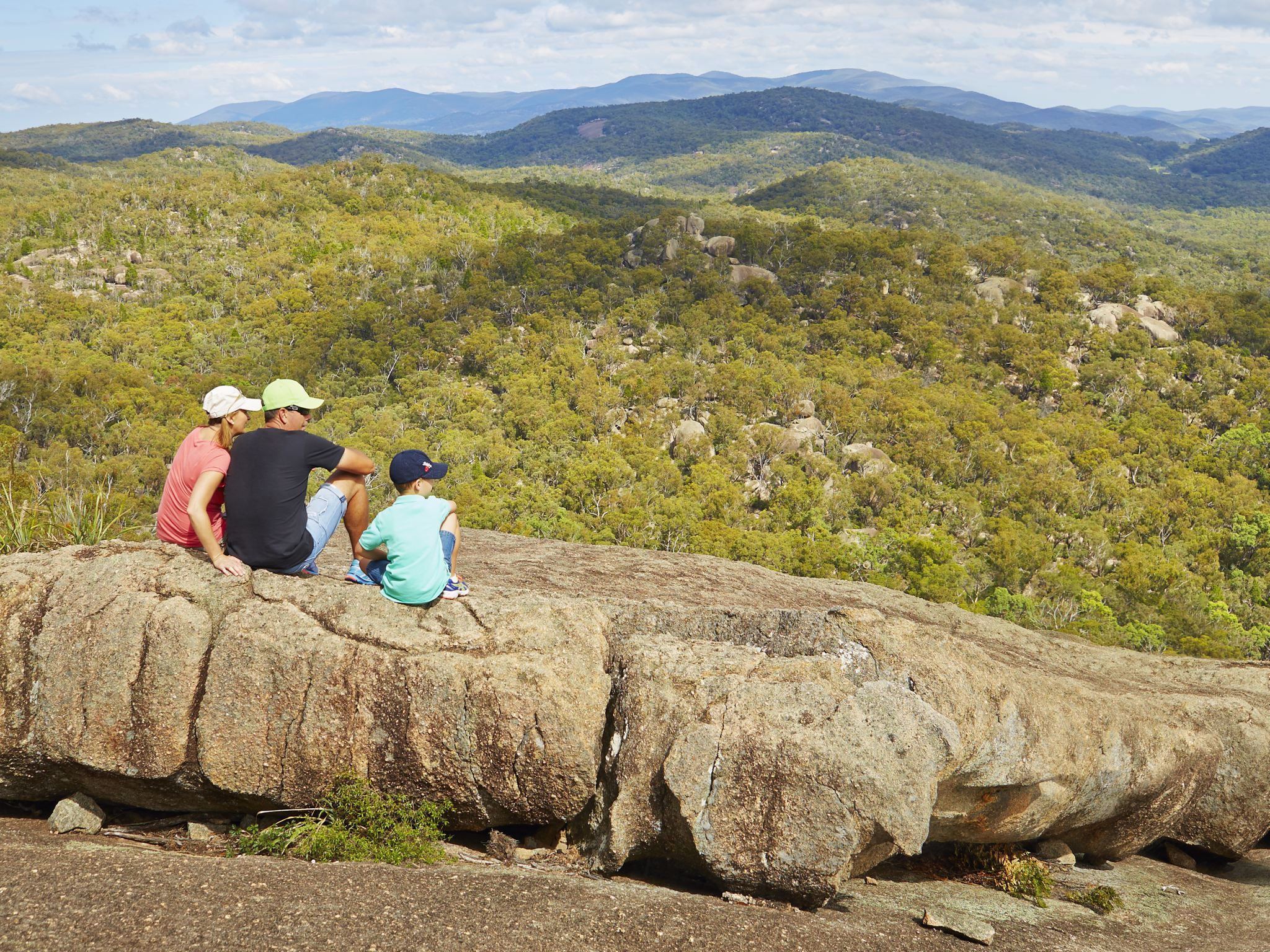
![Enjoy breathtaking panoramic views on the Castle Rock track.]() Enjoy breathtaking panoramic views on the Castle Rock track.
Photo credit: Maxime Coquard © Queensland Government
Enjoy breathtaking panoramic views on the Castle Rock track.
Photo credit: Maxime Coquard © Queensland Government
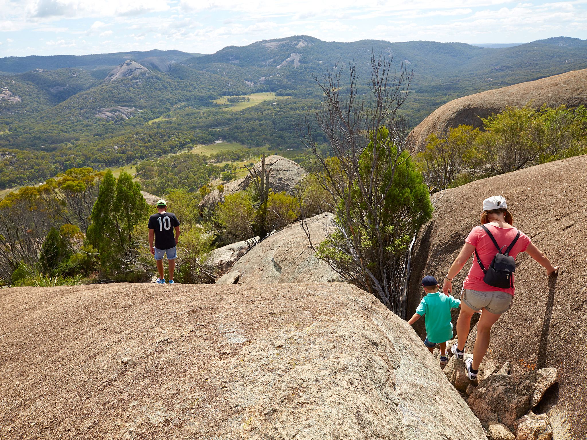
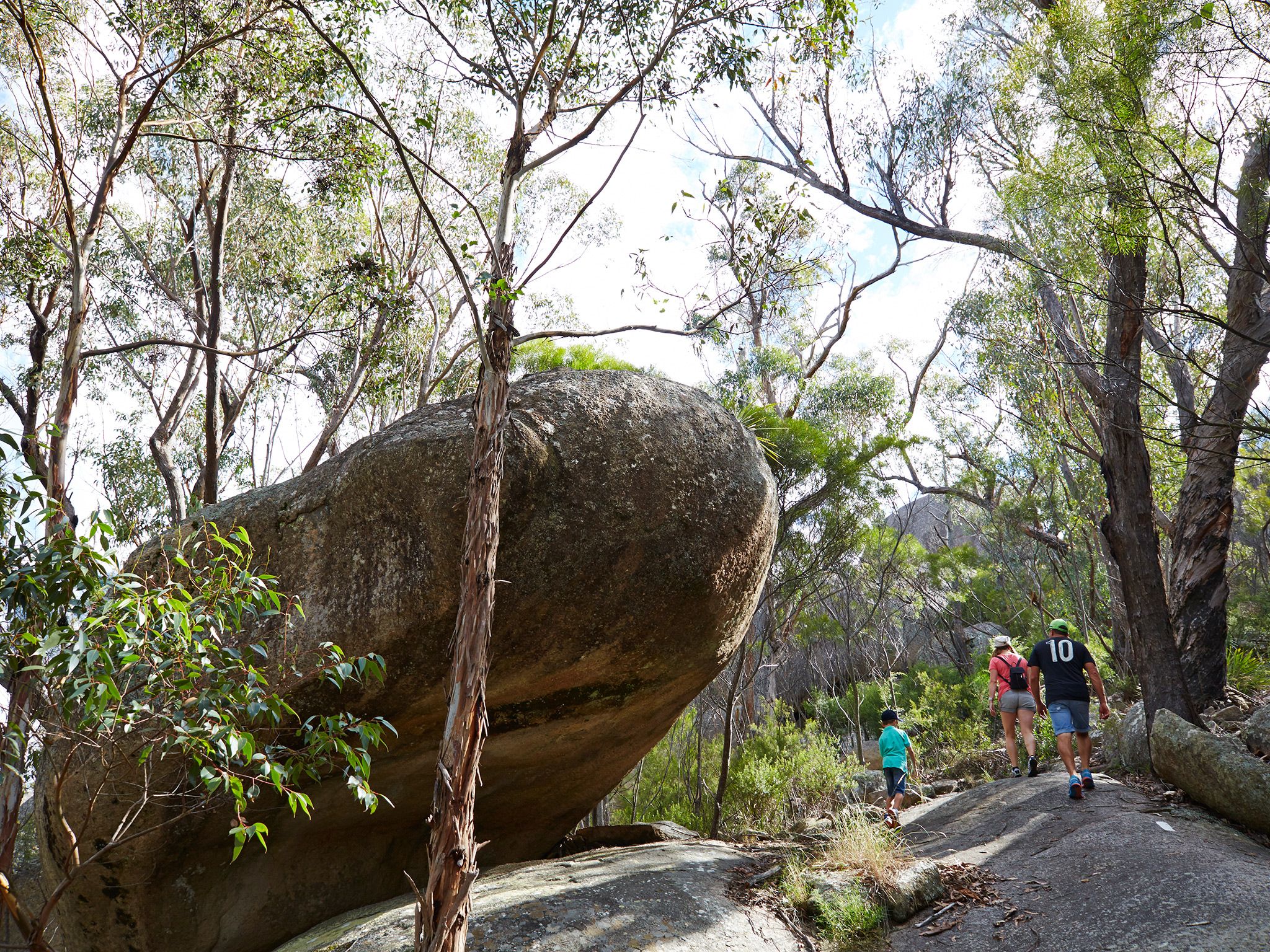
Challenge yourself on this moderately difficult hike to one of Girraween's granite peaks—Castle Rock. Ramble through shady eucalypt woodlands high on rocky ridges, and revel in stunning views from natural lookouts. Enjoy birdwatching amongst the black cypress, stringybark and orange gums perched high on the rocky ridges. Have your binoculars or camera ready!
At the final leg of this hike, tackle the steep climb over exposed granite rocks to Castle Rock and be rewarded by jaw-dropping 360-degree views across the park. Enjoy a well-earned packed lunch at the summit, surrounded by these breathtaking vistas.
Getting there and getting around
The Castle Rock track is one of the southern walking tracks in Girraween National Park, located on the Queensland–New South Wales border, 260km south-west of Brisbane.
The Castle Rock track begins on the southern side of Pyramids Road, near the Girraween Visitor Centre car park. There are two access roads (northern and western) to the visitor centre, all accessible by conventional vehicles.
From Brisbane to western entrance
- Drive about 220km south-west along the New England Highway via Warwick to Stanthorpe.
- Continue 26km along the New England Highway to Wyberba (30km north of Tenterfield).
- Turn onto Pyramids Road and follow this winding bitumen road through the Wyberba Valley 6km east to the western park entrance.
- Drive about 3km to the Girraween Visitor Centre.
From Brisbane to northern entrance
- Drive about 220km south-west along the New England Highway via Warwick to Stanthorpe.
- Turn onto Sugarloaf Road, which turns into Eukey Road and drive about 15km via Storm King Dam towards Eukey.
- About 1km before Eukey, turn onto Breens Road, drive 2.5km then turn onto Pyramids Road and drive about 6km to the northern park entrance.
- Drive about 4km to the Girraween Visitor Centre.
Wheelchair access
There are no wheelchair-accessible facilities.
Before you visit
Opening hours
Castle Rock is open 24 hours a day.
Check park alerts for the latest information on access, closures and conditions.
Visiting safely
For more safety information see Visiting Girraween safely and Walk with care.
- There are currently no park alerts for this park.