Haydens Flat remote bush camp
Spend a relaxing night in an open clearing beneath starry skies in this walkers’ camp near the top of Underground Creek.
Accessible by
- Bicycle
- Walk-in
Camping area facilities
- Tent camping
- Long walk to tent
- Walking
-
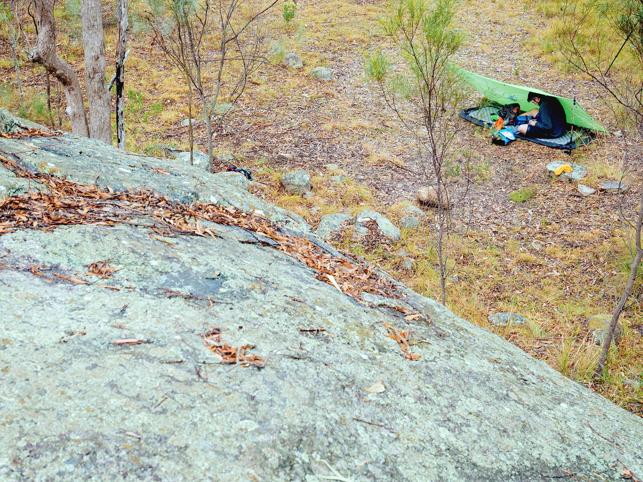
![Camp in an open clearing, just off the Peak trail, at Haydens Flat walkers' camp.]() Camp in an open clearing, just off the Peak trail, at Haydens Flat walkers' camp.
Photo credit: © Ben Blanche
Camp in an open clearing, just off the Peak trail, at Haydens Flat walkers' camp.
Photo credit: © Ben Blanche
-
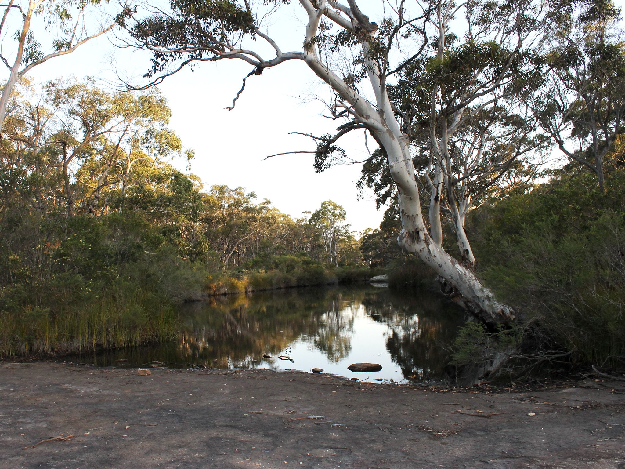
![Haydens Flat walkers' camp is only a short distance from the top of Underground Creek.]() Haydens Flat walkers' camp is only a short distance from the top of Underground Creek.
Photo credit: © Hannah Beaumont
Haydens Flat walkers' camp is only a short distance from the top of Underground Creek.
Photo credit: © Hannah Beaumont
Always check
- Park alerts for the latest information on access, closures and conditions.
- Bureau of Meteorology weather forecasts.
- Current bushfire warnings and incidents and also fire bans and restrictions.
- Your camping permit is booked.
- Any park-specific camping information for
Girraween.
- Visiting Girraween safely for important safety information.
After a hard day's hiking through granite landforms, open woodlands and heathlands, set up camp with great views across an open clearing. Refresh with a dip in the cool waters of Bald Rock Creek and discover Girraween’s creek life. During the warmer months, you'll see a spectacular display of vibrant wildflowers that attract an equally colourful variety of birdlife.
This walkers’ camp, just off the shared Peak trail, is ideal if you are hiking Girraween's southern and eastern walking tracks and remote hiking trails.
Campers using these sites need good navigation skills and should leave trip details with a friend or family member.
Maximum group size is 8.
Getting there and getting around
Haydens Flat walker's camp is in Girraween National Park, located on the Queensland–New South Wales border, 260km by road south-west of Brisbane.
The park has three entrances (northern, western and southern) and is accessible by conventional vehicles. Pyramids Road links the northern and western park entrances.
Haydens Flat walkers' camp: GPS reference under GDA94 datum Zone 56J is (0400389/6809248)—on the eastern side of the management trail.
Getting to the park
From Brisbane to western entrance
- Drive about 220km south-west along the New England Highway via Warwick to Stanthorpe.
- Continue 26km along the New England Highway to Wyberba (30km north of Tenterfield).
- Turn onto Pyramids Road and follow this winding bitumen road through the Wyberba Valley 6km east to the western park entrance.
- Drive about 3km on to the Girraween Visitor Centre, Bald Rock Creek day-use area and Castle Rock and Bald Rock Creek camping areas.
From Brisbane to northern entrance
- Drive about 220km south-west along the New England Highway via Warwick to Stanthorpe.
- Turn onto Sugarloaf Road, which turns into Eukey Road and drive about 15km via Storm King Dam towards Eukey.
- About 1km before Eukey, turn onto Breens Road, drive 2.5km then turn onto Pyramids Road and drive about 6km to the northern park entrance.
- Drive about 4km on to the Girraween Visitor Centre, Bald Rock Creek day-use area and Castle Rock and Bald Rock Creek camping areas.
From Tenterfield (NSW) to southern entrance
- Drive 18km north on the New England Highway to Wallangarra.
- In Wallangarra, cross to the eastern side of the railway line, go over the railway bridge and turn left onto sealed and signposted Mount Norman Road.
- After about 2km the road changes to gravel, turn right across a grid and continue for 1km then turn right at the water treatment plant and enter the park's southern entrance.
- Drive 3.5km along Mount Norman Road to the Mount Norman day-use area and continue north to the northern park boundary where it joins with Pyramid Road. Some sections of this road are suitable for 4WD only.
- Read 4WD with care for important information on 4WD safety and minimal impact driving.
Before you visit
Opening hours
Haydens Flat walkers' camp is open 24 hours a day. Check-in to your camp after 2pm and check-out by 11am on the day of departure.
Check park alerts for the latest information on access, closures and conditions.
Upcoming camping area availability
Visiting safely
For more safety information see Visiting Girraween safely and camp with care.
- There are currently no park alerts for this park.