Northern Management Trail remote bush camp
After a challenging day clambering over ridge tops on Girraween’s ‘wild side’, camp in a eucalypt woodland rich in natural wonders.
Accessible by
- Walk-in
Camping area facilities
- Tent camping
- Long walk to tent
- Walking
Always check
- Park alerts for the latest information on access, closures and conditions.
- Bureau of Meteorology weather forecasts.
- Current bushfire warnings and incidents and also fire bans and restrictions.
- Your camping permit is booked.
- Any park-specific camping information for
Girraween.
- Visiting Girraween safely for important safety information.
After an exhausting climb up and over The Pyramid's ridge top, and clambering through lush undergrowth, discover a camp site nestled in a clear valley surrounded by eucalypt woodlands. Not for the faint-hearted, you have made it to the ‘other side’ of Girraween's iconic Pyramid and Slip Rock, a place that few visitors experience.
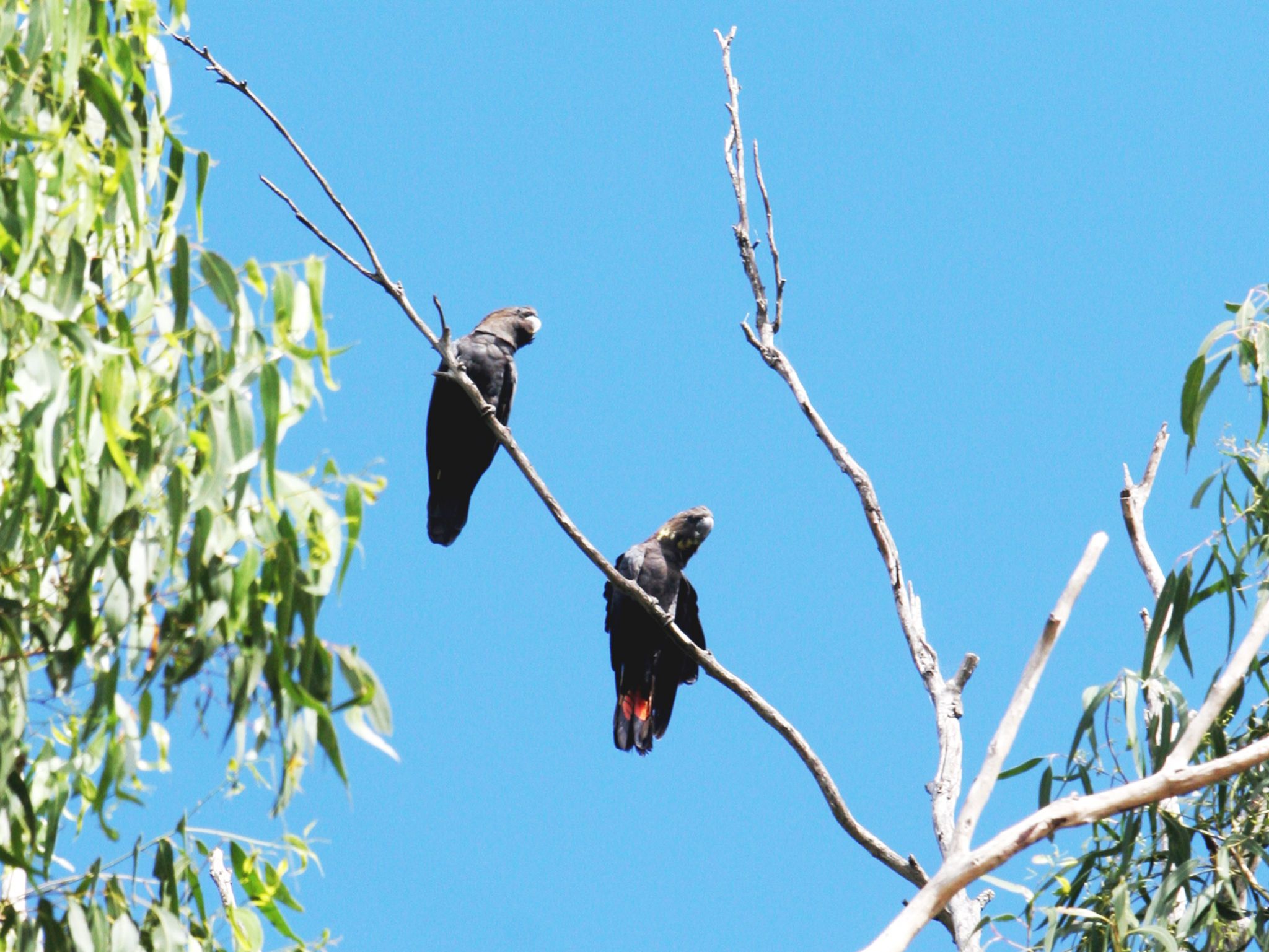
Scan the treetops for glossy black cockatoos, powerful owls and superb lyrebirds, known for their impressive mimicry. Look for common wombats—they prefer to live in Girraween's high altitude areas. Then fall asleep under the stars in your remote eyrie and wake ready for tomorrow’s challenge.
Campers using these sites need good navigation skills and should leave trip details with a friend or family member.
Maximum group size is 8.
Getting there and getting around
Northern management trail walker's camp is in Girraween National Park, located on the Queensland–New South Wales border, 260km by road south-west of Brisbane.
The park has three entrances (northern, western and southern) and is accessible by conventional vehicles. Pyramids Road links the northern and western park entrances.
Northern management trail walkers' camp: GPS reference under GDA94 datum Zone 56J is (0397590/6812780)—on the southern side of the management trail near the slashed track junction. Access is via difficult cross country walking.
Getting to the park
From Brisbane to western entrance
- Drive about 220km south-west along the New England Highway via Warwick to Stanthorpe.
- Continue 26km along the New England Highway to Wyberba (30km north of Tenterfield).
- Turn onto Pyramids Road and follow this winding bitumen road through the Wyberba Valley 6km east to the western park entrance.
- Drive about 3km on to the Girraween Visitor Centre, Bald Rock Creek day-use area and Castle Rock and Bald Rock Creek camping areas.
From Brisbane to northern entrance
- Drive about 220km south-west along the New England Highway via Warwick to Stanthorpe.
- Turn onto Sugarloaf Road, which turns into Eukey Road and drive about 15km via Storm King Dam towards Eukey.
- About 1km before Eukey, turn onto Breens Road, drive 2.5km then turn onto Pyramids Road and drive about 6km to the northern park entrance.
- Drive about 4km on to the Girraween Visitor Centre, Bald Rock Creek day-use area and Castle Rock and Bald Rock Creek camping areas.
From Tenterfield (NSW) to southern entrance
- Drive 18km north on the New England Highway to Wallangarra.
- In Wallangarra, cross to the eastern side of the railway line, go over the railway bridge and turn left onto sealed and signposted Mount Norman Road.
- After about 2km the road changes to gravel, turn right across a grid and continue for 1km then turn right at the water treatment plant and enter the park's southern entrance.
- Drive 3.5km along Mount Norman Road to the Mount Norman day-use area and continue north to the northern park boundary where it joins with Pyramid Road. Some sections of this road are suitable for 4WD only.
- Read 4WD with care for important information on 4WD safety and minimal impact driving.
Before you visit
Opening hours
Northern management trail walkers' camp is open 24 hours a day. Check-in to your camp after 2pm and check-out by 11am on the day of departure.
Check park alerts for the latest information on access, closures and conditions.
Upcoming camping area availability
Visiting safely
For more safety information see Visiting Girraween safely and camp with care.
- There are currently no park alerts for this park.