Bald Rock Creek circuit
Walk among native wildflowers, explore rock pools, and witness the overpowering beauty of Girraween’s landscape on this creek-side meander.
- Journey type
- Walk
- Distance
- 2.2km circuit The same start and finish point, but the traveller doesn’t return along the same path
- Time suggested
- Allow 1hr walking time.
- Grade
- Grade 3 walking track
Accessible by
- Conventional vehicle
- Bicycle
Journey facilities
- Walking
-
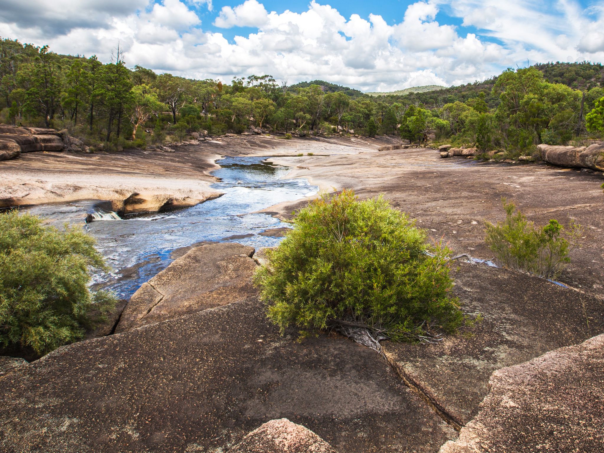
![Sample a slice of Girraween's landscape on the Bald Rock Creek circuit.]() Sample a slice of Girraween's landscape on the Bald Rock Creek circuit.
Photo credit: © MJL Photography
Sample a slice of Girraween's landscape on the Bald Rock Creek circuit.
Photo credit: © MJL Photography
-
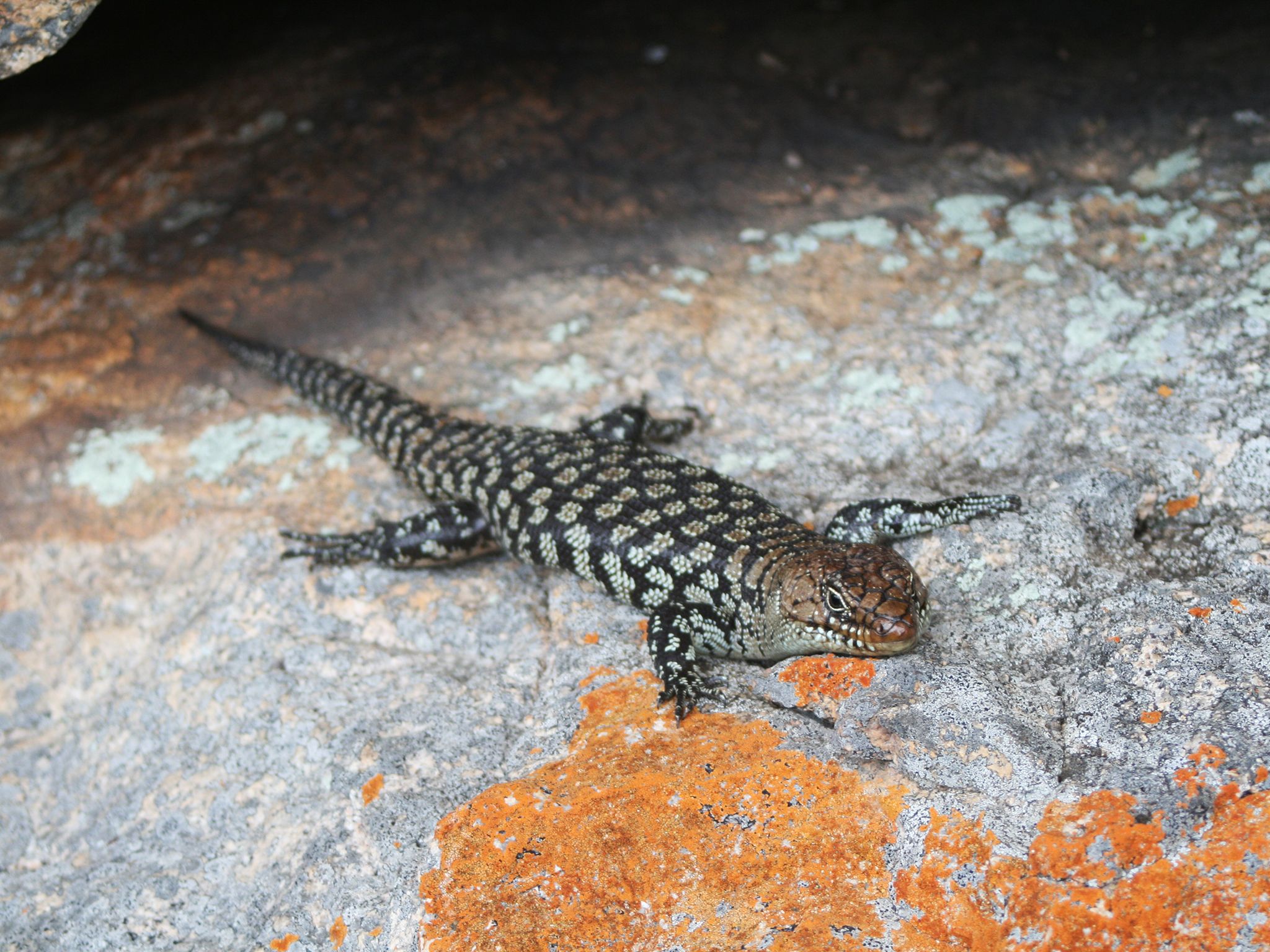
![Bald Rock Creek circuit offers great wildlife viewing opportunities. Keep an eye out for Cunningham's skinks.]() Bald Rock Creek circuit offers great wildlife viewing opportunities. Keep an eye out for Cunningham's skinks.
Photo credit: © Lise Pedersen
Bald Rock Creek circuit offers great wildlife viewing opportunities. Keep an eye out for Cunningham's skinks.
Photo credit: © Lise Pedersen
-
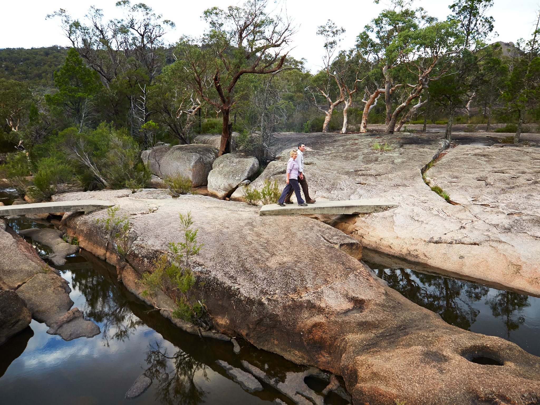
![Discover water-sculpted rocks along Bald Rock Creek circuit.]() Discover water-sculpted rocks along Bald Rock Creek circuit.
Photo credit: Maxime Coquard © Queensland Government
Discover water-sculpted rocks along Bald Rock Creek circuit.
Photo credit: Maxime Coquard © Queensland Government
Cross Bald Rock Creek and follow it downstream. Discover rock pools hidden among tall eucalypts as you wind along the creek bank to the intersection with The Junction. Admire the intricate patterns carved into the rocks by the water's flow and look for butterflies flitting about colourful bottlebrush trees. During spring, enjoy the wildflower display that attracts a vibrant array of birds.
Use stepping stones to cross the creek again and continue past the Bald Rock Creek camping area and the Girraween Visitor Centre to return to the day-use area. Add a 250m detour to your circuit to take in the majestic Granite Arch.
Getting there and getting around
Bald Rock Creek circuit is one of the northern walks in Girraween National Park, located on the Queensland–New South Wales border, 260km by road south-west of Brisbane.
Bald Rock Creek circuit begins at the Bald Rock Creek day-use area. There are two access roads (northern and western) to the day-use area, both accessible by conventional vehicles.
From Brisbane to western entrance
- Drive about 220km south-west along the New England Highway via Warwick to Stanthorpe.
- Continue 26km along the New England Highway to Wyberba (30km north of Tenterfield).
- Turn onto Pyramids Road and follow this winding bitumen road through the Wyberba Valley 6km east to the western park entrance.
- Drive about 3km to the Bald Rock Creek day-use area.
From Brisbane to northern entrance
- Drive about 220km south-west along the New England Highway via Warwick to Stanthorpe.
- Turn onto Sugarloaf Road, which turns into Eukey Road and drive about 15km via Storm King Dam towards Eukey.
- About 1km before Eukey, turn onto Breens Road, drive 2.5km then turn onto Pyramids Road and drive about 6km to the northern park entrance.
- Drive about 4km to the Bald Rock Creek day-use area.
From Tenterfield to southern entrance
- Drive 18km north on the New England Highway to Wallangarra.
- In Wallangarra, head north-west and continue on the New England Highway, then turn onto Pyramids Road and drive to the Bald Rock Creek day-use area.
Wheelchair access
There are no wheelchair-accessible facilities.
Before you visit
Opening hours
Bald Rock Creek circuit is open 24 hours a day.
Check park alerts for the latest information on access, closures and conditions.
Visiting safely
For more safety information see Visiting Girraween safely and Walk with care.
- There are currently no park alerts for this park.