Rous Battery track
Step back in time and discover the remains of a World War II fort set high on the islands dunes.
- Journey type
- Walk
- Distance
- 9.8km one way A path where the start point is different to the finish point
- Time suggested
- Allow 3.5hrs walking time.
- Grade
- Moderate (walk)
Accessible by
- High clearance 4WD
- Boat
Journey facilities
- Walking
-
![WWII battery gun emplacement at Rous Battery.]() WWII battery gun emplacement at Rous Battery.
Photo credit: © Queensland Government
WWII battery gun emplacement at Rous Battery.
Photo credit: © Queensland Government
-
![WWII coastal defence system ruins on the Rous Battery track.]() WWII coastal defence system ruins on the Rous Battery track.
Photo credit: Adam Creed © Queensland Government
WWII coastal defence system ruins on the Rous Battery track.
Photo credit: Adam Creed © Queensland Government
-
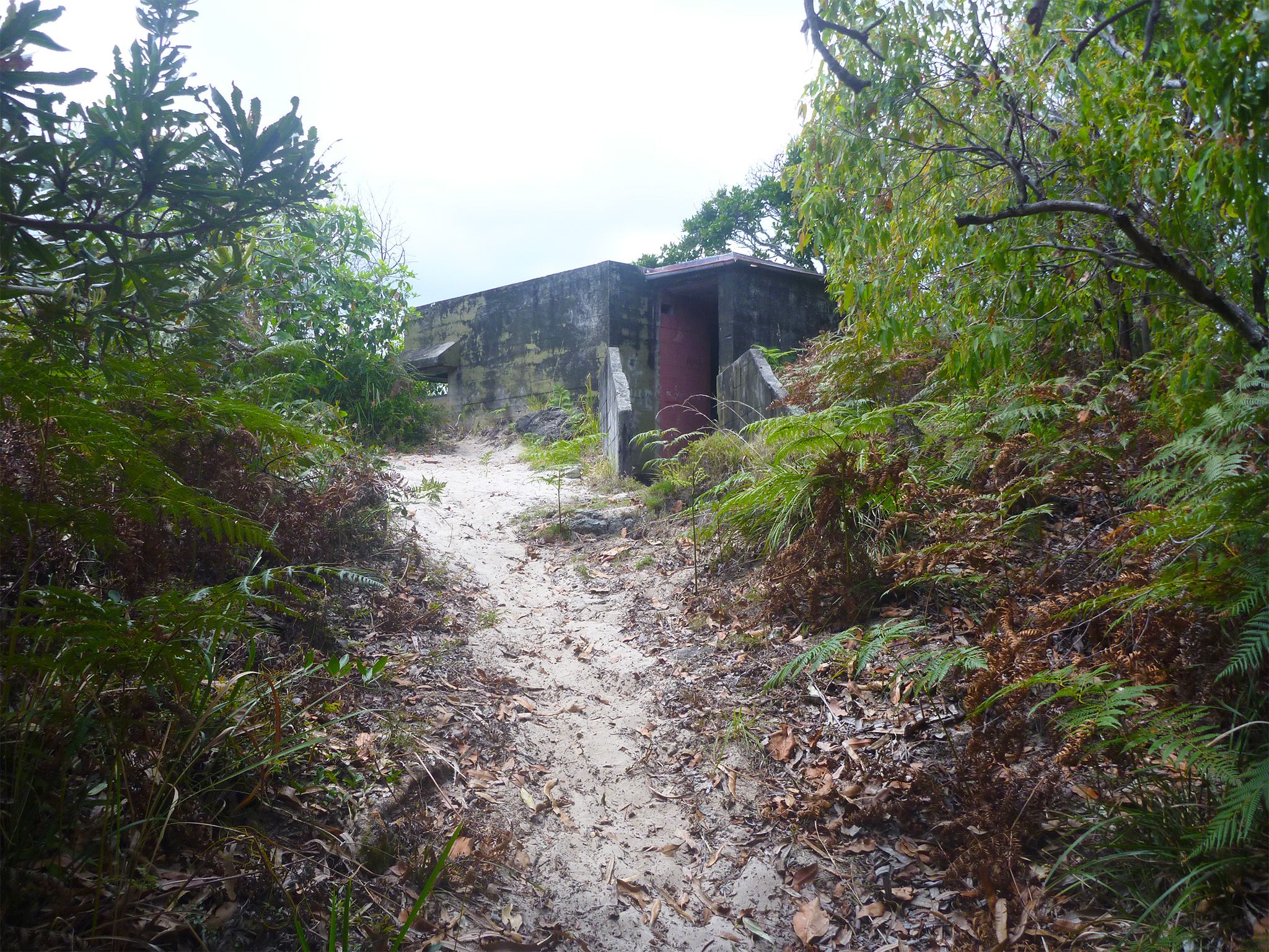
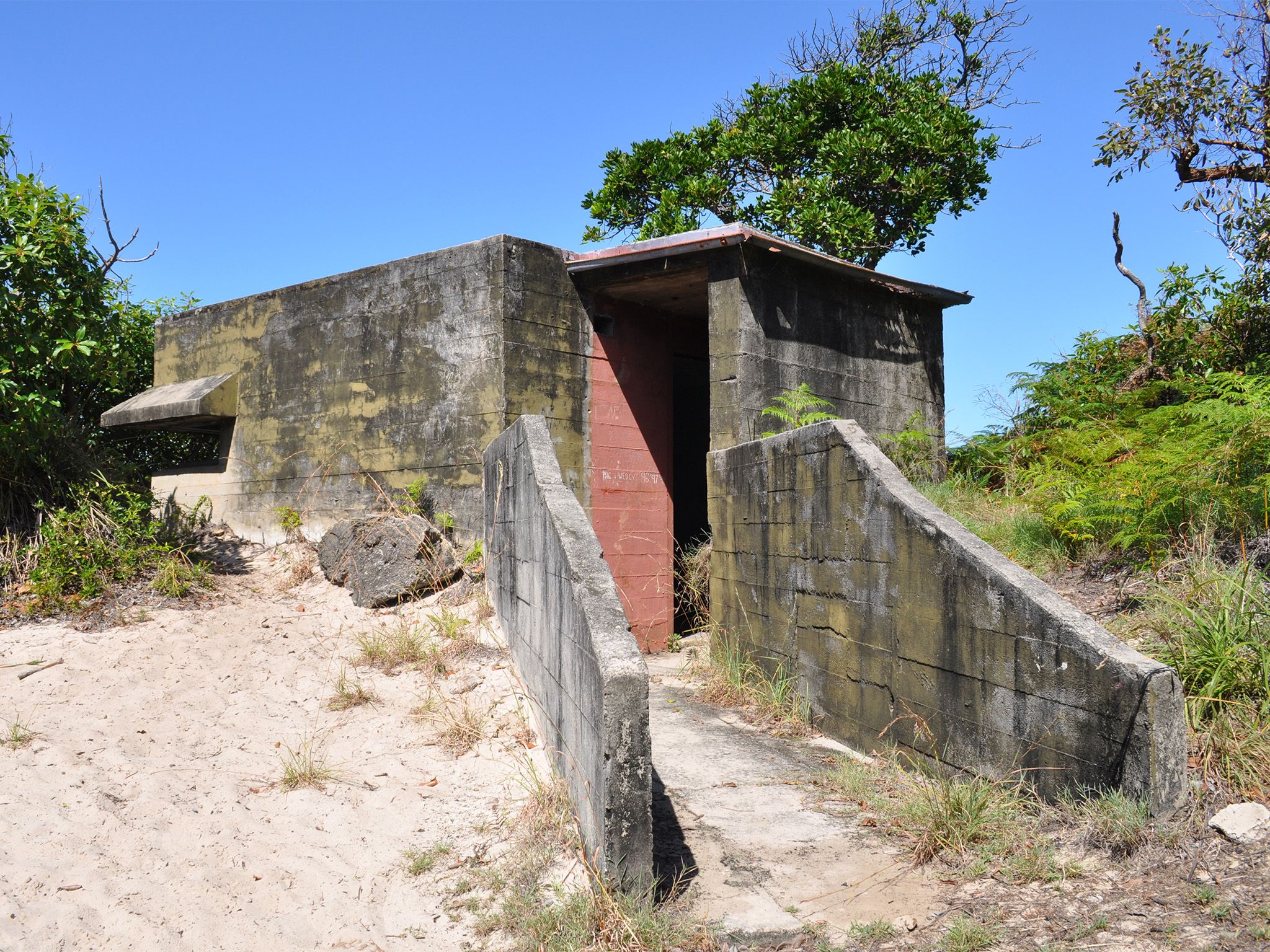
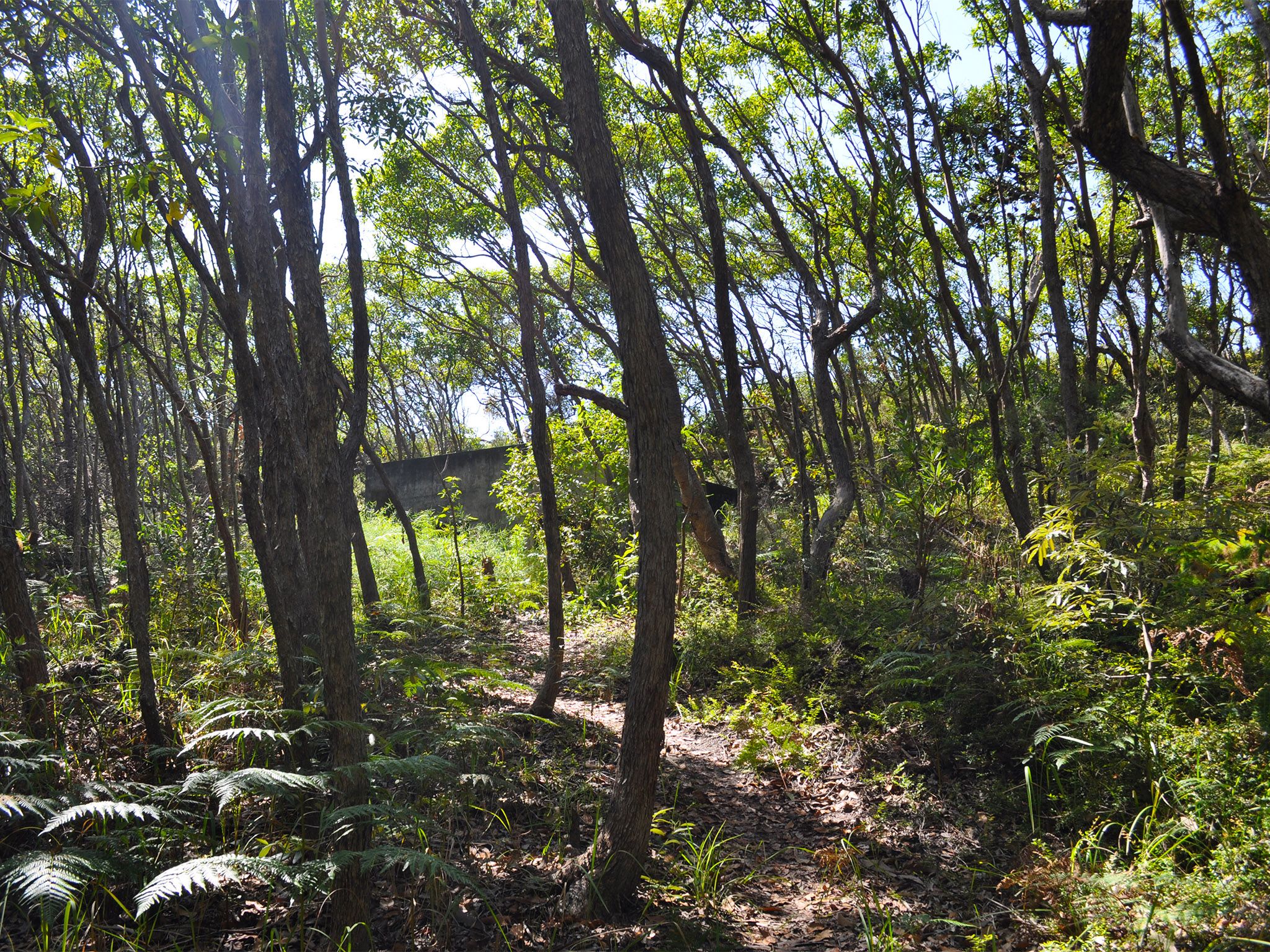
![The track leads to the ruins of a WWII defence structure.]() The track leads to the ruins of a WWII defence structure.
Photo credit: Peter Bull © Queensland Government
The track leads to the ruins of a WWII defence structure.
Photo credit: Peter Bull © Queensland Government
-
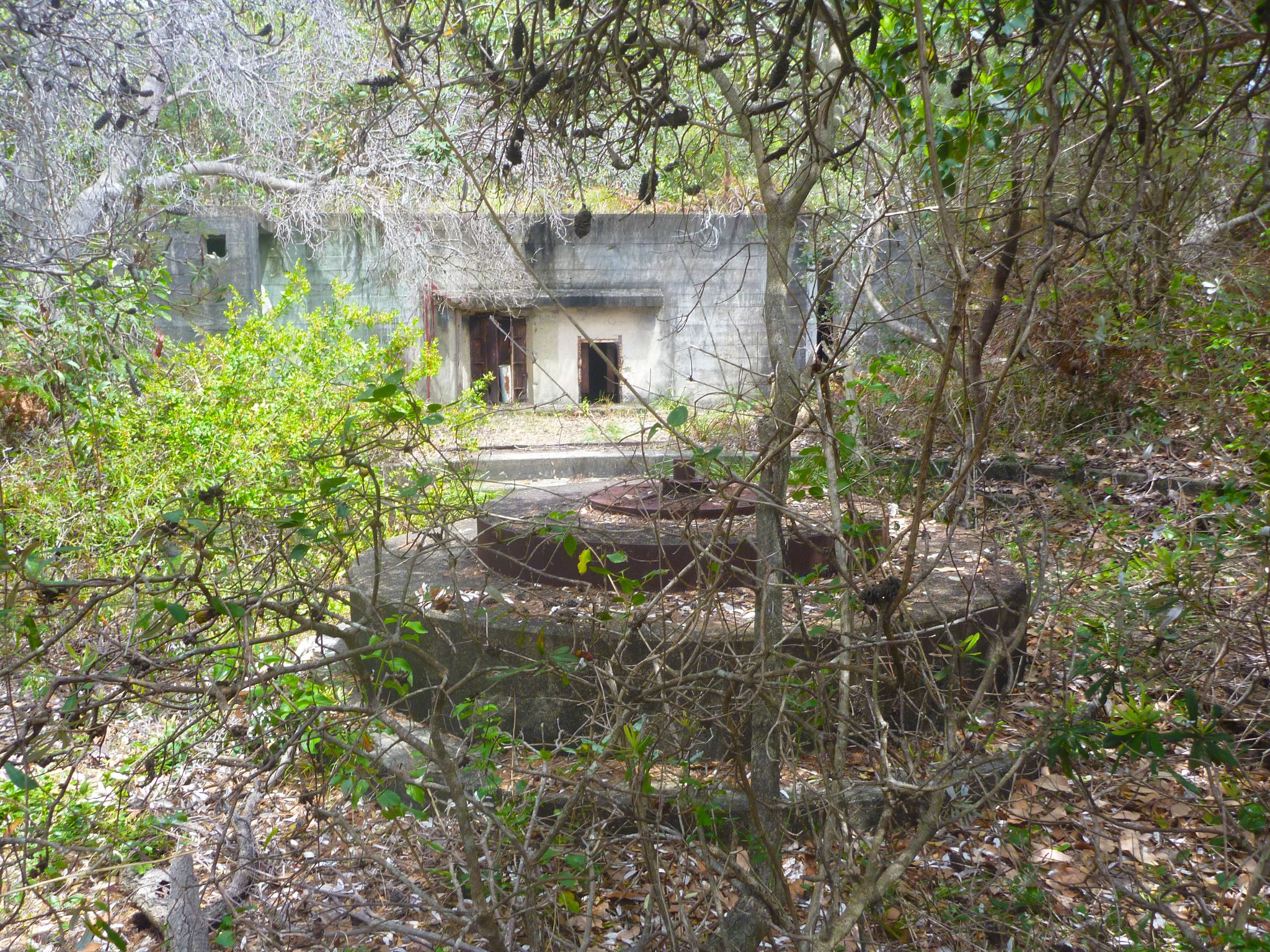
![At Rous Battery there are many ruins of the large defence battery complex built during WWII.]() At Rous Battery there are many ruins of the large defence battery complex built during WWII.
Photo credit: Mark Daly © Queensland Government
At Rous Battery there are many ruins of the large defence battery complex built during WWII.
Photo credit: Mark Daly © Queensland Government
-
![WWII coastal defence system ruins on the Rous Battery track.]() WWII coastal defence system ruins on the Rous Battery track.
Photo credit: Leanne Siebuhr © Queensland Government
WWII coastal defence system ruins on the Rous Battery track.
Photo credit: Leanne Siebuhr © Queensland Government
-
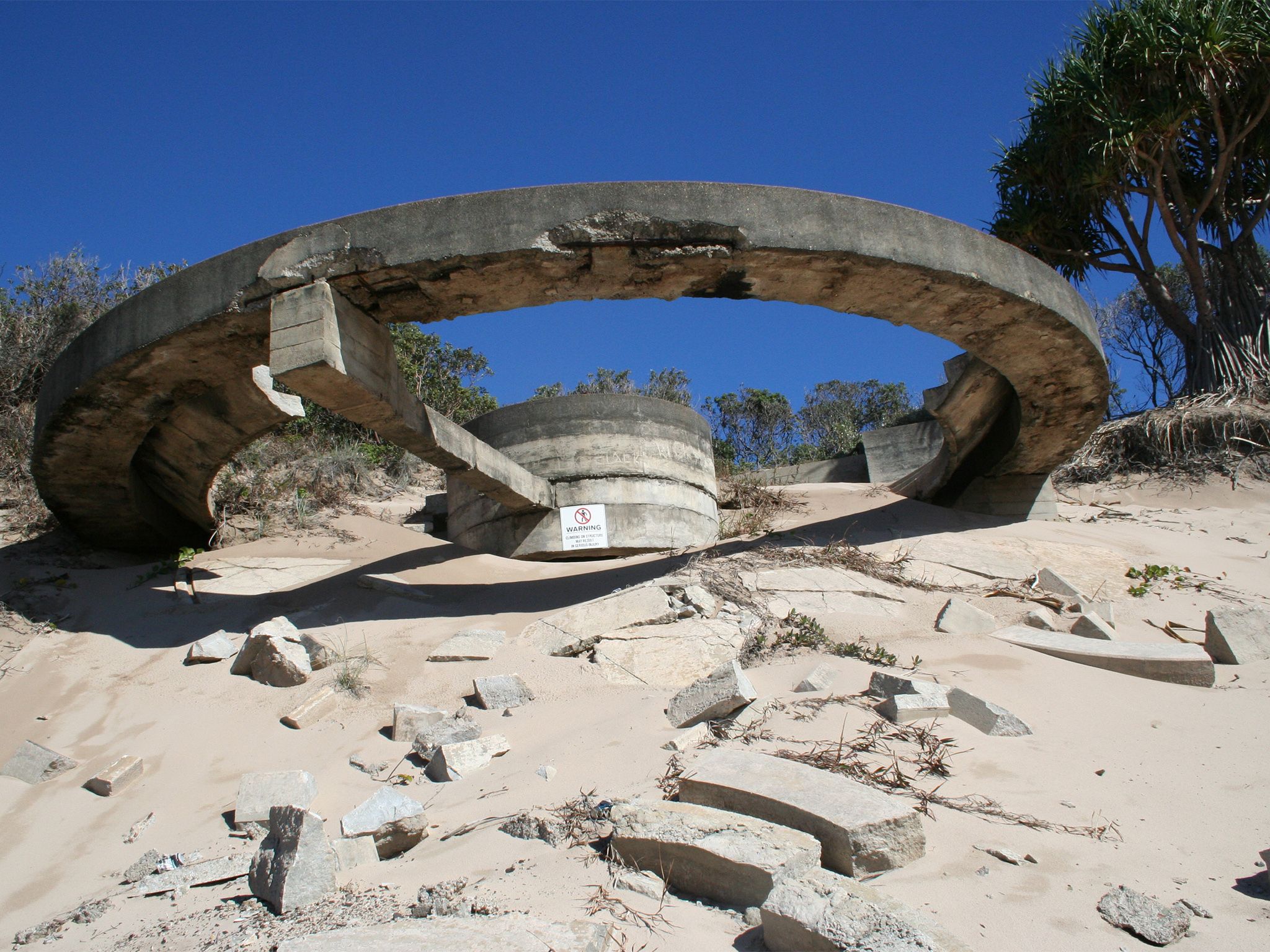
![The ruins at Rous Battery were part of Queensland's coastal defence system during WWII.]() The ruins at Rous Battery were part of Queensland's coastal defence system during WWII.
Photo credit: Leanne Siebuhr © Queensland Government
The ruins at Rous Battery were part of Queensland's coastal defence system during WWII.
Photo credit: Leanne Siebuhr © Queensland Government
-
![The northern entrance to the Rous Battery track.]() The northern entrance to the Rous Battery track.
Photo credit: Leanne Siebuhr © Queensland Government
The northern entrance to the Rous Battery track.
Photo credit: Leanne Siebuhr © Queensland Government
-
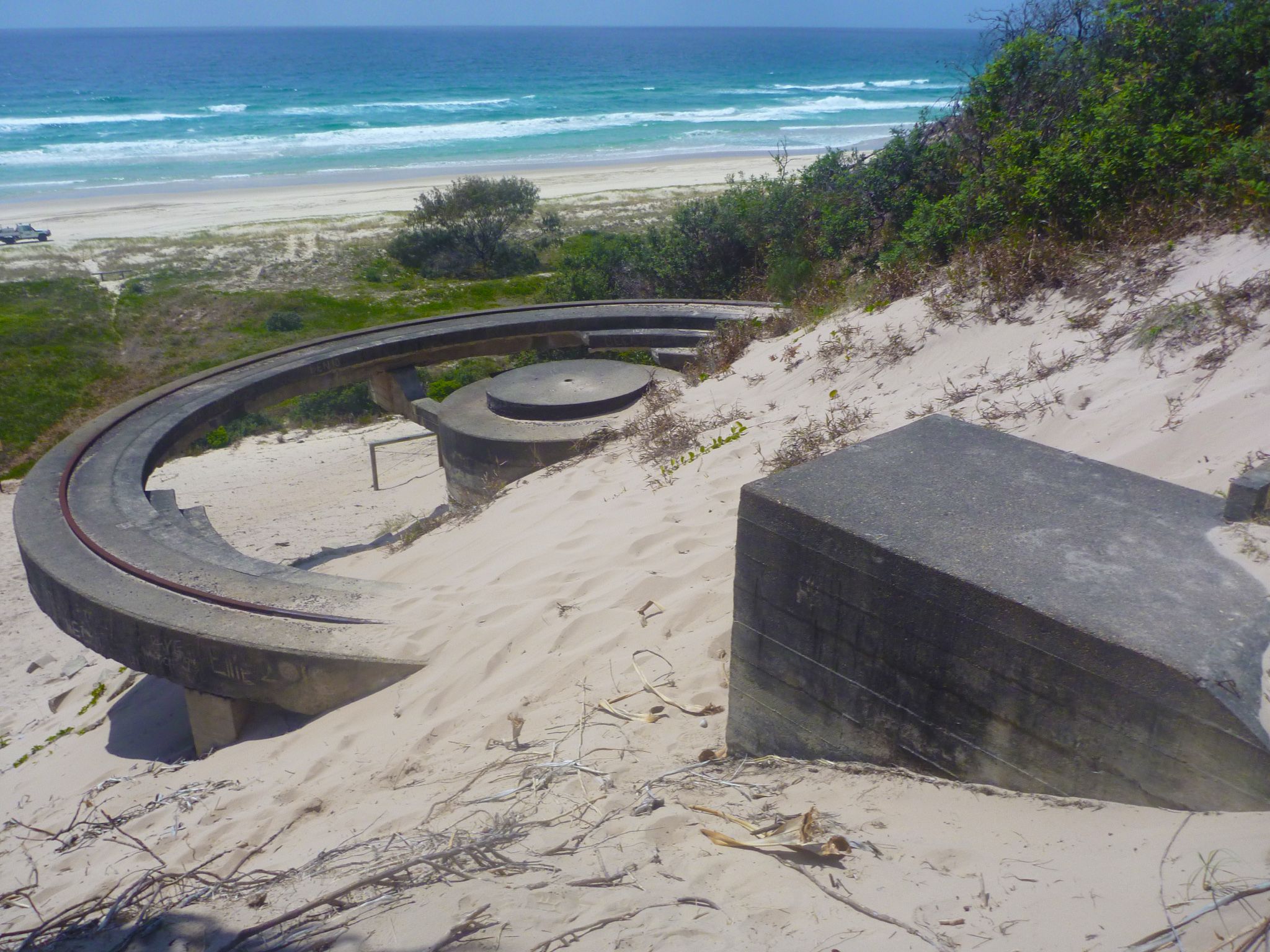
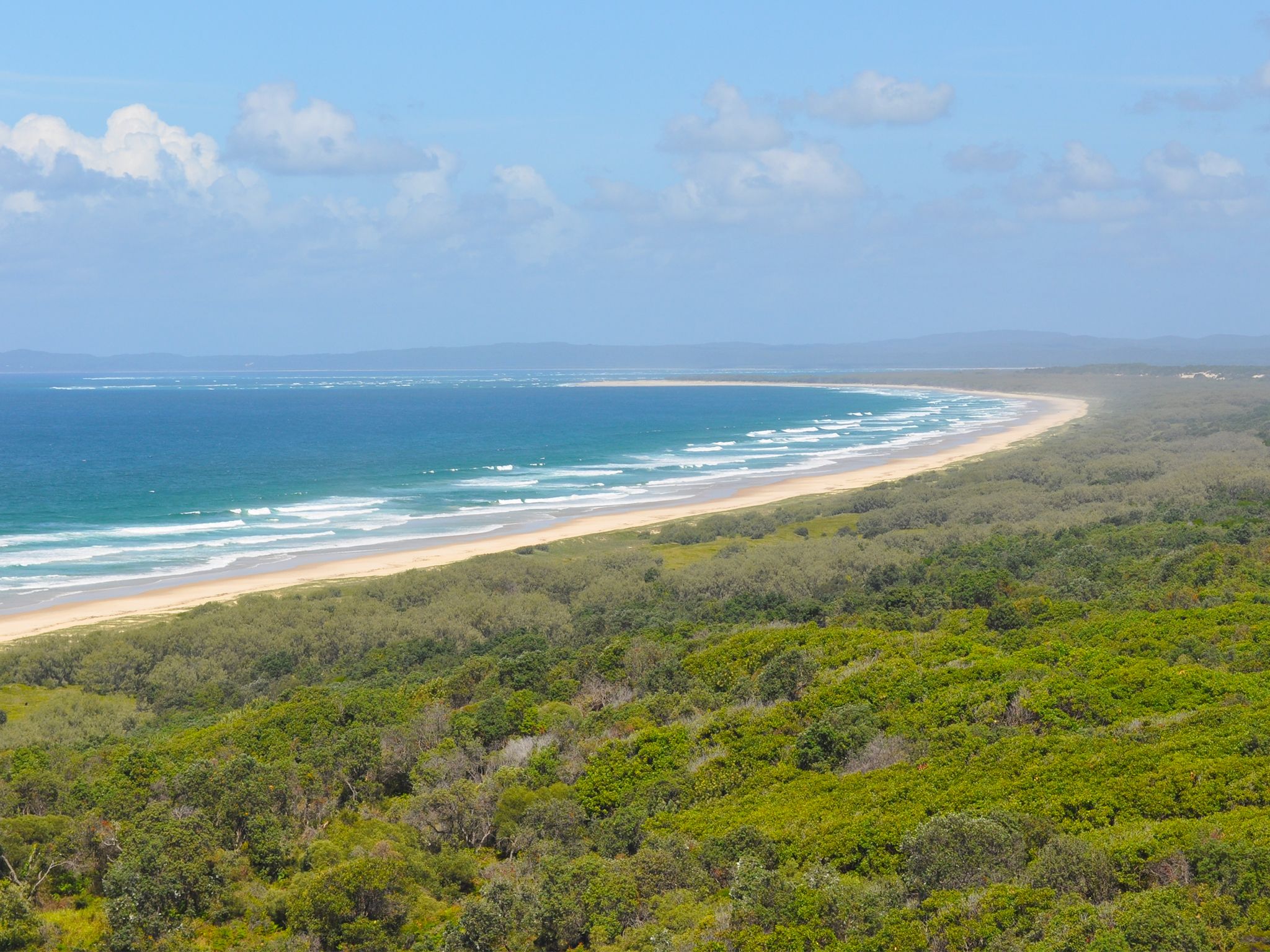
![The northern gun emplacement at Rous Battery has clear views over the beach and out to sea.]() The northern gun emplacement at Rous Battery has clear views over the beach and out to sea.
Photo credit: Mark Daly © Queensland Government
The northern gun emplacement at Rous Battery has clear views over the beach and out to sea.
Photo credit: Mark Daly © Queensland Government
-
![The southern end of the Rous Battery track.]() The southern end of the Rous Battery track.
Photo credit: Leanne Siebuhr © Queensland Government
The southern end of the Rous Battery track.
Photo credit: Leanne Siebuhr © Queensland Government
-
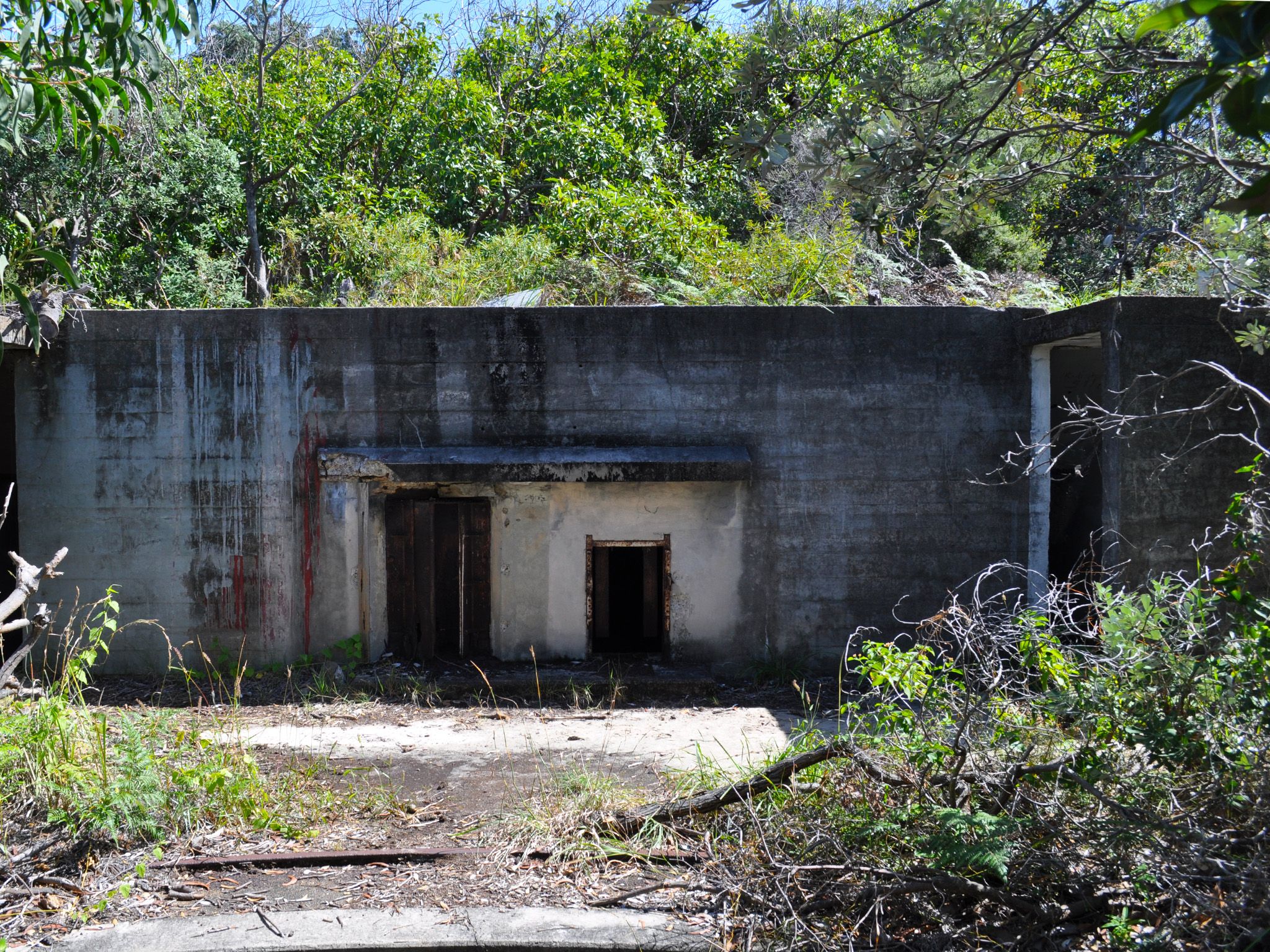
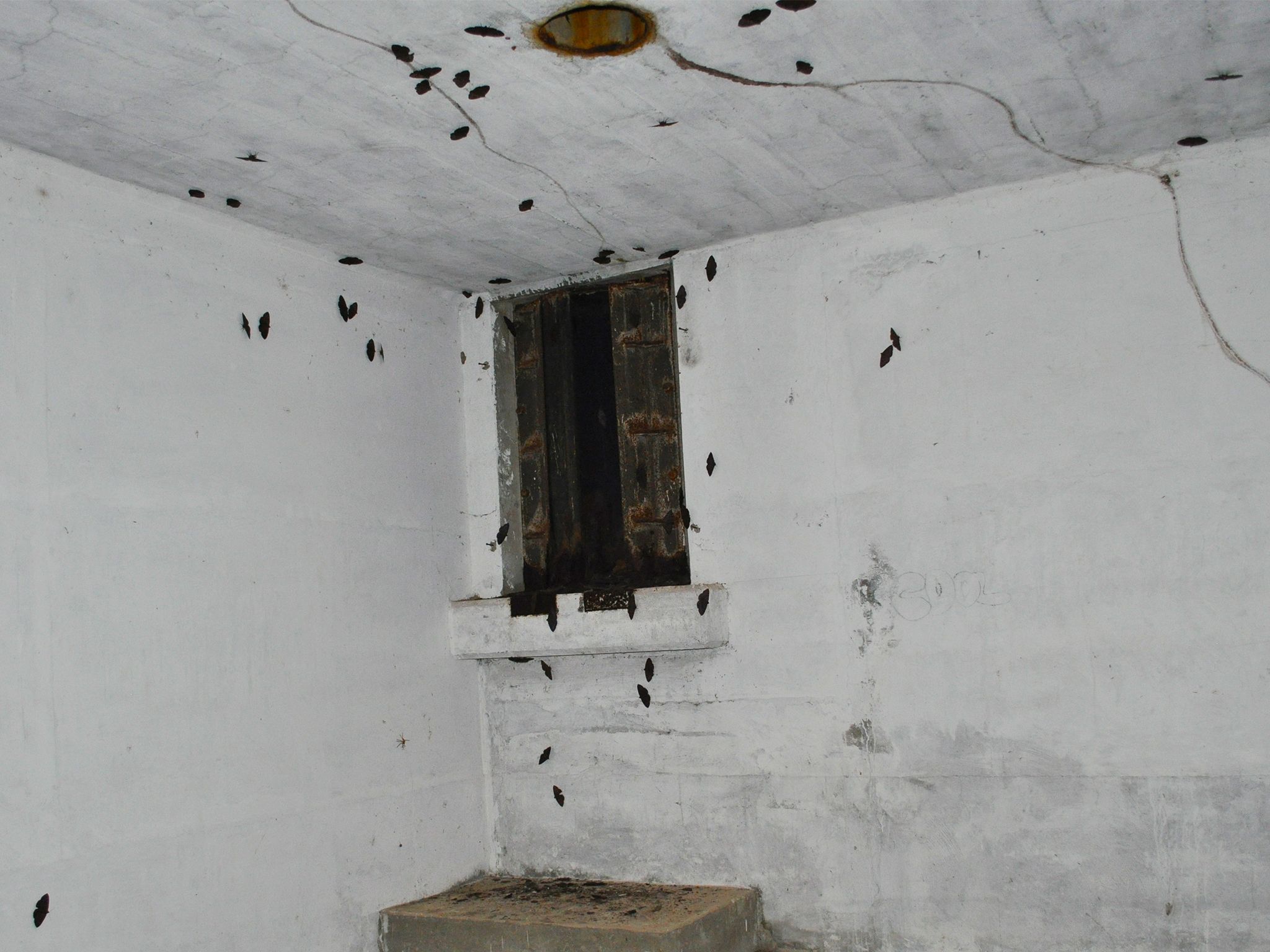
![Inside a WWII ruin on Rous Battery track.]() Inside a WWII ruin on Rous Battery track.
Photo credit: Leanne Siebuhr © Queensland Government
Inside a WWII ruin on Rous Battery track.
Photo credit: Leanne Siebuhr © Queensland Government
-
![View of the WWII defence structures along the Rous Battery track.]() View of the WWII defence structures along the Rous Battery track.
Photo credit: Leanne Siebuhr © Queensland Government
View of the WWII defence structures along the Rous Battery track.
Photo credit: Leanne Siebuhr © Queensland Government
-
![View of the coastline looking south from the southern gun emplacement on the Rous Battery track.]() View of the coastline looking south from the southern gun emplacement on the Rous Battery track.
Photo credit: Leanne Siebuhr © Queensland Government
View of the coastline looking south from the southern gun emplacement on the Rous Battery track.
Photo credit: Leanne Siebuhr © Queensland Government

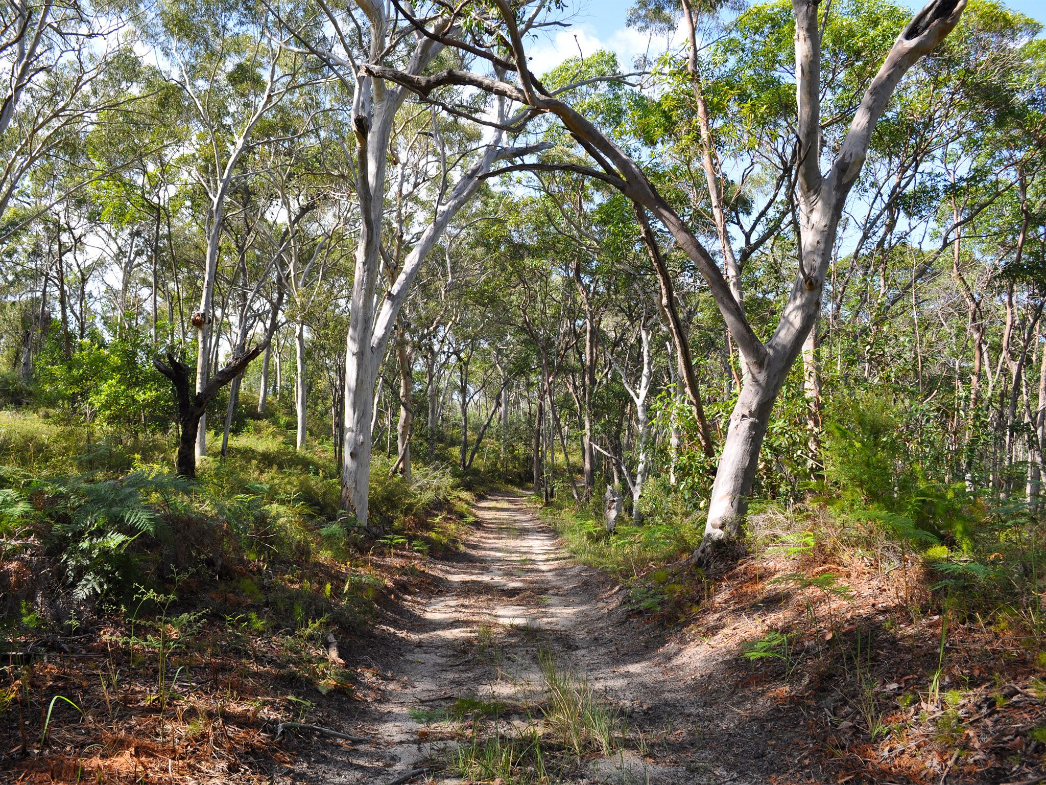

Wander through native forest along a road built by the Civil Construction Corps during World War II.
Imagine a time when this track was used to move troops, supplies and heavy guns between the Cowan Cowan and Rous Battery artillery.
Walk through native scribbly gum forest and feathery foxtails—look for traces of bandicoot diggings in the sandy ground below your feet.
Venture down one of the smaller trails branching off the main track to the World War II Rous Battery buildings perched on the dunes. Explore the remnants of a fort and artillery batteries and admire spectacular views over the eastern beach.
Getting there and getting around
Rous Battery track is in Gheebulum Kunungai (Moreton Island) National Park, 40km offshore from Brisbane. The island can be reached by ferry, barge or boat.
The Rous Battery track starts off The Desert Road and ends at Rous Battery on the eastern beach.
You will need a 4WD for driving on the island. Four-wheel-drives with high clearance and low range function are strongly recommended. All-wheel-drive vehicles without true 4WD function and vehicles with low clearance will have difficulty along inland tracks and in soft sand, therefore we don't recommend them for Mulgumpin (Moreton Island)..
- Follow the Tangalooma Bypass Road and The Desert Road to the start of the track.
- The track extends south following undulating ridge lines for 9.8km, ending at the eastern beach near Rous Battery.
- Stay overnight in one of two camp sites at the end of the track in the South-east camping zone, then return the next day.
- Alternatively you can start from the eastern beach at Rous Battery and walk to The Desert and western beach.
- If you are short of time, drive south on the eastern beach past Middle Road to Rous Battery and spend an hour exploring the fort remnants.
- Remember all vehicles must be registered, drivers must be licensed and all Queensland road rules apply, even on beaches.
- A vehicle access permit must be purchased. Display the permit on your windscreen before driving in the recreation area.
- Read 4WD with care for important information on 4WD safety and minimal impact driving.
Getting to Mulgumpin (Moreton Island)
Barge and ferry access
Barges and ferries for vehicles and passengers run daily. Extra services operate in school holidays and on long weekends. Bookings are essential.
- For tourism information for all regions in Queensland, see Queensland.com, and for friendly advice on how to get there, where to stay and what to do, find your closest accredited visitor information centre.
Private boat access
Mulgumpin (Moreton Island) lies in exposed waters—you may encounter large seas between Mulgumpin (Moreton Island) and the mainland. Consider your experience and the suitability of your vessel, and take into account currents and predicted weather and sea conditions when planning your trip.
- Be aware that there are no public moorings available at Mulgumpin (Moreton Island).
- When anchoring, make sure that your vessel, anchors and ropes don't restrict the safe movement of 4WDs or pedestrians on the beach.
Wheelchair access
There are no wheelchair-accessible facilities.
Before you visit
Opening hours
Rous Battery track is open 24 hours a day.
Check park alerts for the latest information on access, closures and conditions.
Visiting safely
For more safety information see Visiting Gheebulum Kunungai (Moreton Island) safely and Walk with care.
- There are currently no park alerts for this park.
Conditions report
Mulgumpin (Moreton Island) conditions report Updated 28 Mar 2024
Critical information for your safety is included in the conditions report—always check it before you visit.