Cape Moreton track
Stand in the shadow of Queensland's first lighthouse, soaking in spectacular ocean views and the island's fascinating cultural history.
- Journey type
- Walk
- Distance
- 1.5km circuit The same start and finish point, but the traveller doesn’t return along the same path
- Time suggested
- Allow 1hr walking time.
- Grade
- Moderate (walk)
Accessible by
- High clearance 4WD
Journey facilities
- Lookout (natural)
- Toilets (non-flush)
- Walking
-
![The Cape Moreton track.]() The Cape Moreton track.
Photo credit: Leanne Siebuhr © Queensland Government
The Cape Moreton track.
Photo credit: Leanne Siebuhr © Queensland Government
-
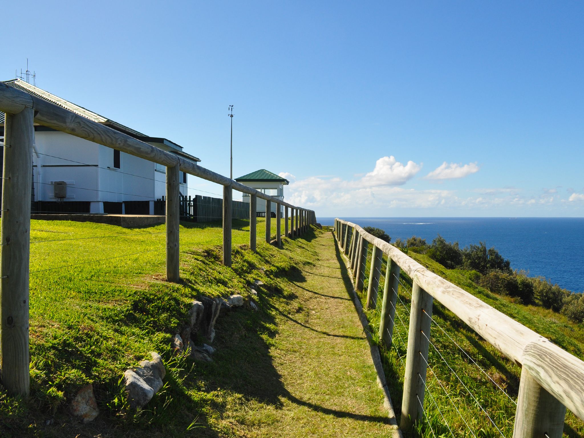
![The Cape Moreton track leads past the lighthouse keeper's grounds.]() The Cape Moreton track leads past the lighthouse keeper's grounds.
Photo credit: Leanne Siebuhr © Queensland Government
The Cape Moreton track leads past the lighthouse keeper's grounds.
Photo credit: Leanne Siebuhr © Queensland Government
-
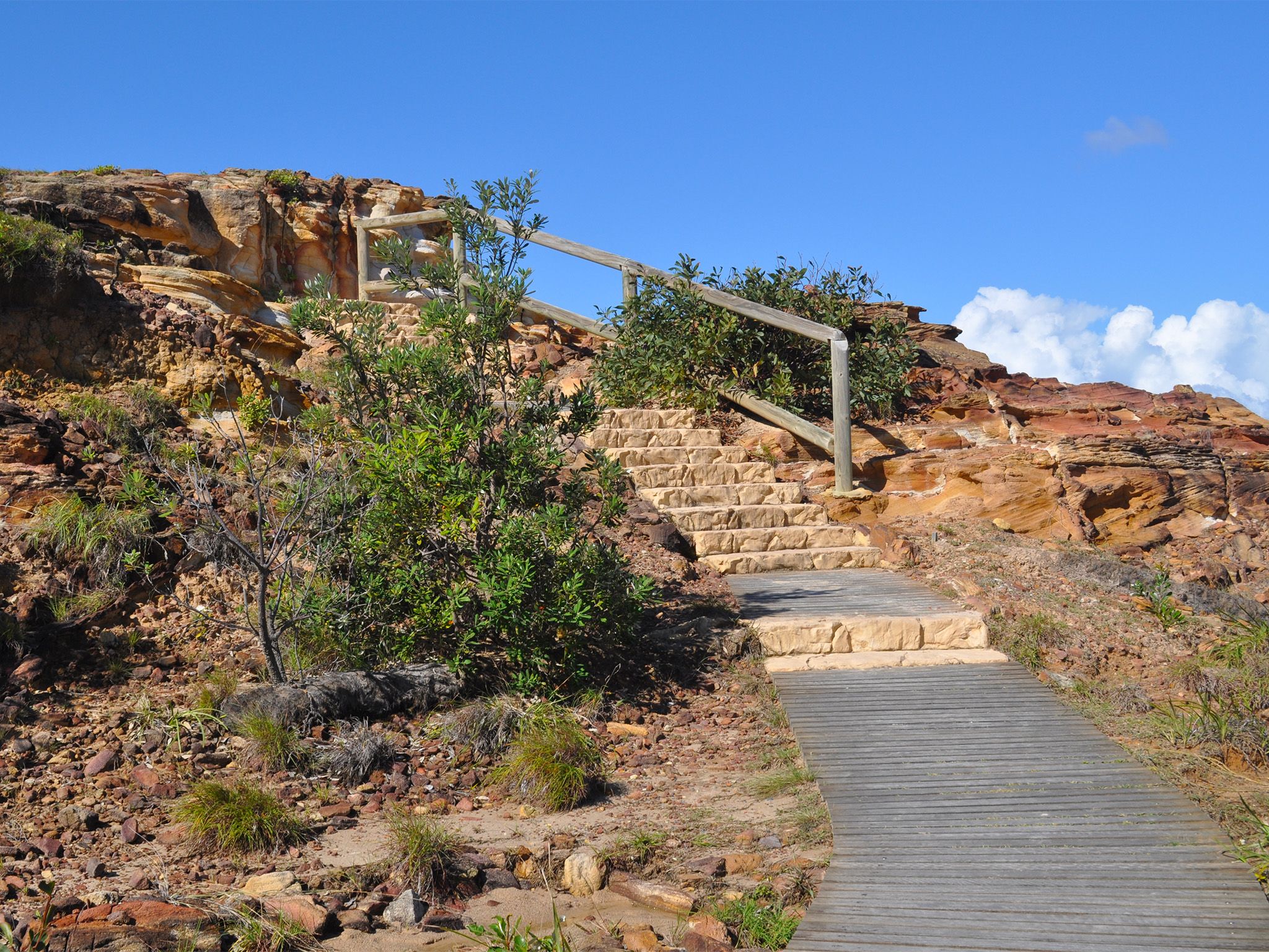
![Head up the stairs to the base of the lighthouse on the Cape Moreton track.]() Head up the stairs to the base of the lighthouse on the Cape Moreton track.
Photo credit: Leanne Siebuhr © Queensland Government
Head up the stairs to the base of the lighthouse on the Cape Moreton track.
Photo credit: Leanne Siebuhr © Queensland Government
-
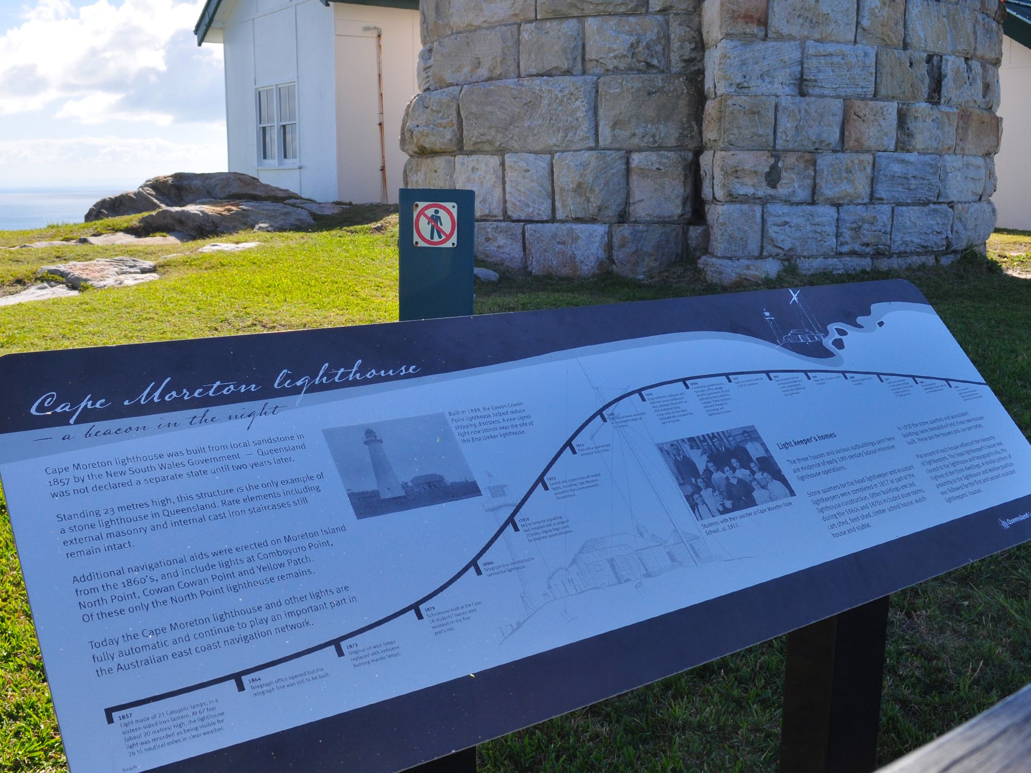
![Learn about the history of the lighthouse from signs along the Cape Moreton track.]() Learn about the history of the lighthouse from signs along the Cape Moreton track.
Photo credit: Leanne Siebuhr © Queensland Government
Learn about the history of the lighthouse from signs along the Cape Moreton track.
Photo credit: Leanne Siebuhr © Queensland Government
-
![Enjoy a picnic with a view from Cape Moreton.]() Enjoy a picnic with a view from Cape Moreton.
Photo credit: Leanne Siebuhr © Queensland Government
Enjoy a picnic with a view from Cape Moreton.
Photo credit: Leanne Siebuhr © Queensland Government
-
![The heritage-listed Cape Moreton Lighthouse is a feature of the Cape Moreton track.]() The heritage-listed Cape Moreton Lighthouse is a feature of the Cape Moreton track.
Photo credit: Leanne Siebuhr © Queensland Government
The heritage-listed Cape Moreton Lighthouse is a feature of the Cape Moreton track.
Photo credit: Leanne Siebuhr © Queensland Government
-
![Cape Moreton headland is a good viewing point for watching whales between June and November.]() Cape Moreton headland is a good viewing point for watching whales between June and November.
Photo credit: Maxime Coquard © Tourism and Events Queensland
Cape Moreton headland is a good viewing point for watching whales between June and November.
Photo credit: Maxime Coquard © Tourism and Events Queensland
-
![The Cape Moreton track has great views south over Moreton Island.]() The Cape Moreton track has great views south over Moreton Island.
Photo credit: Leanne Siebuhr © Queensland Government
The Cape Moreton track has great views south over Moreton Island.
Photo credit: Leanne Siebuhr © Queensland Government
-
![The Cape Moreton track winds past the information centre.]() The Cape Moreton track winds past the information centre.
Photo credit: Leanne Siebuhr © Queensland Government
The Cape Moreton track winds past the information centre.
Photo credit: Leanne Siebuhr © Queensland Government
-
![Stand in the shadow of Queensland's first lighthouse.]() Stand in the shadow of Queensland's first lighthouse.
Photo credit: Leanne Siebuhr © Queensland Government
Stand in the shadow of Queensland's first lighthouse.
Photo credit: Leanne Siebuhr © Queensland Government
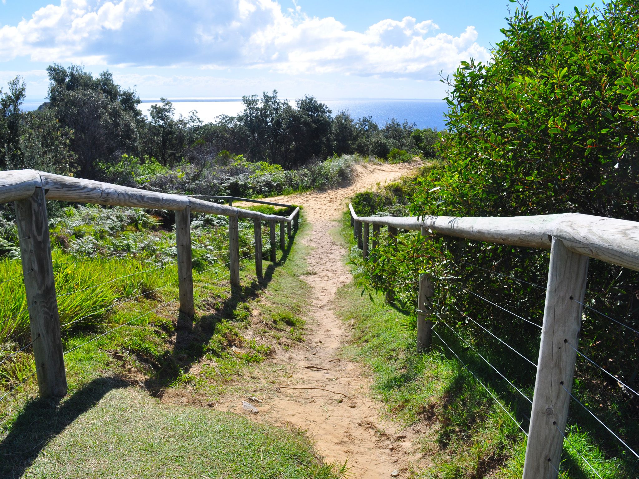

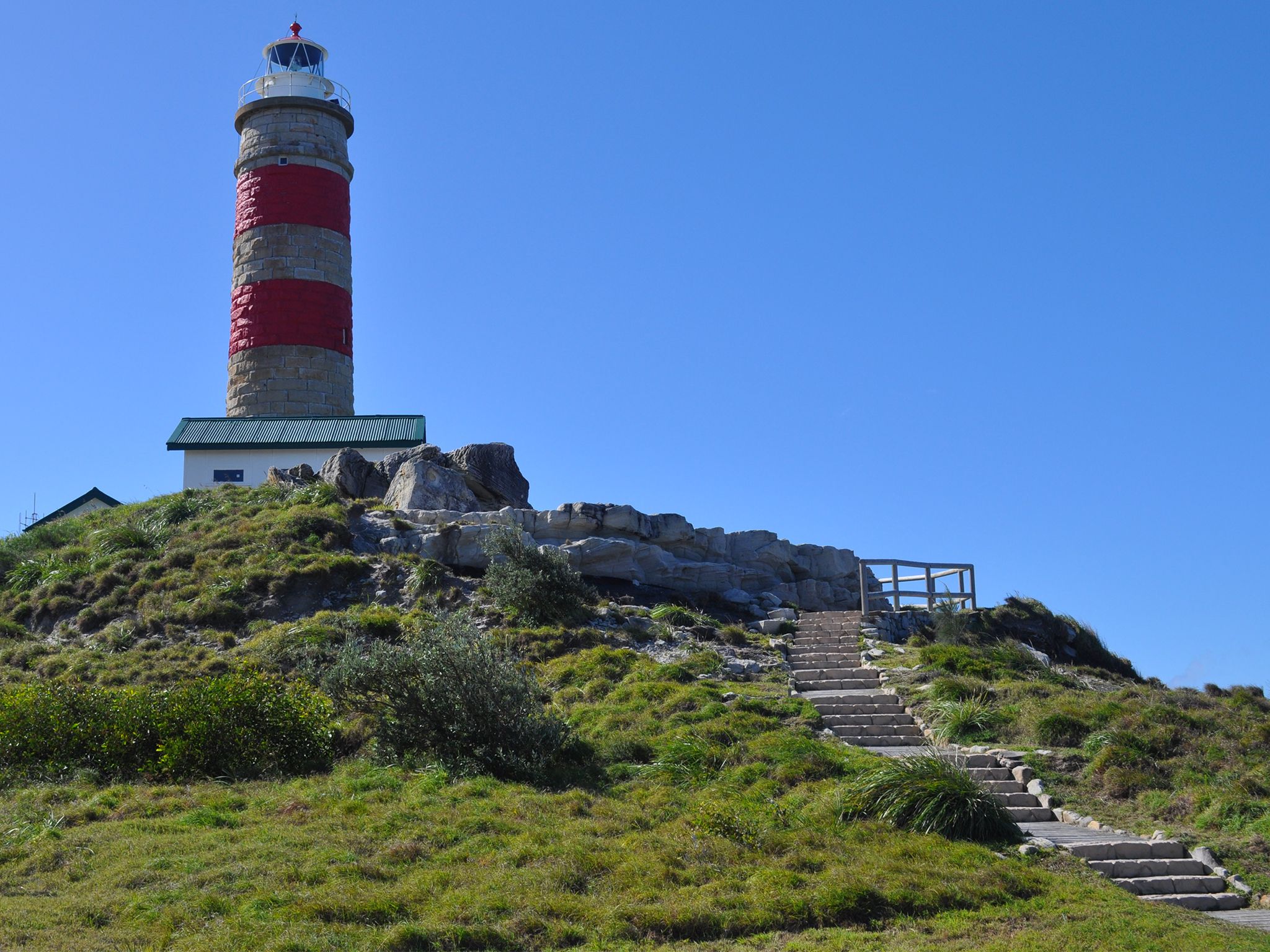


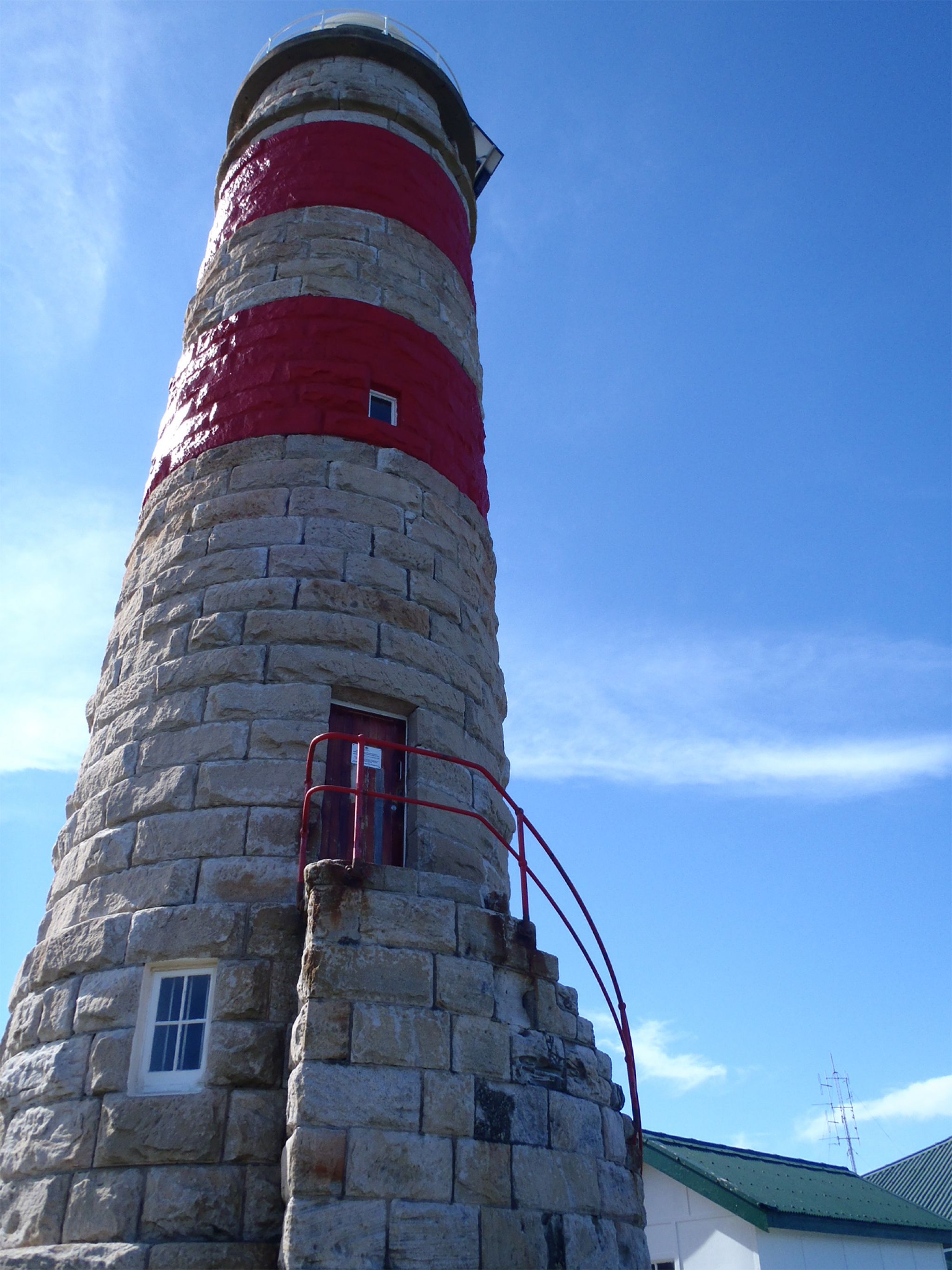
Take a historic trek up this stepped track to the base of Cape Moreton Lighthouse and be rewarded with views across turquoise waters.
Built in 1857 and standing 23m tall, this heritage-listed building is Queensland’s only stone lighthouse and an iconic feature of Mulgumpin (Moreton Island). Stop in at the Cape Moreton Information Centre and discover the island's fascinating cultural and natural history.
Take a break at the picnic tables and seats along the track, breathing in the smell of sea salt in the air. Keep your eyes peeled for dolphins, sharks, manta rays and turtles swimming in the clear waters below the headland.
Witness the acrobatic display of humpback whales between May and November as they continue their annual migration.
Getting there and getting around
Cape Moreton track is in Gheebulum Kunungai (Moreton Island) National Park, 40km offshore from Brisbane. The island can be reached by ferry, barge or boat.
Cape Moreton is located on the north eastern tip of the island and can be accessed from North Point Beach and the eastern beach.
You will need a 4WD for driving on the island. Four-wheel-drives with high clearance and low range function are strongly recommended. All-wheel-drive vehicles without true 4WD function and vehicles with low clearance will have difficulty along inland tracks and in soft sand, therefore we don't recommend them for Mulgumpin (Moreton Island)..
- Remember all vehicles must be registered, drivers must be licensed and all Queensland road rules apply, even on beaches.
- A vehicle access permit must be purchased. Display the permit on your windscreen before driving in the recreation area.
- Read 4WD with care for important information on 4WD safety and minimal impact driving.
From North Point Beach
- Drive 2km along North Point–Cape Moreton Road to the Cape Moreton car park.
From Eastern beach
- Take Harpers Track 900m to the intersection of North Point–Cape Moreton Road, turn right and drive 350m to the car park.
- From the Cape Moreton car park follow the walking track 100m (southern end of car park) up the hill to the information centre and the start of the track.
Getting to Mulgumpin (Moreton Island)
Barge and ferry access
Barges and ferries for vehicles and passengers run daily. Extra services operate in school holidays and on long weekends. Bookings are essential.
- For tourism information for all regions in Queensland, see Queensland.com, and for friendly advice on how to get there, where to stay and what to do, find your closest accredited visitor information centre.
Private boat access
Mulgumpin (Moreton Island) lies in exposed waters—you may encounter large seas between Mulgumpin (Moreton Island) and the mainland. Consider your experience and the suitability of your vessel, and take into account currents and predicted weather and sea conditions when planning your trip.
- Be aware that there are no public moorings available at Mulgumpin (Moreton Island).
- When anchoring, make sure that your vessel, anchors and ropes don't restrict the safe movement of 4WDs or pedestrians on the beach.
Wheelchair access
There are no wheelchair-accessible facilities.
Before you visit
Opening hours
Cape Moreton track is open 24 hours a day.
Check park alerts for the latest information on access, closures and conditions.
Visiting safely
For more safety information see Visiting Gheebulum Kunungai (Moreton Island) safely and Walk with care.
- There are currently no park alerts for this park.
Conditions report
Mulgumpin (Moreton Island) conditions report Updated 28 Mar 2024
Critical information for your safety is included in the conditions report—always check it before you visit.