Honeymoon Bay track
Take a short walk to Honeymoon Bay and witness historical artefacts and spectacular views of North Point and the Cape Moreton Lighthouse.
- Journey type
- Walk
- Distance
- 700m return Start and finish points are the same and the traveller must return via the same path
- Time suggested
- Allow 20min walking time.
- Grade
- Easy (walk)
Accessible by
- High clearance 4WD
Journey facilities
- Walking
-
![Honeymoon Bay is stunning, a must see!]() Enjoy the beach and take in the views at Honeymoon Bay.
Photo credit: Leanne Siebuhr © Queensland Government
Enjoy the beach and take in the views at Honeymoon Bay.
Photo credit: Leanne Siebuhr © Queensland Government
-
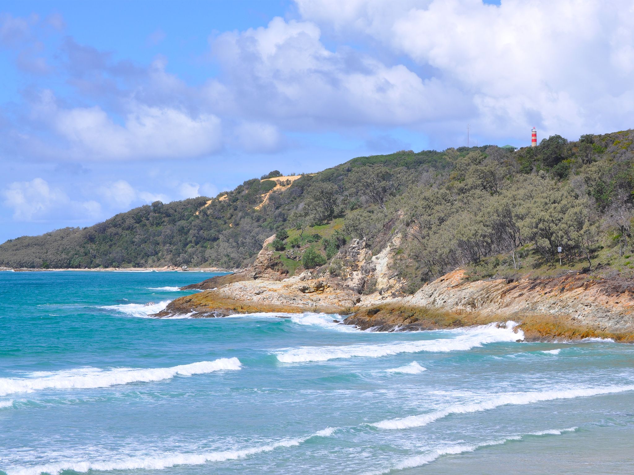
![Honeymoon Bay has views of North Point and Cape Moreton lighthouses.]() Honeymoon Bay has views of North Point and Cape Moreton lighthouses.
Photo credit: Leanne Siebuhr © Queensland Government
Honeymoon Bay has views of North Point and Cape Moreton lighthouses.
Photo credit: Leanne Siebuhr © Queensland Government
-
![The picturesque Honeymoon Bay.]() The picturesque Honeymoon Bay.
Photo credit: Mark Daly © Queensland Government
The picturesque Honeymoon Bay.
Photo credit: Mark Daly © Queensland Government
-
![Honeymoon Bay is surrounded by a rocky headland.]() Honeymoon Bay is surrounded by a rocky headland.
Photo credit: Adam Creed © Queensland Government
Honeymoon Bay is surrounded by a rocky headland.
Photo credit: Adam Creed © Queensland Government
-
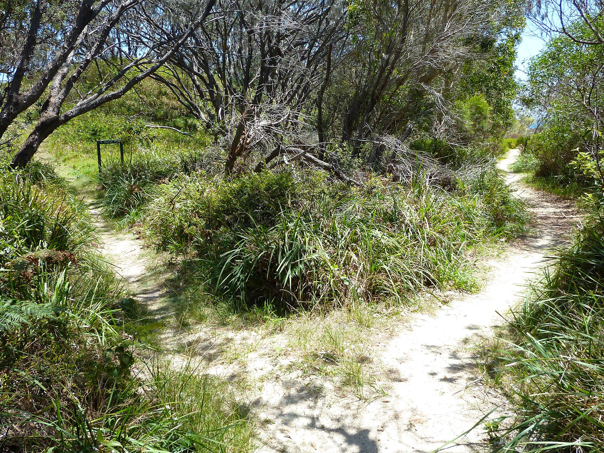
![The easy Honeymoon Bay track passes through coastal woodland.]() The easy Honeymoon Bay track passes through coastal woodland.
Photo credit: Mark Daly © Queensland Government
The easy Honeymoon Bay track passes through coastal woodland.
Photo credit: Mark Daly © Queensland Government
-
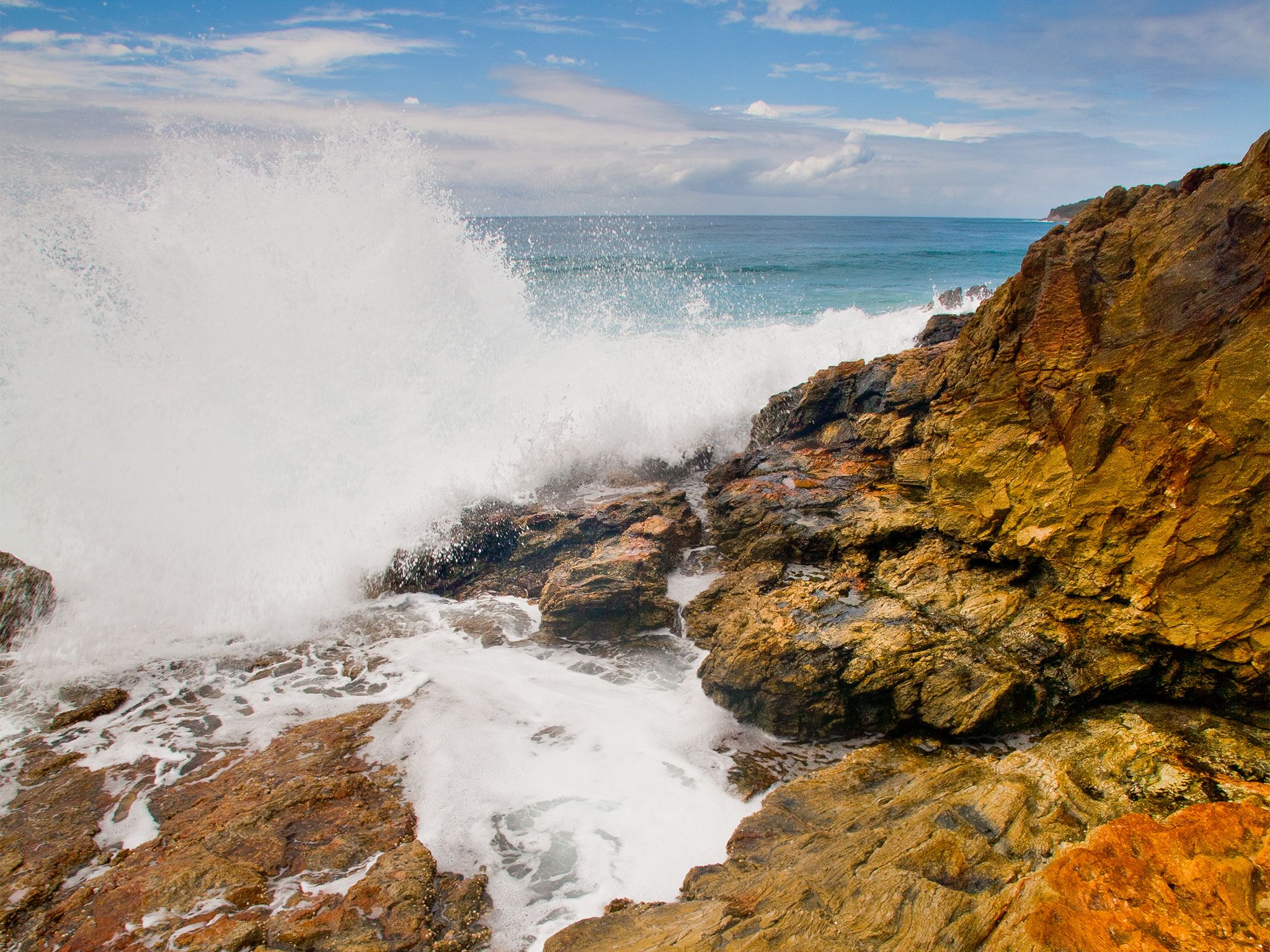
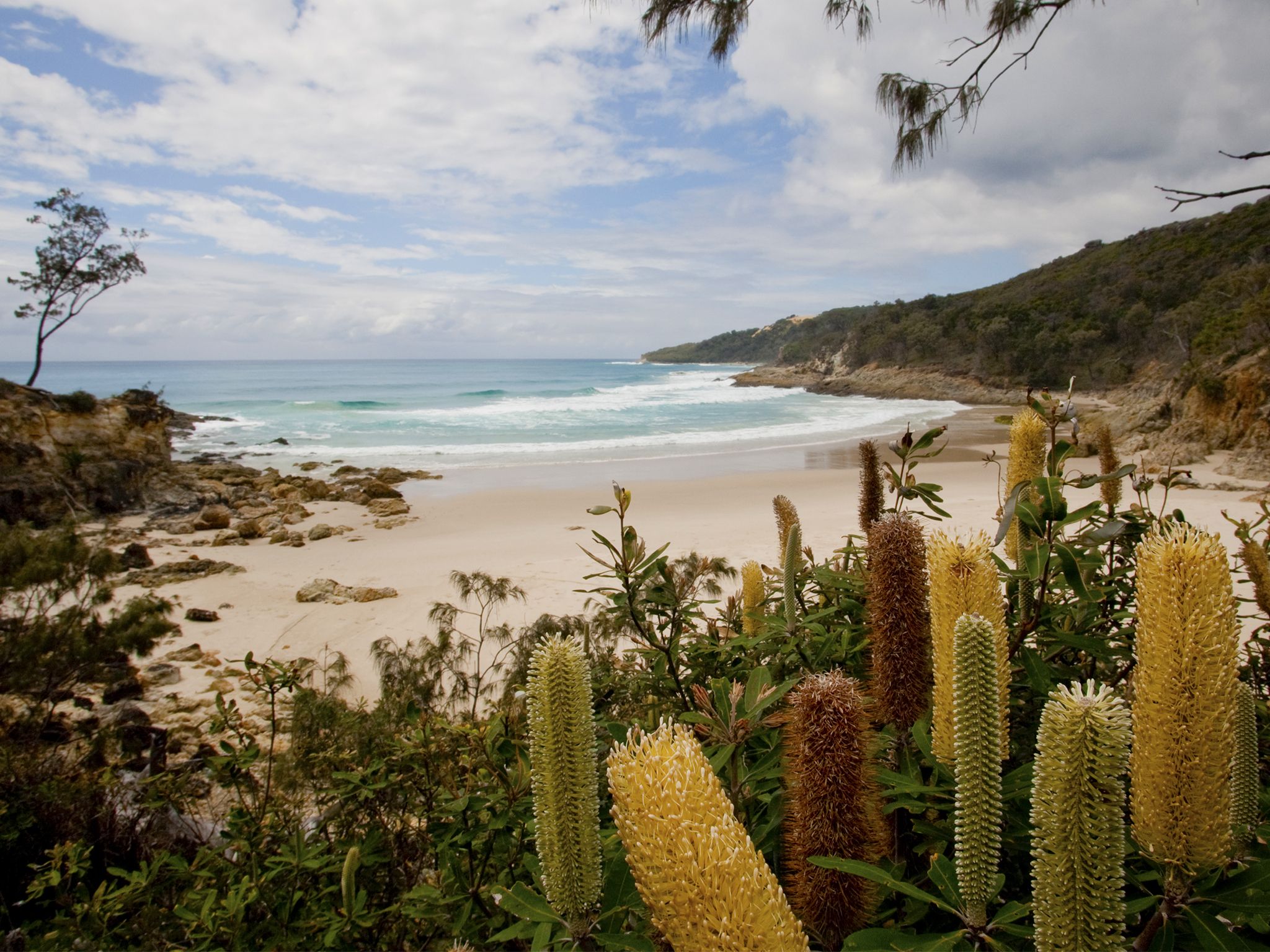
![The rocky headland at Honeymoon Bay is coloured with orange and yellow hues.]() The rocky headland at Honeymoon Bay is coloured with orange and yellow hues.
Photo credit: Adam Creed © Queensland Government
The rocky headland at Honeymoon Bay is coloured with orange and yellow hues.
Photo credit: Adam Creed © Queensland Government
-
![Honeymoon Bay is stunning, a Moreton Island must see!]() Honeymoon Bay is stunning, a Moreton Island must see!
Photo credit: Adam Creed © Queensland Government
Honeymoon Bay is stunning, a Moreton Island must see!
Photo credit: Adam Creed © Queensland Government
-
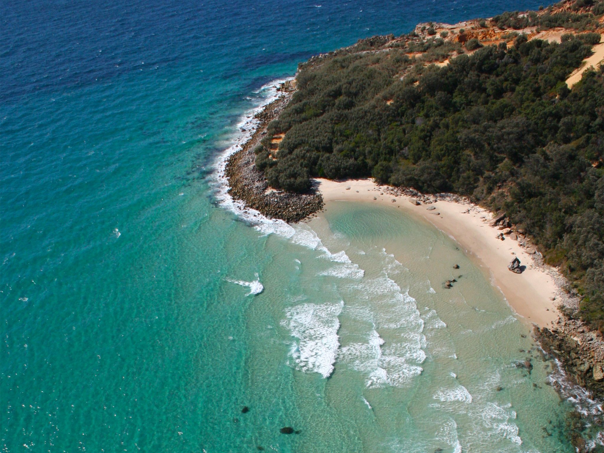
![Aerial view of Honeymoon Bay.]() Aerial view of Honeymoon Bay.
Photo credit: Adam Creed © Queensland Government
Aerial view of Honeymoon Bay.
Photo credit: Adam Creed © Queensland Government
-
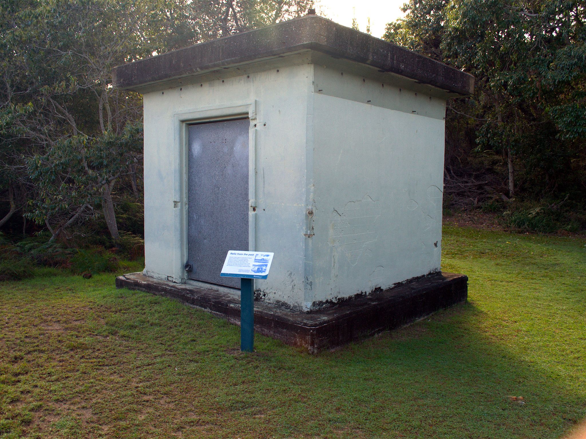
![The Honeymoon Bay track passes a WWII concrete magazine that once stored ammunition for troops stationed at North Point.]() The Honeymoon Bay track passes a WWII concrete magazine that once stored ammunition for troops stationed at North Point.
Photo credit: Peter Bull © Queensland Government
The Honeymoon Bay track passes a WWII concrete magazine that once stored ammunition for troops stationed at North Point.
Photo credit: Peter Bull © Queensland Government
-
![The Honeymoon Bay walking track leads to Honeymoon Bay.]() The Honeymoon Bay walking track leads to Honeymoon Bay.
Photo credit: Peter Bull © Queensland Government
The Honeymoon Bay walking track leads to Honeymoon Bay.
Photo credit: Peter Bull © Queensland Government
-
![The Honeymoon Bay track starts at the northern end of North Point camping area.]() The Honeymoon Bay track starts at the northern end of North Point camping area.
Photo credit: Peter Bull © Queensland Government
The Honeymoon Bay track starts at the northern end of North Point camping area.
Photo credit: Peter Bull © Queensland Government

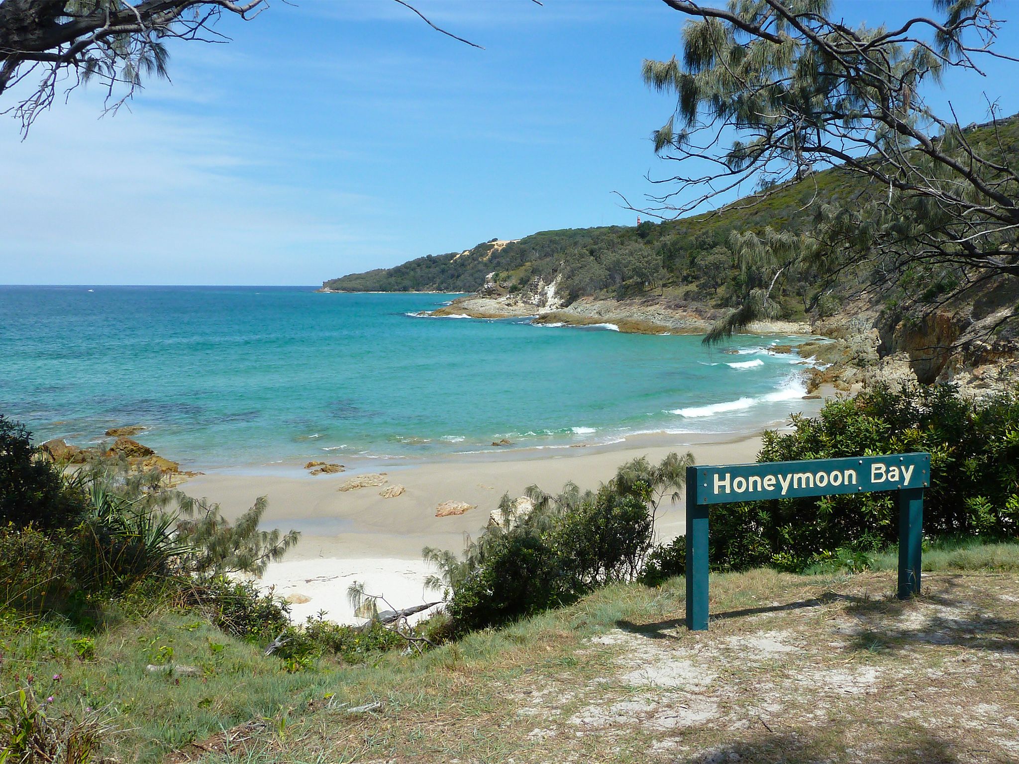

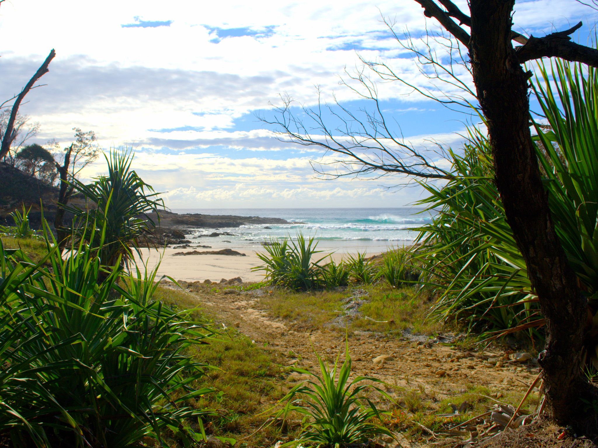
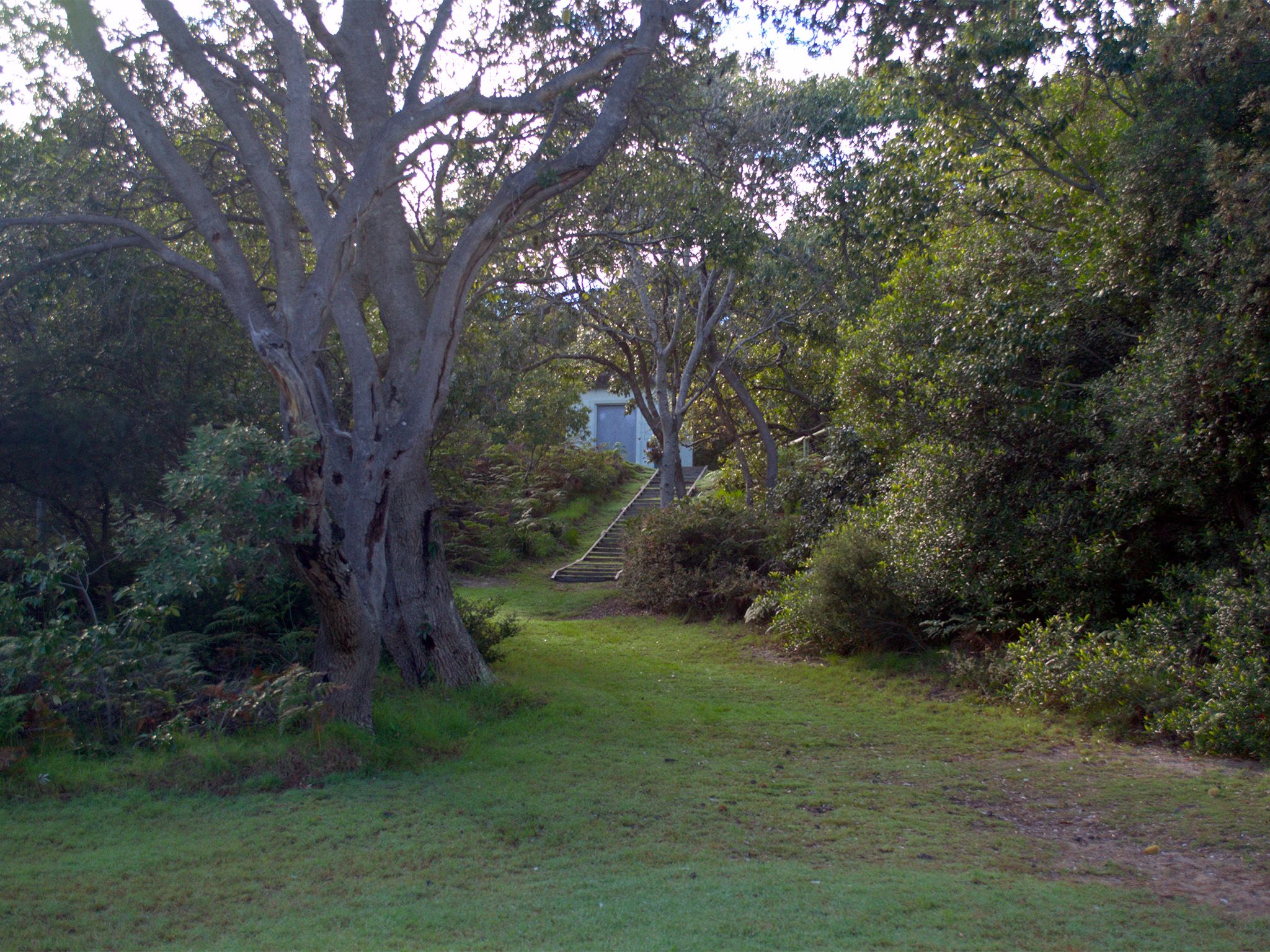
Starting at the northern end of North Point camping area, this short and easy walk takes you to one of the island’s most picturesque and sheltered bays.
Wander through coastal woodlands decorated with casuarinas and banksias, stopping to picnic at North Point along the way. Pass a concrete magazine once used to store ammunition during World War II. Soldiers once fired a gun from here on enemy ships attempting to enter the shipping channel to Brisbane.
Plan to arrive at sunset and be bathed in orange and yellow hues reflecting over the rocky headland. As night falls watch the North Point Lighthouse shine its guiding light out to sea.
Getting there and getting around
Honeymoon Bay track is in Gheebulum Kunungai (Moreton Island) National Park, 40km offshore from Brisbane. The island can be reached by ferry, barge or boat.
The track is located on the north-eastern tip of the island and extends from the North Point camping area to Honeymoon Bay.
You will need a 4WD for driving on the island. Four-wheel-drives with high clearance and low range function are strongly recommended. All-wheel-drive vehicles without true 4WD function and vehicles with low clearance will have difficulty along inland tracks and in soft sand, therefore we don't recommend them for Mulgumpin (Moreton Island)..
- From the western beach drive via Bulwer–North Point Road and Yellow Patch Beach to the North Point camping area.
- From the eastern beach drive via Harpers Track and North Point–Cape Moreton Road to the North Point camping area.
- Remember all vehicles must be registered, drivers must be licensed and all Queensland road rules apply, even on beaches.
- A vehicle access permit must be purchased. Display the permit on your windscreen before driving in the recreation area.
- Read 4WD with care for important information on 4WD safety and minimal impact driving.
Getting to Mulgumpin (Moreton Island)
Barge and ferry access
Barges and ferries for vehicles and passengers run daily. Extra services operate in school holidays and on long weekends. Bookings are essential.
- For tourism information for all regions in Queensland, see Queensland.com, and for friendly advice on how to get there, where to stay and what to do, find your closest accredited visitor information centre.
Private boat access
Mulgumpin (Moreton Island) lies in exposed waters—you may encounter large seas between Mulgumpin (Moreton Island) and the mainland. Consider your experience and the suitability of your vessel, and take into account currents and predicted weather and sea conditions when planning your trip.
- Be aware that there are no public moorings available at Mulgumpin (Moreton Island).
- When anchoring, make sure that your vessel, anchors and ropes don't restrict the safe movement of 4WDs or pedestrians on the beach.
Wheelchair access
There are no wheelchair-accessible facilities.
Before you visit
Opening hours
Honeymoon Bay track is open 24 hours a day.
Check park alerts for the latest information on access, closures and conditions.
Visiting safely
For more safety information see Visiting Gheebulum Kunungai (Moreton Island) safely and Walk with care.
- There are currently no park alerts for this park.
Conditions report
Mulgumpin (Moreton Island) conditions report Updated 28 Mar 2024
Critical information for your safety is included in the conditions report—always check it before you visit.