Koondaii circuit
Experience the colours and sounds of the rainforest and enjoy views from the western edge of the Bunya Mountains.
- Journey type
- Walk
- Distance
- 2.5km circuit The same start and finish point, but the traveller doesn’t return along the same path
- Time suggested
- Allow 1hr walking time.
- Grade
- Grade 4 walking track
Accessible by
- Conventional vehicle
- Bicycle
Journey facilities
- Lookout (constructed)
- Walking
-
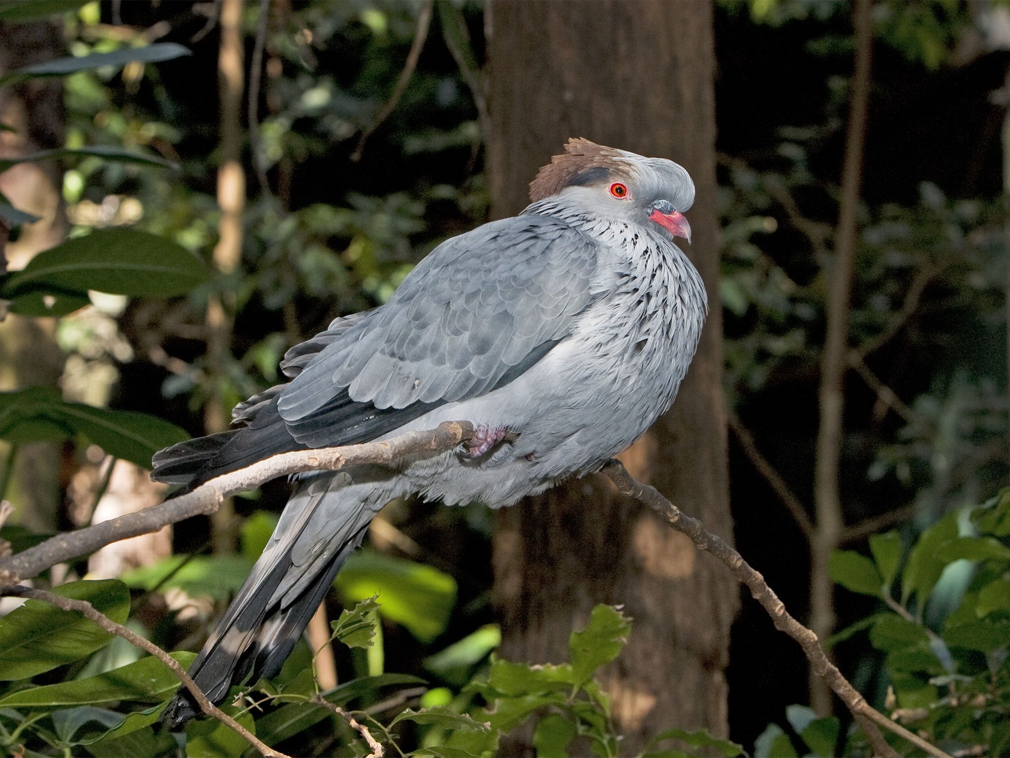
![Look for topknot pigeons feasting at fig trees in the sheltered valleys.]() Look for topknot pigeons feasting at fig trees in the sheltered valleys.
Photo credit: © Bruce Thomson
Look for topknot pigeons feasting at fig trees in the sheltered valleys.
Photo credit: © Bruce Thomson
-
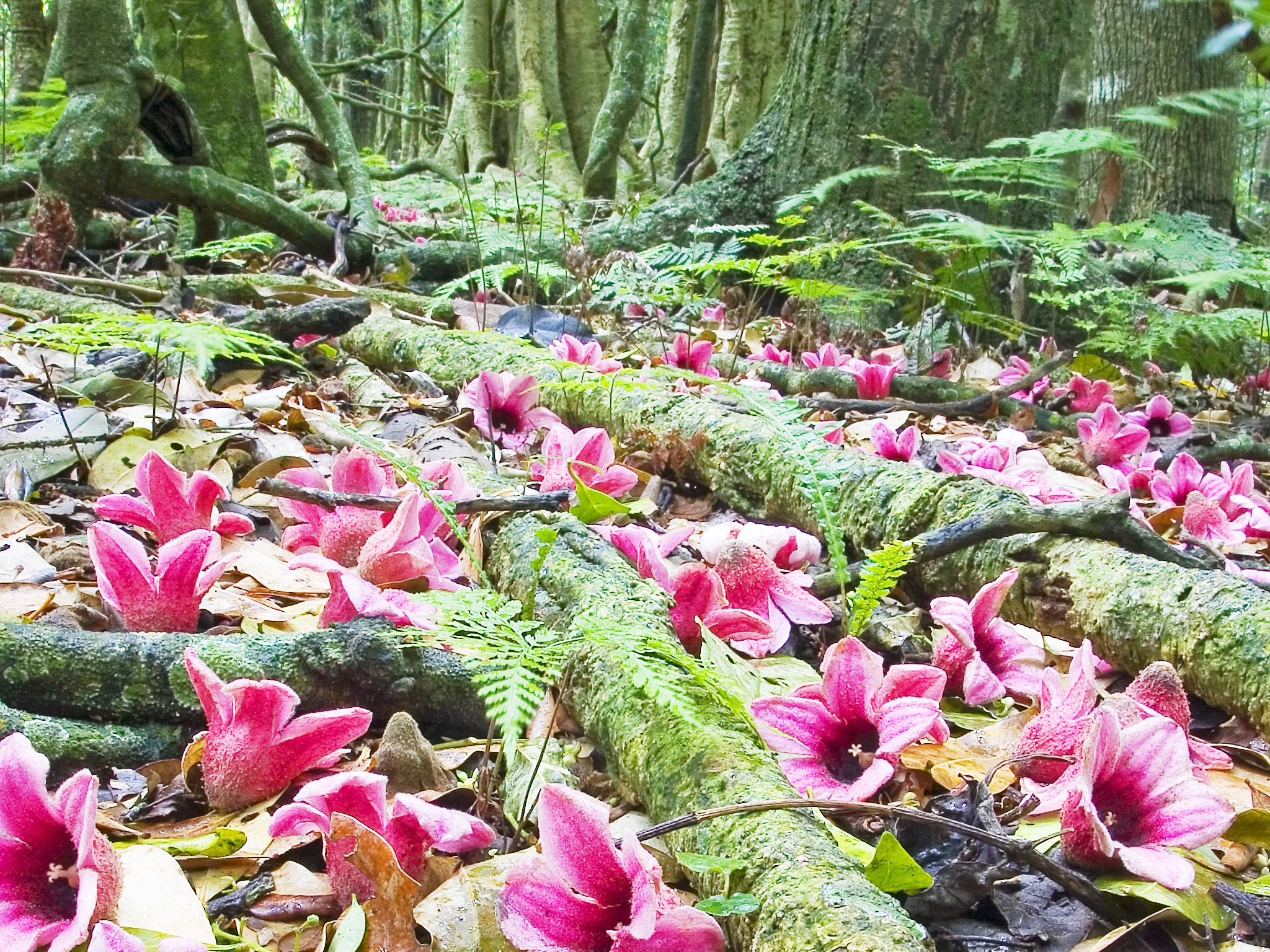
![During summer, walk the velvety carpet of lacebark flowers on the Koondaii circuit.]() During summer, walk the velvety carpet of lacebark flowers on the Koondaii circuit.
Photo credit: © Bruce Thomson
During summer, walk the velvety carpet of lacebark flowers on the Koondaii circuit.
Photo credit: © Bruce Thomson
-
![The Koondaii circuit zigzags down the mountainside.]() The Koondaii circuit zigzags down the mountainside.
Photo credit: Robert Ashdown © Queensland Government
The Koondaii circuit zigzags down the mountainside.
Photo credit: Robert Ashdown © Queensland Government
-
![Follow the mountain side track to Koondaii lookout and stunning views of the Koondaii Valley.]() Follow the mountain side track to Koondaii lookout and stunning views of the Koondaii Valley.
Photo credit: Robert Ashdown © Queensland Government
Follow the mountain side track to Koondaii lookout and stunning views of the Koondaii Valley.
Photo credit: Robert Ashdown © Queensland Government
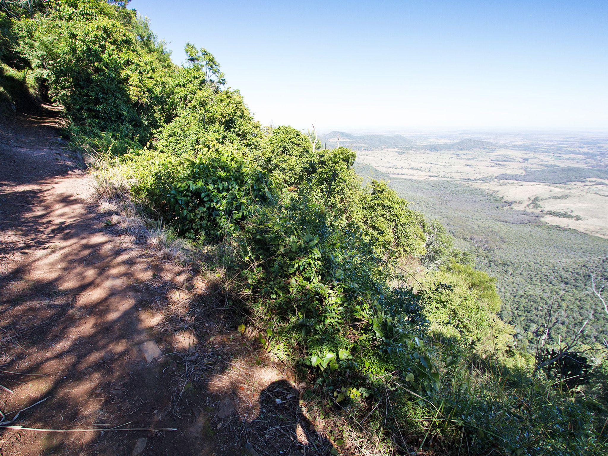

From the Westcott picnic area, zigzag down a steep slope in and out of open forest to the Koondaii lookout. Gaze at panoramic views over the rainforest gully, Koondaii Valley and the distant plains of the Darling Downs. The return walk is a steady uphill climb.
In late summer, enjoy the picturesque carpet of velvety-pink lacebark flowers covering the track. During spring, delight in the elaborate yellow blossoms of king orchids along the cliff edge. Listen for wonga pigeons cooing and honeyeaters chattering as they feed on nectar-filled blossoms. See topknot pigeons feeding in fig trees and watch peregrine falcons taking flight from the cliffs.
It's easier to walk this circuit in a clockwise direction.
Getting there and getting around
The Koondaii circuit is in the Bunya Mountains National Park, 200km north-west of Brisbane and 125km north-west of Toowoomba in the South Burnett region.
- The circuit starts from Westcott picnic area, 4km along Bunya Mountains Road from the Dandabah area.
Three steep, narrow and winding routes, signposted as the Great Bunya Drive, lead to the park. The Bunya Mountains Road passes through the park from the south-east to the north.
For more details on how to get to Bunya Mountains National Park, please see getting there and getting around.
Wheelchair access
There are no wheelchair-accessible facilities.
Before you visit
Opening hours
Koondaii circuit is open 24 hours a day.
Check park alerts for the latest information on access, closures and conditions.
Visiting safely
For more safety information see Visiting Bunya Mountains safely and Walk with care.
- Bunya Mountains - Burtons Well walking tracks closed due to storm damage 1 February to 19 July 2024
- The Bunya Bunya walking track is closed 29 January 2023 to 29 January 2025