Cherry Plain picnic area
Park or picnic on a tiny grassland 'bald' surrounded by rainforest. From here you can head off for a scenic west-side walk to Burtons Well or Westcott.
Accessible by
- Conventional vehicle
- Bicycle
Attraction facilities
- Picnic tables
-
![Cherry Plain picnic area is the starting point for walking tracks leading south to Westcott and north to Burtons Well.]() Cherry Plain picnic area is the starting point for walking tracks leading south to Westcott and north to Burtons Well.
Photo credit: Robert Ashdown © Queensland Government
Cherry Plain picnic area is the starting point for walking tracks leading south to Westcott and north to Burtons Well.
Photo credit: Robert Ashdown © Queensland Government
-
![Cherry Plain picnic area is a peaceful spot that you will rarely share with others.]() Cherry Plain picnic area is a peaceful spot that you will rarely share with others.
Photo credit: Robert Ashdown © Queensland Government
Cherry Plain picnic area is a peaceful spot that you will rarely share with others.
Photo credit: Robert Ashdown © Queensland Government
-
![Picnic on a tiny grassland 'bald' surrounded by rainforest.]() Picnic on a tiny grassland 'bald' surrounded by rainforest.
Photo credit: Robert Ashdown © Queensland Government
Picnic on a tiny grassland 'bald' surrounded by rainforest.
Photo credit: Robert Ashdown © Queensland Government
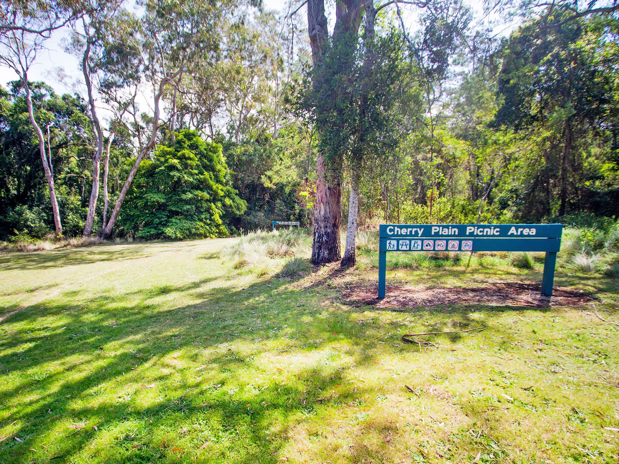

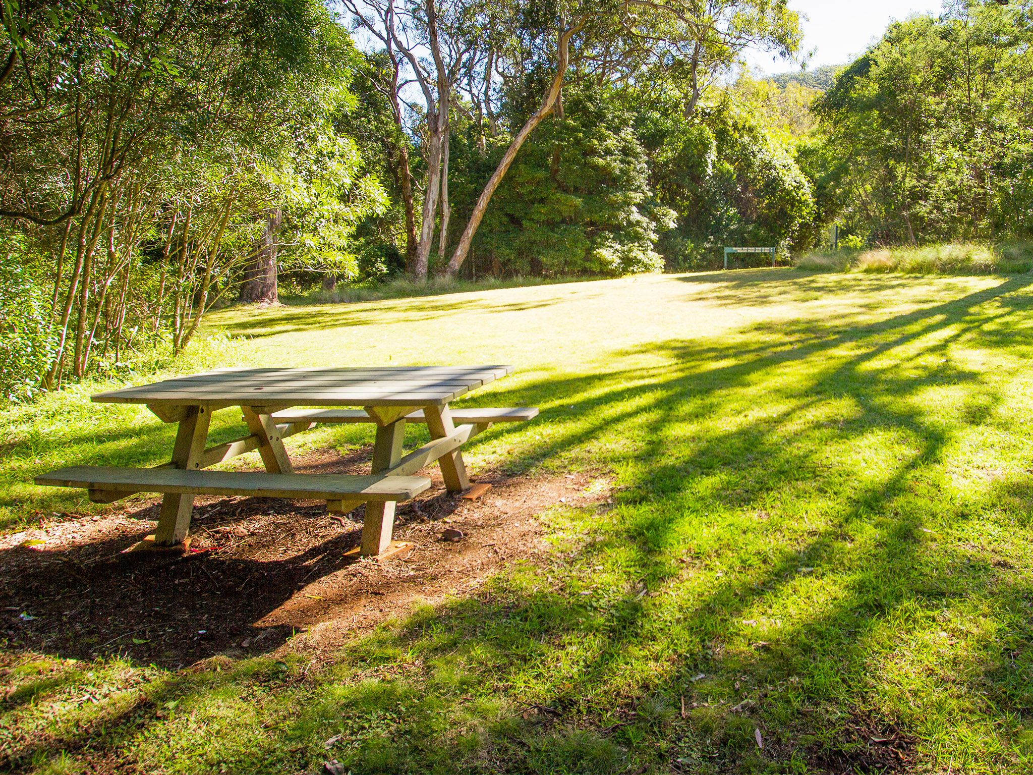
Enjoy the serenity of this peaceful picnic and roadside parking area surrounded by rainforest, well away from the main visitor area of the Bunya Mountains. From here, walk north on Cherry Plains to Burtons Well track or south on the Westcott to Cherry Plains track.
Look for shy black-breasted button-quails in the dry rainforest gully a short distance along the track from Cherry Plain. Spy fairy-wrens, finches and scurrying skinks in open grassy areas. Listen for the sounds of wonga pigeons, green catbirds and eastern whipbirds calling in the surrounding rainforest. In the evening, spotlight for bandicoots, wallabies and pademelons.
Getting there and getting around
The Cherry Plain picnic area is in the Bunya Mountains National Park, 200km north-west of Brisbane and 125km north-west of Toowoomba in the South Burnett region.
- The picnic area is 6km along Bunya Mountains Road from the south-eastern park entrance.
Three steep, narrow and winding routes, signposted as the Great Bunya Drive, lead to the park. The Bunya Mountains Road passes through the park from the south-east to the north.
For more details on how to get to Bunya Mountains National Park, please see getting there and getting around.
Wheelchair access
There are no wheelchair-accessible facilities.
Before you visit
Opening hours
Cherry Plain picnic area is open 24 hours a day
Check park alerts for the latest information on access, closures and conditions.
Visiting safely
For more safety information see Visiting Bunya Mountains safely.
- Bunya Mountains - Burtons Well walking tracks closed due to storm damage 1 February to 19 July 2024
- The Bunya Bunya walking track is closed 29 January 2023 to 29 January 2025