- Categories:
- Regions:
Journey through vast savannah plains, wetlands and tropical rainforests, and explore the iconic national parks of ‘the cape’. Discover untouched coastlines, termite-mound dotted plains and wild rivers that are home to big crocs. Learn about the significance of sacred Aboriginal sites, discover relics of WWII and delve into the area’s fascinating pastoral history.
But most of all, follow your sense of adventure and revel in the freedom of being on the road … to the northern-most tip of the country! Then, when you reach your goal, bask in the pride of standing at the true ‘Top End’ of Australia.
Travelling to the wild north
 Hann Crossing, Rinyirru (Lakefield) National Park (CYPAL) | John Augusteyn © Queensland Government
What is the best way to do ‘the cape’? How long is a piece of string! Do your research, decide which parks are on your bucket list, look at how long you have, refer to some of the many travel guides available, and then start to build your itinerary.
Top tip: remember to book your camp sites online in advance. If you don’t want to lock it all in before you leave home, make sure you plan where and when you will book ahead as you travel—phone and internet coverage is ‘patchy’, to say the least, on Cape York Peninsula!
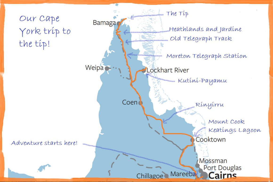 Map of Cape York trip | © Queensland Government
Some people rush ‘up the cape’ and back again; others spend leisurely weeks enjoying the journey. Whichever way you go, you’re sure to return with special memories. Here’s a sneak-peak at a travel journal for a 2-week (one-way) itinerary to give you just a taste of the adventure that awaits.
Journal day 1: exploring Cooktown and surrounds
 View from lookout, Mount Cook National Park | © Queensland Government
The 4WD is packed and we’re on the road. We’ve planned to be totally self-sufficient for at least 2 weeks as we want to get away from it all on our ‘frontier’ adventure. But before we leave ‘civilisation’, we take a look around the historic town of Cooktown. As well as interesting museums and historic buildings, we explore Mount Cook National Park with its dramatic granite boulders and expansive views over the Great Barrier Reef and the southern Wet Tropics. And we manage to squeeze in a spot of birdwatching at Keatings Lagoon Conservation Park! We could spend days here!
Journal day 2: venturing into 4WD country
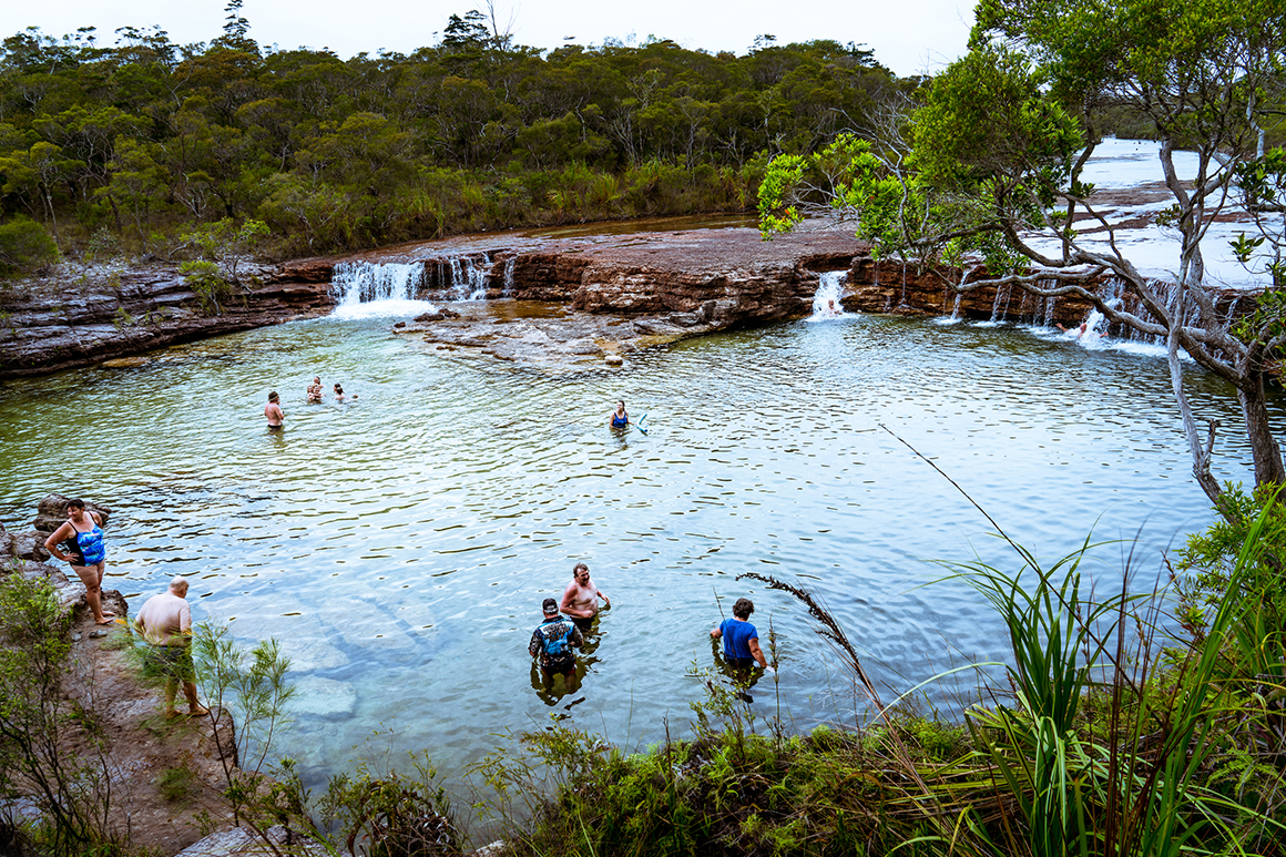
 Lagoon, Rinyirru (Lakefield) National Park (CYPAL) | © Paul Curtis, North Queensland Wildscapes
It’s an exciting drive along the 4WD-only Battle Camp Road into Rinyirru (Lakefield) National Park (CYPAL), where we will camp for the next few days, spending time exploring and (of course) fishing for barramundi! Lakefield, as its old name suggests, is renowned for vast river systems and spectacular wetlands. Its changed name—Rinyirru—reflects the change to Aboriginal ownership and joint management of the park.
Journal days 3–5: exploring Rinyirru (Lakefield)
 Old Laura Homestead, Rinyirru (Lakefield) National Park, (CYPAL) | © Queensland Government
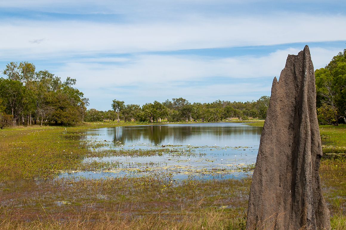
We really enjoy Rinyirru (Lakefield). It’s the second largest national park in Queensland, so we have no hope of exploring it all in our short time here, but the tinny has come in handy, and we’re happily exploring some of the lagoons and waterholes, getting lots of ‘ticks’ in our bird watching guide as we go, and always being crocwise, of course.
We see the amazing waterlily displays at Red and White Lily lagoons, explore the historic Old Laura Homestead and learn about the park’s pastoral heritage, watch birds at Rarda-Ndolphin (Low Lake) and try to photograph the amazing termite mounds dotted across the vast grasslands of Nifold Plain. Feeling very refreshed and peaceful.
Journal day 6: pushing north
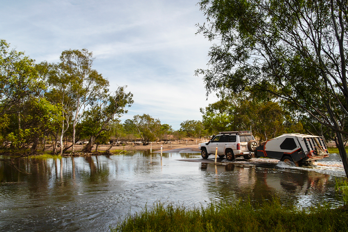 Hann Crossing, Rinyirru (Lakefield) National Park (CYPAL) | © Paul Curtis, North Queensland Wildscapes
Travelling west through Rinyirru, we pass swamps and lagoons full of ducks and other waterbirds. We join the main road north—the Peninsula Developmental Road—passing through the small township of Coen and crossing the mighty Archer River. The feeling of freedom and adventure is intoxicating. After hours of driving north (or so it seems) we turn east to head for the coast.
Journal days 7–9: exploring Kutini-Payamu (Iron Range)
 Chilli Beach, Kutini-Payamu (Iron Range) National Park (CYPAL) | © John Augusteyn
Kutini-Payamu (Iron Range) National Park (CYPAL) protects the largest area of lowland tropical rainforest in Australia—it’s exhilarating to be this far from civilisation and surrounded by such wild beauty. Our photos of Chilli Beach don’t do it justice—we spend hours beach walking and gazing at the distinctive rocks dotted along the shore.
We are pleased to learn a little about Aboriginal culture—the Dreamtime stories associated with Chilli Beach—and to know that this park is also jointly managed by the First Nations peoples. We discover some fascinating history of the area—Captain Bligh and Restoration Island, WWII Iron Range air base, war remnants like old bridges and gun emplacements now mostly smothered by rainforest, and even relics of gold prospecting at Cooks Hut.
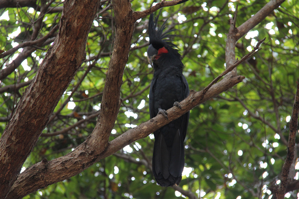 Palm cockatoo, Kutini-Payamu (Iron Range) National Park (CYPAL) | Ian Holloway © Queensland Government
We explore the rainforest walks further inland looking for eclectus parrots and palm cockatoos, and spotlight at night for spotted cuscus. (We get lucky with the palm cockatoo, and also see some owls, giant tree geckos and a striped possum). Feeling a bit sad to leave this place!
Journal day 10: tackling the Telegraph Road
 Overland Telegraph Track | © Tourism Tropical North Queensland
After a brief stop off at the Moreton Telegraph Station, which, we learn, played a historic role as communication was established between Thursday Island in the Torres Strait and Mount Surprise, we continue north.
By the time we hit Bramwell Junction the reality of what we’re about to undertake starts to hit us. The rough ‘road’ towards the top we’re about to follow is the legendary OTT (Overland Telegraph Track) and it sure is tough going! Lots of creek and river crossings—some very deep crossings and steep and slippery river banks—to contend with. Then we reach the infamous Gunshot Creek—this is probably our most challenging crossing to date. We sure have to use all our 4WDing expertise on this route!
 Twin Falls, Heathlands Resources Reserve | Maxime Coquard © Tourism and Events Queensland
Being in the surrounds of Apudthama National Park (CYPAL) is just incredible. This feels like the ‘real cape york’—and the vast, remote wilderness around us must be full of Aboriginal significance. We arrive, exhausted, at Eliot Falls camping area but a swim at the (croc-free) Twin Falls soon refreshes us enough to set up camp.
Journal days 11–12: relaxing at Eliot Falls
 Fruit Bat Falls,| © Tourism Tropical North Queensland
What a relaxing few days! This area was known as ‘wet desert’ by early explorers because the hard sandstone landscape didn’t provide feed for cattle or horses yet freshwater was abundant in the spring-fed creeks and swamps. Well, we’re making full use of the freshwater creeks—swimming at Fruit Bat Falls, enjoying the natural ‘spa’ at The Saucepan and discovering amazing carnivorous plants along the creek edges. Wish we had longer here but time is running out! Tomorrow—crossing the mighty Jardine River and to the tip!
Journal day 13: to the top
 Tip of Cape York | © Tourism Tropical North Queensland
We’ve crossed off another one on our bucket list: standing at the tip of Australia! The Jardine River ferry took us across early this morning, and after another few hours driving, and a bit of a walk, we reached the tip of mainland Australia. To look out across the Torres Strait towards Thursday Island was amazing. The journey has been just under 2 weeks—but right now everything else feels like it’s a lifetime away.
Inspired to plan your own Cape York Peninsula adventure?
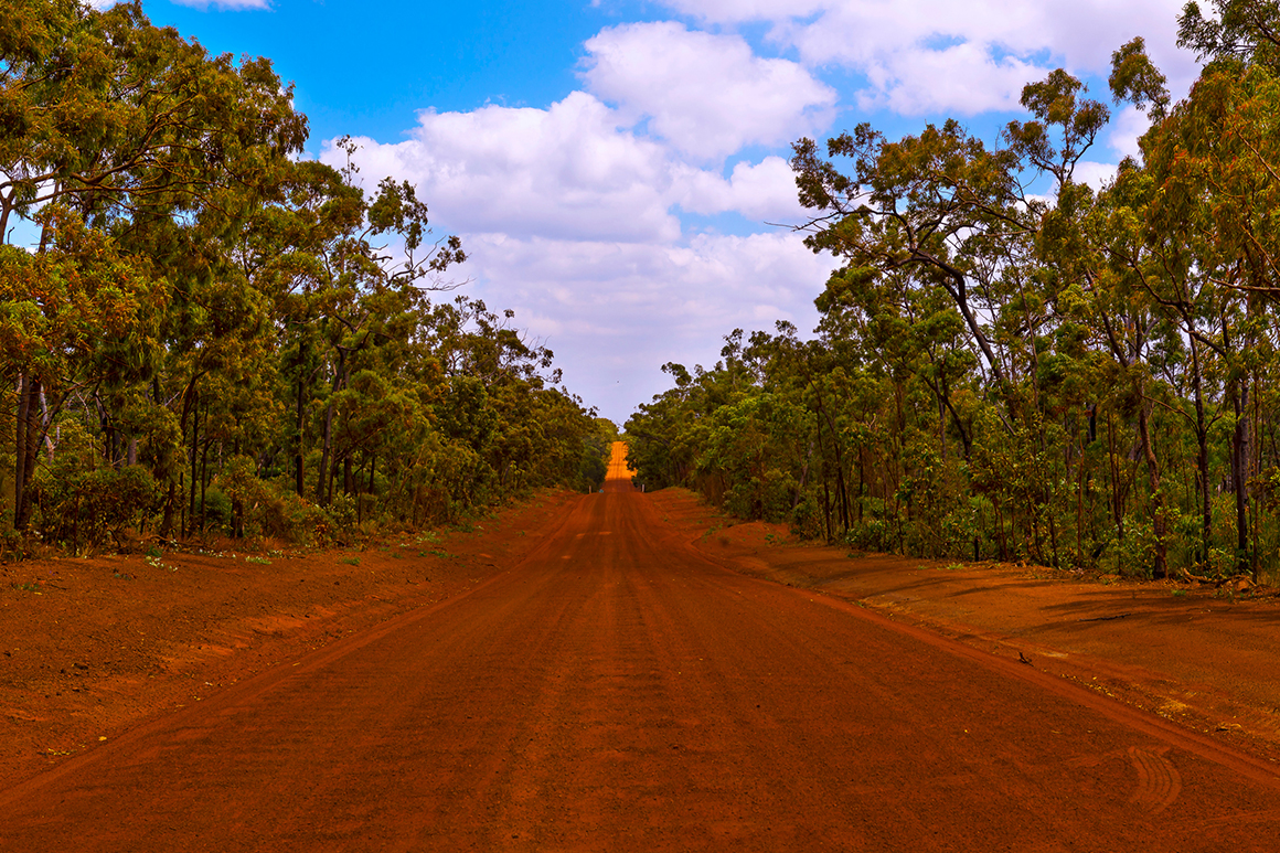 Red dirt road of Cape York Peninsula | © Tourism Tropical North Queensland
Whether you are an adventurous family, a bunch of thrill-seeking mates or a couple with wanderlust looking for new horizons, you need to put the national parks of Cape York Peninsula on your bucket list. A cape york adventure will leave you with priceless memories, a sense of true achievement and many, many stories (not to mention enviable social media snaps) to share!
Learn more about the national parks of Cape York Peninsula.
Download the Cape York Peninsula parks and reserves journey guide.
Find out more about where to go and what to do in the remote Cooktown and Cape York region.
Related articles
-
Image credit Steven Nowakowski © Queensland Government![]() Chasing volcanoes (and waterfalls) in the tropical north
Chasing volcanoes (and waterfalls) in the tropical north
They say ‘don’t go chasing waterfalls’ but we suggest you do, and volcanoes too!
-
Image credit © Tourism and Events Queensland![]() Queensland National Parks’ best-loved camping areas
Queensland National Parks’ best-loved camping areas
We are truly a nation of coast dwellers, so when it comes to camping holidays, where do we head? To the water, of course!
-
Turning your Instagram inspo into reality? Read our tips for visiting Josephine Falls to equip you with the info for the best possible experience.


