Things to do

Some of the trails are shared use, for walkers and mountain bike riders.
Photo credit: Fiona O'Grady © Queensland Government
Camping and accommodation
Camping
Camping is not permitted in Townsville Town Common Conservation Park.
Other accommodation
There is a range of holiday accommodation in and around Townsville. For more information see the tourism information links.
Walking and mountain biking
The Cape Pallarenda Trails are a network of shared walking and mountain biking trails in the Townsville Town Common and Cape Pallarenda conservation parks.
The trails range from short easy trails to challenging hikes and cross-country mountain bike rides. Consider your fitness level before undertaking the extended trails.
The give way code, Cape Pallarenda trails
The Cape Pallarenda trails are shared between walkers, runners and bike riders. Please be careful and courteous to all trails users and follow the shared trails give way code.
- Be alert for bike riders approaching from either direction.
- Cyclists must alert others when approaching.
- Everyone must slow down and go around wildlife.
- Cape Pallarenda trails map
- Townsville Town Common Conservation Park map
- Cape Pallarenda Conservation Park map
| Trail name | Distance | Duration | Classification |
|---|---|---|---|
| Shelly Beach trail | 8.2km return | 4hr walking time 2hr riding time | |
| Under the Radar trail (UTR) | 10.1km one-way | 5hr walking time 2.5hr riding time | |
| Smedley's trail | 6.8km circuit | 3hr walking time 1.5hr riding time | |
| Many Peaks track | 5.7km one-way | 3hr walking time |
|
| Lagoon trail | 4.6km one-way | 2hr walking time 1.5hr riding time | |
| Freshwater trail | 3.6km one-way | 2hr walking time 1hr riding time | |
| Jacana bird hide | 450m one-way | 30min walking time 10min riding time | |
| Wetland walk | 850m return | 30min walking time |
|
| Forest walk | 1.7km return | 1hr return walking time |
|
Trail descriptions
Shelly Beach trail
Distance: 8.2km return
Time: allow 4hr walking time; 2hr riding time
Following the edge of a large marine plain, this trail leads through coastal woodland before finishing at the western end of Shelly Beach. Trail users must return the way they came. The northern part of this trail, towards the beach, is soft and sandy, and can be physically demanding.

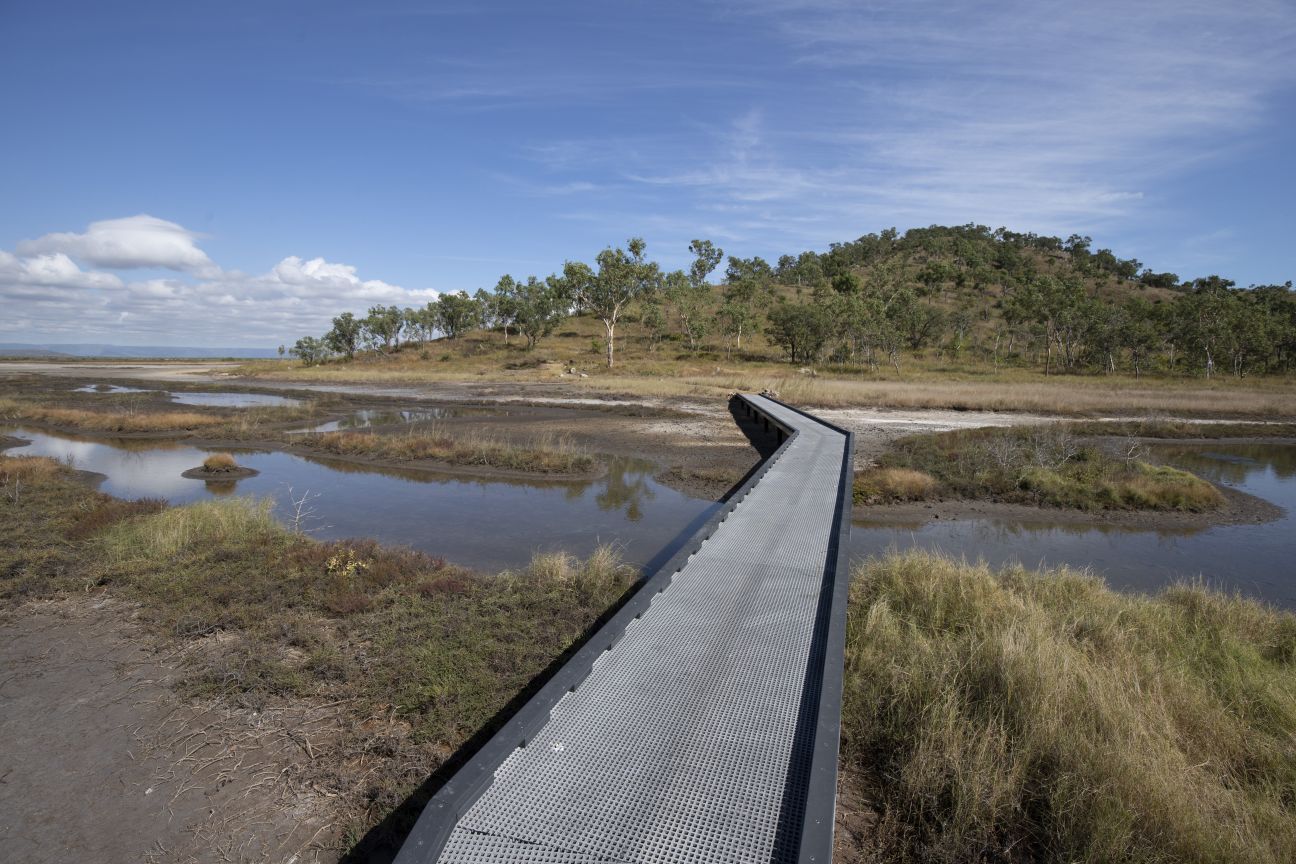
Ride the Under the Radar trail for a view to Magnetic Island.
Photo credit: Fiona O'Grady © Queensland Government
Under the Radar trail (UTR)
Distance: 10.1km one-way
Time: allow 5hr walking time; 2.5hr riding time
This narrow two-way trail is for cross country mountain biking. Walkers must be alert and considerate for mountain bike riders approaching from either direction.
At its western end, the trail starts 500m along the Shelly Beach trail and crosses the western and northern slopes of Many Peaks Range. The trail offers excellent views of the islands to the north and the Coral Sea beyond. At its eastern end, the trail begins 700m along the Shelly Cove trail. UTR has rough surfaces and some steep sections. Trail users can return the way they came or may use the other trails and internal park roads to return to their starting point (see the Cape Pallarenda trails map ).
 Open larger image
Cross the link bridge over the wetlands to Smedley’s trail.
Photo credit: Phil Copp © Queensland Government
Smedley's trail
Distance: 6.8km circuit
Time: allow 3hr walking time; 1.5hr riding time
Accessed via a link from UTR (6.6 km from the eastern beginning of UTR) or 2.8km from the beginning of Shelly Beach trail. This circuit winds around Smedley’s hill taking in panoramic views over the Town Common wetlands, Bohle River and the Coral Sea to the north. It is a challenging but rewarding ride with steep sections and rock obstacles.
 Open larger image
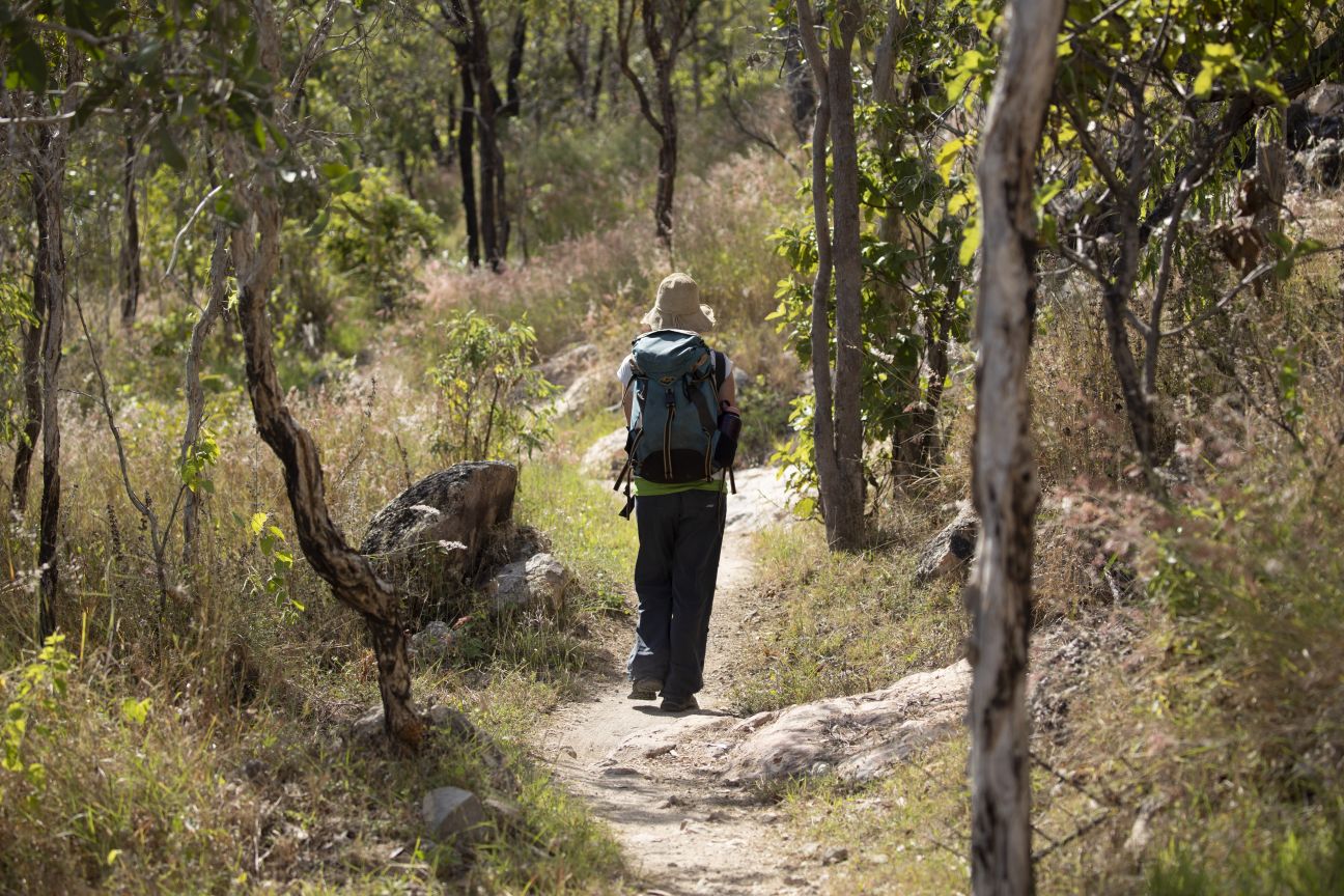
When hiking the Cape Pallarenda Trails, remember to carry drinking water, a first aid kit and communication equipment.
Photo credit: Phil Copp © Queensland Government
 Open larger image
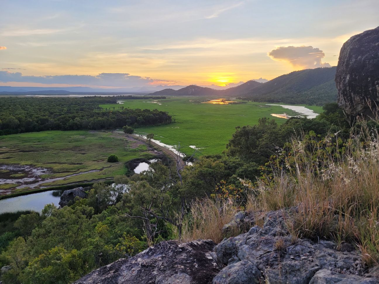
Catch a stunning sunset across the Town Common wetlands from Tegoora Rock, Many Peaks trail.
Photo credit: Linda Thompson © Queensland Government
Many Peaks track
 Bicycles prohibited
Distance: 5.7km one-way
Time: allow 3hr walking time
Starting at the western end, or 450m along the eastern end of the Lagoon trail, this challenging hike across Many Peaks Range leads to the summit of Mount Marlow, before descending through vine thickets and woodland towards the wetlands below. The walk has spectacular views over the Town Common wetlands and along the coastline from the Palm Islands in the north to Cape Cleveland in the south. Some sections of the trail are very steep and there are many steps. In some areas the trail can be indistinct, walkers must follow the orange trail markers. Return on the same trail or via the Lagoon trail.
Lagoon trail
Distance: 4.6km one-way
Time: allow 2hr walking time; 1.5hr riding time
Starting at the intersection of Freshwater and Shelly Beach trails or opposite Walter Nesbit Park at the end of Cape Pallarenda Road, this trail follows the edge of Freshwater Lagoon at the southern base of Many Peaks Range. The trail can become boggy after wet weather. Trail users can return the way they came or can walk the Many Peaks track or ride the Under the Radar trail to complete a loop.
Freshwater trail
Distance: 3.6km one-way
Time: allow 2hr walking time; 1hr riding time
Starting at the intersection with Shelly Beach and Lagoon trails, or 1.2km along the eastern end of the Lagoon trail, the Freshwater trail passes through coastal sand dune vegetation, crosses the dam wall of Freshwater Lagoon and provides access to the Freshwater and Jacana bird hides. Trail users can return the way they came or use the Lagoon or Under the Radar trails to complete a loop.
Jacana bird hide
Distance: 450m one-way
Time: allow 30min walking time; 10min riding time
Access the Jacana bird hide from the Freshwater trail—the turn-off to the hide is 350m from the Freshwater car park. The track leading to the hide is 100m long. Overlooking Freshwater Lagoon, the bird hide is a great place to spot nesting and foraging waterbirds. Trail users can return the way they came or continue along the Freshwater trail.

A pair of binoculars will help spot the more elusive birds in the park.
Photo credit: Fiona O'Grady © Queensland Government
Wetland walk
Bicycles prohibited
Distance: 850m return
Time: allow 30min walking time
This short walk starts 150m along the eastern end of the Lagoon trail and meanders through melaleuca forest within a seasonal wetland.
Forest walk
Bicycles prohibited
Distance: 1.7km return
Time: allow 1hr return walking time
Starting beside Freshwater Lagoon Road in the southern part of the park, this walk follows the edge of Barramundi Waterhole and is shaded by melaleucas, eucalypts and acacias. In the cooler parts of the day this is a good area for viewing forest birds such as honeyeaters and kingfishers.
Remember to follow the Parks and forests mountain bike and cycle with care plus the walk with care guidelines.

Brolgas feeding near Long Swamp, Pandanus viewing area.
Photo credit: Fiona O'Grady © Queensland Government
Viewing wildlife
The Town Common is home to many woodland and waterbird species. Five observation points are provided for keen birdwatchers but many birds (including brolgas) are regularly seen from the roads and trails within the park.
The Freshwater and Jacana bird hides overlook Freshwater Lagoon. Pandanus and Melaleuca viewing areas, beside Long Swamp are located on Freshwater Lagoon Road and provide space for a vehicle to pull over on the roadside. A car park and short track lead to Payets Tower in the south of the park. This observation tower looks out over seasonal wetlands.
Sand monitors roam the park and are sometimes seen sunning themselves on the roads and trails. Agile wallabies also live in the area.
Read more about the natural environment of Townsville Town Common Conservation Park.
Fishing
Marine waters adjacent to Shelly Beach are internationally significant and are protected in the Great Barrier Reef World Heritage Area. Zones in the two marine parks, the Great Barrier Reef Coast and Great Barrier Reef, provide a balanced approach to protecting the marine and intertidal environments while allowing recreational and commercial use. Check zoning information and maps before entering or conducting any activities in the marine parks.
Fisheries regulations apply—information on bag and size limits, restricted species and seasonal closures is available from Department of Agriculture and Fisheries.
- Townsville Town Common Conservation Park and Cape Pallarenda Conservation Park planned burns 3 April to 31 May 2024
- Townsville Town Common Conservation Park 27 February to 3 May 2024