Lake Euramoo lookout and track
Stop at the lookout showcasing tranquil Lake Euramoo below, and then take a stroll along the circuit track through the lakeside rainforest.
- Journey type
- Walk
- Distance
- 500m circuit The same start and finish point, but the traveller doesn’t return along the same path
- Time suggested
- Allow 10min walking time.
- Grade
- Grade 3 walking track
Accessible by
- Conventional vehicle
- Bicycle
Journey facilities
- Lookout (constructed)
- Walking
-
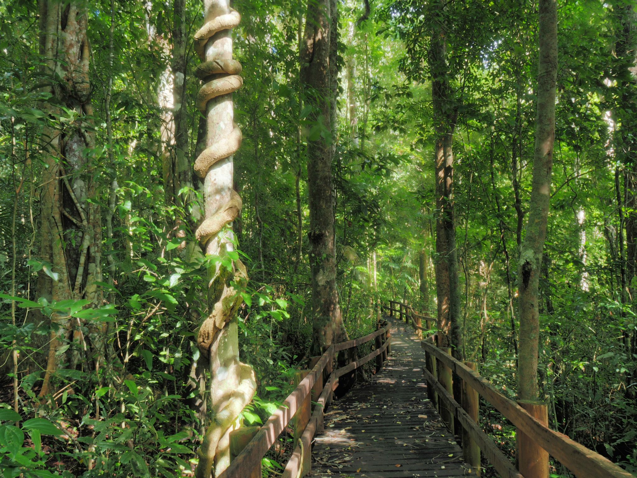
![The track winds through the rainforest near the lake.]() The Lake Euramoo circuit track winds through the rainforest near the lake.
Photo credit: Roger James © Queensland Government
The Lake Euramoo circuit track winds through the rainforest near the lake.
Photo credit: Roger James © Queensland Government
-
![The Lake Euramoo lookout affords excellent views of this volcanic maar.]() The Lake Euramoo lookout affords excellent views of this volcanic maar.
Photo credit: Julie Swartz © Queensland Government
The Lake Euramoo lookout affords excellent views of this volcanic maar.
Photo credit: Julie Swartz © Queensland Government
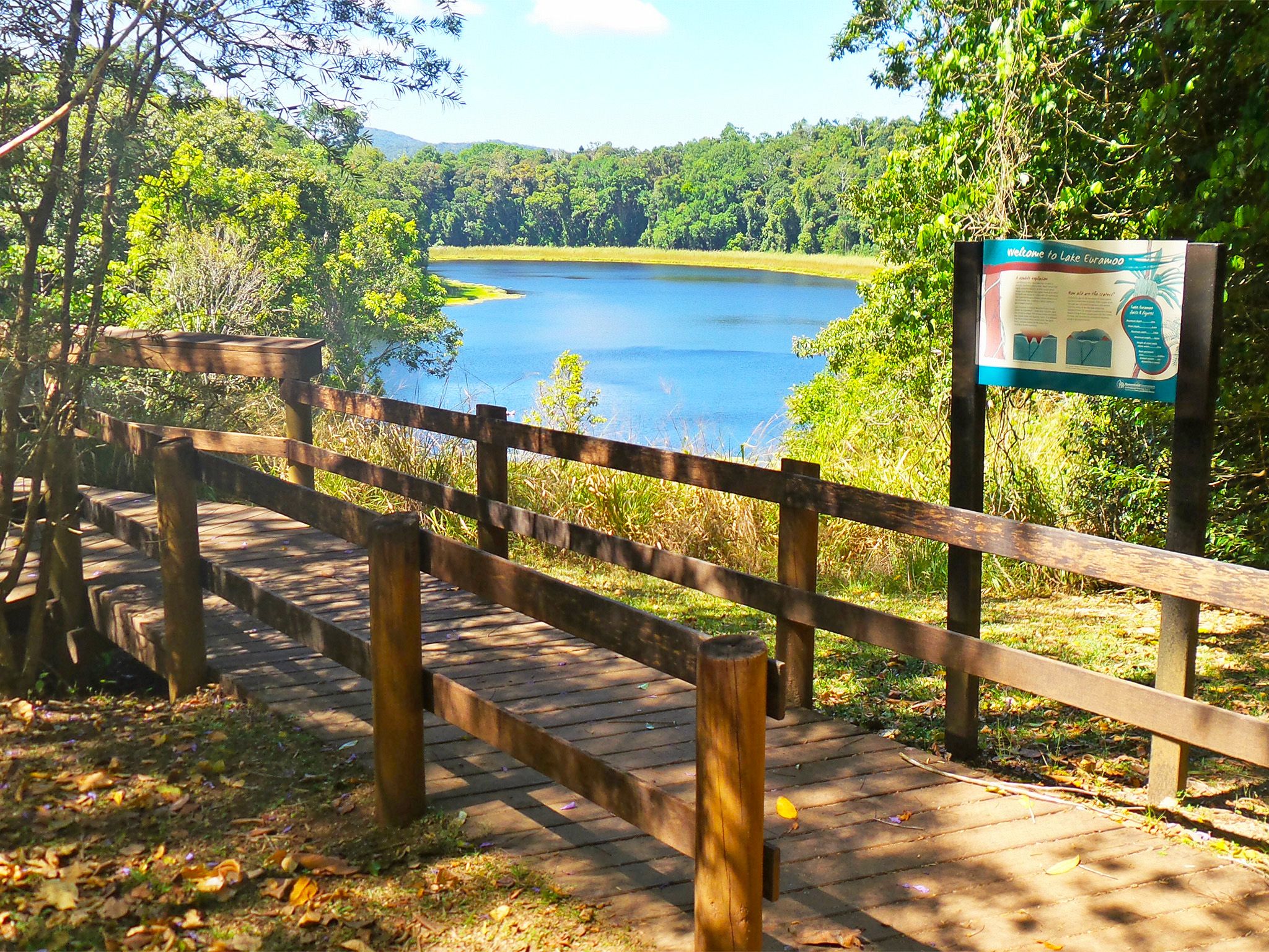
Lake Euramoo will captivate you with its beauty and unique geological history.
As you gaze down at the dark water of this rainforest lake you'll notice the unique dumbbell shape of the lake, formed from twin volcanic explosions. This unusual formation sets Lake Euramoo apart from other crater lakes.
Once you’ve had your fill, take a short stroll along the easy circuit track that winds through the rainforest. Birdlife is rich here so be sure to take your binoculars.
Lake Euramoo lookout and track, Danbulla National Park are part of the Wet Tropics World Heritage Area, famed for its exceptional natural beauty, outstanding examples of the record of life, evolutionary history and remarkable diversity.
Getting there and getting around
Lake Euramoo is in Danbulla National Park on the central part of the Atherton Tableland, 70km (1.5hr) from Cairns.
- The circuit is 18.4km from the western entrance and 9.6km from the eastern entrance, on Danbulla Road.
- Most of Danbulla Road is unsealed but it is accessible to all vehicles.
Refer to number 8 reference on Danbulla National Park and State Forest locality and road maps .
For more information see visiting safely—getting there and getting around.
Wheelchair access
There are no wheelchair-accessible facilities.
Before you visit
Opening hours
Lake Euramoo lookout and track is open 24 hours a day.
Check park alerts for the latest information on access, closures and conditions.
Visiting safely
For more safety information see Visiting Danbulla safely and Walk with care.
- Temporary closure: camp sites 2 and 3 at Curri Curri bush camping area, Danbulla National Park 19 April to 10 June 2024
- Temporary road closures: Mount Edith Road, Kauri Creek Road and Tinaroo Creek Road, Danbulla National Park 22 December 2023 to 29 May 2024
- Temporary closure: Madigan Road and Gillies lookout, Danbulla National Park 30 January to 29 May 2024
- Planned works: Fong-on Bay camping and day-use area, Danbulla National Park 16 November to 1 December 2024