Platypus day-use area
Pack the esky and bring a shady marquee for a fun-filled day at this sheltered lakeside picnic area.
Accessible by
- Conventional vehicle
- Bicycle
- Boat
Attraction facilities
- Wood-fired barbecue (BYO wood)
- Picnic tables
- Toilets (flush)
- Wheelchair access (may require assistance)
-
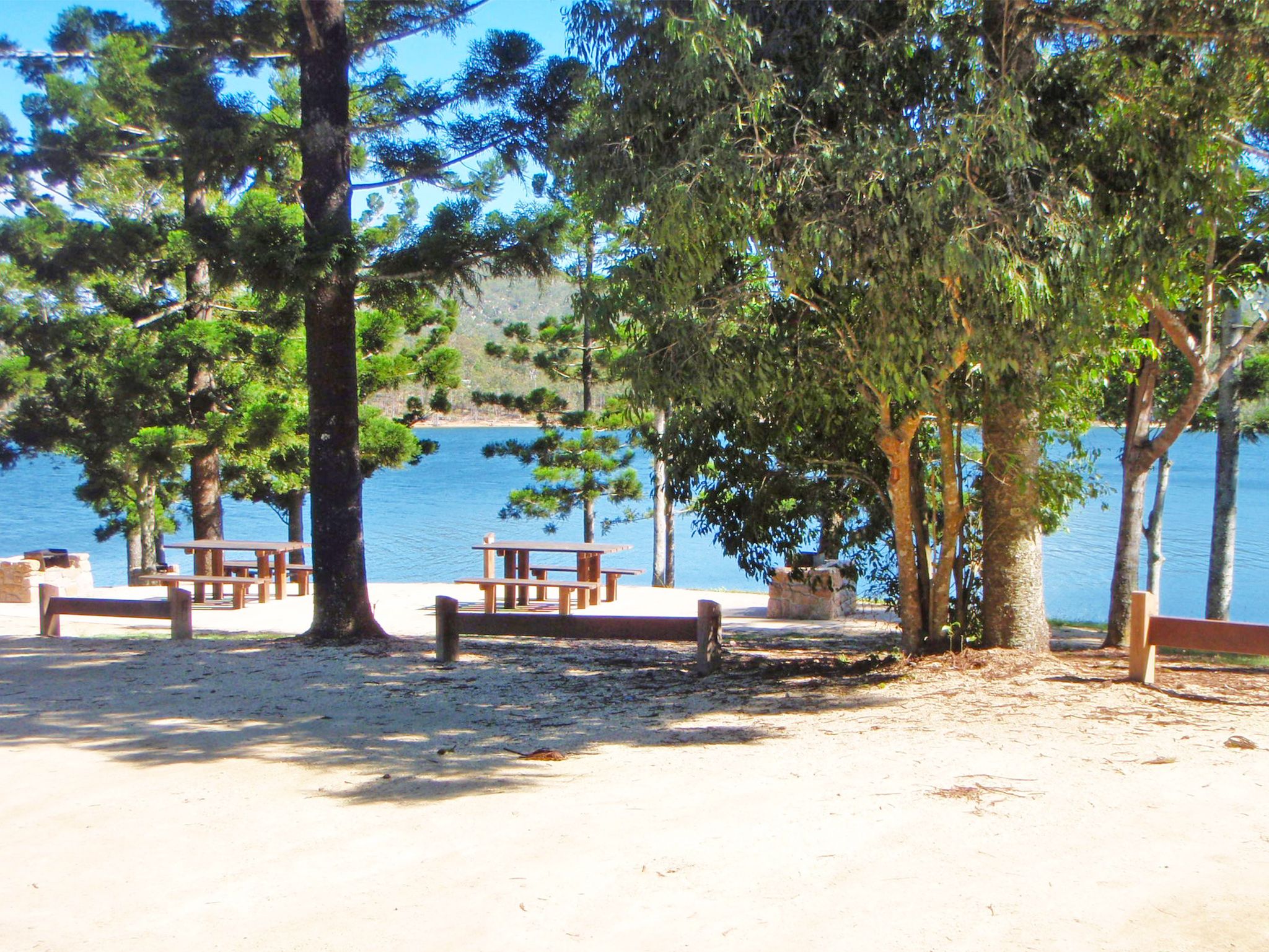
![Picnic tables and wood fired barbecues are provided at Platypus day-use area.]() Picnic tables and wood fired barbecues are provided at Platypus day-use area.
Photo credit: © Queensland Government
Picnic tables and wood fired barbecues are provided at Platypus day-use area.
Photo credit: © Queensland Government
-
![At Platypus day-use area enjoy a picnic in the shade of hoop pines beside Lake Tinaroo.]() At Platypus day-use area enjoy a picnic in the shade of hoop pines beside Lake Tinaroo.
Photo credit: © Queensland Government
At Platypus day-use area enjoy a picnic in the shade of hoop pines beside Lake Tinaroo.
Photo credit: © Queensland Government

Head out on the water for a ski, or to see if you can hook one of the lake’s famous monster barras. Remember to chuck in a few redclaw pots to catch your lunch. If something a little more sedate is your style, slip a canoe or kayak onto the water and explore the nearby creeks, coves and bays.
Cook lunch on the wood-fired BBQ (BYO firewood) and enjoy a lakeside feast.
After a refreshing swim at the end of the day, settle back in your chair and watch the sunset colours splash across the sky.
Getting there and getting around
Platypus day-use area is in Danbulla State Forest, on the central part of the Atherton Tableland, 70km (1.5hr) from Cairns.
- The day-use area is 4km from the western entrance and 24km from the eastern entrance on Danbulla Road.
- Most of Danbulla Road is unsealed but it is accessible to all vehicles.
- You can also get to the day-use area by boat.
Refer to number 2 reference on Danbulla National Park and State Forest locality and road maps .
For more information see visiting safely—getting there and getting around.
Wheelchair access
The day-use area picnic tables and car park are wheelchair accessible.
Before you visit
Opening hours
Platypus day-use area is open 24 hours a day.
Check park alerts for the latest information on access, closures and conditions.
Visiting safely
For more safety information see Visiting Danbulla safely.
- Temporary closure: camp sites 2 and 3 at Curri Curri bush camping area, Danbulla National Park 19 April to 10 June 2024
- Temporary road closures: Mount Edith Road, Kauri Creek Road and Tinaroo Creek Road, Danbulla National Park 22 December 2023 to 29 May 2024
- Temporary closure: Madigan Road and Gillies lookout, Danbulla National Park 30 January to 29 May 2024
- Planned works: Fong-on Bay camping and day-use area, Danbulla National Park 16 November to 1 December 2024