Kauri Creek day-use area
This quaint and centrally-located picnic area is a beautiful place to stop for lunch on your day exploring this feature-packed area.
Accessible by
- Conventional vehicle
Attraction facilities
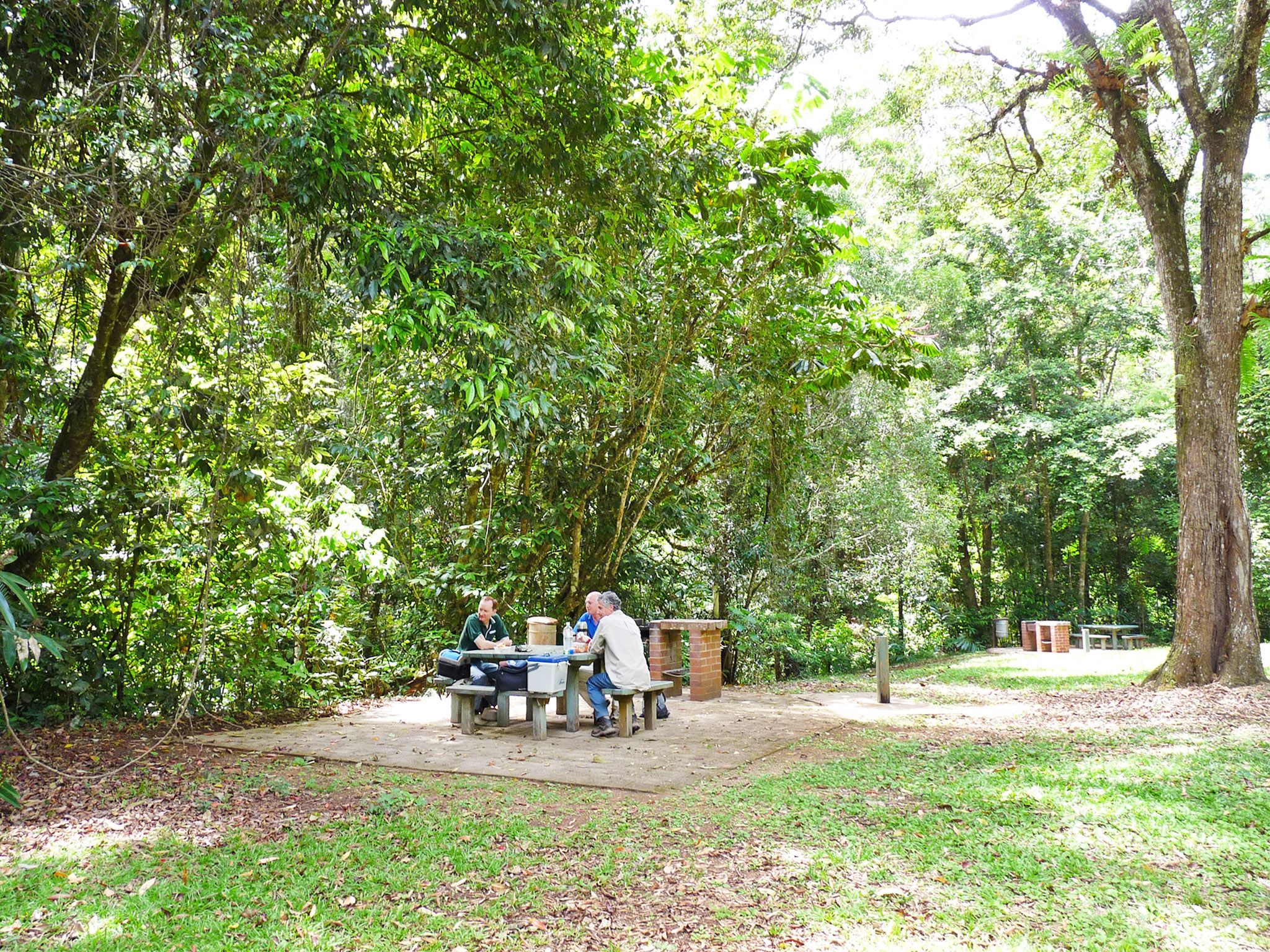
- Wood-fired barbecue (BYO wood)
- Picnic tables
- Toilets (non-flush)
- Wheelchair access (may require assistance)
-
![Enjoy a picnic beside the scenic Kauri Creek at Kauri Creek day-use area.]() Enjoy a picnic beside the scenic Kauri Creek at Kauri Creek day-use area.
Photo credit: © Lovegreen Photography
Enjoy a picnic beside the scenic Kauri Creek at Kauri Creek day-use area.
Photo credit: © Lovegreen Photography
-
![Picnic tables and wood barbecues are provided at Kauri Creek day-use area.]() Picnic tables and wood barbecues are provided at Kauri Creek day-use area.
Photo credit: Tamara Vallance © Queensland Government
Picnic tables and wood barbecues are provided at Kauri Creek day-use area.
Photo credit: Tamara Vallance © Queensland Government

Tucked away among towering pines and native forest, this picnic area is a quiet retreat for the whole family.
Let the kids swim in the shallow, sandy-bottomed creek while you take a well-earned break in the shade. When you start to feel hungry, cook lunch on the wood-fired barbecue (bring your own wood) and have a picnic at one of the tables.
You can walk some of the Jungaljungal walk from here, or take a 600m stroll to the Kauri Creek camping area.
When everything is packed away, it’s time for more exploration along Danbulla Road.
Getting there and getting around
Kauri Creek day-use area is in Danbulla State Forest, on the central part of the Atherton Tableland, 70km (1.5hr) from Cairns.
- The day-use area is 9.5km from the western entrance and 18.5km from the eastern entrance, on Danbulla Road.
- Most of Danbulla Road is unsealed but it is accessible to all vehicles.
Refer to number 5 reference on Danbulla National Park and State Forest locality and road maps .
For more information see visiting safely—getting there and getting around.
Wheelchair access
The toilets and picnic tables are wheelchair accessible.
Drinking water
Available from taps in the day-use area.
Before you visit
Opening hours
Kauri Creek day-use area is open 24 hours a day.
Check park alerts for the latest information on access, closures and conditions.
Visiting safely
For more safety information see Visiting Danbulla safely.
- Temporary road closures: Mount Edith Road, Kauri Creek Road and Tinaroo Creek Road, Danbulla National Park 22 December 2023 to 29 May 2024
- Temporary closure: Madigan Road and Gillies lookout, Danbulla National Park 30 January to 29 May 2024
- Planned works: Fong-on Bay camping and day-use area, Danbulla National Park 16 November to 1 December 2024