Mountain-bike rides
Pedal past lakes, through valleys and over rocky ridges on shared trails also used by walkers and horseriders.
- Journey type
- Walk, cycle
- Distance
- Various trail network
- Time suggested
- Various
- Grade
- Various
Accessible by
- Conventional vehicle
Journey facilities
- Lookout (natural)
- Walking
- Cycling
-
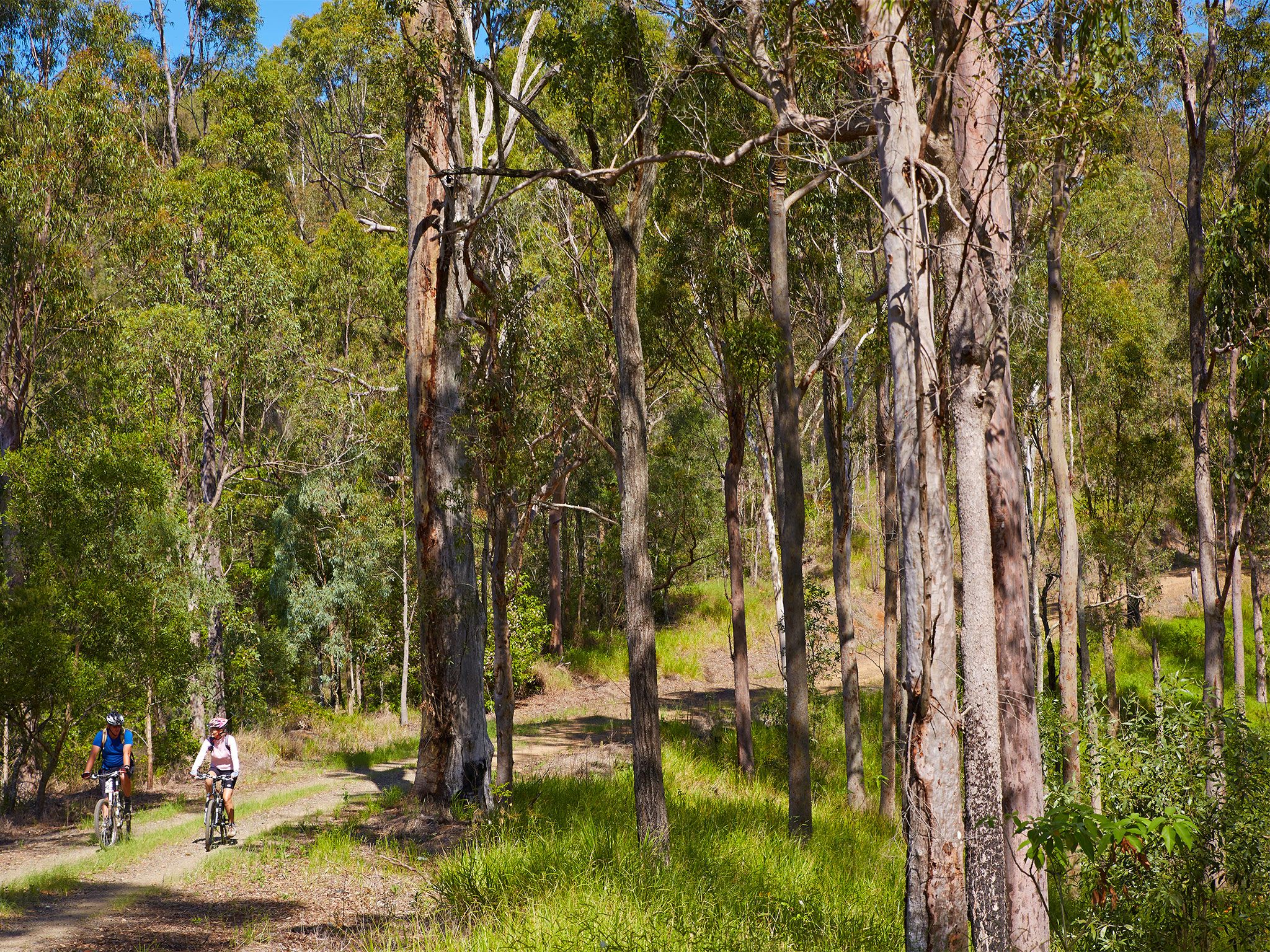
![You'll share the trail with other users when mountain biking in D'Aguilar National Park.]() You'll share the trail with other users when mountain biking in D'Aguilar National Park.
Photo credit: Maxime Coquard © Queensland Government
You'll share the trail with other users when mountain biking in D'Aguilar National Park.
Photo credit: Maxime Coquard © Queensland Government
-
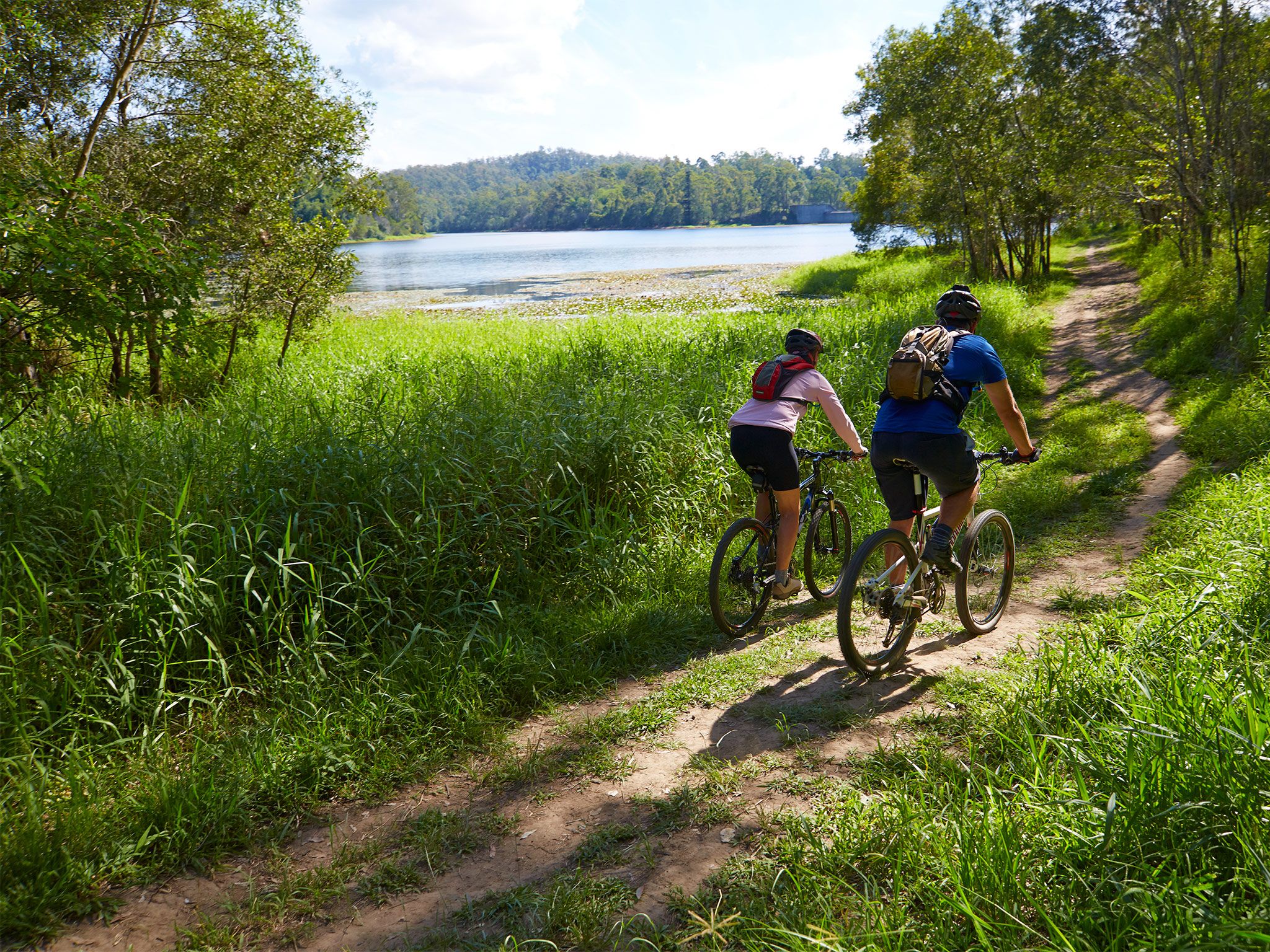
![Mountain bike ride on a network of shared trails in the southern section of D'Aguilar National Park.]() Mountain bike ride on a network of shared trails in the southern section of D'Aguilar National Park.
Photo credit: Maxime Coquard © Queensland Government
Mountain bike ride on a network of shared trails in the southern section of D'Aguilar National Park.
Photo credit: Maxime Coquard © Queensland Government
Set out on a two-wheeled adventure in the southern section of D'Aguilar National Park, where hundreds of kilometres of rides crisscross the landscape.
Two popular routes include the 22km one-way South Boundary Road trail and the 25km Aquila loop—keep a look out for road and junction signs marking where mountain-bike access is prohibited.
Make a weekend of it and stay at one of five remote bush camps—Scrub Road remote bush camp, Light Line Road remote bush camp, Dundas Road remote bush camp, England Creek remote bush camp and Northbrook Mountain remote bush camp located along the trails.
More detail about the mountain-bike rides is provided in the South D'Aguilar shared trails map and the D'Aguilar National Park—South D’Aguilar section topographic map, available for purchase from the Walkabout Creek Discovery Centre at The Gap.
Getting there and getting around
There are many entry points to D’Aguilar National Park’s the shared trails from Walkabout Creek Discovery Centre or from entry points along Mount Nebo Road.
Access roads to the South D’Aguilar shared trails are suitable for conventional (2WD) vehicles.
- From the Brisbane suburb of The Gap located about 10km from Brisbane's city centre, take Mount Nebo Road (tourist route number 8).
- Turn left into Walkabout Creek Discovery Centre at 60 Mount Nebo Road or continue along Mount Nebo Road to access points through the park.
- For more information about mountain-bike riding in the park, purchase a D'Aguilar National Park—South D’Aguilar section topographic map from the Walkabout Creek Discovery Centre.
- Read mountain-bike and cycle with care for tips on riding safety and riding with care.
Wheelchair access
There are no wheelchair-accessible facilities on these rides. The closest wheelchair-accessible facilities are located at Walkabout Creek Discovery Centre.
Before you visit
Opening hours
Mountain-bike rides are open 24 hours a day.
Check park alerts for the latest information on access, closures and conditions.
Visiting safely
For more safety information see:
- Planned Burn- Mt Mee Section of D'Aguilar National Park 17–23 April 2024
- Flood recovery roadworks within Camp Mountain and Bellbird Grove areas. 8 April to 31 May 2024
- Mt Mee - Mill Rainforest walking track closed due to storm damage 5 January 2021 to 30 September 2024
- Camp Mountain Road Works 24 January to 30 June 2024