Cooloola Way 4WD track
Tackle a challenging 4WD track through the western catchment of the Upper Noosa River.
- Journey type
- 4WD, trail bike
- Distance
- 30km one way A path where the start point is different to the finish point
- Time suggested
- Allow 1hr driving time.
- Grade
- Unrated
Accessible by
- High clearance 4WD
- Trail bike
Journey facilities
- Scenic drive
- Trail bike riding
-
![Use the Cooloola Way 4WD track to travel to Inskip Peninsula Recreation Area with your dog.]() Use the Cooloola Way 4WD track to travel to Inskip Peninsula Recreation Area with your dog.
Photo credit: © Chris Whitelaw
Use the Cooloola Way 4WD track to travel to Inskip Peninsula Recreation Area with your dog.
Photo credit: © Chris Whitelaw
-
![Get adventurous on the Cooloola Way 4WD track—a rough track through pine plantations.]() Get adventurous on the Cooloola Way 4WD track—a rough track through pine plantations.
Photo credit: © Chris Whitelaw
Get adventurous on the Cooloola Way 4WD track—a rough track through pine plantations.
Photo credit: © Chris Whitelaw

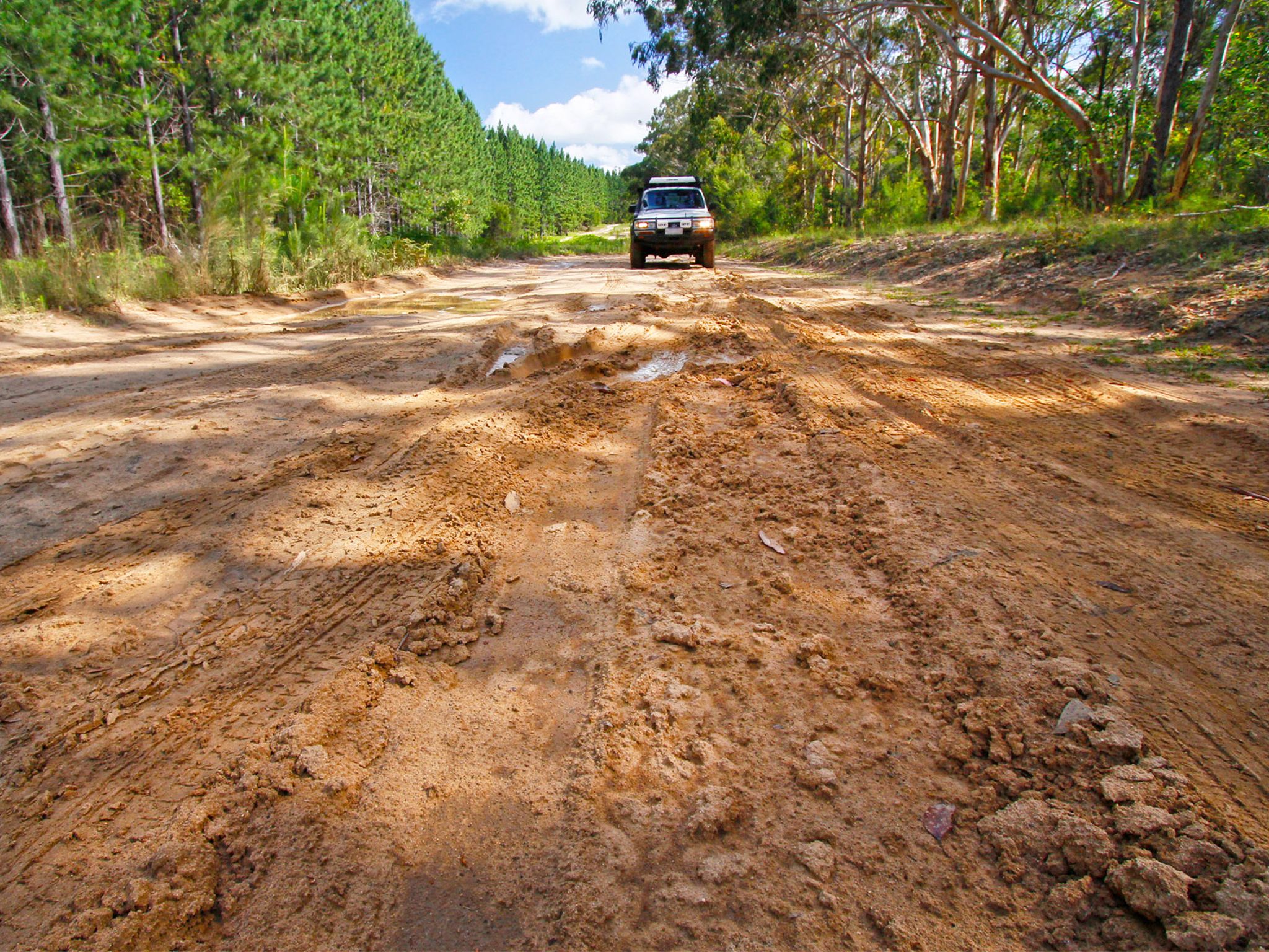
Explore this rough high-clearance council maintained 4WD track along Cooloola’s western boundary, linking the area’s southern access with Rainbow Beach road in the north. Discover tall pine plantations, scribbly gum woodlands and low heathlands dotted in spring wildflowers. Along the way enjoy glimpses of the scenic Cooloola sandmass to the east.
If you’re travelling to Inskip with a dog, you can use this track as a thoroughfare through Cooloola (just make sure pooch stays inside your vehicle). This track is frequently wet and boggy, and sometimes flooded—when conditions are poor, you’re best to take the safer route along inland roads farther west.
Refer to the Cooloola and Inskip recreation areas discovery guide for a map and more details.
Getting there and getting around
Cooloola Way is in Cooloola Recreation Area, Great Sandy National Park, on the Sunshine Coast between Noosa Heads and Rainbow Beach (155–240km north of Brisbane).
- Cooloola Way connects connects the Kin Kin-Wolvi Road in the south of Cooloola with Rainbow Beach Road in the north.
- You need a high clearance 4WD to access Cooloola Way.
- Vehicle access permits are not required for Cooloola Way but may be required if you plan to travers beaches and other inland tracks within the Cooloola Recreation Area.
- Read 4WD with care for important information on 4WD safety and minimal impact driving.
From the south
- From Brisbane, drive 135km north on the Bruce Highway or the Sunshine Motorway to Tewantin. Follow McKinnon Drive, Louis Bazzo Drive and Junction Road for about 18km north-west to Cootharaba Road. Turn right and travel about 10km along Cootharaba, Kimmond Creek and Dr Pages roads to the Gympie Kin Kin Road. Turn right and drive 6km, then turn right onto Cooloola Way.
- From Gympie, drive 10km east on Tin Can Bay Road, turn right onto to the Gympie Kin Kin Road and drive about 31km, then turn left onto Cooloola Way.
From the north
- From Brisbane, drive about 160km north on the Bruce Highway towards Gympie. At the southern edge of Gympie, turn onto Tin Can Bay Road and drive 42km, then turn right onto Rainbow Beach Road.
- From Maryborough, drive 57km south on the Cooloola Coast Road, then turn left onto Tin Can Bay Road and drive 3.5km, then turn right onto Rainbow Beach Road.
- Drive another 13km to the Cooloola Way turnoff on your right.
Wheelchair access
There are no wheelchair-accessible facilities.
Before you visit
Opening hours
Cooloola Way 4WD track is open 24 hours a day.
Check park alerts for the latest information on access, closures and conditions.
Visiting safely
For more safety information see:
- Pest control program at Teewah Beach and Freshwater camping areas 13–16 May 2024
- King’s Bore Circuit temporary closure 12 May to 10 June 2024
- Annual Cooloola Hazard Reduction Burn Program 15 April to 31 August 2024
- Permanent fire prohibition on Teewah Beach 1 April 2021 to 11 October 2024
- Cooloola Wilderness Trail - No pedestrian access across Kin Kin Creek 31 January to 1 July 2024
- Portable toilets mandatory for Teewah Beach camping zones 15 March 2022 to 29 November 2024
- Unstable sand cliffs and dunes along Rainbow and Teewah beaches 4 August 2023 to 30 June 2024
- Marine turtles breeding season 1 November 2023 to 30 April 2024
Conditions report
Cooloola conditions report Updated 17 Apr 2024
Critical information for your safety is included in the conditions report—always check it before you visit.