Northern access track
Cruise in your 4WD through scenic landscapes where you'll discover heath, eucalypt and melaleuca woodlands.
- Journey type
- 4WD
- Distance
- 16.5km one way A path where the start point is different to the finish point
- Time suggested
- Allow 35min driving time.
- Grade
- Unrated
Accessible by
- High clearance 4WD
Journey facilities
- Scenic drive
-
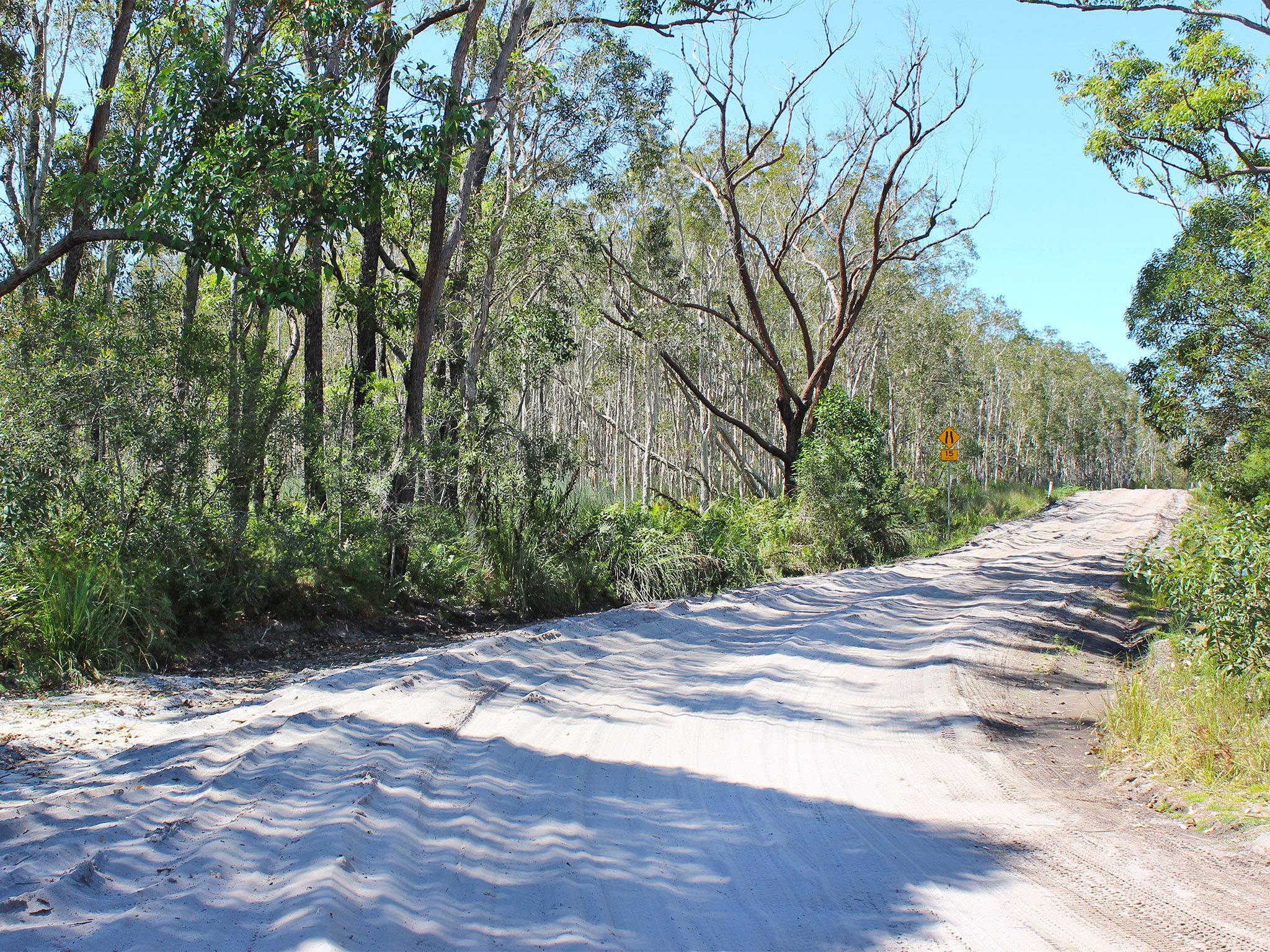
![Head through the forest on this sandy track.]() Head through the forest on this sandy track.
Photo credit: Rose Gray © Queensland Government
Head through the forest on this sandy track.
Photo credit: Rose Gray © Queensland Government
-
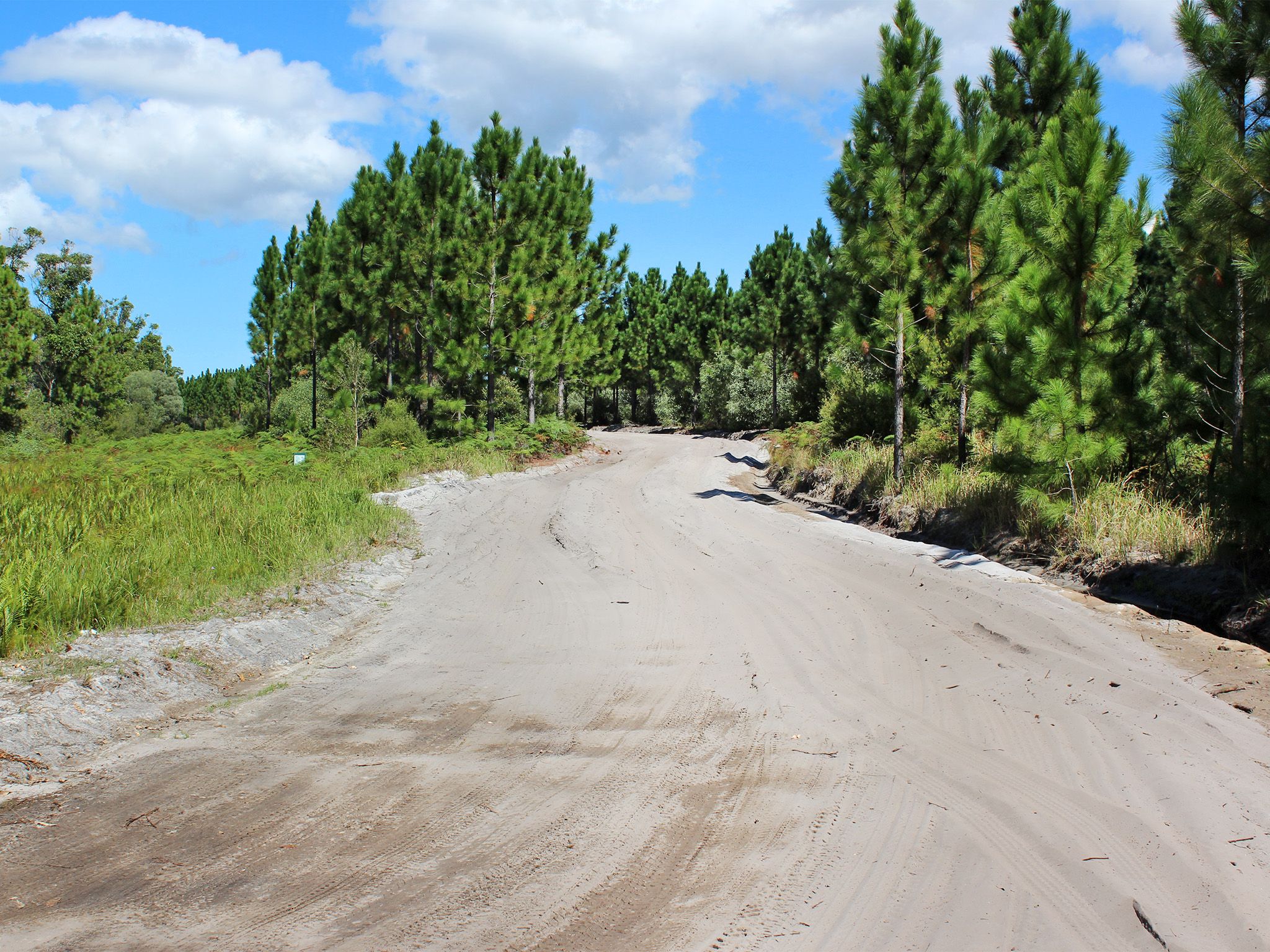
![Pine plantations line some of the drive.]() Pine plantations line some of the drive.
Photo credit: Rose Gray © Queensland Government
Pine plantations line some of the drive.
Photo credit: Rose Gray © Queensland Government
-
![The landscape constantly changes.]() The landscape constantly changes.
Photo credit: Rose Gray © Queensland Government
The landscape constantly changes.
Photo credit: Rose Gray © Queensland Government
-
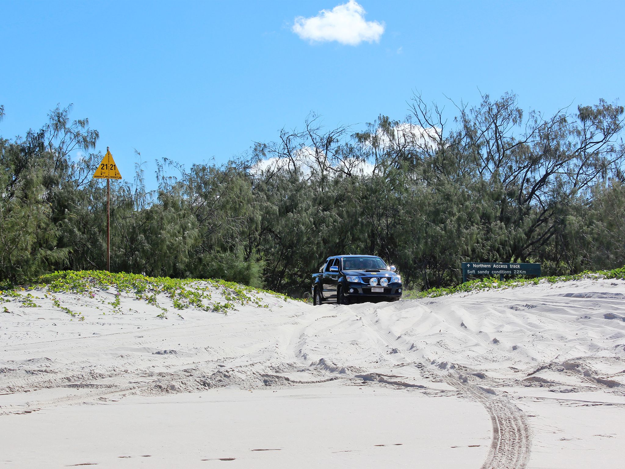
![The track takes you right to the eastern Beach.]() The track takes you right to the eastern Beach.
Photo credit: Rose Gray © Queensland Government
The track takes you right to the eastern Beach.
Photo credit: Rose Gray © Queensland Government
-
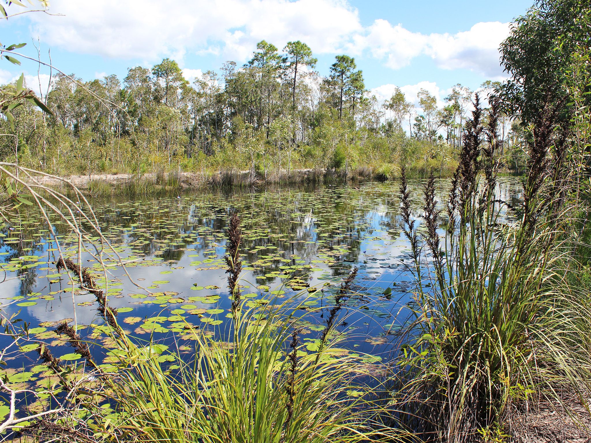
![Coastal swamps are just one of the fantastic features long this drive.]() Coastal swamps are just one of the fantastic features long this drive.
Photo credit: Rose Gray © Queensland Government
Coastal swamps are just one of the fantastic features long this drive.
Photo credit: Rose Gray © Queensland Government
-
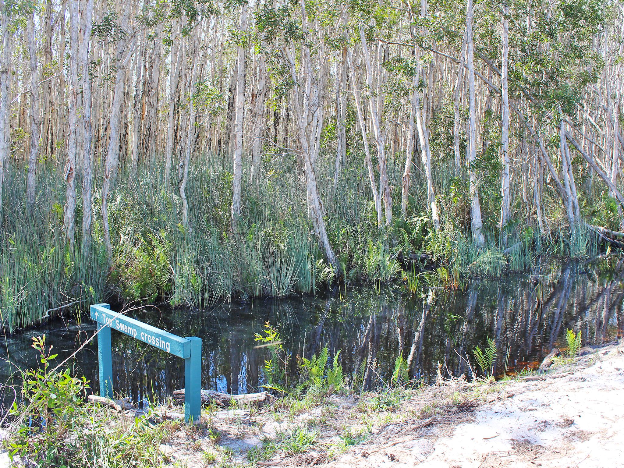
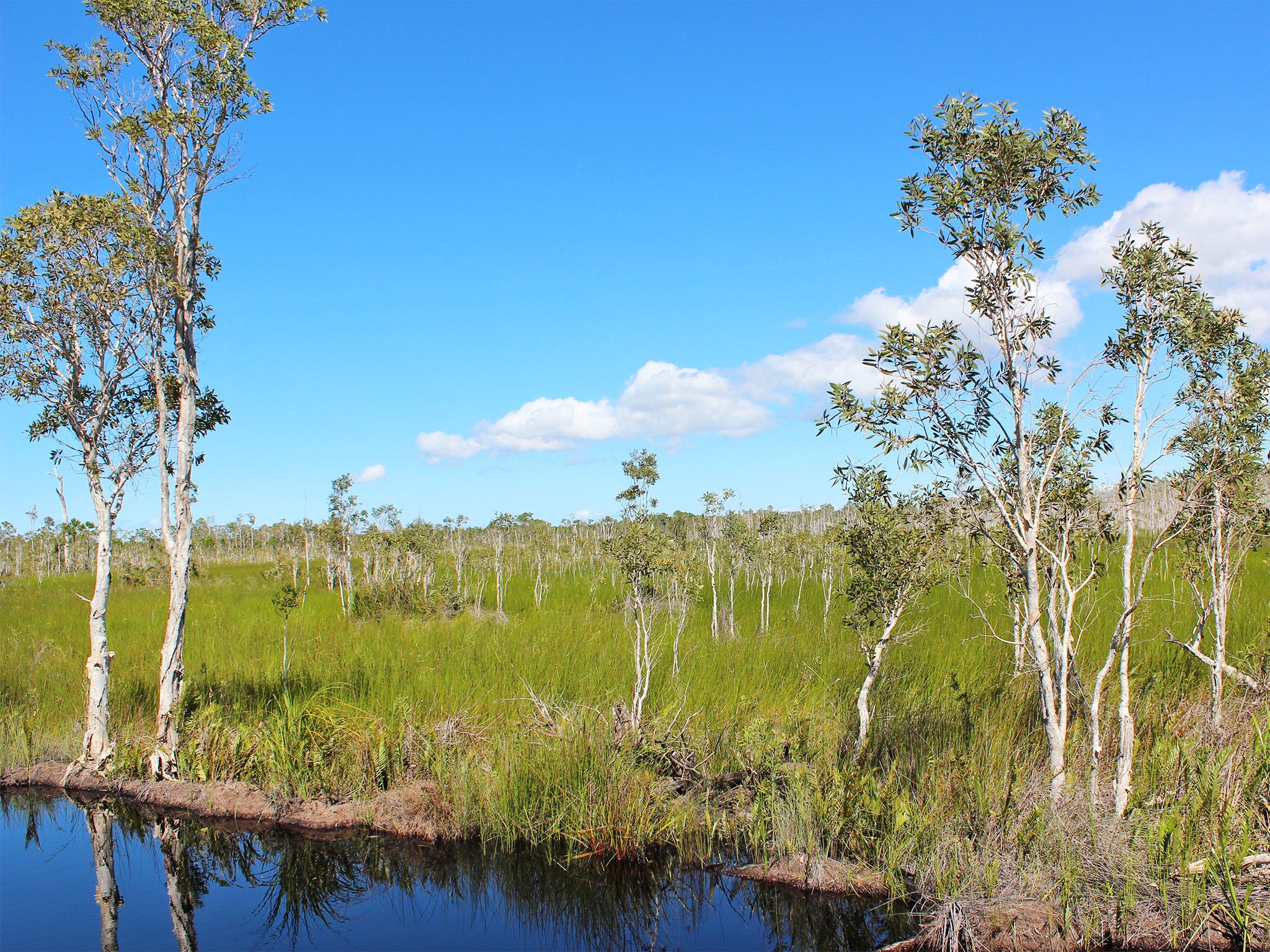
![You'll drive through lush melaleuca swamps.]() You'll drive through lush melaleuca swamps.
Photo credit: Rose Gray © Queensland Government
You'll drive through lush melaleuca swamps.
Photo credit: Rose Gray © Queensland Government
Begin your 4WD adventure at White Patch then follow the track as it meanders inland, and brings you to the coast on the east side of the island.
Discover heath and eucalypt forests and melaleuca woodlands along the track. Detour into Gallagher Point camping area and Poverty Creek day-use area to launch the kayak from the beach if you want to paddle or fish. Enjoy a picnic at Lighthouse Reach or Fort Bribie day-use areas and explore heritage-listed WWII remnants.
Drive on the beach to Ocean Beach camping area to sleep under the stars, with the murmur of the ocean for company.
Getting there and getting around
The Northern access track is in Bribie Island National Park and Recreation Area, 65km north of Brisbane.
- This drive takes you along an inland track, from the Poverty Creek access track on the western side of the island, past Lighthouse Reach and Fort Bribie, to the beach.
- From the bridge, drive north along Sunderland Drive and continue along White Patch Esplanade.
- At White Patch, follow the main track north to the gate at the turn-off to the Poverty Creek camping area. This is the start of the Northern access track.
- A high-clearance 4WD with low range capability is required to drive this route.
- A vehicle access permit must be purchased. Display the permit on your windscreen before driving in the recreation area. 24hr number plate surveillance cameras in use. Please ensure vehicle registration details are correct on your permit. For more information see:
- Two-wheel-drive (2WD) vehicles, trail bikes and motorbikes are prohibited from obtaining a vehicle access permit and entering the Bribie Island Recreation Area.
- Read 4WD with care for important information on 4WD safety and minimal impact driving.
Speed limits
- 30km/hr on inland roads.
- 10km/hr at Poverty Creek camping area.
Getting to Bribie Island
The island can be reached via a road bridge from the Caboolture turn-off on the Bruce Highway, or by boat from the nearby mainland.
Wheelchair access
There are no wheelchair-accessible facilities.
Before you visit
Opening hours
Northern access track is open 24 hours a day.
Check park alerts for the latest information on access, closures and conditions.
Visiting safely
For more safety information see Visiting Bribie safely and Four-wheel drive with care.
- Poverty Creek camping area closed from 15 April 2024 for toilet block upgrade 3 November 2023 to 8 July 2024
- Drive with care during marine turtle nesting season 6 March to 3 June 2024
- Camp site booking restrictions due to tidal inundation 11 January to 31 December 2024
- Bribie Island’s northern breakaway section remains part of the recreation area 30 June 2023 to 30 December 2024