Poverty Creek camping area
Arrive by 4WD or by boat and camp with your friends in this spacious camping area on the shores of Pumicestone Passage.
Accessible by
- High clearance 4WD
- Boat
- Canoe or kayak
Camping area facilities
- Anchoring allowed
- Wood-fired barbecue (BYO wood)
- Campfires allowed (conditions apply)
- Picnic tables
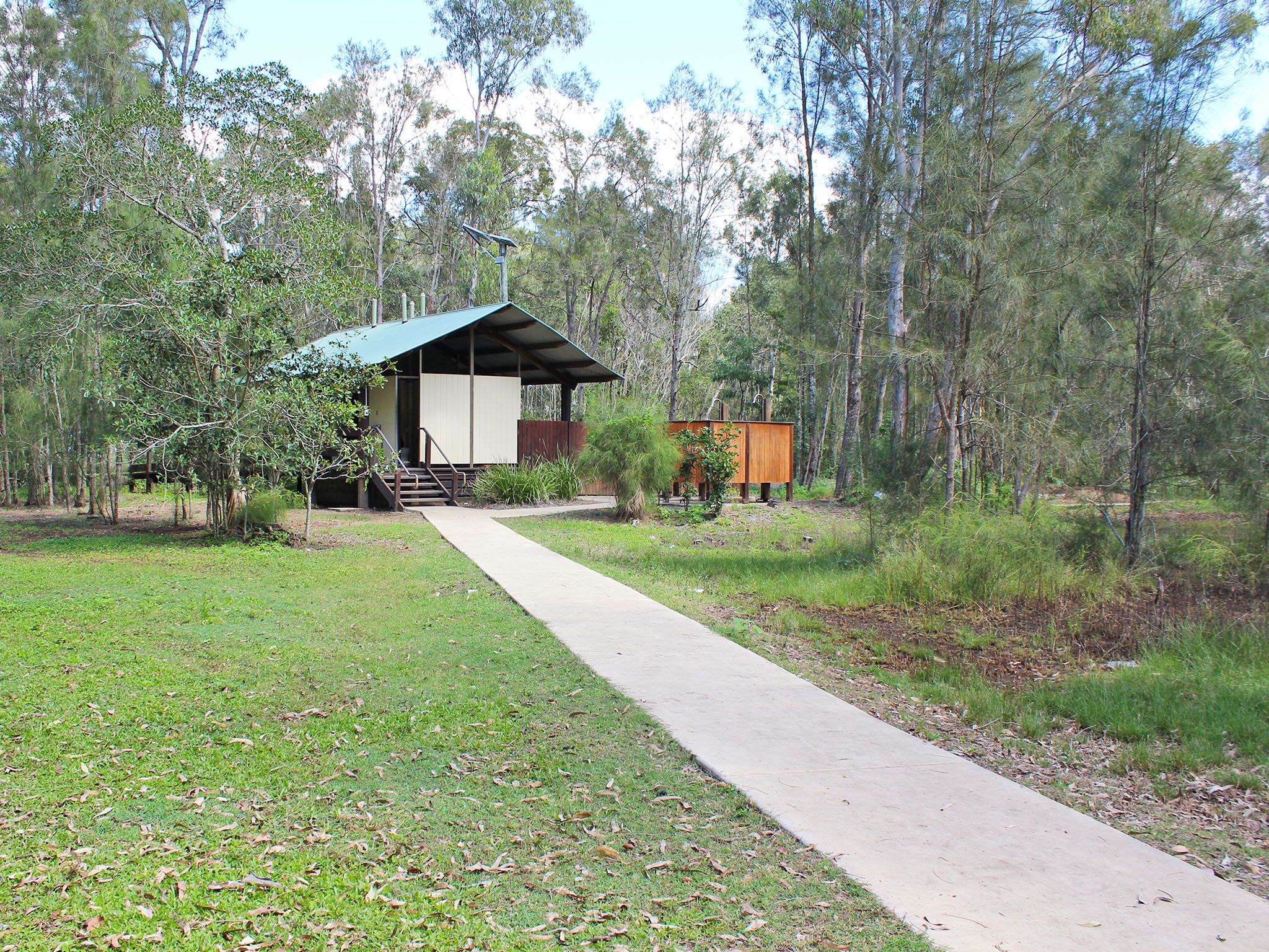
- Toilets (flush)
- Wheelchair access (may require assistance)
- Tent camping
- Camper trailer camping
- Cold showers
- Tent camping beside car
- Short walk to tent
- Walking
- Scenic drive
- Cultural and historic sites
- Canoeing and kayaking
- Boating
- Swimming
- Fishing
-
![Grassy sites and shady trees await!]() Grassy sites and shady trees await!
Photo credit: Rose Gray © Queensland Government
Grassy sites and shady trees await!
Photo credit: Rose Gray © Queensland Government
-
![Enjoy a meal around the camp fire.]() Enjoy a meal around the camp fire.
Photo credit: © MJL Photography
Enjoy a meal around the camp fire.
Photo credit: © MJL Photography
-
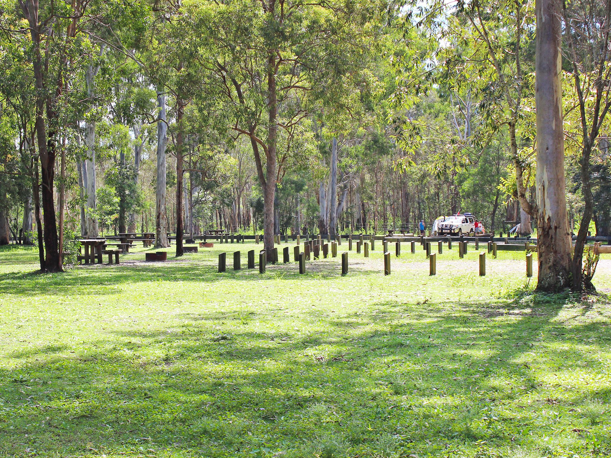
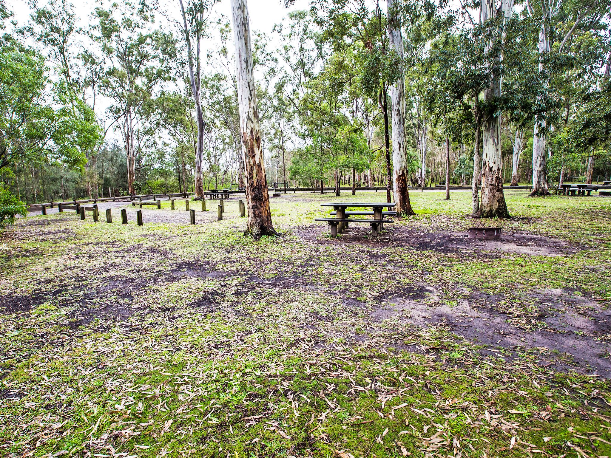
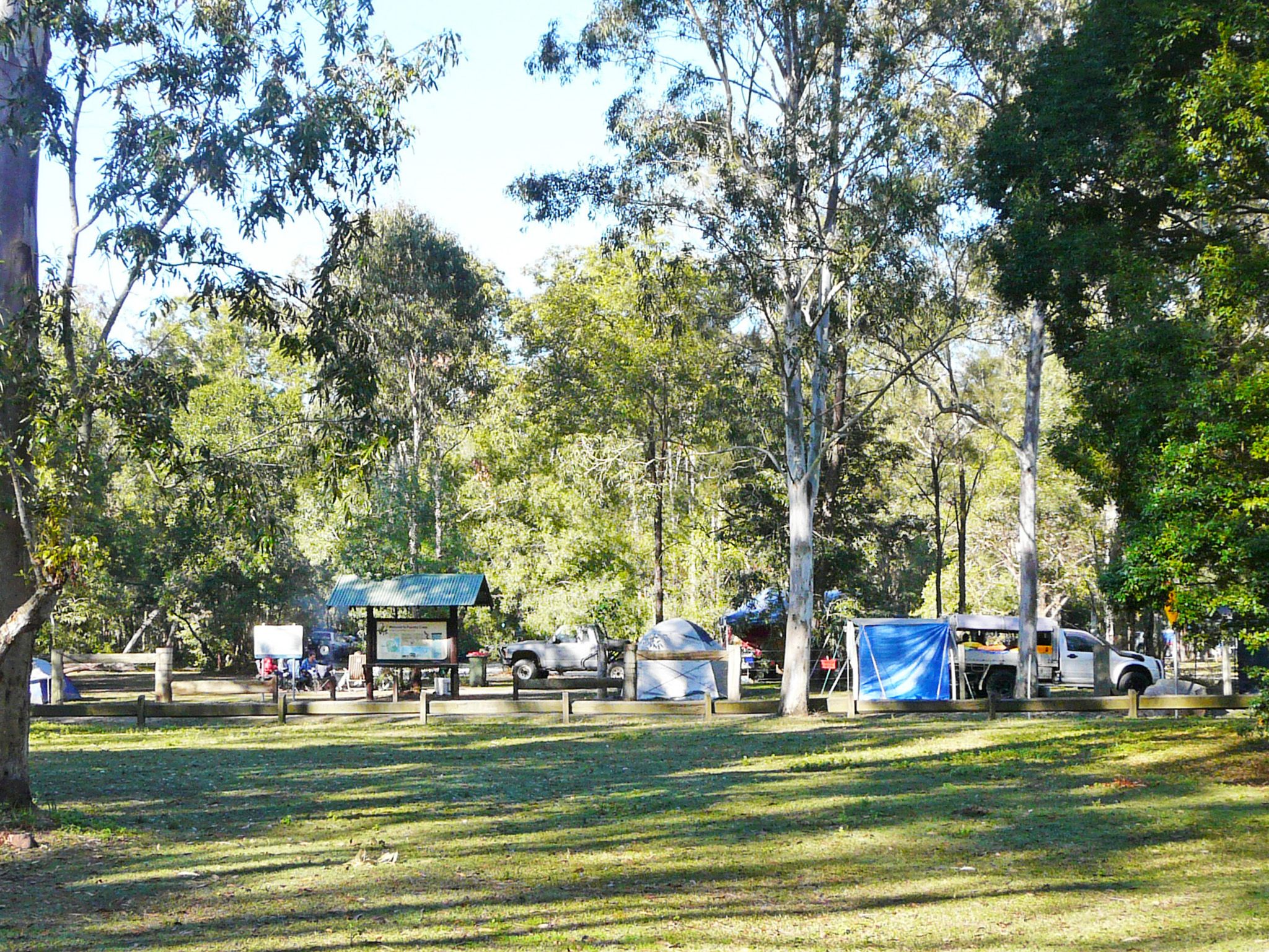
![The camping area is large and grassy, with plenty of shade.]() The camping area is large and grassy, with plenty of shade.
Photo credit: © MJL Photography
The camping area is large and grassy, with plenty of shade.
Photo credit: © MJL Photography
-
![You'll share your camp site with eastern grey kangaroos.]() You'll share your camp site with eastern grey kangaroos.
Photo credit: Rose Gray © Queensland Government
You'll share your camp site with eastern grey kangaroos.
Photo credit: Rose Gray © Queensland Government
-
![You'll find toilets and cold showers at the camping area.]() You'll find toilets and cold showers at the camping area.
Photo credit: Rose Gray © Queensland Government
You'll find toilets and cold showers at the camping area.
Photo credit: Rose Gray © Queensland Government
-
![There's plenty of space for everyone.]() There's plenty of space for everyone.
Photo credit: Leanne Siebuhr © Queensland Government
There's plenty of space for everyone.
Photo credit: Leanne Siebuhr © Queensland Government

Always check
- Park alerts for the latest information on access, closures and conditions.
- Bureau of Meteorology weather forecasts.
- Current bushfire warnings and incidents and also fire bans and restrictions.
- Your camping permit is booked.
- Any park-specific camping information for
Bribie.
- Visiting Bribie safely for important safety information.
Camp in this wide grassy area with shady trees that is ideal for groups and camper trailers. Relax against a scenic backdrop of the Glasshouse Mountains and Donnybrook across Pumicestone Passage.
If you're keen on fishing, wet a line and catch a flathead, whiting, tailor and mangrove jack for dinner—fish from the beach or your boat. If fishing's not your thing, bring your canoe or kayak for a paddle around the sheltered waters of Pumicestone Passage.
At low tide, take a peaceful stroll along the water's edge or, if you're after some adventure, head off in your 4WD (along one of the drives you can access from here) to explore greater Bribie Island.
Getting there and getting around
The Poverty Creek camping area is in Bribie Island National Park and Recreation Area, 65km north of Brisbane.
- The camping area is on the western side of the island, on the shores of Pumicestone Passage and can be accessed by high-clearance 4WD with low range capability, or by boat.
Road access
- From the bridge, drive north along Sunderland Drive and continue along White Patch Esplanade.
- At White Patch, follow the main track north, passing the turn-off to Gallagher Point camping area.
- At the next track intersection, veer left and continue to the Poverty Creek camping area.
- A vehicle access permit must be purchased. Display the permit on your windscreen before driving in the recreation area. 24hr number plate surveillance cameras in use. Please ensure vehicle registration details are correct on your permit. For more information see:
- Two-wheel-drive (2WD) vehicles, trail bikes and motorbikes are prohibited from obtaining a vehicle access permit and entering the Bribie Island Recreation Area.
- Read 4WD with care for important information on 4WD safety and minimal impact driving.
Speed limits
- 30km/hr on inland tracks.
- 10km/hr at Poverty Creek camping area.
Boat access
- The closest boat ramps are on the mainland at Donnybrook, Toorbul and Sandstone Point.
- Boat ramps are also located at Golden Beach, Bells Creek and Coochin Creek on the mainland.
- You can also launch your boat from the island at Bellara and Bongaree boat ramps.
- When boating over seagrass beds in Pumicestone Passage, do your best to minimise impacts on dugongs. Take it easy and observe the go slow areas .
- Read boat and fish with care for tips on boating and fishing safety and caring for parks.
Getting to Bribie Island
The island can be reached via a road bridge from the Caboolture turn-off on the Bruce Highway, or by boat from the nearby mainland.
Before you visit
Opening hours
Poverty Creek camping area is open 24 hours a day. Check-in to your camp after 2pm and check-out by 11am on the day of departure.
Check park alerts for the latest information on access, closures and conditions.
Camping area features: this is a large camping area that has open grassy sites and shady trees. It is situated on land that was once a cattle property.
Location: on the western side of Bribie Island. The adjoining picnic area overlooks the Pumicestone Passage and has views to the Glass House Mountains and Donnybrook.
Map: Poverty Creek camping area map
Access: the camping area can be reached by 4WD and boat. There are no boat launching or recovery facilities.
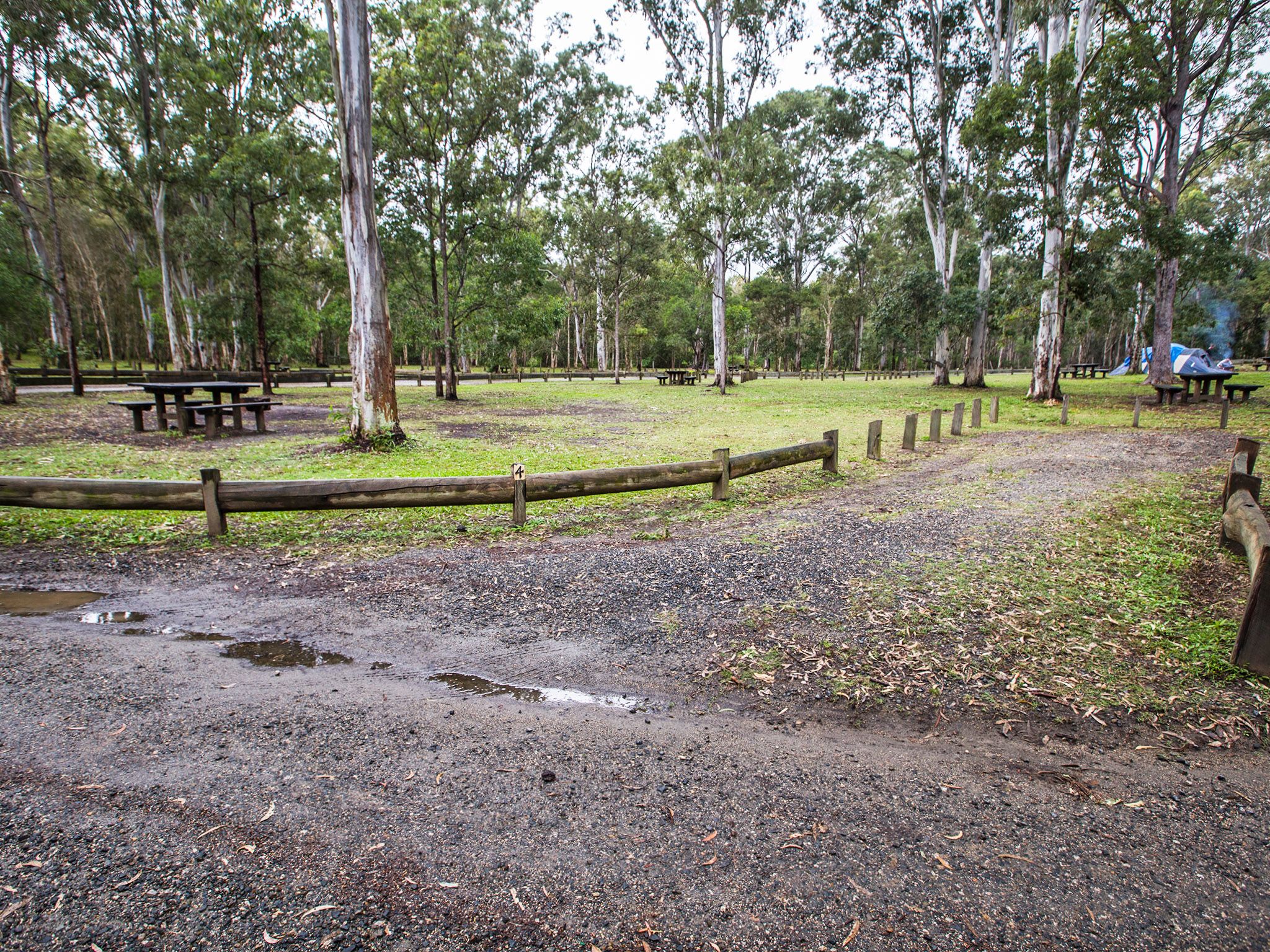
Number of sites: 14 numbered sites plus one large group and/or trailer area.
Camp sites are suitable for: tent camping beside your 4WD and walk-in camping. There is also an area designated for camper trailers or large groups.
Camp site surface: sand, dirt, grass.
Facilities: micro-flush toilets, portable toilet dump point, screened cold showers, water taps (not suitable for drinking), picnic tables and fire rings.
Open fires: allowed (except when fire bans or prohibitions apply) in provided fire rings only, but fuel stoves recommended.
Generators: not permitted.
Essentials to bring: water for drinking and cooking; gas stoves (preferable) or firewood (such as untreated mill off-cuts not bush wood); rubbish bags; insect repellent and tarpaulins to protect tents and vehicles from bat droppings. Read more about before you visit.
Bookings: book online or learn about our camping booking options.
Mobile phone coverage: Poor.
Upcoming camping area availability
Visiting safely
For more safety information see Visiting Bribie safely and camp with care.
- Poverty Creek camping area closed from 15 April 2024 for toilet block upgrade 3 November 2023 to 8 July 2024
- Smoke hazard from forestry planned burn 19–22 April 2024
- Drive with care during marine turtle nesting season 6 March to 3 June 2024
- Camp site booking restrictions due to tidal inundation 11 January to 31 December 2024
- Bribie Island’s northern breakaway section remains part of the recreation area 30 June 2023 to 30 December 2024