Alligator Falls trail, Mount Elliot
Wade across creeks, venture through eucalypt woodlands and scramble over boulders in the rainforest for a view of Alligator Falls.
- Journey type
- Walk
- Distance
- 17km return from the Alligator Creek day-use area trail head
- Time suggested
- Allow 5-6hr walking time.
- Grade
- Grade 5 walking track
Accessible by
- Conventional vehicle
Journey facilities
- Lookout (natural)
- Walking
-
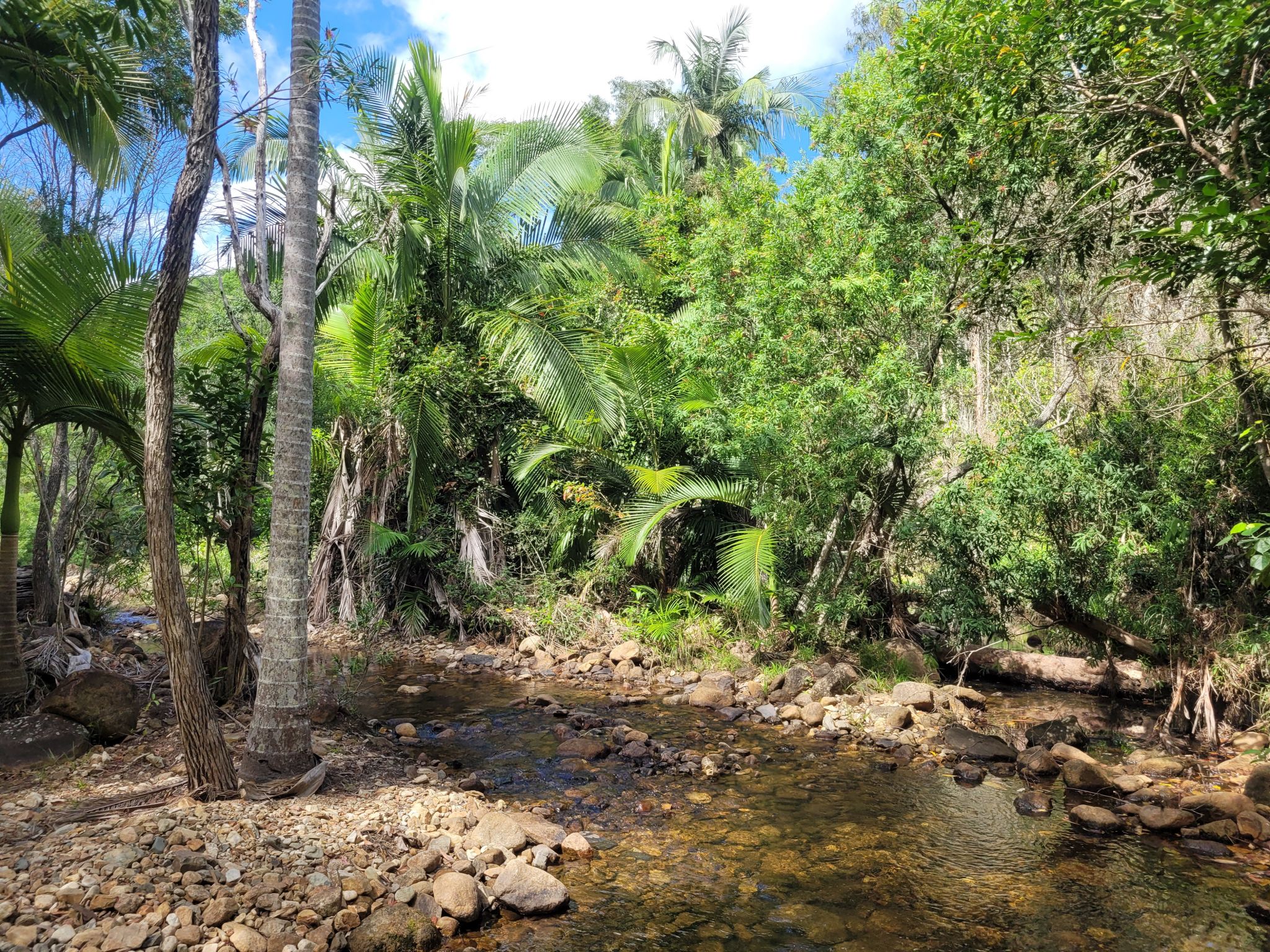
![Take care on the creek crossing along the Alligator Falls trail.]() Take care on the creek crossing along the Alligator Falls trail
Photo credit: Linda Thompson © Queensland Government
Take care on the creek crossing along the Alligator Falls trail
Photo credit: Linda Thompson © Queensland Government
-
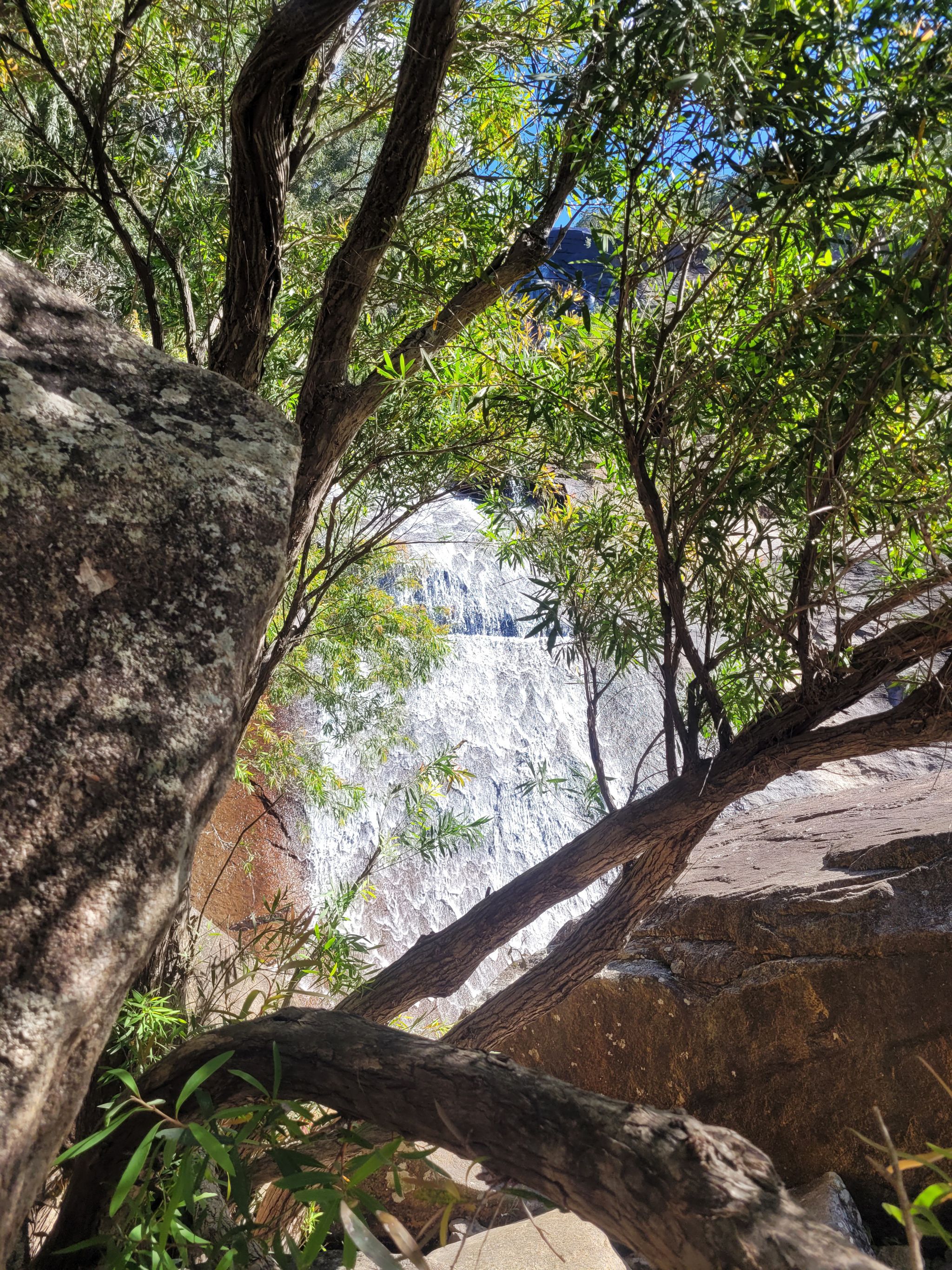
![The cascading water of Alligator Falls]() The cascading water of Alligator Falls
Photo credit: Linda Thompson © Queensland Government
The cascading water of Alligator Falls
Photo credit: Linda Thompson © Queensland Government
-
![Make sure you are fit and prepared to hike the Alligator Falls trail.]() Make sure you are fit and prepared to hike the Alligator Falls trail.
Photo credit: Phil Copp © Queensland Government
Make sure you are fit and prepared to hike the Alligator Falls trail.
Photo credit: Phil Copp © Queensland Government
-
![Take heed of all safety advice along the trail]() Take heed of all safety advice along the trail
Take heed of all safety advice along the trail
-
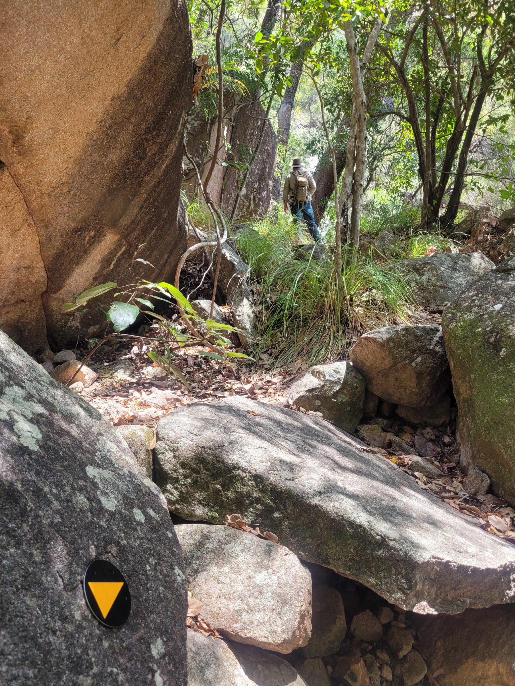
![Follow the trail markers to arrive at the base of Alligator Falls]() Follow the trail markers to arrive at the base of Alligator Falls
Photo credit: Linda Thompson © Queensland Government
Follow the trail markers to arrive at the base of Alligator Falls
Photo credit: Linda Thompson © Queensland Government
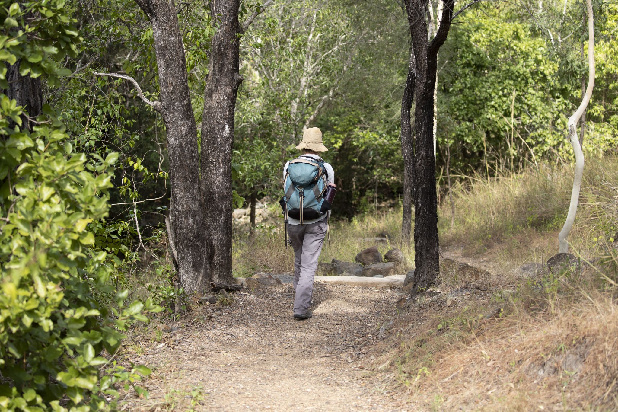
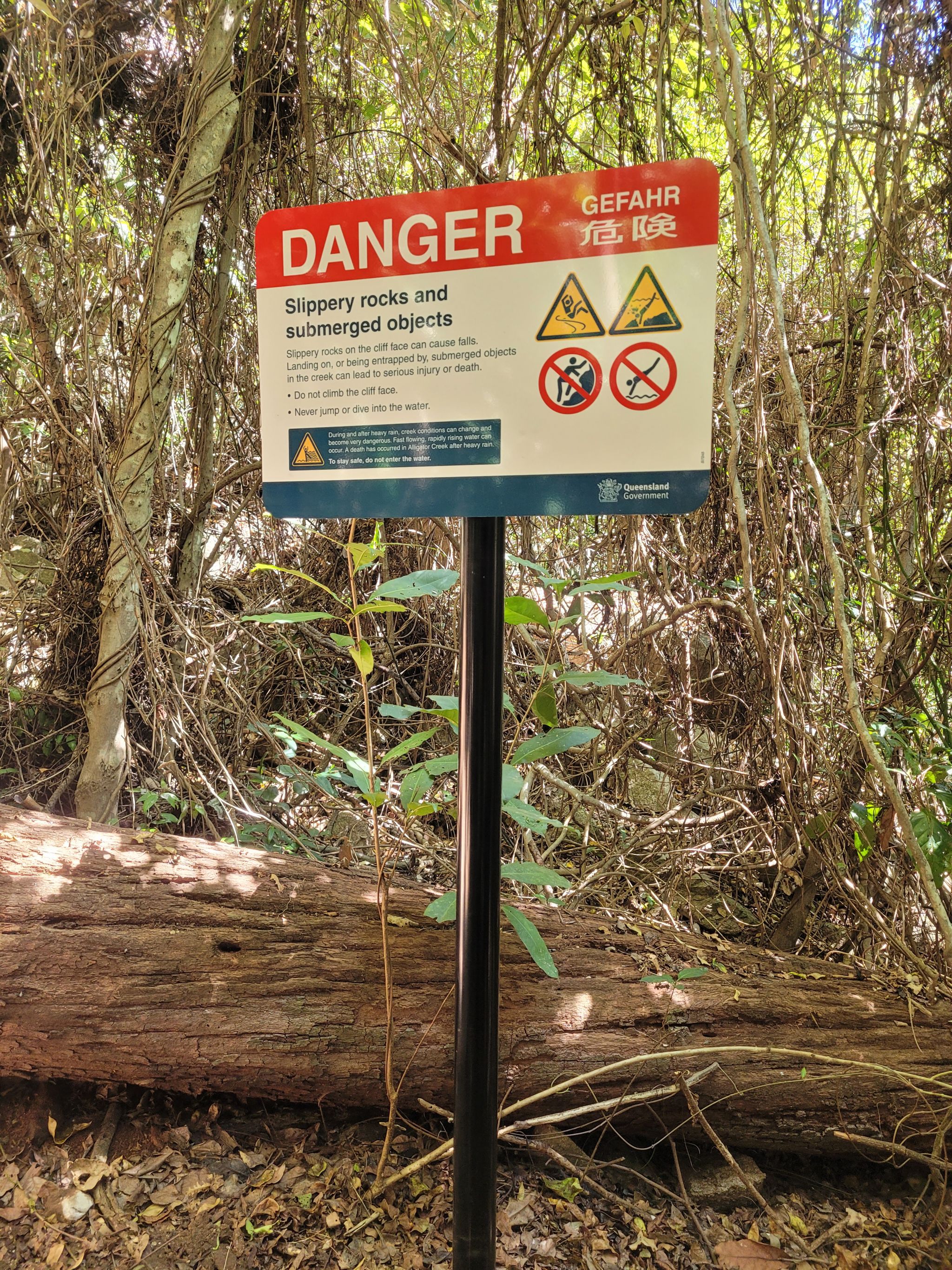
Important information. This rugged, difficult trail should only be undertaken by prepared, fit and experienced hikers and should never be attempted during or after heavy rain or if heavy rain is forecast. Rain in the upper catchment can cause rapid rises in water (flash flooding), making creek crossings dangerous. Hikers can also become stranded between crossings.
Follow the Alligator Falls trail through the different environments of Mount Elliot. Venture through eucalypt woodlands, wade across creek crossings (there is three of them!), ascend a series of steps then scramble over boulders in the rainforest to arrive beside the creek at the base of the cascading falls. There is no access to or above the falls. Do not climb the cliff face, or dive or jump into the water. Serious injuries have occurred.
Savour the creek crossings on the way to falls! With overhanging bottlebrush trees, damselflies skimming the water and butterflies fluttering above the surface, the creek crossings are a perfect place to rest and catch your breath.
Make sure to begin this hike with enough time to return the same way before dark—unless to plan to stay the night at Alligator Falls camping area. Remember, a pre-booked camping permit is required.
Getting there and getting around
The Alligator Falls trail is in the Mount Elliot section of Bowling Green Bay National Park about 25km south of Townsville.
- From the day-use area follow the Alligator Creek lookout track. Just before the lookout is the track junction to the Cockatoo Creek and Alligator Falls walking trail.
- Follow the Cockatoo Creek trail then cross the creek to the Cockatoo Creek camping area.
- From Cockatoo Creek camping area, the Alligator Falls trail crosses the creek 3 times and follows the same path as a management access road which is quite exposed and can be very hot. Follow the trail for 6.4km one way to Alligator Falls camping area.
- From Alligator Falls camping area follow the marked trail a further 400m, scrambling over boulders, to arrive beside the creek at the base of Alligator Falls. Return the same way. There is no access to or above the falls.
- Refer to Cockatoo Creek and Alligator Falls walking trails map . Please take note of all safety advice.
Wheelchair access
There is no wheelchair access to the Alligator Falls trail.
Before you visit
Opening hours
The Alligator Falls trail is open 24 hours a day.
Seasonal closures
Access to the Alligator Falls trail may be closed at times due to localised flooding, severe weather conditions and park management activities.
Check park alerts for the latest information on access, closures and conditions.
Visiting safely
For more safety information see Visiting Bowling Green Bay safely and Walk with care.
- Alligator Creek Falls walking track and camping area seasonal closure 27 February to 3 May 2024
- Bowling Green Bay National Park hazard reduction burns 3 April to 31 May 2024