Bartle Frere trail camping
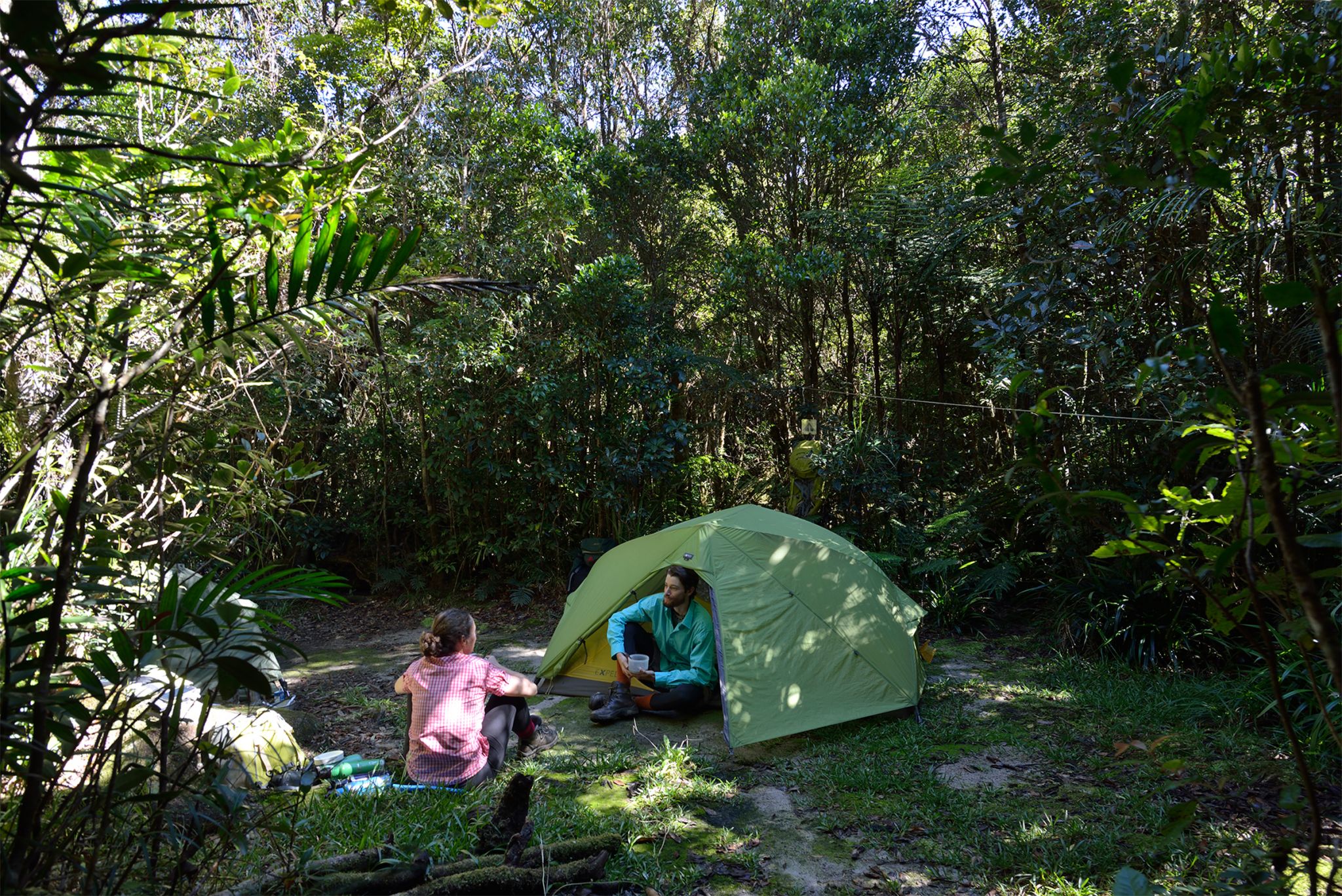
The Bartle Frere trail camping areas include rainforest, camping beside creeks and fabulous views over Innisfail and the undulating Atherton Tableland.
Accessible by
- Walk-in
Camping area facilities
- Tent camping
- Walking
Always check
- Park alerts for the latest information on access, closures and conditions.
- Bureau of Meteorology weather forecasts.
- Current bushfire warnings and incidents and also fire bans and restrictions.
- Your camping permit is booked.
- Any park-specific camping information for
Bartle Frere.
- Visiting Bartle Frere safely for important safety information.
The Bartle Frere trail is rugged and remote, with isolated camping areas. Only experienced and extremely fit bushwalkers should attempt the trail. Prepare thoroughly to ensure you have a safe and enjoyable walking and camping experience. Eastern access to the trail is from Josephine Falls car park, where camping areas are walk-in only. Western access starts from Junction camp (accessible via vehicle), then camping areas are walk-in only.
There are 4 camping areas along the trail: from west to east they are, Junction camping area, Western Summit camping area, Eastern Summit camping area and Big Rock camping area. The Bartle Frere trail camping areas each have a maximum of 8 people per night per camping area with a maximum group size of 4 people. No facilities are provided.
Camping permits are required and fees apply. A camping tag with your booking number must be displayed at your campsite.
Park-specific conditions
All camping along the Bartle Frere trail must be pre-booked—self-registration at camping areas is not possible. Camping bookings are only available at each of the 4 designated camping areas The Bartle Frere trail camping areas each have a maximum of 8 people per night per camping area with a maximum group size of 4 people.
Read more about staying safe and looking after the park.
Junction camping area
Camp features: bush camp surrounded by rainforest.
Location: at the western end of the walking trail, 2km by gravel road from the park entrance on the Atherton Tableland. See Getting there.
Access: the camping area can usually be reached by conventional vehicles. In the wet season, check Park alerts.
Number of sites: open area without separately defined sites.
Camping area suitable for: tent camping beside your car and walk-in camping.
Camping area surface: dirt and grass.
Facilities: none.
Open fires: prohibited. Bring a fuel stove.
Generators: not permitted.
Essentials to bring: drinking water, food, rubbish bags, insect repellent and fuel stove. Read more about before you visit.
Bookings: book online or learn about our camping booking options. Note: camping bookings are only available at each of the 4 designated camping areas. The Bartle Frere trail camping areas each have a maximum of 8 people per night per camping area with a maximum group size of 4 people.
Mobile phone coverage: poor. Satellite phone or Personal Location Beacon (PLB) recommended.
Western Summit camping area
Camp features: bush camping opportunities in a small clearing beside a creek.
Location: 8km walk from the Junction camping area and the Atherton Tableland (west) end of the walking trail. The Bartle Frere summit is 750m from this camp.
Access: the camping area can be reached on foot only.
Number of sites: a small open area without separately defined sites.
Camping area suitable for: walk-in camping.
Camping area surface: dirt and grass.
Facilities: none.
Open fires: prohibited. Bring a fuel stove.
Generators: not permitted.
Essentials to bring: drinking water, food, rubbish bags, insect repellent and fuel stove. Read more about before you visit.
Bookings: book online or learn about our camping booking options. Note: camping bookings are only available at each of the 4 designated camping areas. The Bartle Frere trail camping areas each have a maximum of 8 people per night per camping area with a maximum group size of 4 people.
Mobile phone coverage: poor. Satellite phone or Personal Location Beacon (PLB) recommended.
Eastern Summit camping area
Camp features: bush camp with fabulous views over Innisfail and the undulating Atherton Tableland.
Location: 7km walk from the Josephine Falls carpark and the east end of the walking trail. This camping area is about one hour’s walk from the Bartle Frere summit.
Access: the camping area can be reached only on foot.
Number of sites: an open area without separately defined sites.
Camping areas suitable for: walk-in camping.
Camping area surface: dirt and grass.
Facilities: none.
Open fires: prohibited. Bring a fuel stove.
Generators: not permitted.
Essentials to bring: drinking water, food, rubbish bags, insect repellent and fuel stove. Read more about before you visit.
Bookings: book online or learn about our camping booking options. Note: camping bookings are only available at each of the 4 designated camping areas. The Bartle Frere trail camping areas each have a maximum of 8 people per night per camping area with a maximum group size of 4 people.
Mobile phone coverage: poor. Satellite phone or Personal Location Beacon (PLB) recommended.
Big Rock camping area
Camp features: bush camping opportunities in the rugged wilderness of the Bellenden Ker Range.
Location: 3km walk from Josephine Falls car park area (east) approach.
Access: camping area can be reached on foot only.
Number of sites: an open area without separately defined sites.
Camping area suitable for: walk-in camping.
Camping area surface: dirt and grass.
Facilities: none.
Open fires: prohibited. Bring a fuel stove.
Generators: not permitted.
Essentials to bring: drinking water, food, rubbish bags, insect repellent and fuel stove. Read more about before you visit.
Bookings: book online or learn about our camping booking options. Note: camping bookings are only available at each of the 4 designated camping areas. The Bartle Frere trail camping areas each have a maximum of 8 people per night per camping area with a maximum group size of 4 people.
Mobile phone coverage: poor. Satellite phone or Personal Location Beacon (PLB) recommended.
Visiting safely
For more safety information see Visiting Bartle Frere safely and camp with care.